
Old maps are a great place to start when researching the history of your house and your local area. Our collections include hundreds of different maps, covering the length and breadth of the county of North Yorkshire.
Carrying out a map regression exercise using our collection of historic maps and plans may help to establish an approximate age for your property and identify how it might have changed over time. As an added bonus, you may also find out information about previous owners and inhabitants. We suggest you start with the most recent Ordnance Survey maps and work backwards in time.
You can see further examples of historic maps and plans in several of our blog posts, in particular those on Malton, Richmond and Whitby


There are five main types of maps and plans in our collections:
- Historic Ordnance Survey maps
- Tithe maps and apportionments
- Enclosure maps and awards
- Estate plans and surveys
- County and riding maps
Historic Ordnance Survey maps
Dating from the late 1840s and 1850s onwards, the 6-inch to the mile Ordnance Survey mapping covers the whole county. From then onwards, individual map sheets were produced at different scales in a series of editions published at regular intervals. The 1:500 and 1:1056 scale town plans, and first editions of the 25-inch to a mile series appeared in the 1890s. These are the most useful scales for house history, showing building footprints/block plans in the greatest detail. We hold a large number of historic Ordnance Survey map sheets in our collections. The National Library of Scotland website also makes historic Ordnance Survey map sheets available online. Modern, digital vector mapping is also available online via the North Yorkshire Council’s maps website.

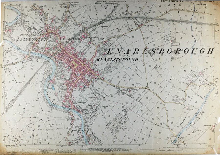
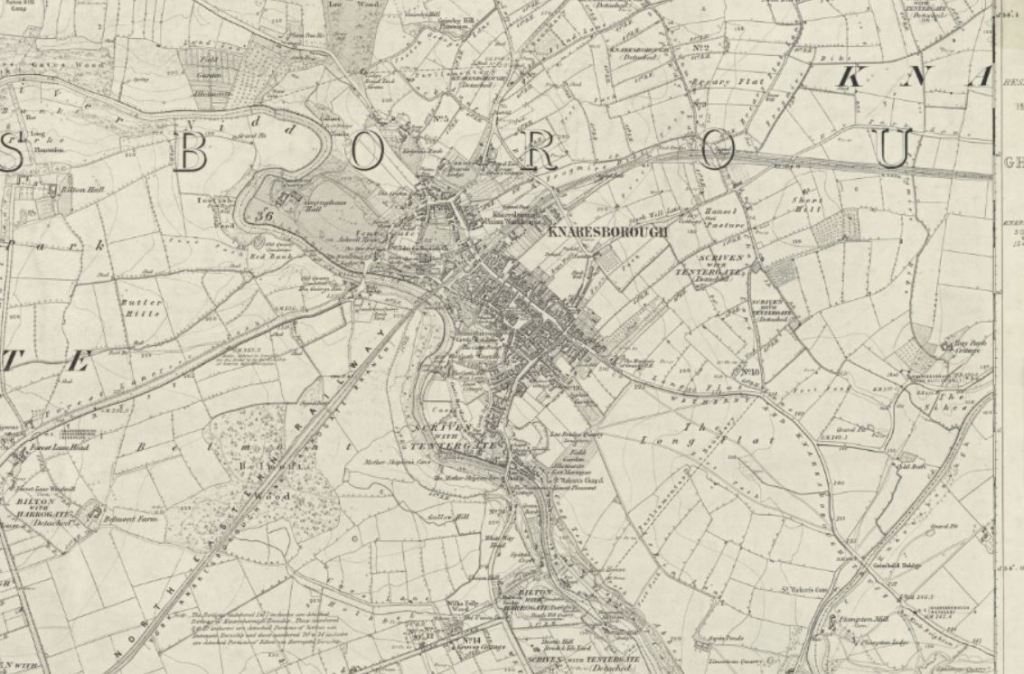
Three Ordnance Survey map sheets for the town of Knaresborough:
- 1:500 scale 1890 town plan [Yorkshire (West Riding) sheet 154.12.12]
- 25-inch to a mile (1:2500) scale 1891 [Yorkshire (West Riding) sheet 154.12]
- 6-inch to a mile (1:10560) scale 1854 [Yorkshire (West Riding) sheet 154]
Tithe maps and apportionments
Dating to the late 1830s and 1840s, plot numbers on tithe maps relate to numbers on an associated apportionment or schedule listing owners and occupiers. The maps were prepared to identify lands subject to tithes (a payment for the upkeep of the church) following the Tithe Commutation Act of 1836. The Act substituted the traditional payment in kind with a monetary payment. We hold over 300 tithe maps for parishes and townships throughout North Yorkshire, but they do not exist for all areas.
You can find out which tithe maps we hold in Archives Collection Guide no.3, and read more about tithe maps and apportionments in some of our blog posts. We have a guest post by members of the Thornton le Street History Group, about their ‘Roads to the Past’ tithe project and a post about our ongoing volunteer tithe project. See also The National Archives Research Guide on Tithes.
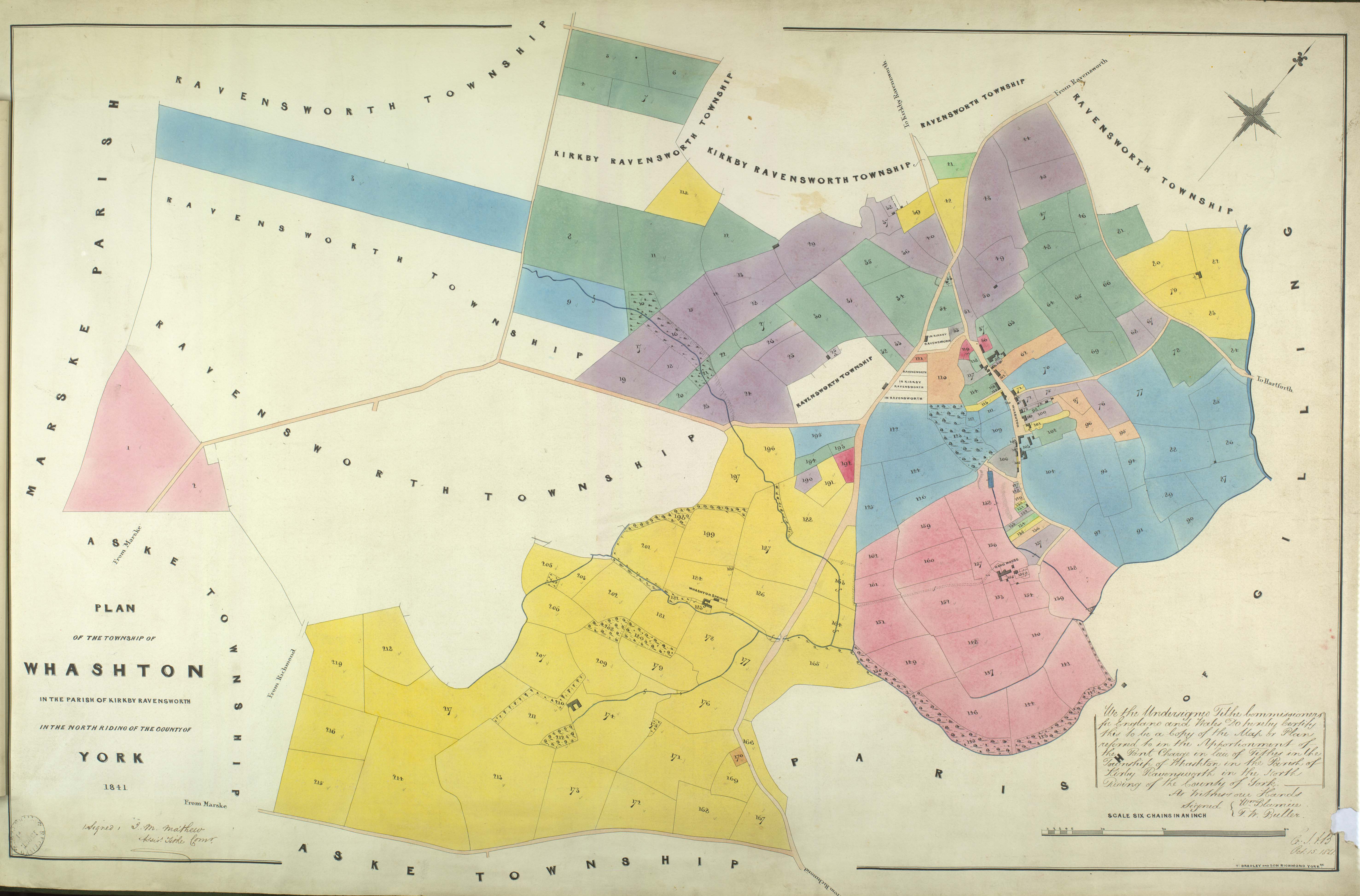


Whashton tithe map and apportionment, 1841 [T]
Enclosure maps and awards
Made to record the reorganisation of open fields into smaller plots, details of ownership, roads, paths and boundaries appear in the written award. Names of owners are sometimes written onto the map as well, although enclosure primarily involved the land around a town or village and outlying farms, so the core settlement may not be recorded in detail. Most of the enclosure maps we hold date from c.1750 to the early 1800s. You can find details of these enclosure maps and awards in Archives Collection Guide no.4. See also The National Archives Research Guide on Enclosure Maps & Plans and our 2022 blog providing a case study of Enclosure and the Landscape: Harome, near Helmsley.

Estate plans and surveys
Recording the landholdings of particular owners, estate plans may depict a few fields or an entire township. Names of farms, fields, tenants, land-use and acreages, as well as neighbouring landowners, may be included on the plan. Alternatively, there may be numbers on the map with related details recorded in a separate survey or field book, which might not always survive. Such plans and surveys date from as early as the 1600s onwards, depending on the area. You can see further examples of surveys and field books on our sources for buildings and sources for owners and occupiers pages. A list of the maps we hold can be found in Archives Collection Guide no.3.
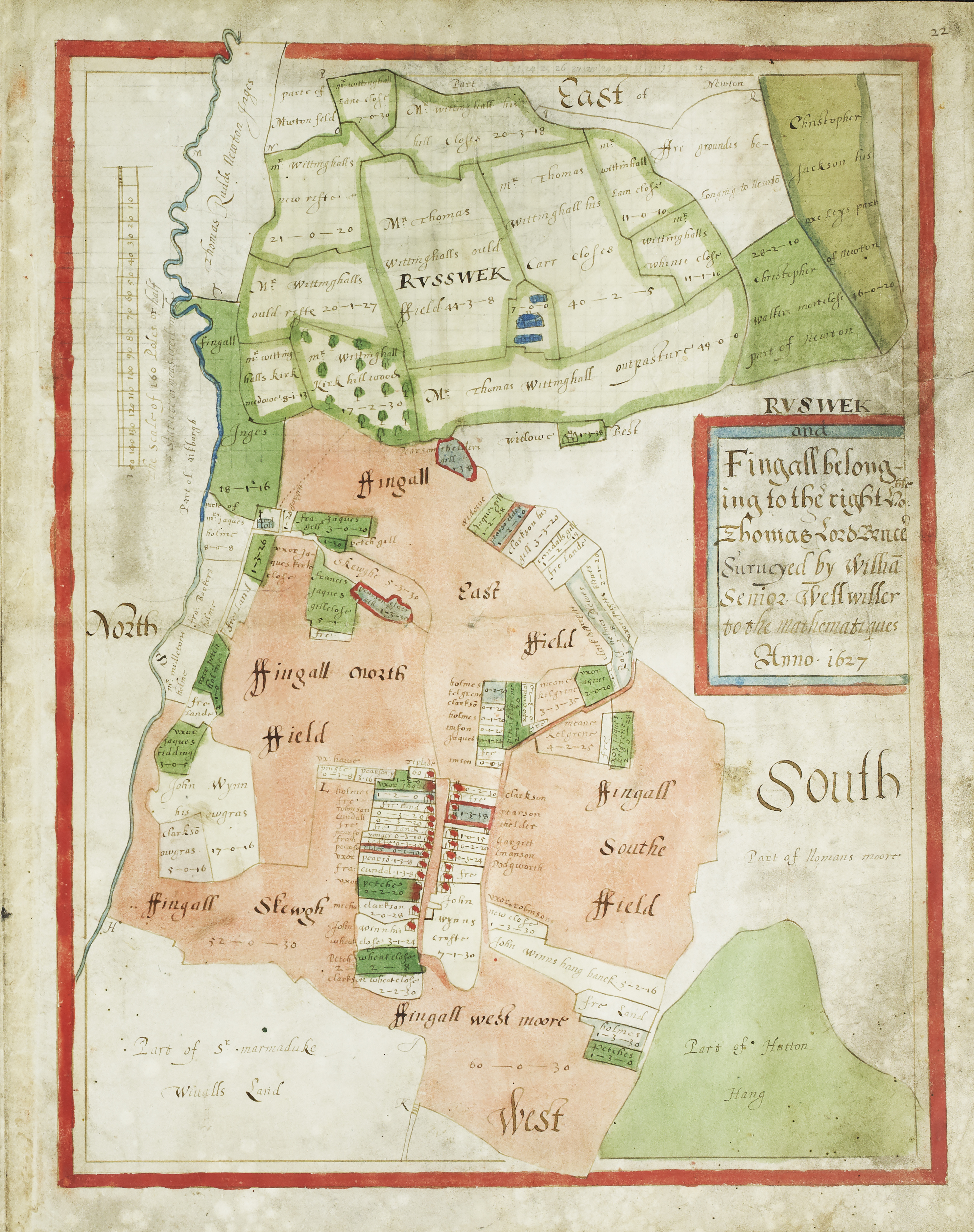


Clockwise from top left:
- Plan of Fingall belonging to Thomas Lord Bruce, by William Senior, Wellwiller to the mathematiques, 1627 [ZJX 10/1/10 (ii)]
- Plan of an estate of William Chaytor Esq. within Constable Burton, by G Thornton, 1813 [ZQH 6/7]
- A map of an estate belonging to the Revd Mr Lodge situate at Yockenthwaite (Buckden) in the West Riding of Yorkshire, undated [M117]
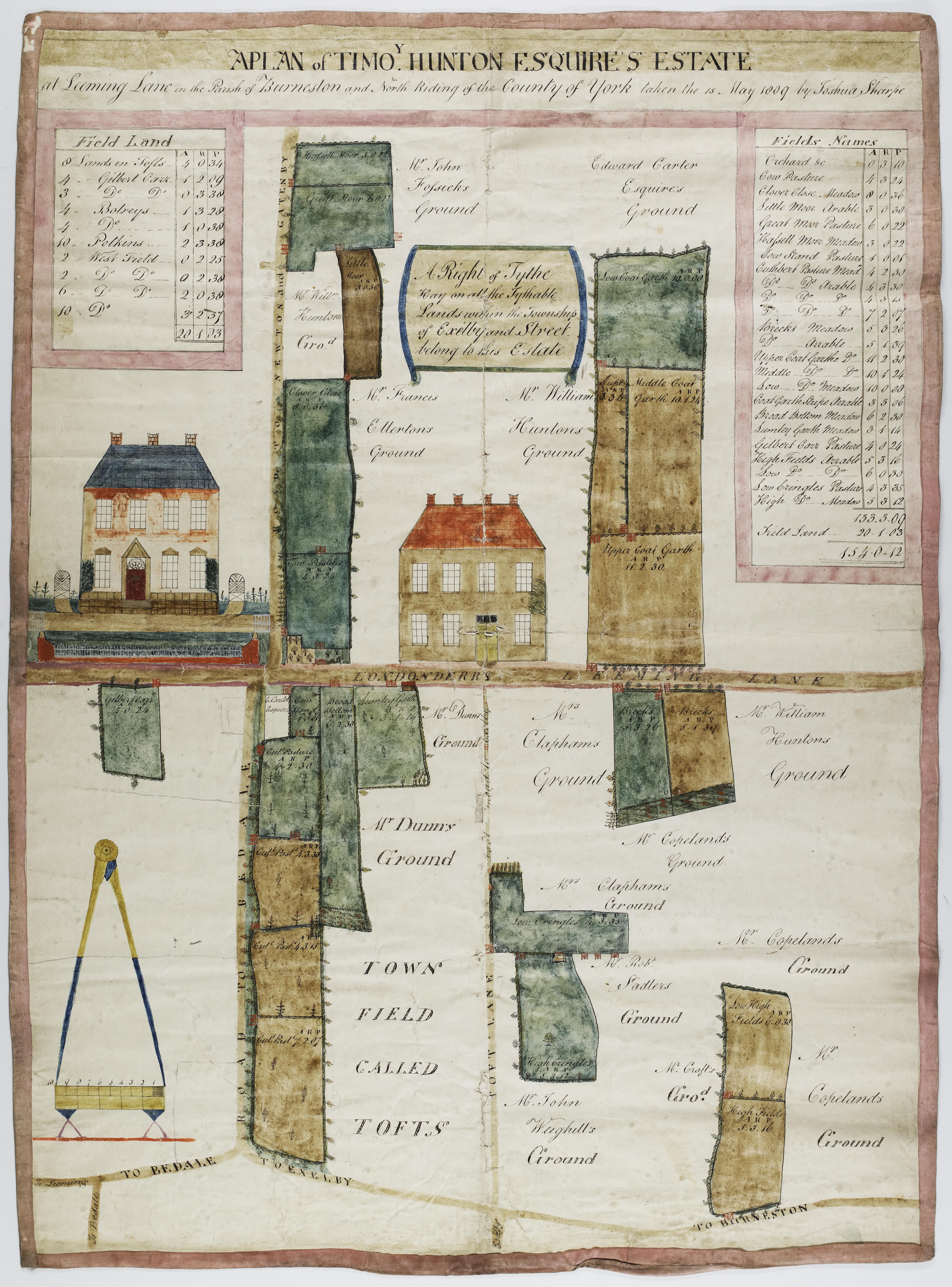
- A plan of Timothy Hunton Esquire’s estate at Leeming Lane in the parish of Burneston, by Joshua Sharpe, 15 May 1809 [ZPL 4/8]
- Plan of that estate belonging to the Revd. John Whaley & situate near Askrigg, by Thomas Pratt, early-19th-century [M6]

County and riding maps
A range of mapmakers produced county-wide maps and maps of individual Yorkshire Ridings from the 1600s onwards, including Speed 1610, Blaeu 1662, Jeffreys 1771, Tuke 1794, Greenwood 1817 and Langdale 1822. Owing to the large areas they cover, these maps are more useful for looking at the wider context and topographic location of a building or settlement than for details of specific houses. To find out more about historic Yorkshire maps and mapmakers, there are some suggested titles listed on our further reading page.

How can I find out what maps you hold?
You can find details of our holdings of maps and plans, listed alphabetically by place, in our Archives Collection Guides:
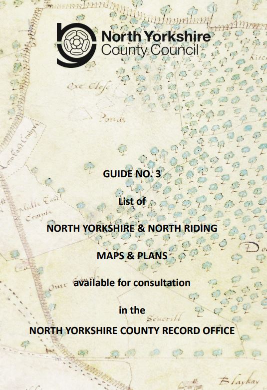
Guide no. 3: List of North Yorkshire & North Riding Maps & Plans
Guide no. 4: List of North Yorkshire & North Riding Enclosure Awards & associated documents
A selection of our historic maps are available to view and/or purchase via our online shop.
TIP: Although our collections are extensive, other local archives and private collections may also hold historic maps and plans and other archive material relating to the modern county of North Yorkshire.
How are maps referenced?
All our non-Ordnance Survey maps are identified by a unique collection reference number, e.g. ZQG 6/6; M5; I (PR/ALN) and T.
The majority of our map collections are available to view on microfilm in our search room. The relevant microfilm number and frame references are cited in the map guides preceded by ‘MIC’ as in these examples: MIC 1771/97-102 is microfilm number 1771, frames 97 to 102.
Ordnance Survey maps have a scale, sheet number and a surveyed and/or revision date, as well as a publication date.

