
Maps and Plans
The County Record Office holds thousands of historic maps and plans covering North Yorkshire dating from the 16th to the 20th centuries. These holdings include substantial collections of parish tithe maps, enclosure maps and historic Ordnance Survey maps. Maps can also be found in estate archives, local authority archives, parish collections and attached to sales particulars. Our online catalogue can be used to identify maps and plans in our custody. Copies of many of the historic maps we hold can be purchased through our online shop.
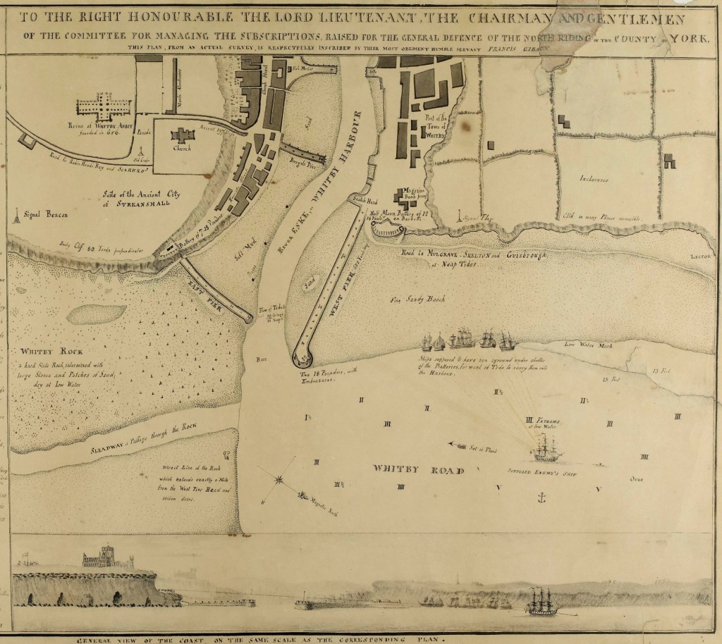
This plan of the town of Whitby was made in 1794 showing gun emplacements both sides of the harbour and on the West Pier. This plan was made when Great Britain was at war with France.
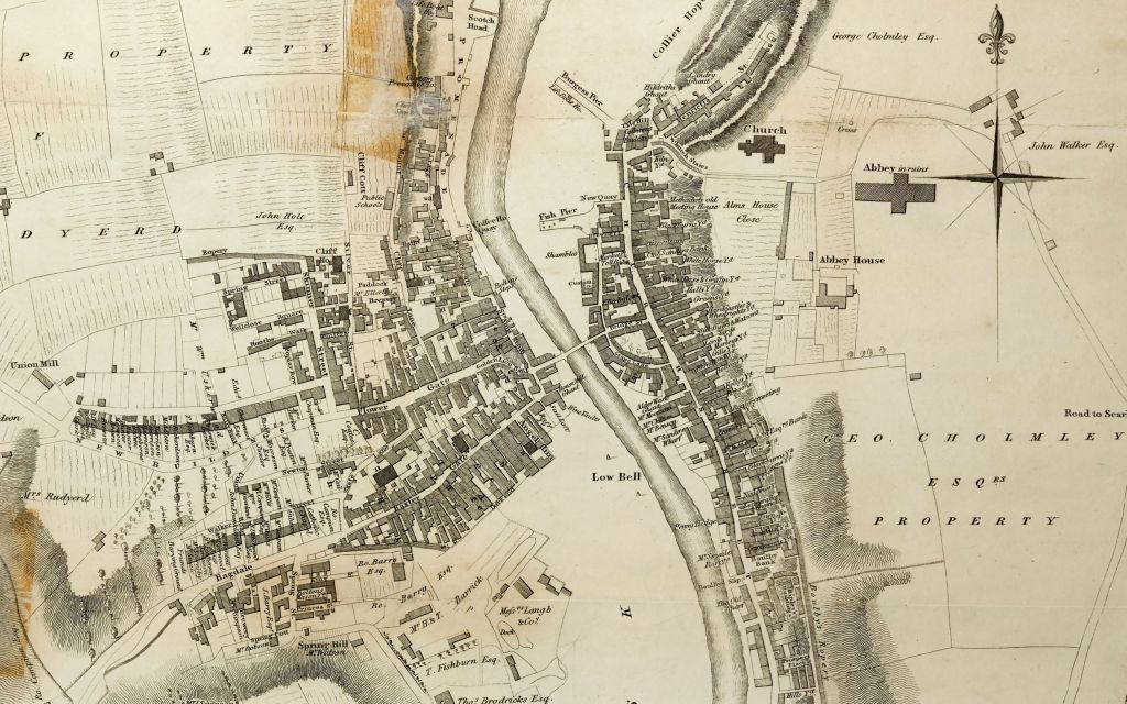
This map names the owners of larger properties in the town and also gives the names of some of the yards off Church Street.

Tithe maps were made in the 1830s and 1840s as part of a nationwide survey of tithe payments. The Record Office holds these for several hundred townships (civil parishes) including Ruswarp, which covers part of present-day Whitby. In most cases the Record Office holds an apportionment, which names owners and occupiers of individual properties.
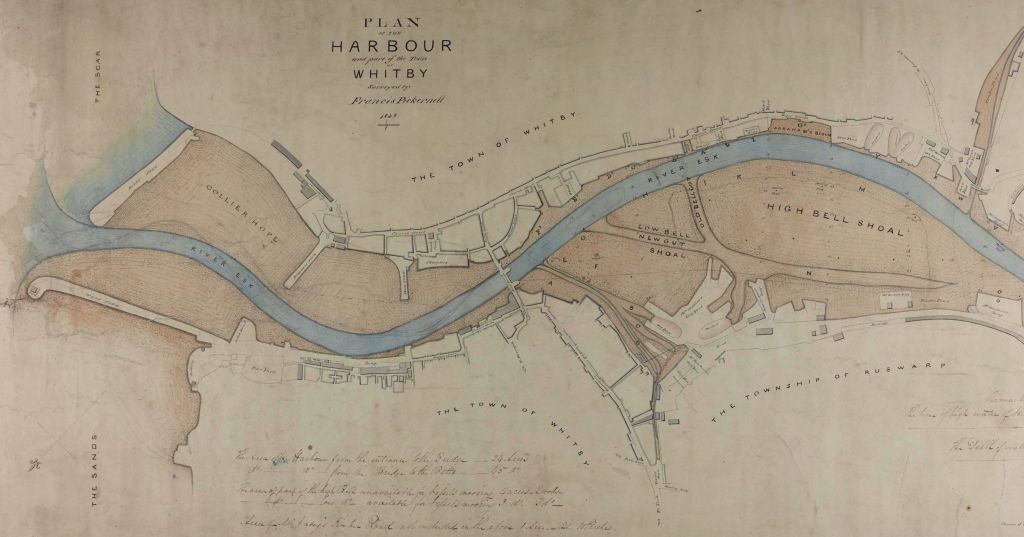
This plan of Whitby Harbour from 1828 is found amongst the records of the Harbour Trustees and forms part of the archives of Whitby Urban District Council who took over responsibility for the Harbour in 1905.

The Record Office hold a large collection of plans of railway lines and railway buildings. One of the earliest railway plans we hold is that of the Whitby to Pickering Railway, surveyed by George Stephenson in 1832.
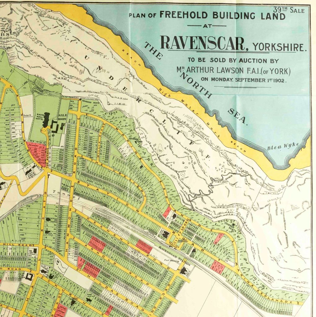
The County Record Office holds the archives of the Ravenscar Estate, which charts the failed attempt to establish a resort at Ravenscar. Though elaborate plans were drawn up and streets laid out, only a handful of properties were actually built.

Terrific maps, thank you for sharing from your archives.
Hello, was looking at purchasing a cottage in Robin hoods bay.. but big sticking point is no records ? Freehold or leasehold I believe the Cholmley lease was 999 year but is there any records for Cottages in RHB from this lease ? I’m looking at Staithe Cottage in RHB can you help
Hi Anthony,
We may be able to help. Please can you email us at archives@northyorks.gov.uk with the details of the information that you’re looking for and we’ll see if we can help.
Thanks – North Yorkshire Archives