
By Gail Falkingham, Record Assistant
A great place to start with any research is to look at historic maps and plans of an area. The Fitzwilliam archive contains a number of historic maps dating from 1770 to 1846. Some of these show both Old and New Malton, whilst others focus on a particular site or area of the town.
Old maps are an invaluable source of information about the local topography of a settlement and changes through time. When researching an area, and a series of maps and plans of different dates are available, it is often helpful to start with the most recent and work backwards (this is called a map regression exercise).
Ordnance Survey maps
Historic editions of Ordnance Survey (OS) maps are a good place to begin, with both 6 inch and 25 inch to the mile series. The County Record Office holds copies of most OS map 6 inch and 25 inch scale first editions (1850s and 1890s respectively), and some later editions.
Digital versions can also be found online via the North Yorkshire County Council website, where they can be compared with current digital mapping (at zoom levels 11 and 12) and also via the National Library of Scotland website.


Right: Ordnance Survey 6” to 1 mile sheet 124, 1854
Before the Ordnance Survey, maps and plans were made for a variety of purposes, in a range of scales and sizes, by and for a variety of surveyors and clients. North was not always pointing to the top of the map, as is the case today, and there was no national grid.
The Browse
The Fitzwilliam archive includes a plan of 1846 showing intended building plots for villa residences on The Browse in the parish of Old Malton, on land belonging to Earl Fitzwilliam. The title indicates that the land was
“To be let on Lease for a term of 99 years at a moderate ground rent for the erection of villa residences. For particulars apply to William Allen, The Lodge, Smithson & Jackson Solicitors, or to Robert Wise, Surveyor &c, Malton”.
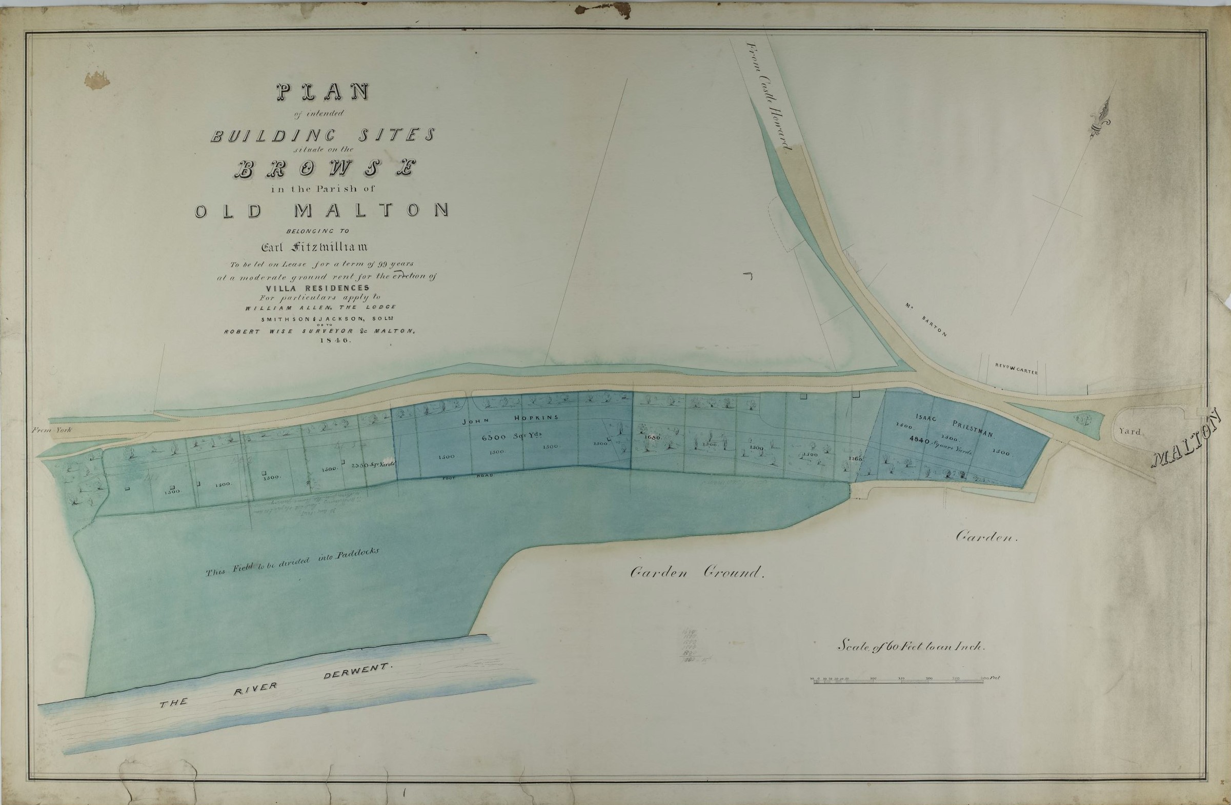
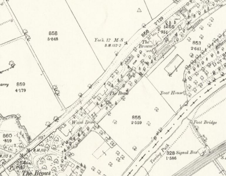
This area of land, known as The Browse, lies immediately to the west of the town of New Malton. The 1846 plan shows a number of plots along the south side of the York Road, north of the River Derwent and the Spa Gardens. Comparing this to the first edition 6 inch Ordnance Survey map of 1854 shows that the opportunity to build appears to have been taken up quickly, as four villas have been mapped, each with large gardens. By the time of the first edition 25 inch OS map, fifty years later, a fifth villa can be seen to have been built at the southern end of The Browse (sheet 126.6, 1892).
Plan of the town of Malton, 1844
Caution must often be used when looking at early maps and plans; just because a building or feature is not shown on a particular map, does not necessarily mean that it was not there. Similarly, just because something is shown on a map, does not always mean that it was built, some plans might be showing proposals which were never, or only partially, implemented.
An example of this, from the Fitzwilliam archive, is a plan of 1844, showing the town of Malton and Norton, and the line of the proposed York to Scarborough railway running approximately east to west to the south of the River Derwent.

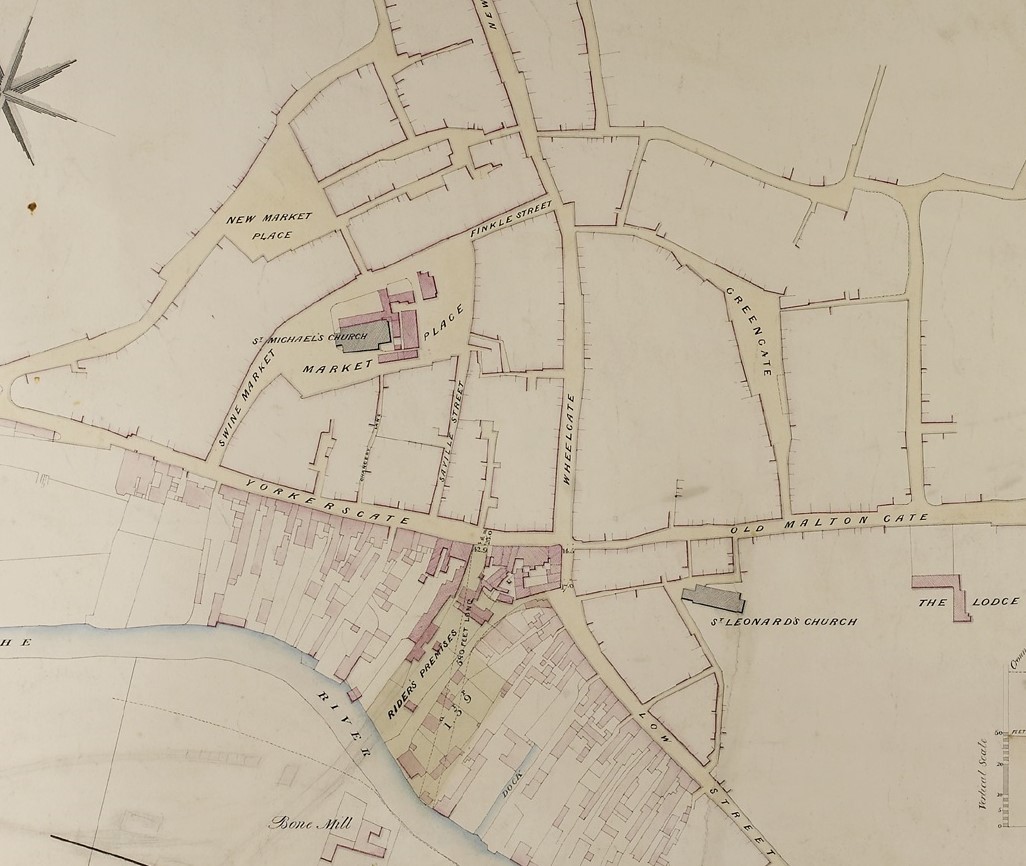
Looking more closely at the centre of Malton, whilst the detail of properties to the south of Yorksersgate and Low Street are shown, those to the north and around the Market Place are not; only the layout of the streets is mapped. This is not to say that there weren’t any buildings there in 1844, but rather that the main purpose of the plan was to show something else. In this case, the map highlights the course of the proposed railway line between York and Scarborough and a group of premises between the junction of Yorkersgate, Low Street and the River Derwent.
The railway line was built remarkably soon afterwards by the North Midland Railway; it opened the following year on 7th July 1845.
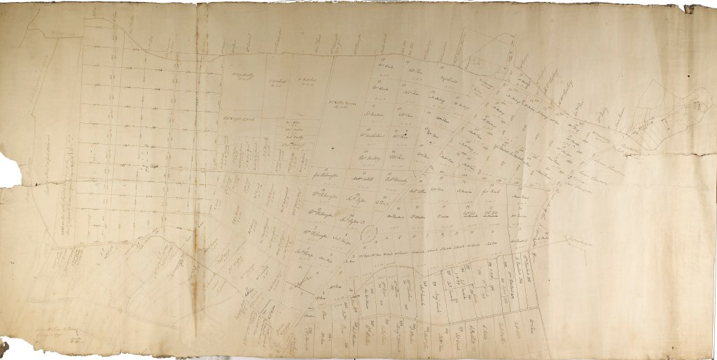
Old Malton Tithe Map and Apportionment, 1844
Tithes were a local tax of one tenth of agricultural produce, originally paid to support the local church and clergy. After the 1836 Tithe Commutation Act, these tithes were to be a monetary payment called a ‘tithe rent charge’, rather than goods. Tithe maps were generally made in the 1840s to calculate the properties liable for tithe and the amount of money to be paid for each. Three copies were originally made, one for the Tithe Commissioner (now held at the National Archives in London) and two other copies for the church, one for the diocesan registry and one for the local parish church.
This example for Malton covers the area around both settlements of Old and New Malton. It is accompanied by an apportionment, a schedule listing the landowner, occupier, plot number (as shown on the map) and the name and description of premises. From the summary at the end, we can see that the total area of titheable land in the parish is 2,954 acres and 2 roods, owing a total rent charge of £920. The landowner with the most property is the Earl Fitzwilliam, holding 2,689 acres, 1 rood and 31 perches of land, owing a rent charge of £844, 7 shillings and 1 pence. This equates to 92% of the total land. The next highest on the list is Thomas Walker esq., with 123 acres, 1 rood and 20 perches of land, owing £25 11s 5d.
This apportionment is a fantastic resource for the study of farming and land use in Malton in the mid-19th century.


Earlier maps and plans
This plan of 1809 by Ralph Burton shows the centre of New Malton. Most of the properties are numbered, although some are annotated with surnames. Originally, there would most likely have been an accompanying field or survey book to go with this map, listing the owners and tenants according to the numbers on the map. North is not to the top of this map, but to the left. The top of the map is eastwards.

There is another plan by Ralph Burton in the collection, dated 1801, surveyed for the Right Honourable Earl Fitzwilliam. It is described in our catalogue as being of parchment (mutilated). From the image below, you can see how the edges of the map have been damaged. This plan would have originally been stored rolled up and the damage has been caused by rodents, who have nibbled away at the parchment from the edges. Like the 1809 map, east is to the top of this map.

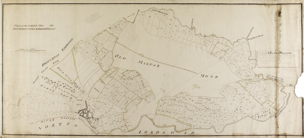
This plan of Malton Moor shows its subdivision into a series of regular field enclosures with straight boundaries, each annotated with the acreage and name of the landowner. It is labelled ‘from Mr Isaac Milbourn’s Survey of 1795’. Isaac Milbourn was one of the enclosure commissioners at the time of the Enclosure Acts of 1794 and 1796 for Old Malton. Within our collections we also hold copies of the original Enclosure award and plan, covering the open fields, common waste and ings of Old Malton, which was surveyed by Ralph Burton, 1805.
The earliest plan in the collection dates from 1770 and is a plan of Malton showing the property of the Most Honourable Christopher Watson Wentworth, Marquess of Rockingham. There is a large area at the centre labelled Old Malton Moor, on which there is a tiny sketch of a horse!

Further information
This is just a selection of the historic maps held by the County Record Office. Whilst our collection is extensive, it is not exhaustive; other archives and collections in Yorkshire, and further afield, may hold material relevant to Malton and North Yorkshire.
Those maps we do hold are listed in our Guide no. 3: List of North Yorkshire and North Riding maps and plans available for consultation in the North Yorkshire County Record Office. This is available for visitors to consult in our searchroom, and to purchase via our online shop
