
By comparing maps of different dates, we can see how the landscape has evolved over time and identify elements in today’s field patterns surviving from earlier periods
Early descriptions of land were generally written rather than mapped. From the 16th century, advances in mathematics, measurement and drawing techniques led to an increase in map making by surveyors using chains, compasses and measuring rods. By the 18th and 19th centuries, enclosure maps, tithe maps and estate maps provided detailed records of the landscape. Eventually, the Ordnance Survey produced the first comprehensive map coverage to a national, military standard. From the 1840s, the six-inch series shows every field boundary and every single building across the entire country.
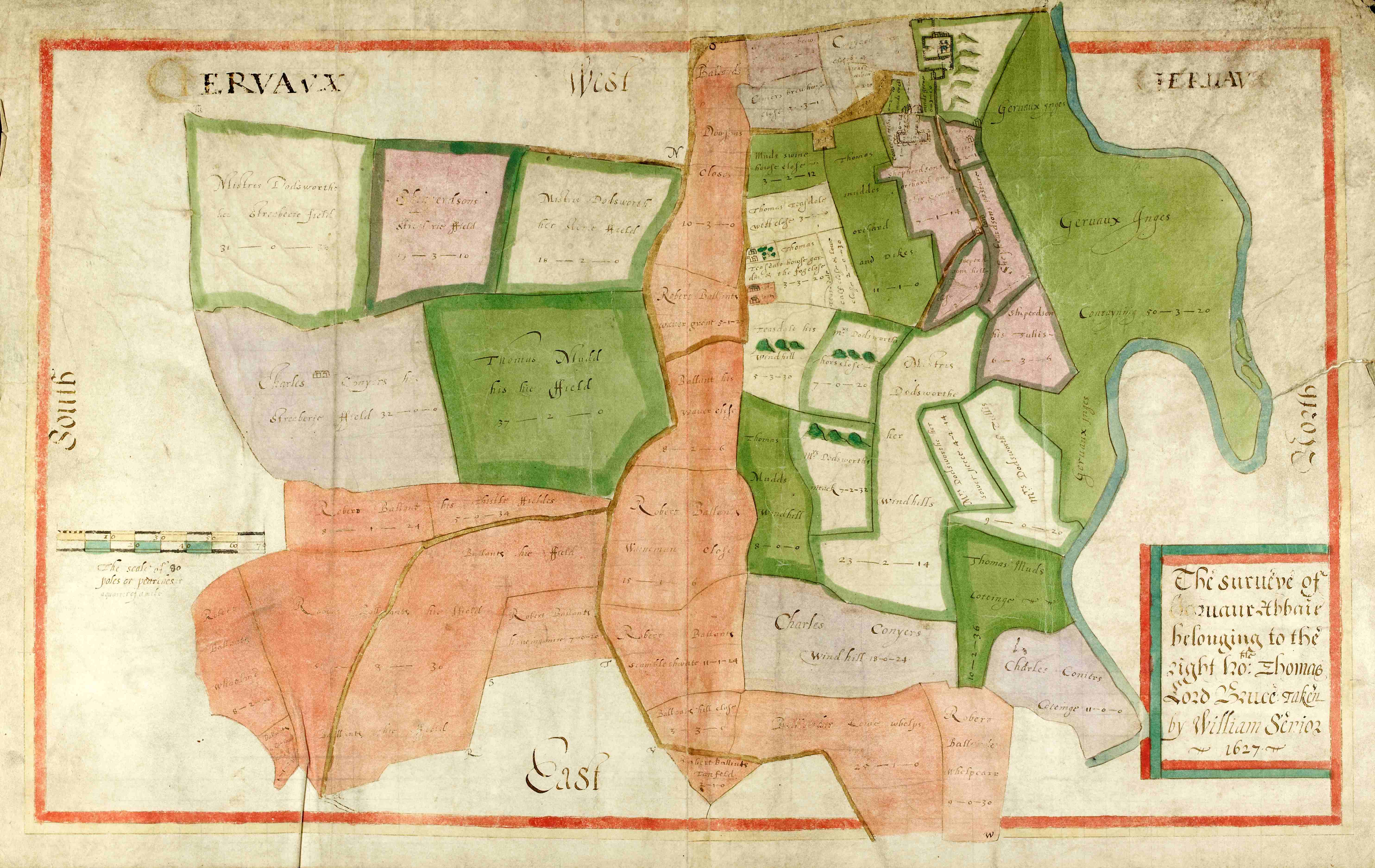
Survey of Jervaulx Abbey belonging to the right honourable Thomas Lord Bruce taken by William Senior, 1627 [ZJX 10/1/4]
The size, shape and arrangement of fields can reveal evidence of different farming practices and types of enclosure. Long, narrow boundaries often preserve the pattern of medieval open field strips. Irregular fields and sinuous boundaries respecting natural features may represent gradual piecemeal enclosure. Straight roads and regular rectangular fields cutting across earlier boundaries indicate planned enclosure.
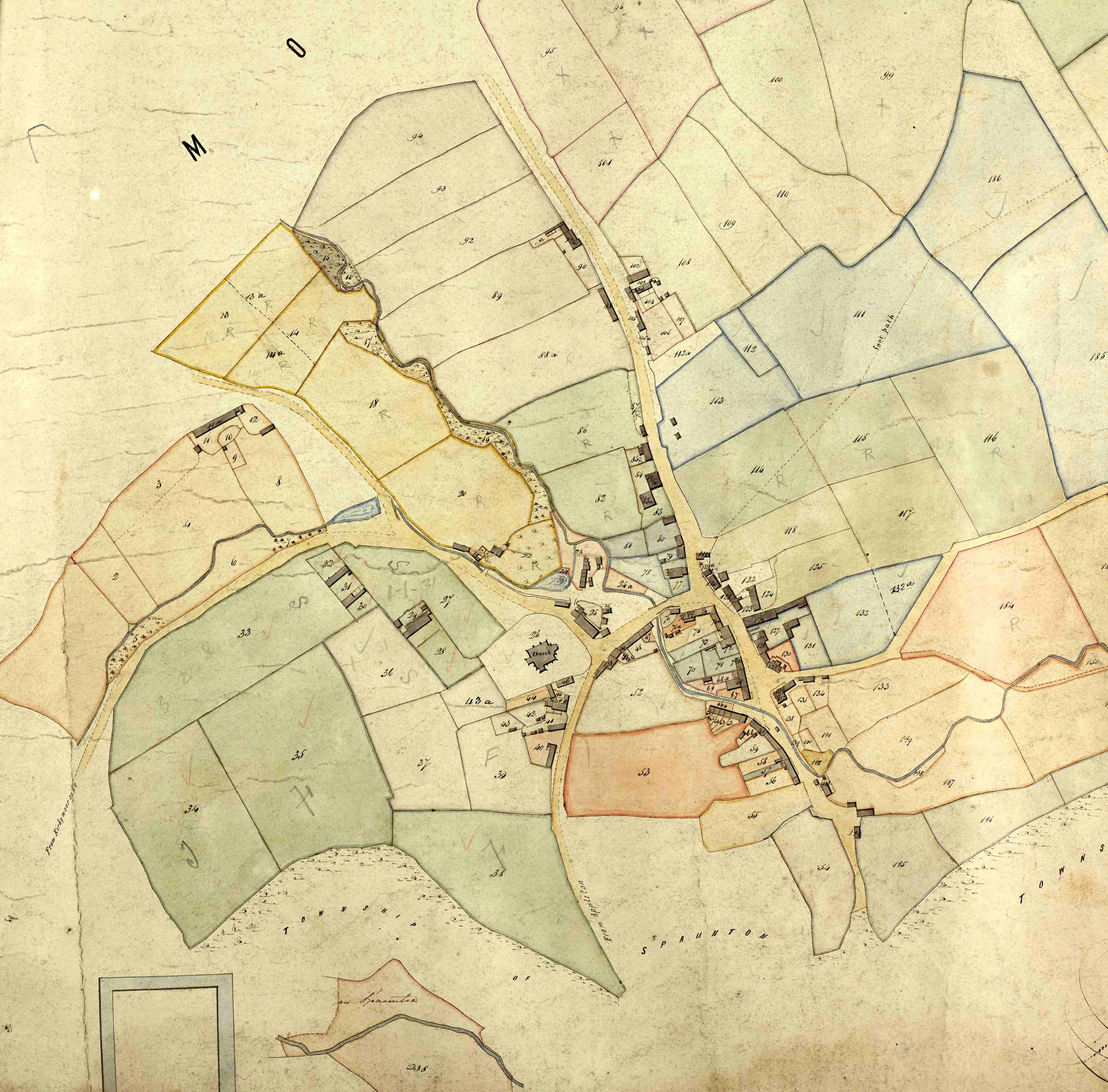
Lastingham tithe map extract, 1841 [T (PR/LAS)]
While some areas retain their historic field patterns, others have changed drastically. Traditional boundaries and hedgerows may have been altered to create bigger fields for large, modern farm machinery, or lost entirely to new development.
Historic maps and documents are a vital source to help us trace the evolution of these changes. You can find out more about reading the historic landscape through such sources in the examples from our archive collections illustrated in the following pages.
Further reading:
See also our Introduction to historic maps and plans page
