
by Gail Falkingham, Archives Assistant
Our latest exhibition, Fields in the Landscape, opened on 21 May 2026 to coincide with this year’s annual North Yorkshire Archives Discovery Day on the theme of North Yorkshire: A Living Landscape. The exhibition will be on display in our foyer until 27 August 2026, from Tuesday to Friday, 9.30am-4.00pm, with free entry.
Exploring how fields and their boundaries have shaped the countryside from the medieval period to the present day, the exhibition illustrates the hidden history of North Yorkshire’s landscape using a selection of historic maps and documents from the archives.
If you cannot visit the exhibition in person, or would like a preview of the material on display, we have put together an online version, which can be accessed via this link.
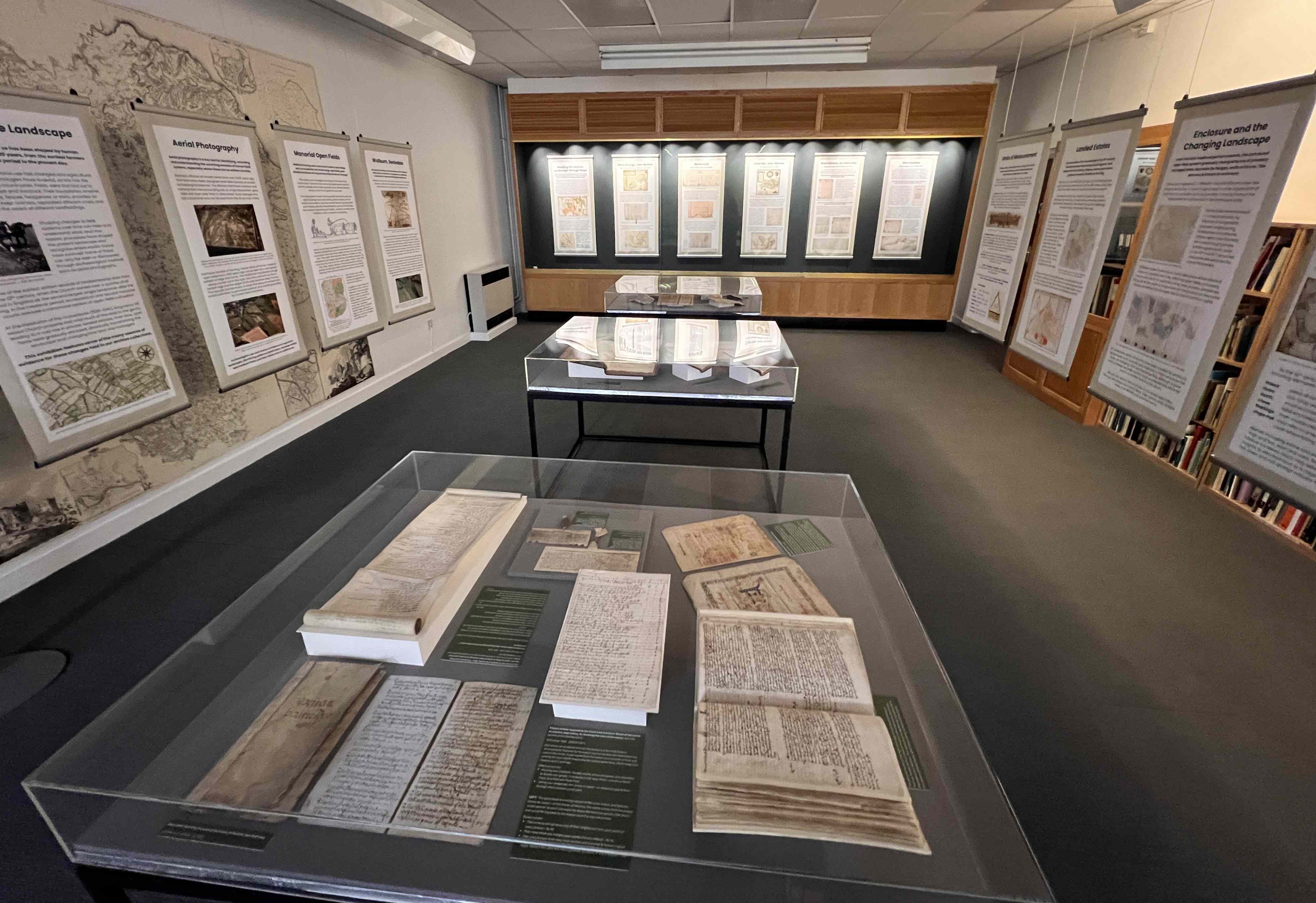
General view of the Fields in the Landscape exhibition
Themes covered include the medieval open-field system and related manorial documents and how this communal system gradually changed to one of privately managed fields bounded by hedges, walls or fences through the process of enclosure, whether by agreement and by parliamentary Act. Enclosure had a dramatic impact on the organisation of the landscape and has left us with an invaluable series of records that documented the process: agreements, acts, awards and maps, which are a major source for the study of changing land use and ownership.
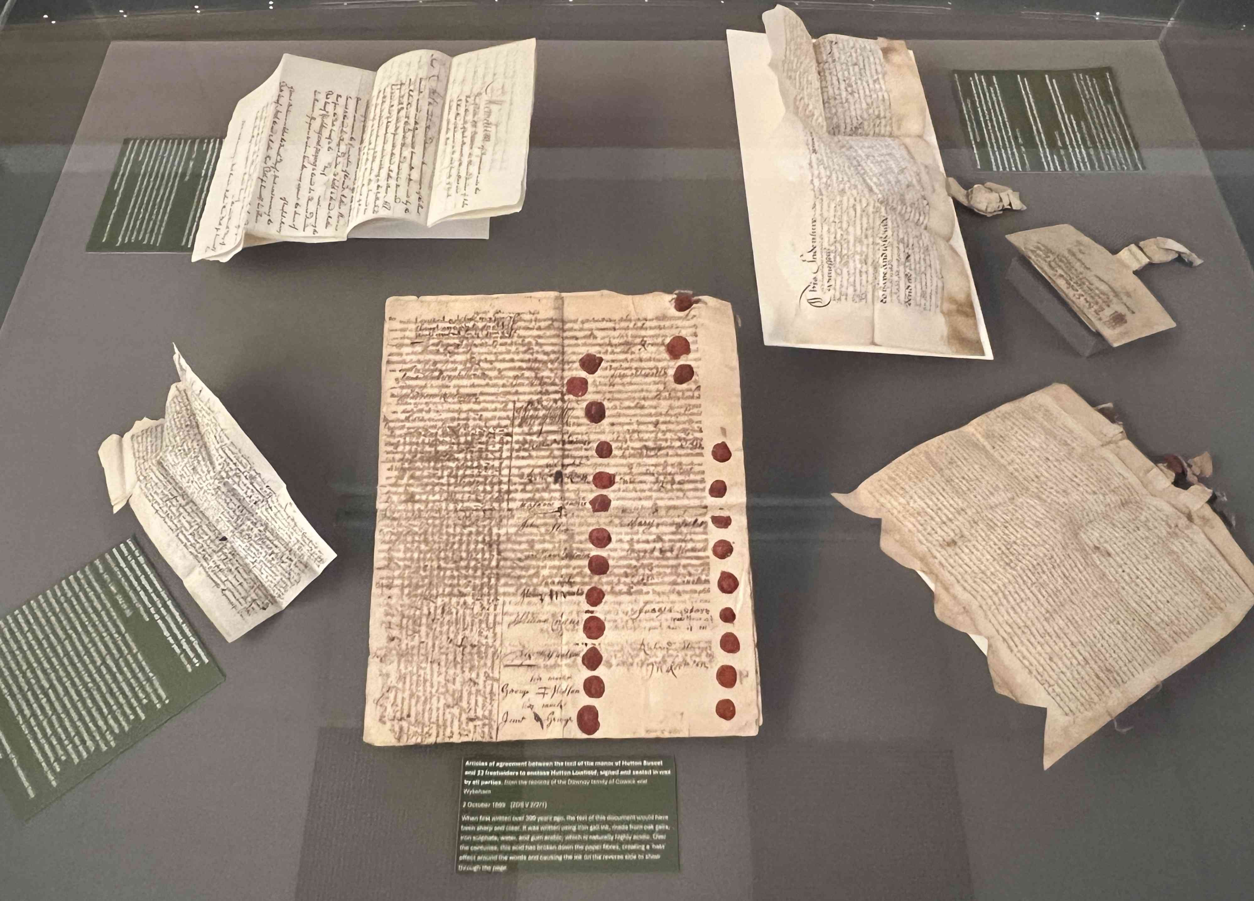
A selection of documents on display including 15th to 18th century title deeds and leases mentioning field names and land use and (centre front) articles of agreement between the lord of the manor of Hutton Buscel and 23 freeholders to enclose Hutton Lowfield, signed and sealed in wax by all parties, 1699
Some of the earliest written records of landholding date from the 12th century, when the Church held over a quarter of all land in England as the second largest single landowner after the King. The dissolution of the monasteries in the 16th century transformed land ownership across England; vast estates formerly held by religious houses were sold or granted to wealthy families by the King. Over time, such families built up large, private landed estates, often including several tenanted farms. Managing these estates required detailed records; owners commissioned surveyors to map their holdings, and produce handwritten field books including plans of each farm, and recording tenants, field names, land use, acreage and rental values. Where they survive, estate maps are often the earliest visual record of a township or parish, which can date back as far as the early-17th century.
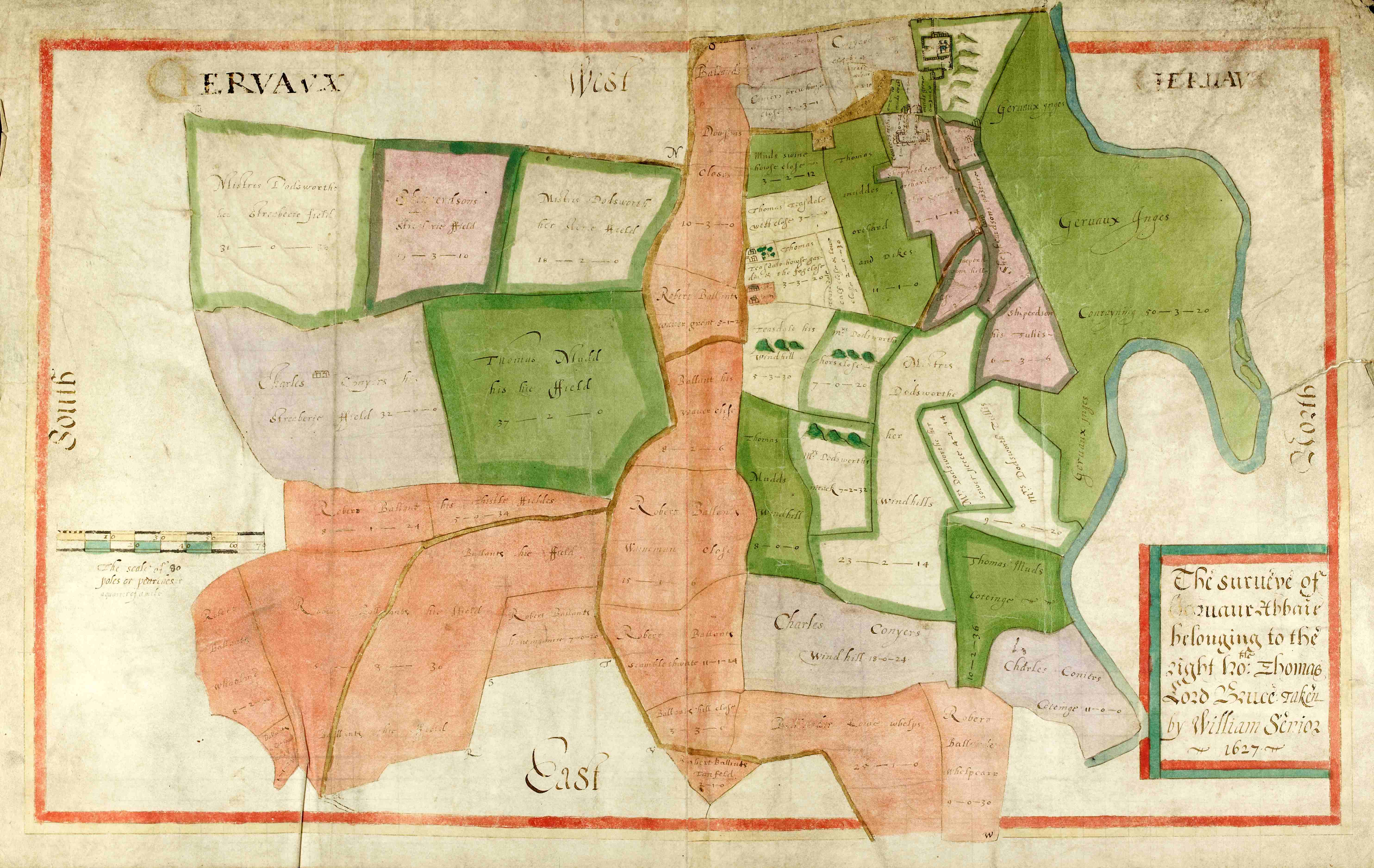
Survey of Jervaulx Abbey belonging to the right honourable Thomas Lord Bruce taken by William Senior, 1627 [ZJX 10/1/4]
By comparing maps of different dates, we can see how the landscape has evolved over time and identify elements in today’s field patterns surviving from earlier periods. The size, shape and arrangement of fields can reveal evidence of different farming practices and types of enclosure. Long, narrow boundaries often preserve the pattern of medieval open field strips. Irregular fields and sinuous boundaries respecting natural features may represent gradual piecemeal enclosure. Straight roads and regular rectangular fields cutting across earlier boundaries indicate planned enclosure.
The exhibition features a series of case studies of Crambe, near Malton; Rand Grange, near Bedale; Richmond; Wombleton, near Helmsley; Dale, near Hawnby and Walburn in Swaledale.
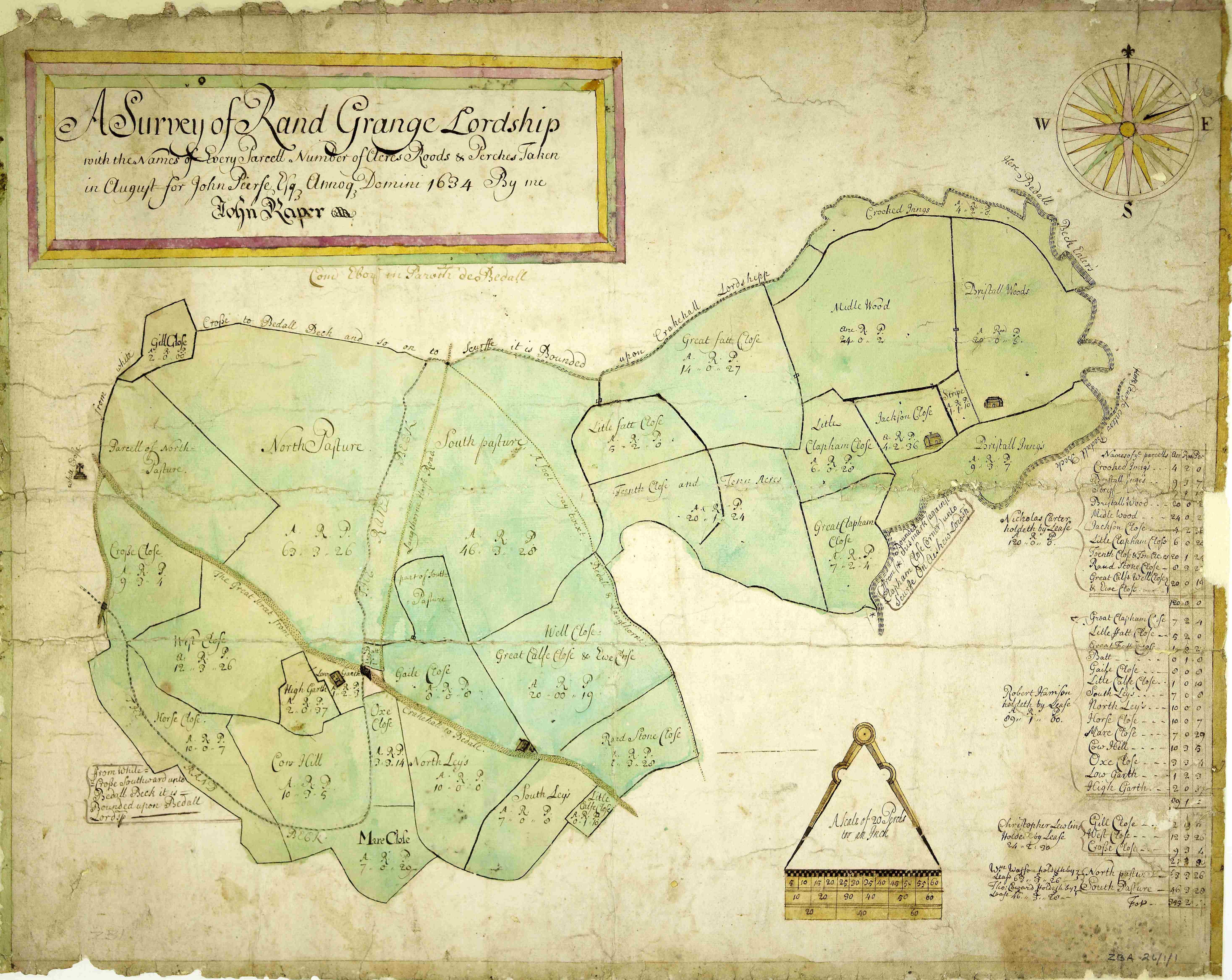
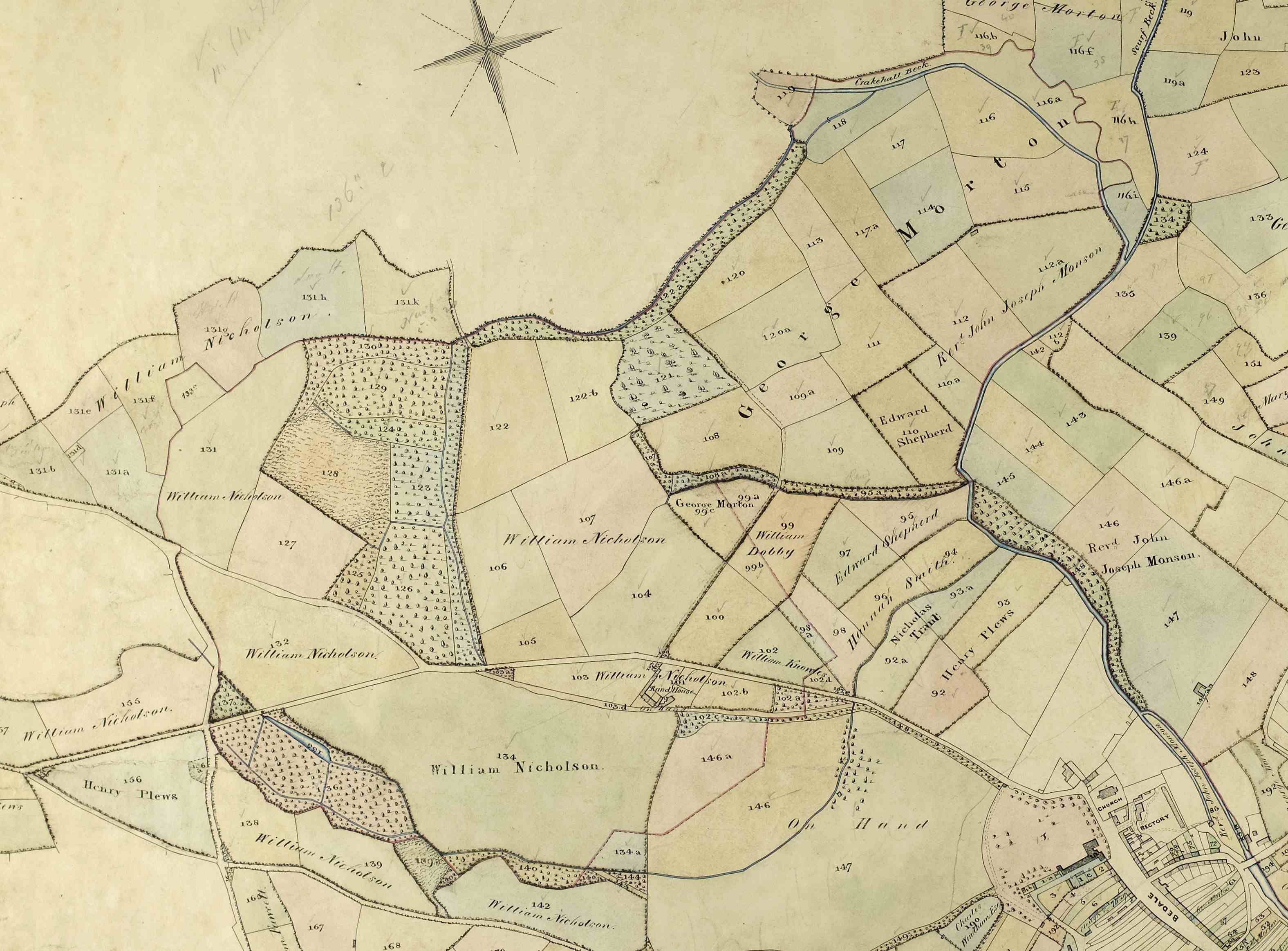
- Left: A Survey of Rand Grange lordship for John Peirse Esq. by John Raper, 1634 [ZBA 26/1/1]
- Right: Extract from map of Crakehall, Bedale & Aiskew showing Rand Grange, 1850 [ZBA 26/1/5]
Do come and visit us in person, or online, to find out more!
Further reading:
Link to the online version of the Fields in the Landscape exhibition (link opens new window)
