
The dissolution of the monasteries in the 16th century transformed land ownership across England; vast estates formerly held by religious houses were sold or granted to wealthy families by the King
Over time, such families built up large, private landed estates, often including several tenanted farms. Until the 19th century, land was one of the most important sources of income and wealth. Enclosure was seen as a means to improve agricultural efficiency and revenues, for example by converting arable to pasture when wool prices were higher than grain or adopting new technology and growing new crops.
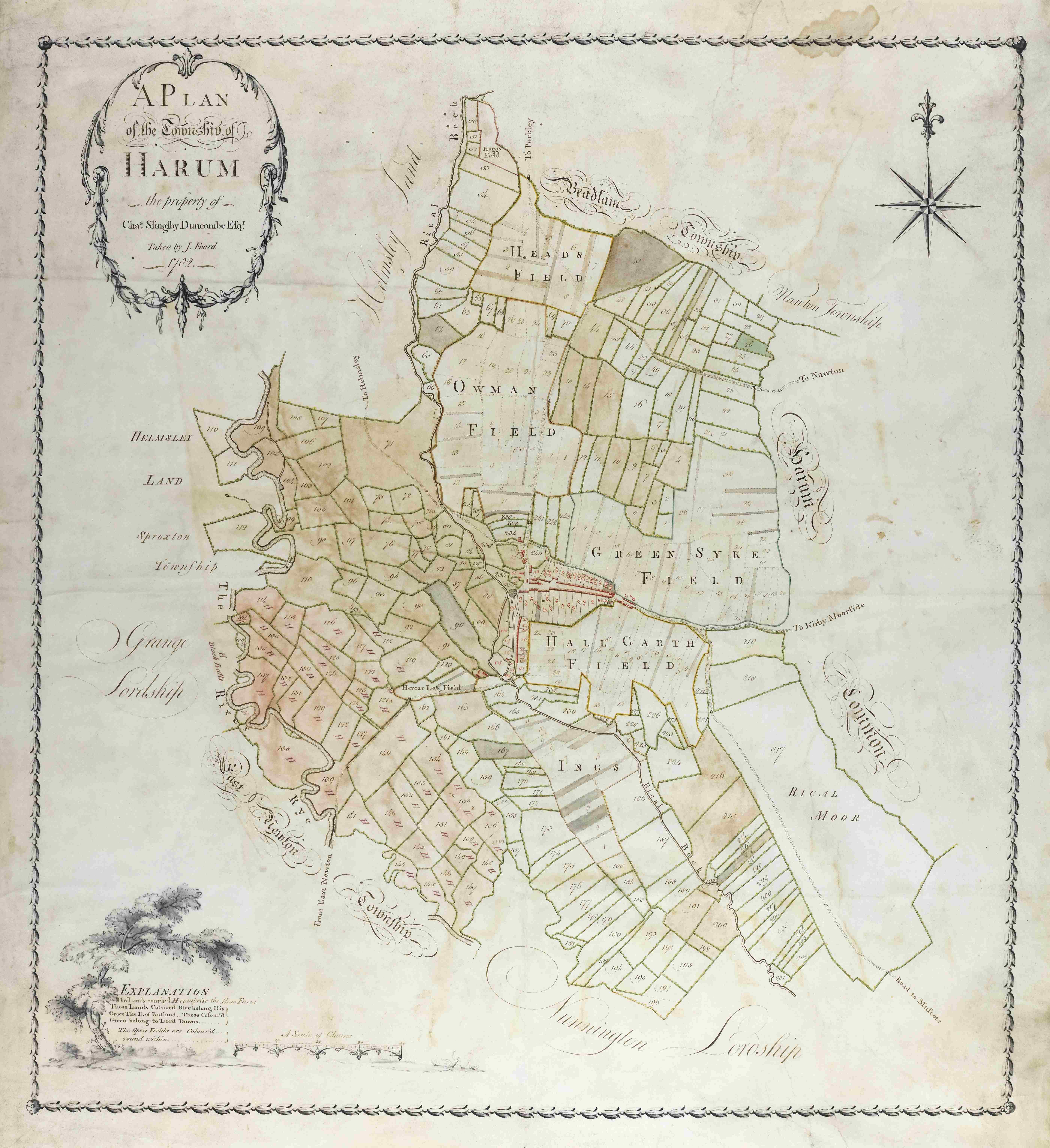
A plan of Harome for Charles Slingsby Duncombe by Joseph Foord, 1782 [ZEW M8]
Managing these estates required detailed records. Owners commissioned surveyors to map their holdings, showing farms, fields, woodland, roads and watercourses. Surveys also took the form of written field books. These working documents included a plan of each farm, recording tenants and every field by name, including land use, acreage and rental value.
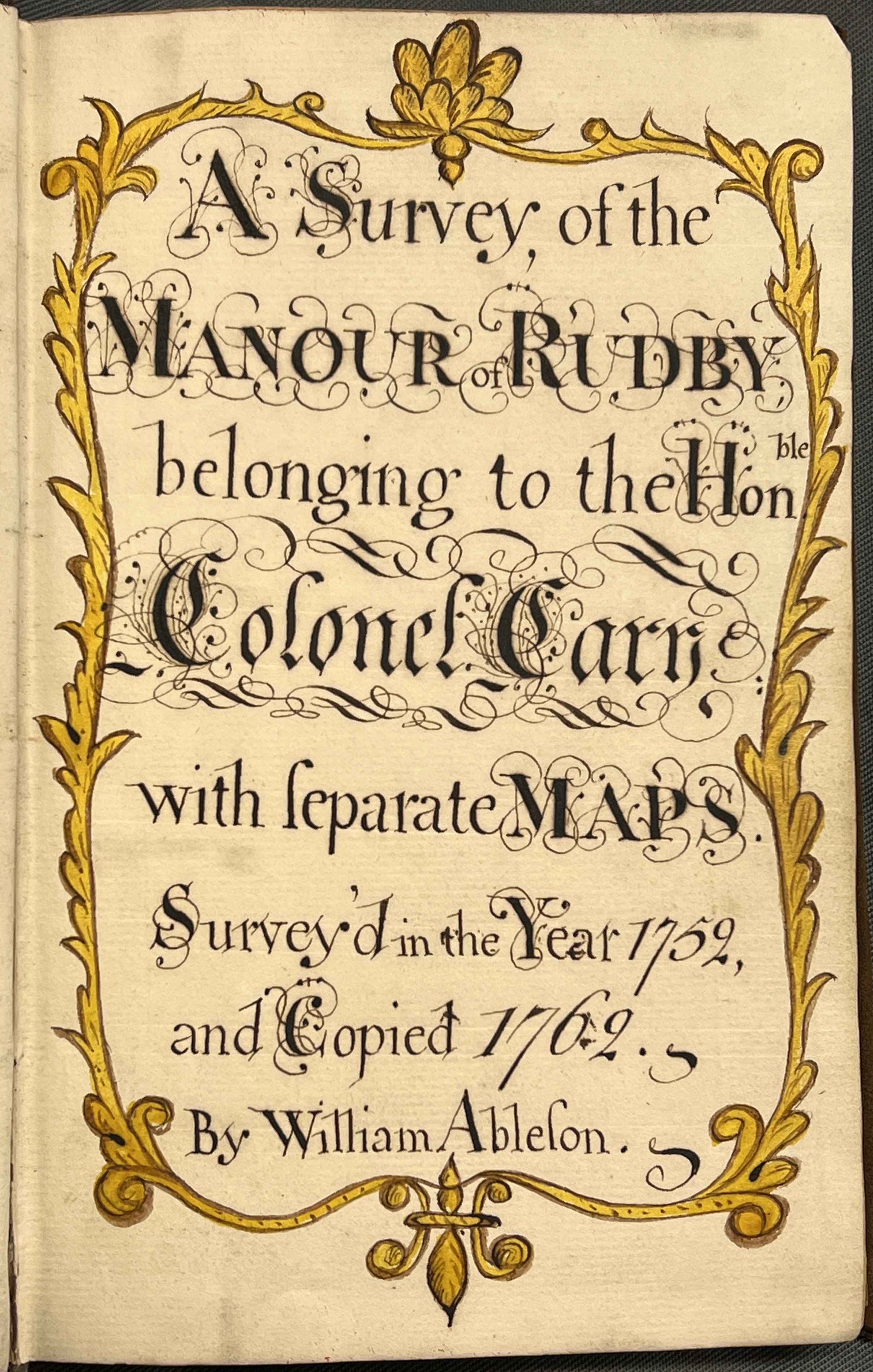
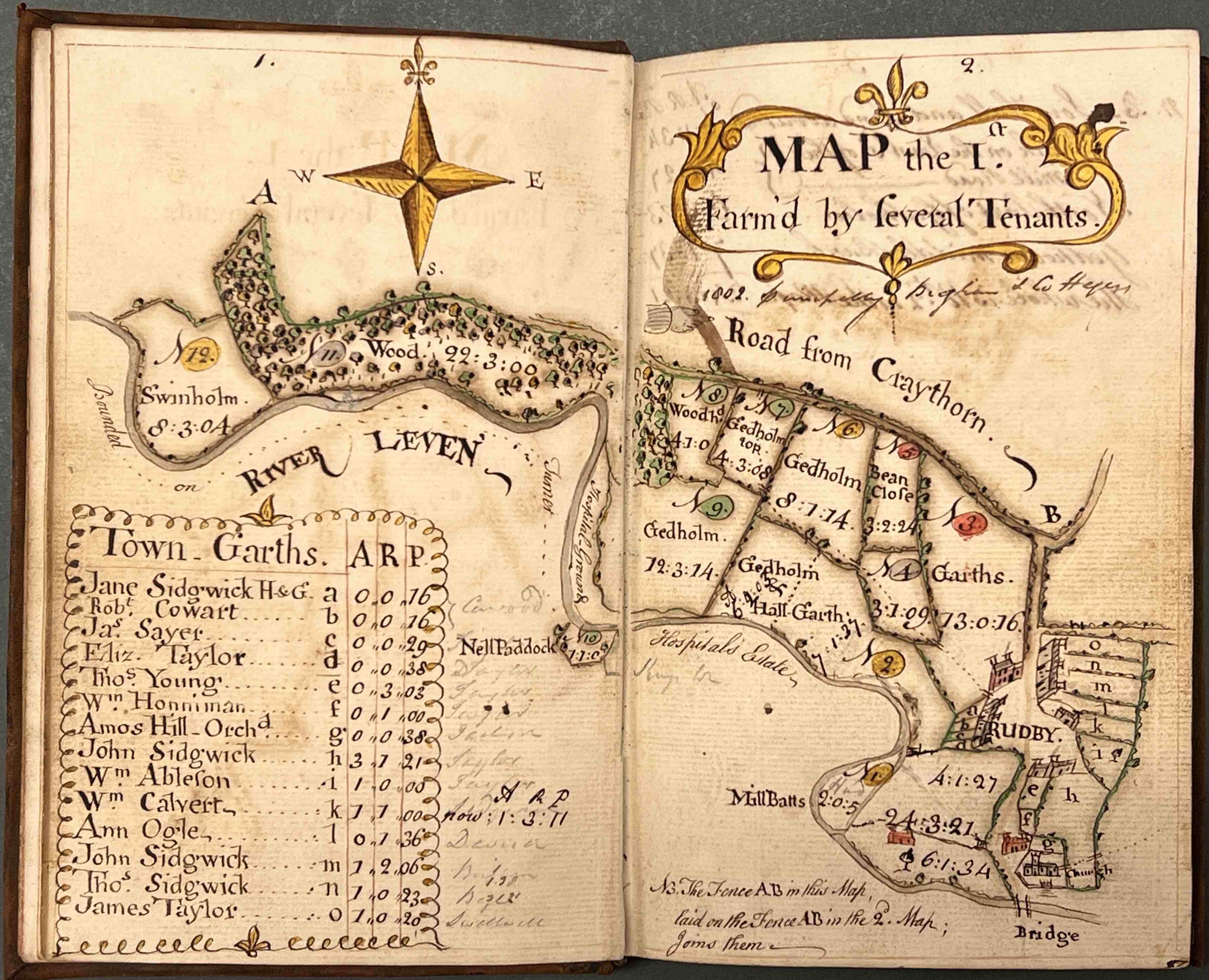
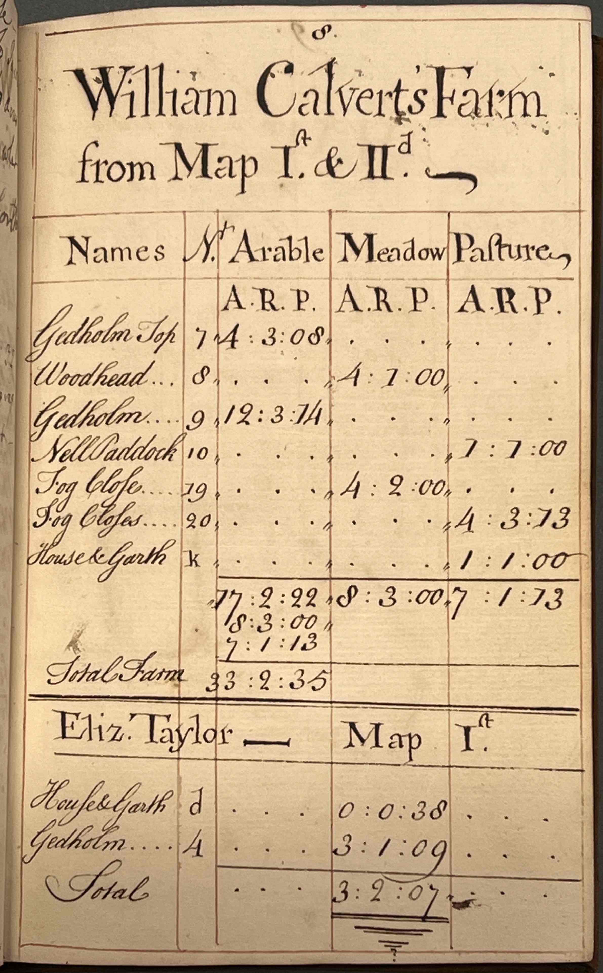
Pages from a survey of the manor of Rudby belonging to the Honourable Colonel Cary, surveyed in 1752 and copied in 1762 by William Ableson, from the records of the Falkland (Cary) family of Leven Grove (Skutterskelfe Hall), 1762 [ZFD] – map of Rudby, shows field names, areas in acres, roods and perches, and summary list of tenants’ acreages, with further details of the holdings of individual tenants on subsequent pages.
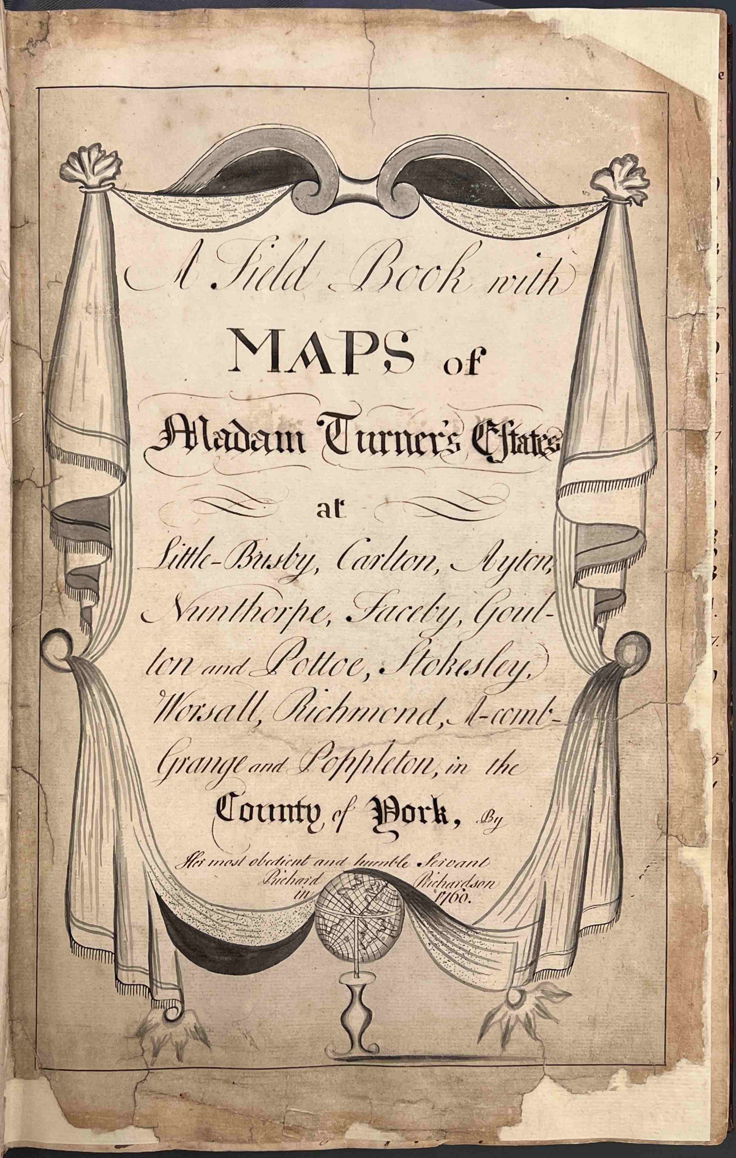
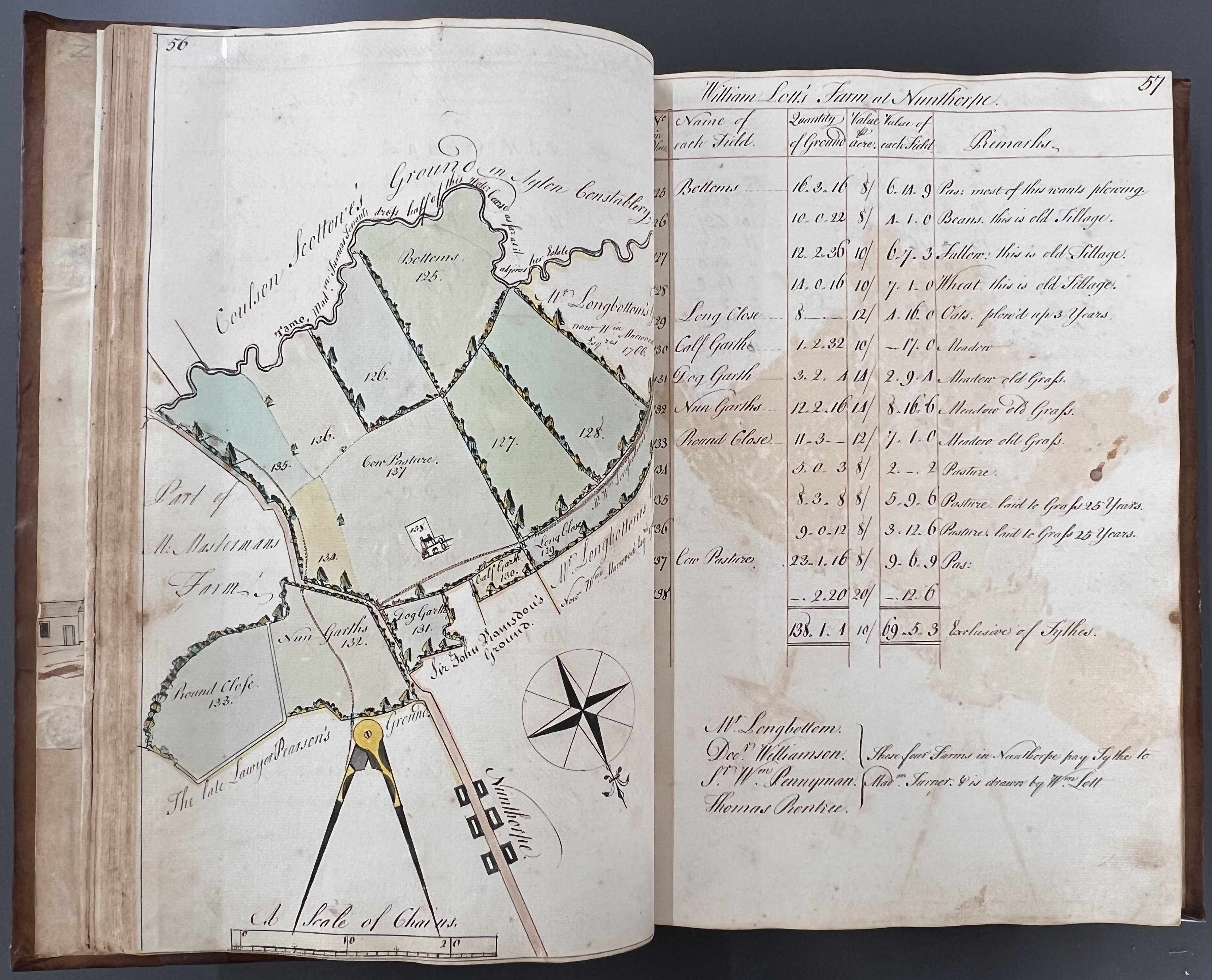
Fronticepiece of field book of Madam Turner of Busby’s estates by Richard Richardson, from the Busby Hall archive, 1760 [ZDU 82] – Field book open to show William Lett’s farm at Nunthorpe, recording field names, areas in acres, roods and perches, values in pounds, shillings and pence, with remarks as to land use and crops.
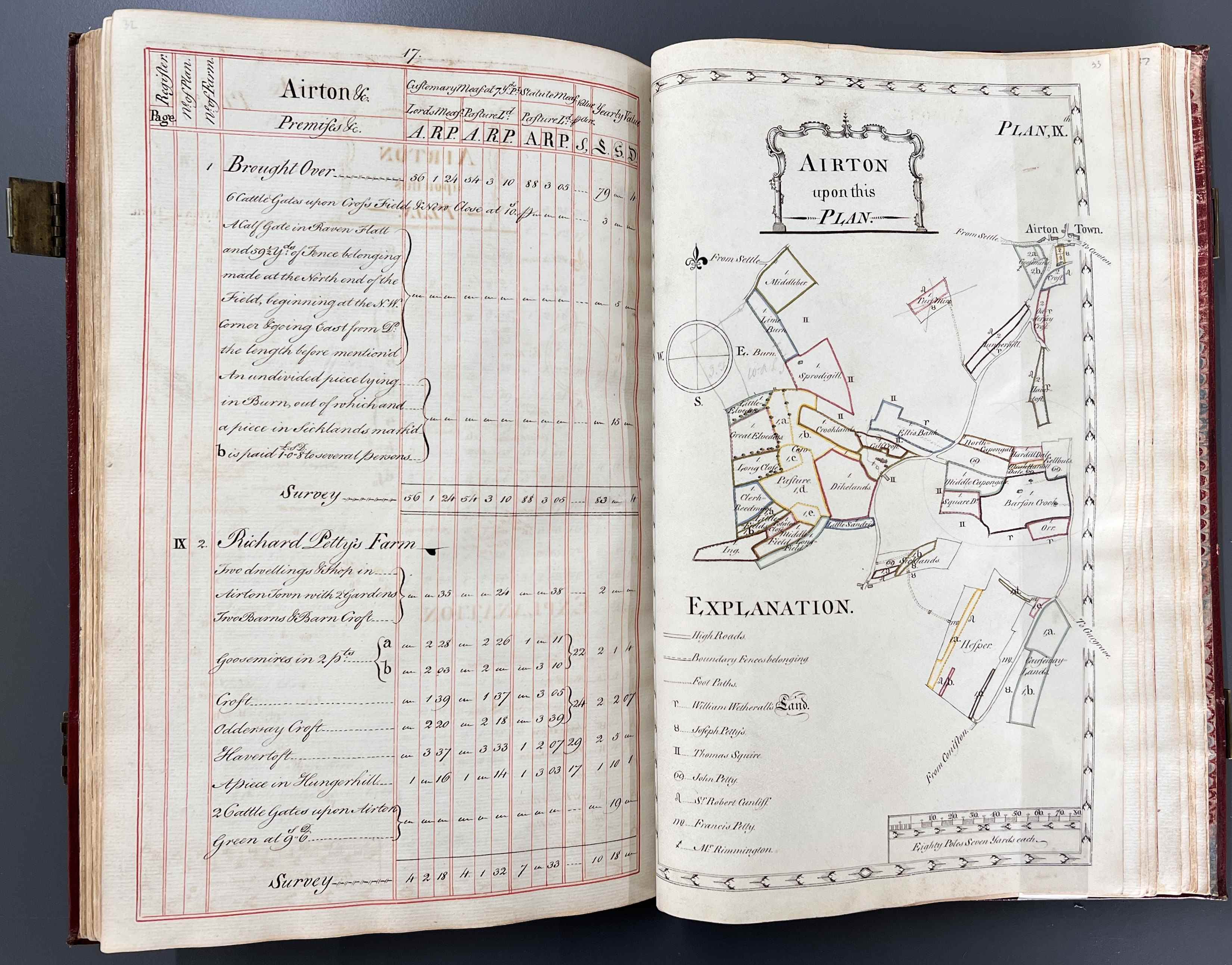
A survey with maps of the estate of William Serjeantson Esq. within the townships of Hanlith and Kirby in Malhamdale by George Lang of Leyland, 1776 [Z.1443] – Open at plan of Airton showing details of Richard Petty’s farm, recording field names, areas in acres, roods and perches, and values in pounds, shillings and pence. Symbols of the zodiac are used in the key to the map listing names of adjoining landowners.
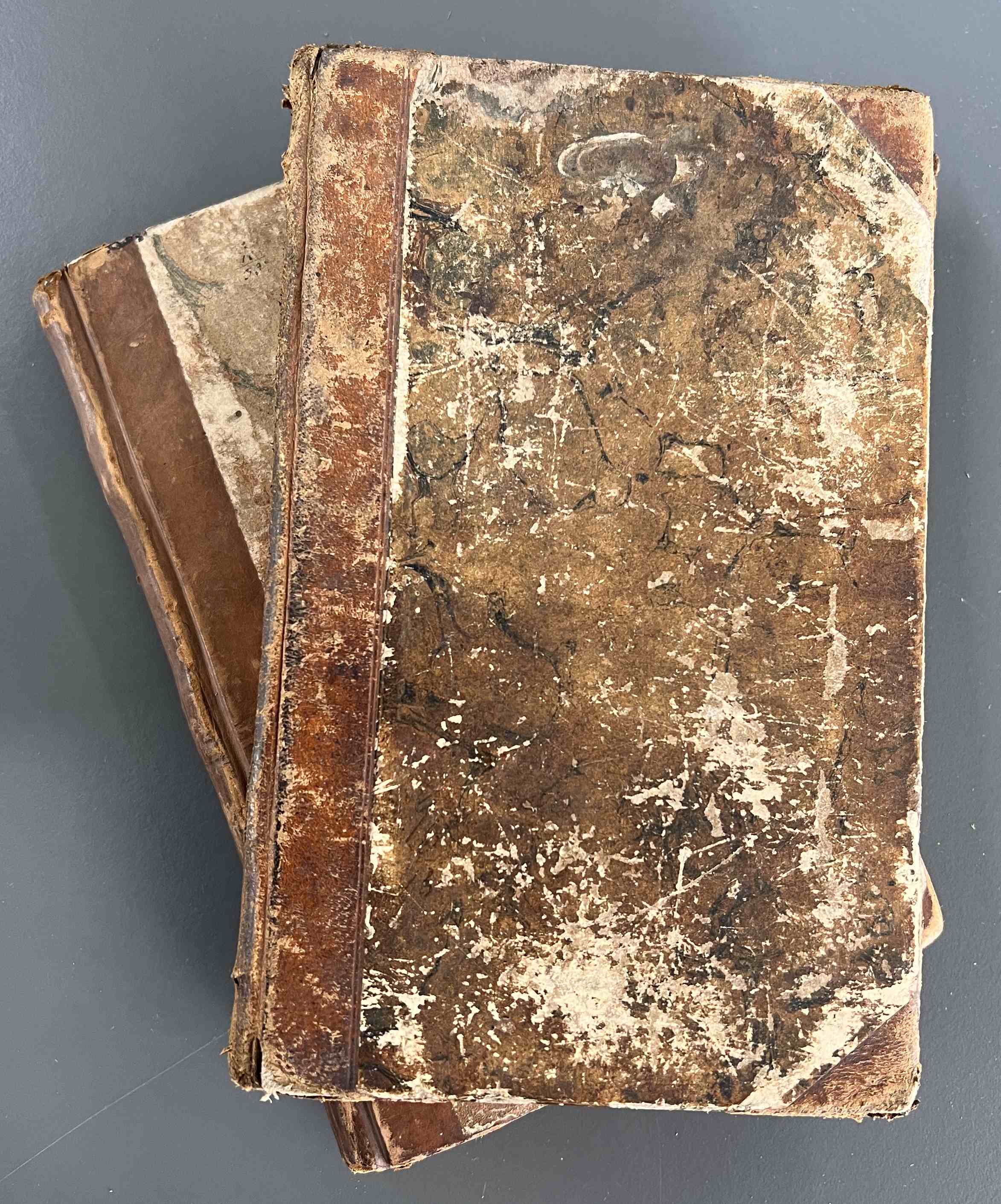
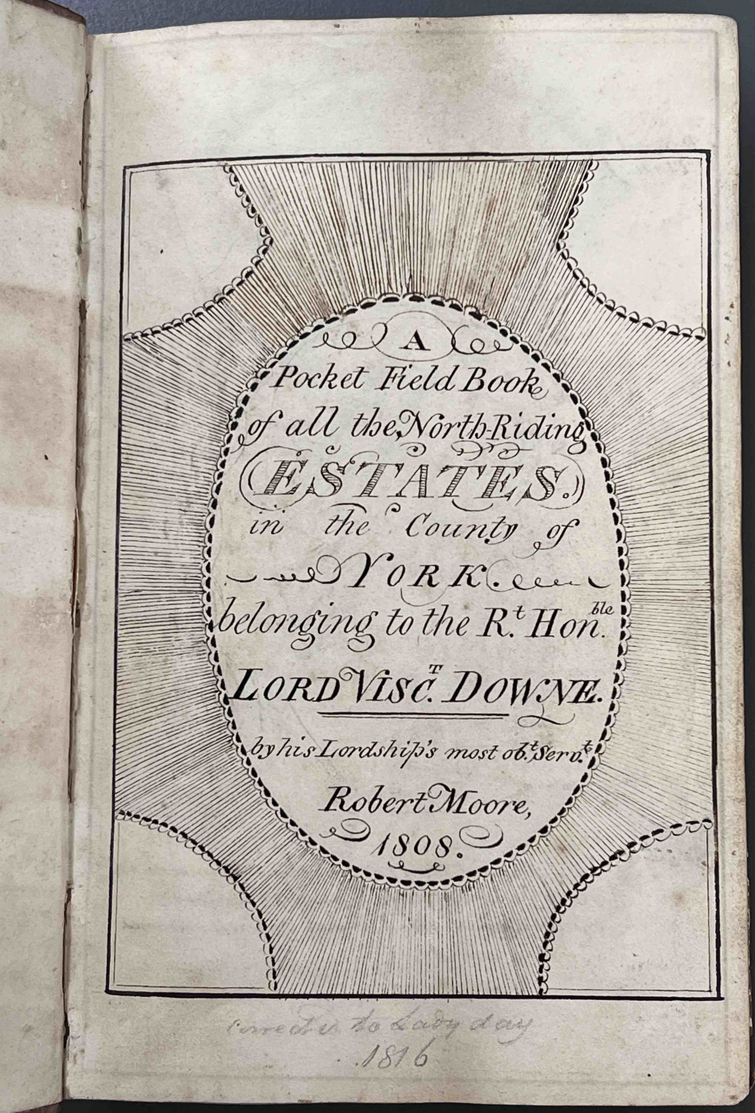
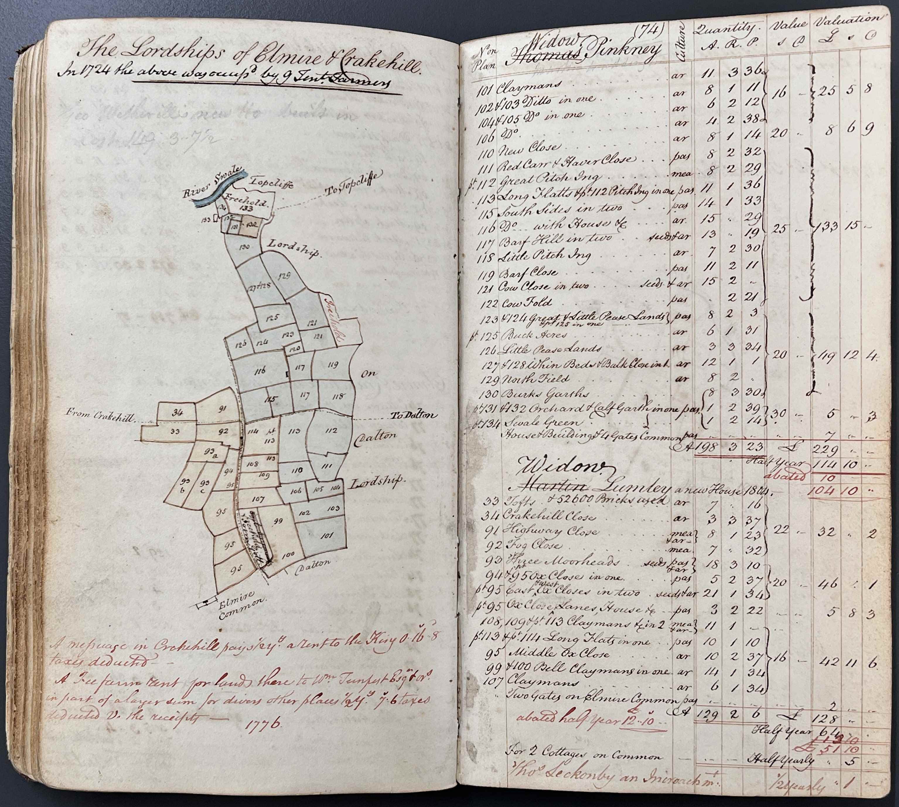
Two pocket field books recording the estates of Viscount Downe, two closed, one open to show fronticepiece, the other open to show plans of farms at Eldmire and Crakehill, from the records of the Dawnay family of Cowick and Wykeham, 1808 & 1828 [ZDS IV 1/1/2 & 5]
These pocket field books were working documents that often include later annotations and amendments; the later entry of 1828 above has been amended to record Widows Pinkney and Lumley in occupation, presumably following the deaths of their respective husbands, Thomas Pinkney and Martin Lumley, whose names have been crossed out. (A, P & M stand for arable, pasture and meadow, recording land use. A.R.P. stands for acres, roods & perches, the units of measuring area).
Today, surviving estate records provide valuable evidence for the historic landscape and how patterns of ownership and land use have changed through time. Where they exist, estate maps are often the earliest visual record of a township or parish.
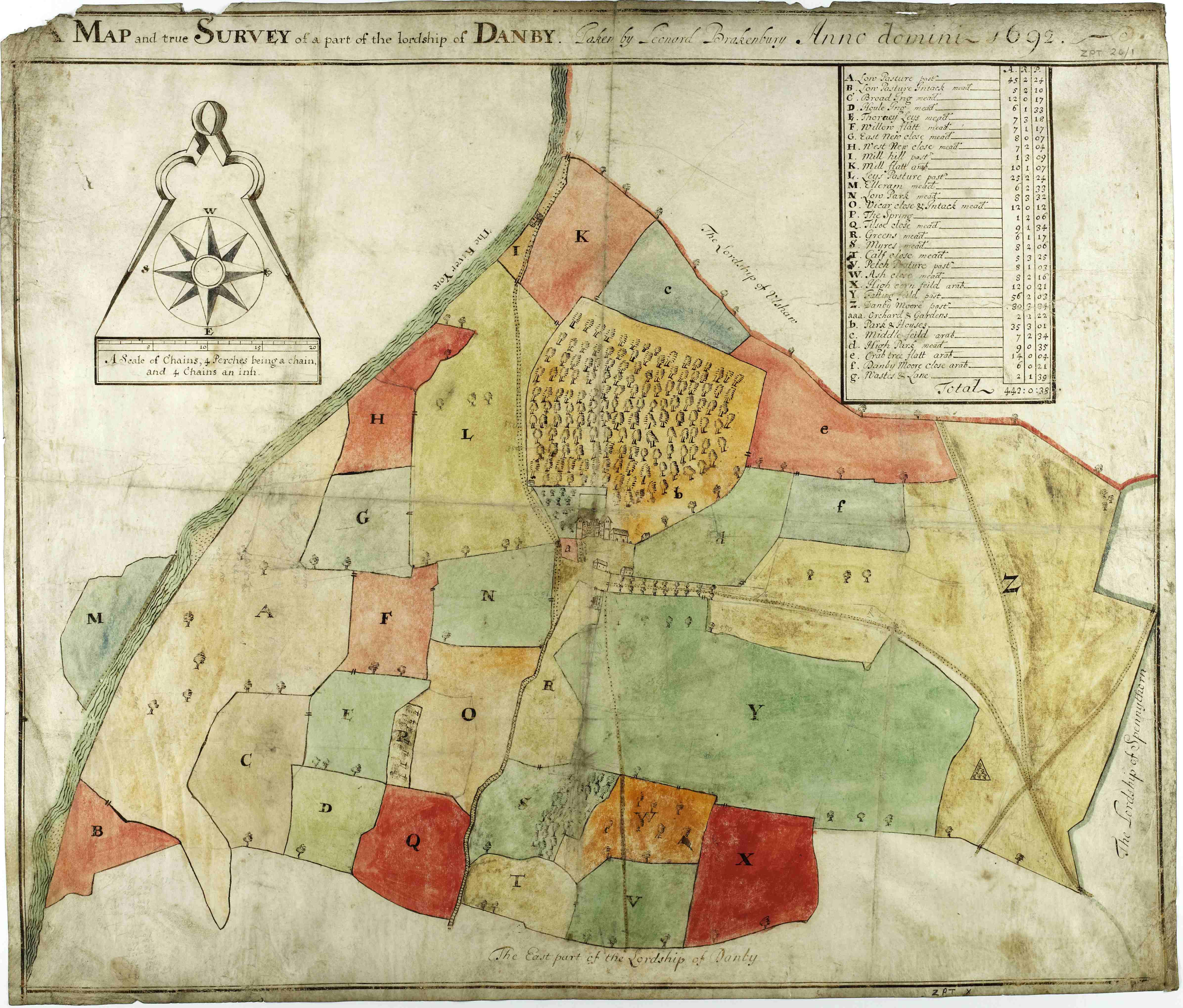
Map and true survey of part of the Lordship of Danby, from the Scrope family of Danby archive, 1692 [ZPT 26/1]
