
From the late medieval period onwards, the communal open-field system gradually changed to one of privately managed fields bounded by hedges, walls or fences: this process is known as enclosure
Enclosure happened in different ways at different times over several centuries. It had a huge impact on the organisation of both the countryside and rural society, creating many of the field patterns that survive in the landscape today.
Some fields were enclosed in a piecemeal way by informal arrangements between neighbouring landowners and tenants. Others were more formally enclosed through private written agreements. Later, in the 18th and 19th centuries, enclosure was enforced by Acts of Parliament. Examples of this phased process of enclosure can be seen in our page on the enclosure of Wombleton, near Helmsley.
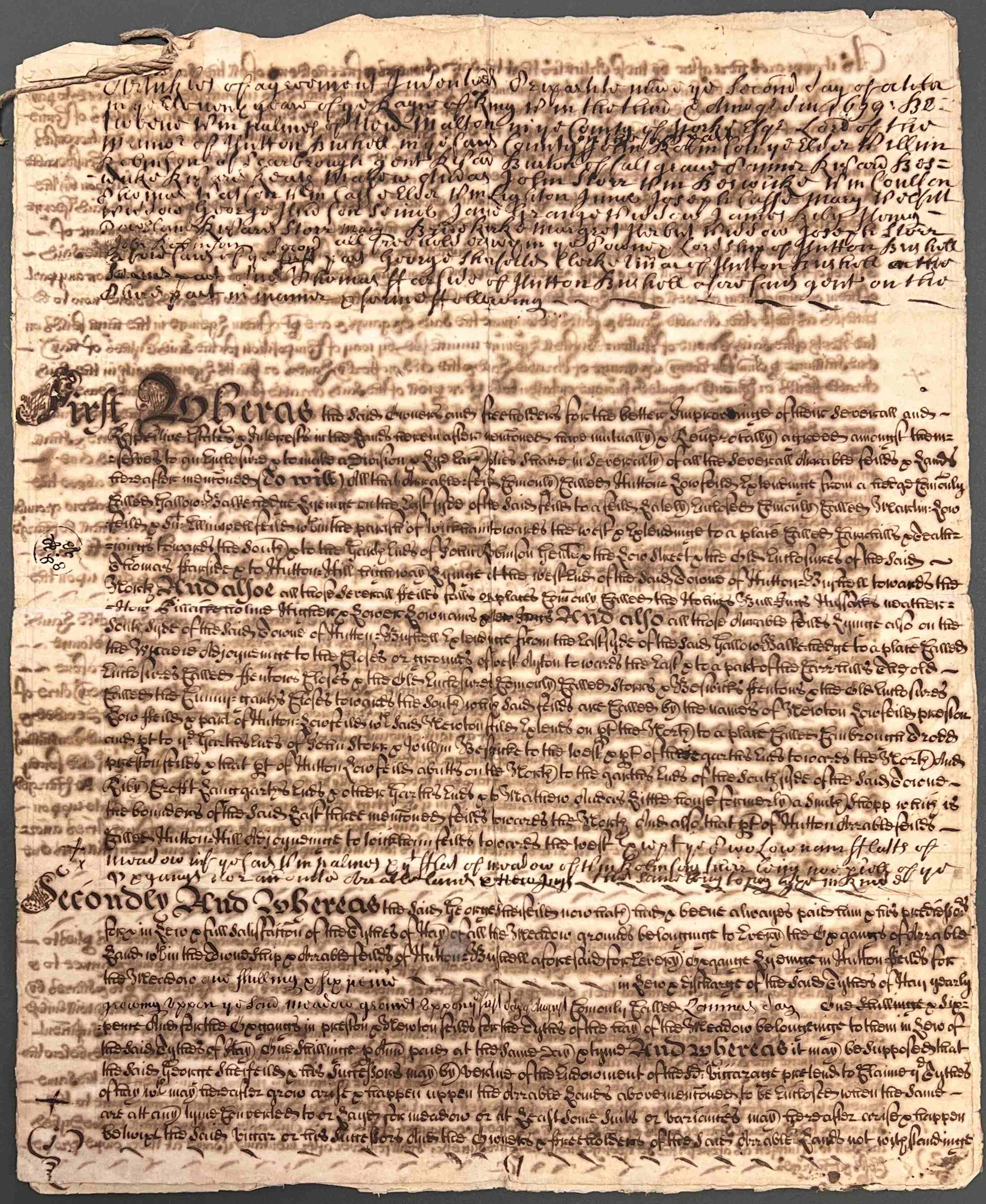
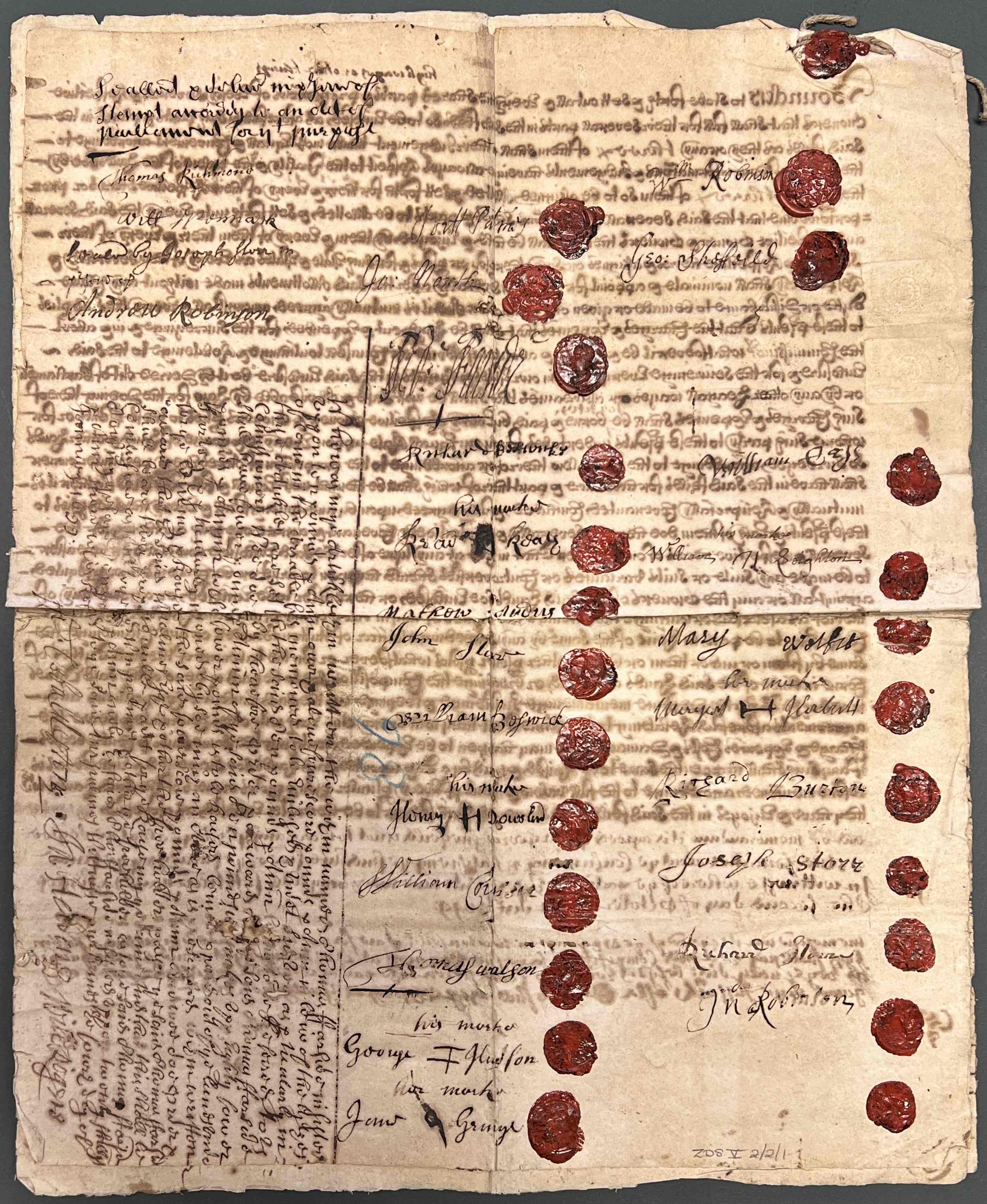
First and last pages of articles of agreement between the lord of the manor of Hutton Buscel and 23 freeholders to enclose Hutton Lowfield, signed and sealed in wax by all parties, from the records of the Dawnay family of Cowick and Wykeham, 2 October 1699 [ZDS V 2/2/1]
When first written over 300 years ago, the text of the above document would have been sharp and clear. It was written using iron gall ink, made from oak galls, iron sulphate, water, and gum arabic, which is naturally highly acidic. Over the centuries, this acid has broken down the paper fibres, creating a ‘halo’ effect around the words and causing the ink on the reverse side to show through the page.
Different types of enclosure could take place within different areas of a parish over time, affecting open fields, commons, moors and waste. It could be a long, slow process, sometimes taking up to ten years to implement on the ground; not everyone readily accepted the changes due to loss of common rights.
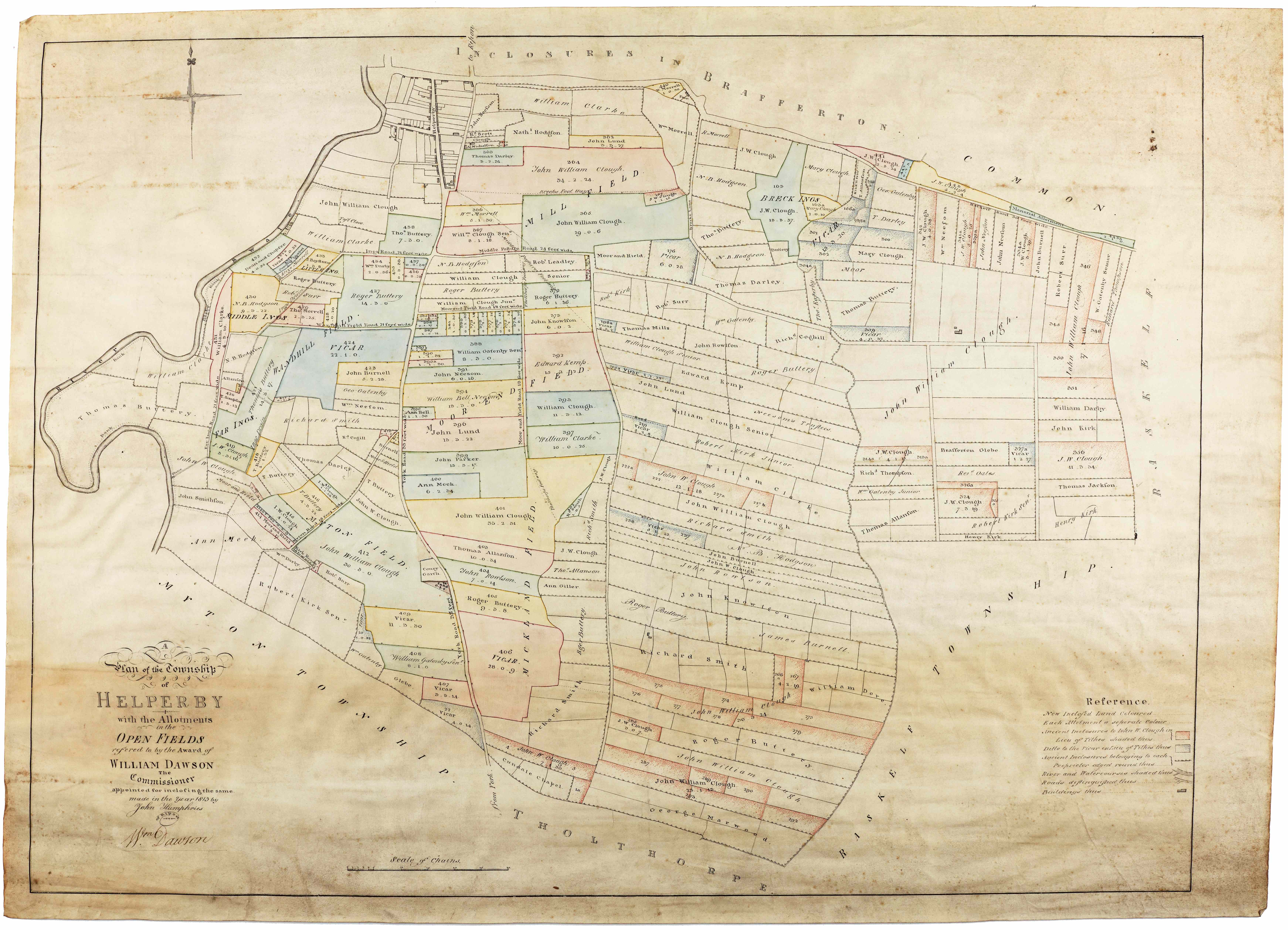
Helperby enclosure map, 1813 [I NRRD 21]
An invaluable series of records have been created by enclosure: agreements, acts, awards and maps are a major source for the study of changing land use and ownership. Although a great many of these records survive, much enclosure took place for which no written record is still extant. You can find out more about parliamentary enclosure and associated records in the examples illustrated in the following pages.
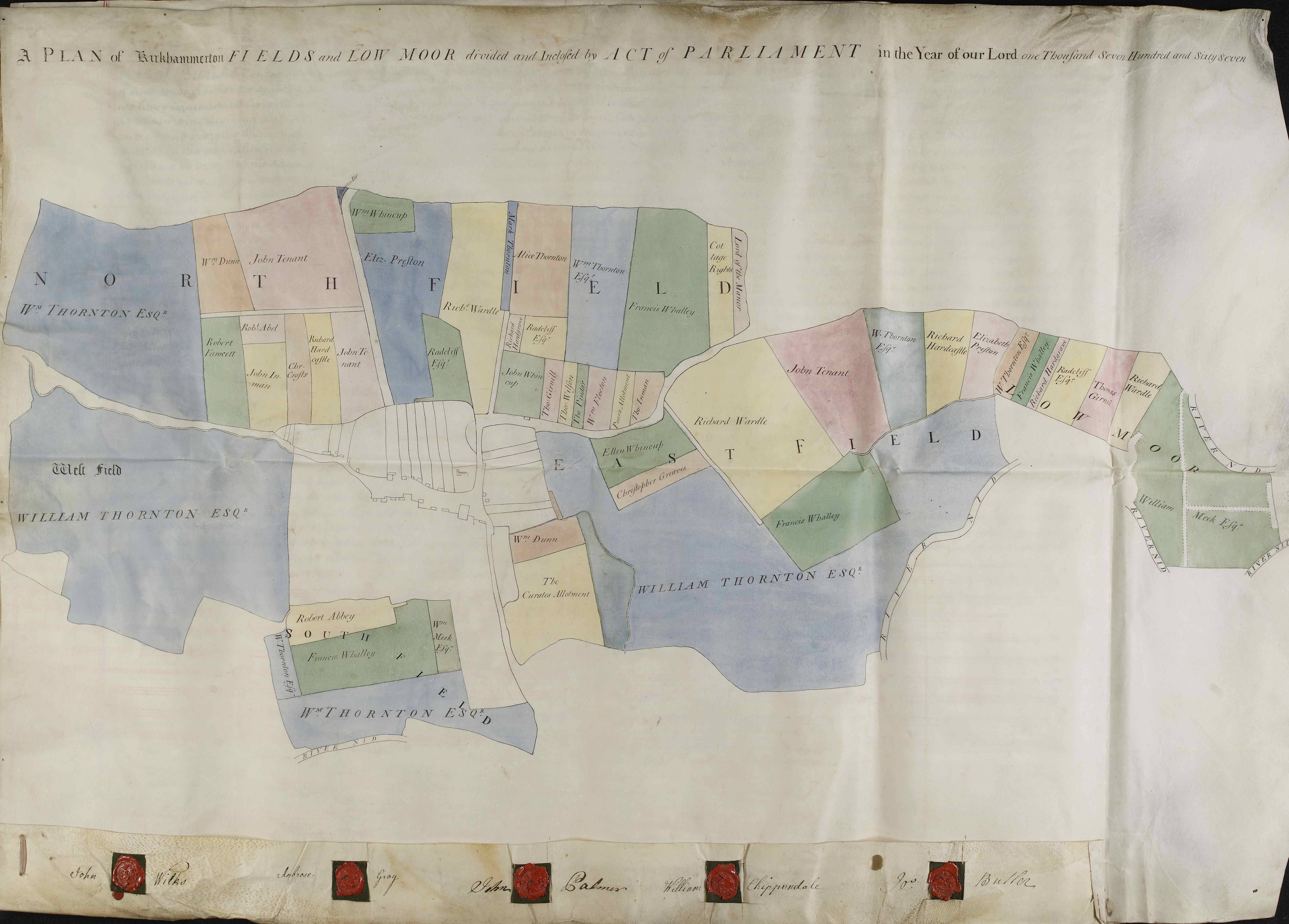
Plan showing the enclosure of the former open fields of Kirk Hammerton, 1767 [I PR/HMK]
We can still detect this enclosure in the landscape today through the shape and size of fields, their names, long straight roads and ditches and planned farms. You can find out more about reading the historic landscape through maps and documents in the examples illustrated in the following pages.
Further reading:
The National Archives online research guide: How to look for… Enclosure Acts, awards and maps
Yorkshire Enclosure Awards by Barbara English, University of Hull Department of Adult Education, 1985
Enclosure Records for Historians by Steven Hollowell, The History Press Ltd., 2000
See our other North Yorkshire Archives blog: Enclosure and the Landscape: a case study from Harome, near Helmsley
See our North Yorkshire Archives publications:
The Hessay Enclosure of 1831: A study in the economic and social history of an Ainsty township in the 19th century by P.R. Newman, 1982 (North Yorkshire County Record Office Publication 29)
Parliamentary Enclosure in Carlton in Coverdale: theory, practice and outcomes by Dr Elaine Joynes, 2012 (North Yorkshire County Record Office Publication 73) – During the height of parliamentary enclosure in the late 18th and early 19th centuries, there was a rush to enclose common ground as a means of agricultural improvement. This detailed study of enclosure in one Dales township compares the theory of enclosure with the practice as it happened on the ground.
