
Local administrative boundaries have changed over time. Which of the former Yorkshire ridings, and which township or parish you live in, will determine which of our collections are relevant and whether you are likely to find records held in a different archive elsewhere, which we can help you to identify. Prior to 1974, we were the North Riding County Record Office. Accordingly, many of our collections are specific to the historic North Riding, including the Registry of Deeds, electoral registers and Quarter Sessions records.
Yorkshire ridings and wapentakes

Historically, from the 9th century CE, Yorkshire was subdivided into three ridings, the North Riding, East Riding, West Riding, and the Ainsty of York. The word ‘riding’ is derived from an Old Norse word meaning ‘a third’. These ridings were each subdivided into administrative units known as wapentakes, which operated until the end of the 19th century. A number of our historic records are organised according to wapentake. There were thirteen wapentakes in the North Riding; the smallest administrative unit below the wapentake was the township.

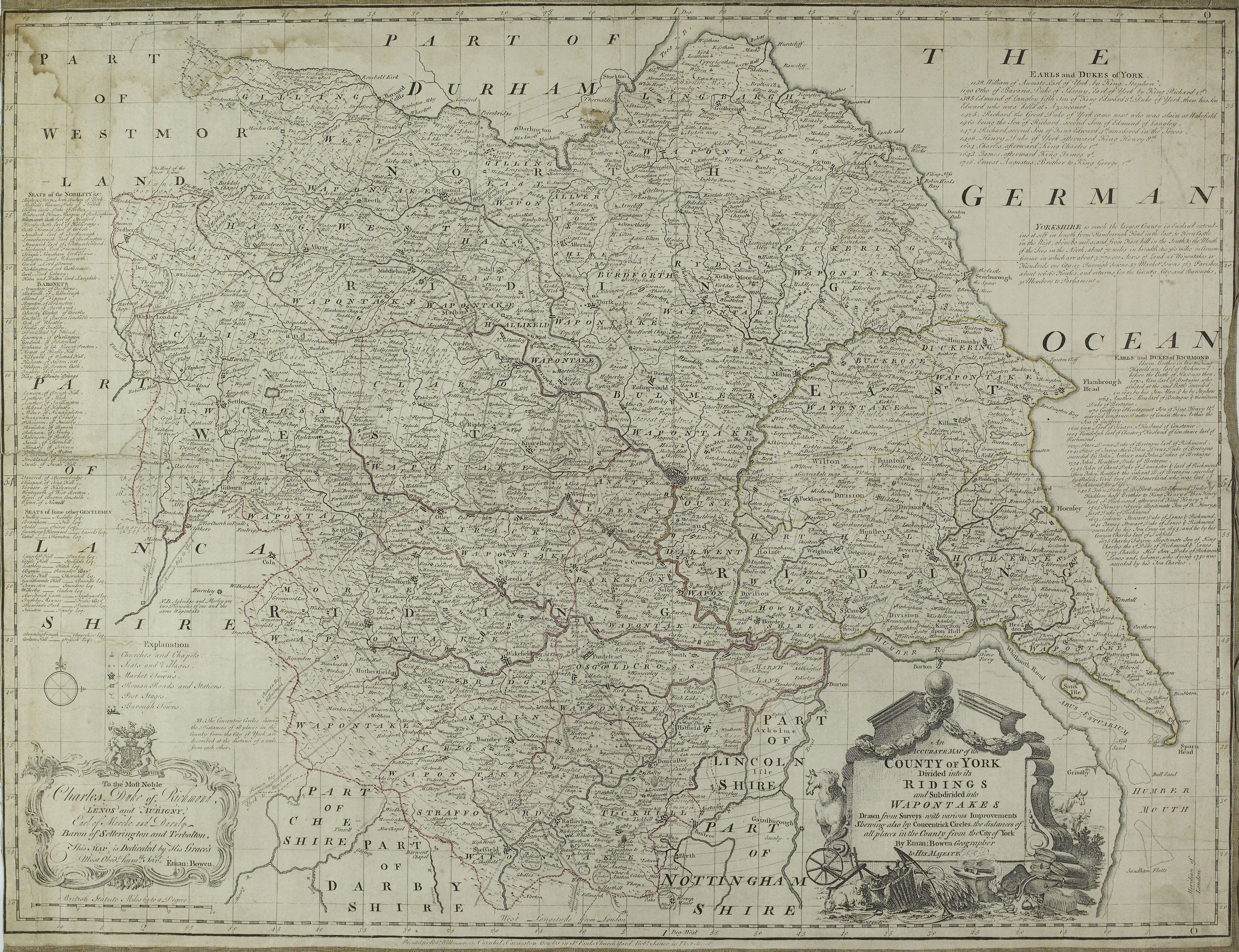
The area of the historic North Riding corresponds to the modern district areas of Hambleton, Richmondshire, Ryedale, the Borough of Scarborough and parts of the Borough of Harrogate. It also included areas now outside North Yorkshire, for example Yarm, Middlesbrough, Guisborough, Redcar, Saltburn and Marske (now covered by Teesside Archives) and an area of Teesdale which formed Startforth Rural District (now covered by Durham Record Office).
The area of the historic East Riding included parts of what is now Ryedale District, and the West Riding areas roughly correspond to the Craven, Harrogate and Selby districts of North Yorkshire.
From 1889 to 1974, the administrative areas of the three county councils of the North, East and West Riding closely followed the boundaries of the historic ridings. Each of these county council areas was divided into municipal boroughs, urban districts and rural districts under the Local Government Act 1894. From this date, the smallest administrative unit became known as the parish.
The county of North Yorkshire
The present county of North Yorkshire was formed on 1 April 1974 as a result of the Local Government Act 1972, covering most of the lands of the historic North Riding, as well as the northern half of the West Riding, parts of the northern and eastern fringes of the East Riding and the former county borough of York.

From 1974, the smallest administrative unit became known as the civil parish. This is distinct from the ecclesiastical parish, which is the area under the jurisdiction of a church priest.
In 1996, a number of parishes from North Yorkshire were transferred to the newly-formed unitary authority of the City of York (including Clifton Without, Earswick, Haxby, Heworth Without, Holtby, Huntington, Murton, New Earswick, Osbaldwick, Rawcliffe, Skelton, Stockton-on-the-Forest, Strensall, Towthorpe and Wigginton).

Useful links:
NYCRO Guide no. 6: North Yorkshire Gazetteer of Townships and Parishes can be used to identify the township/place and its corresponding ecclesiastical parish, wapentake, riding and municipal borough, urban or rural district.
The Genuki website page Where is it in Yorkshire?
NYCRO Publication 69: A History of the North Riding County Council
