
Comparison of two maps dated 1703 and 1792
The map below depicts the enclosure of the open fields and common pastures of Crambe in 1703. Fields are identified by name as well as numbers and letters, which correspond to the associated survey below. The survey records the holdings of each tenant, the size of each parcel, the rental value and value per acre.
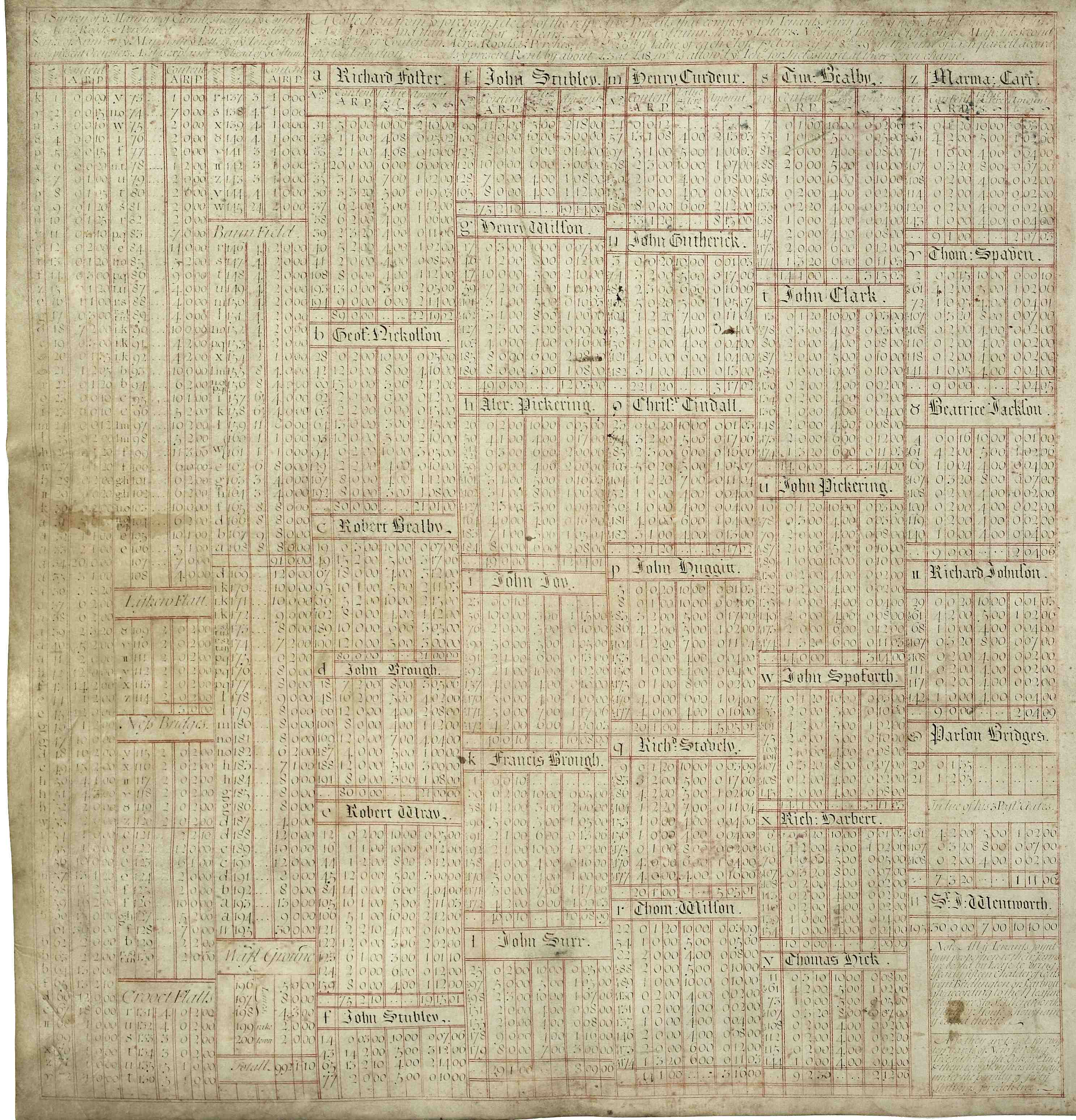
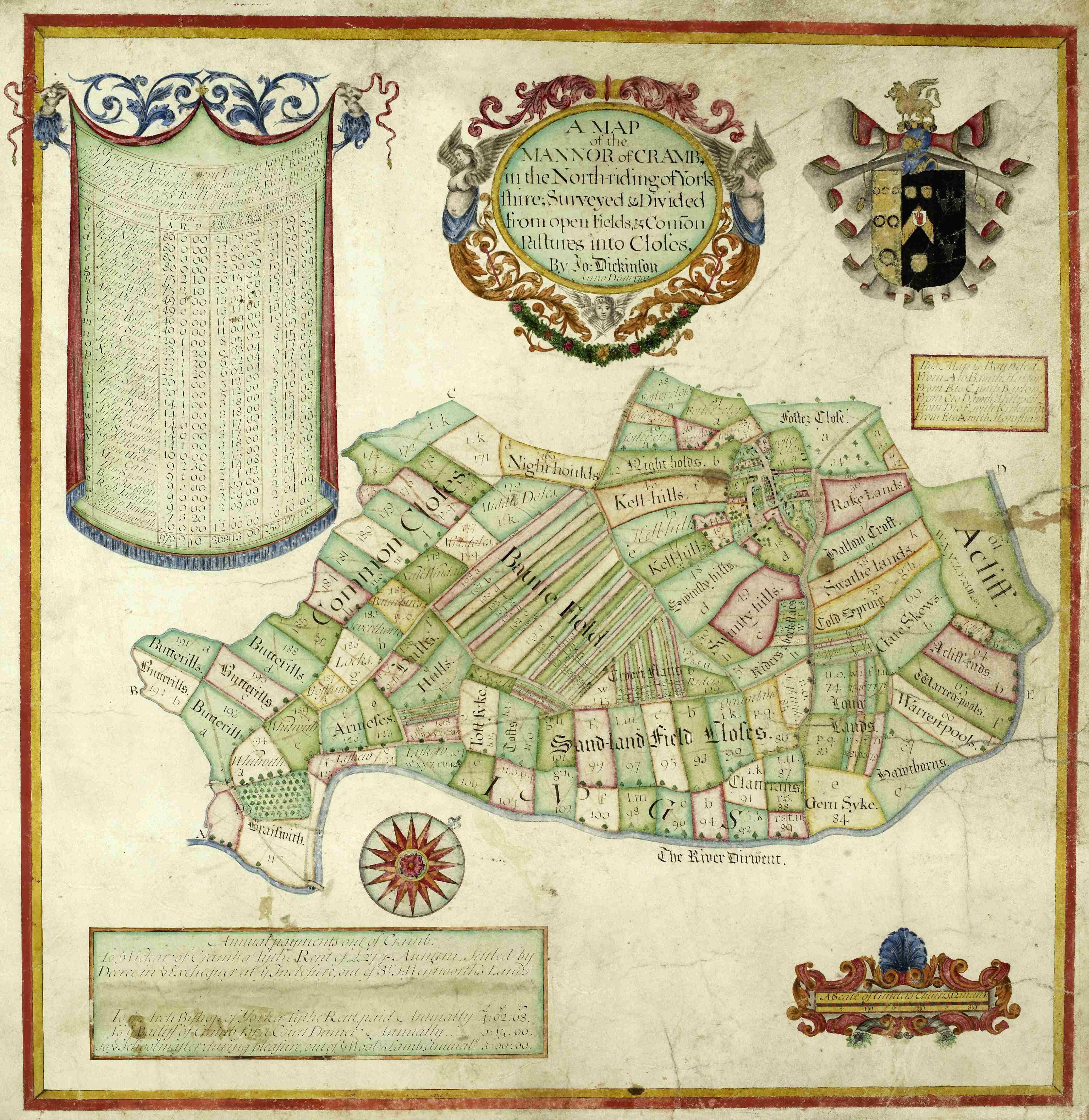
Map of the manor of Crambe surveyed and divided from open fields & common pastures into closes with associated survey by John Dickinson, 1703 [ZCG M 1/2]
Tenants have a lease for 21 years. At their own expense, for every ten yards of new fencing, they must plant a tree of either ash, oak or lime and replace them if they die under penalty of 40 shillings for each tree. The economic benefit of enclosure can be seen through an increase in land values of £3 per acre.
The schedule also records that all the tenants jointly in proportion to their farms are bound by lease to bring yearly fifteen chalder of coals from Bridlington or Scarborough, according to the measure used there, to Sir J. Wentworth’s manor house of Howsham if called thereto. Based on volume rather than weight, and varying in size between different areas, a chalder is roughly the amount of coal that could be carried in a large cauldron.
The map of 1792 below shows a broadly similar field pattern to the map above, although some of the narrow strips in Baune Field, for example, appear to have been consolidated into larger units.
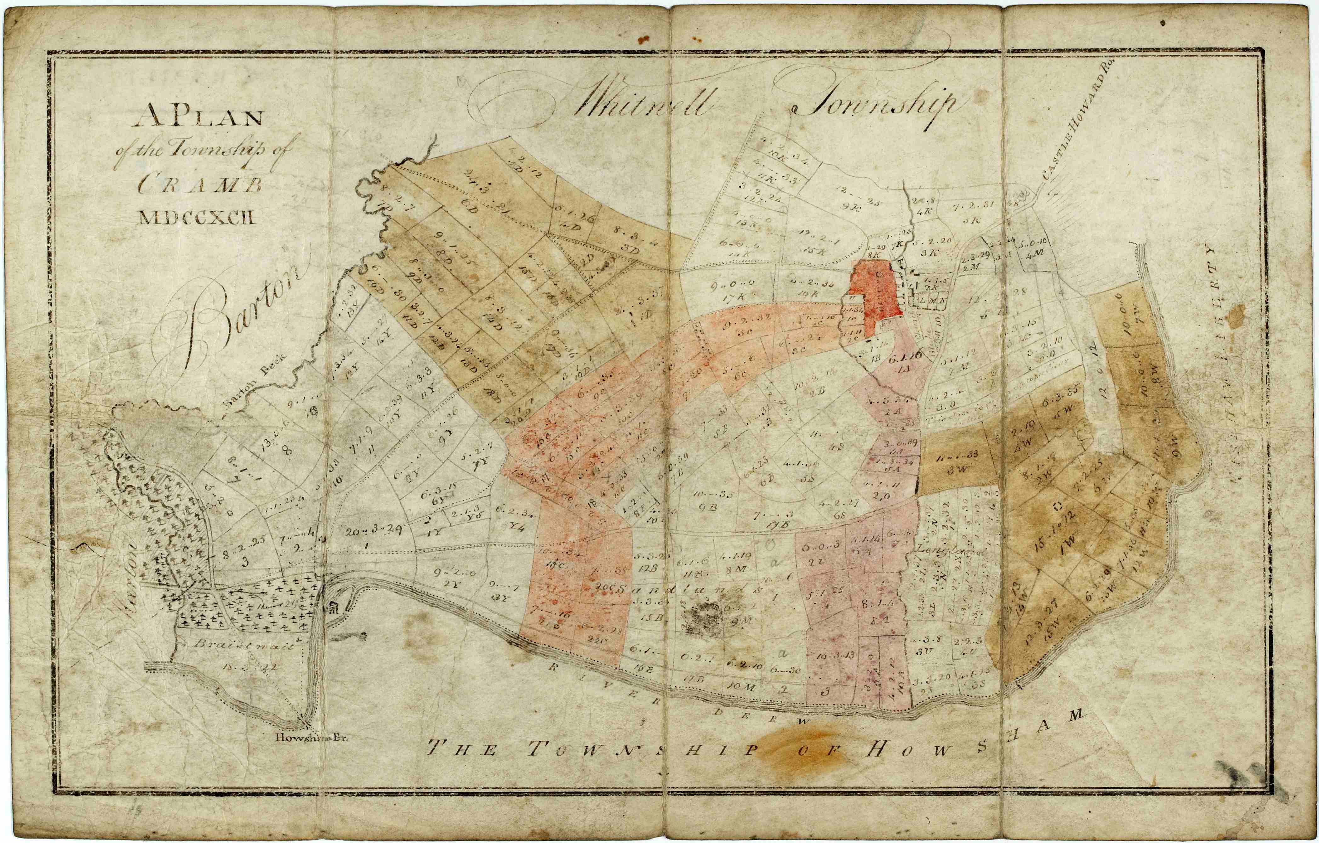
Plan of the township of Crambe, 1792 [ZCG(W)]
