
Enclosure awards and maps provide a wealth of information on landownership as well as social and agricultural changes – here we can see examples of the types of information they contain
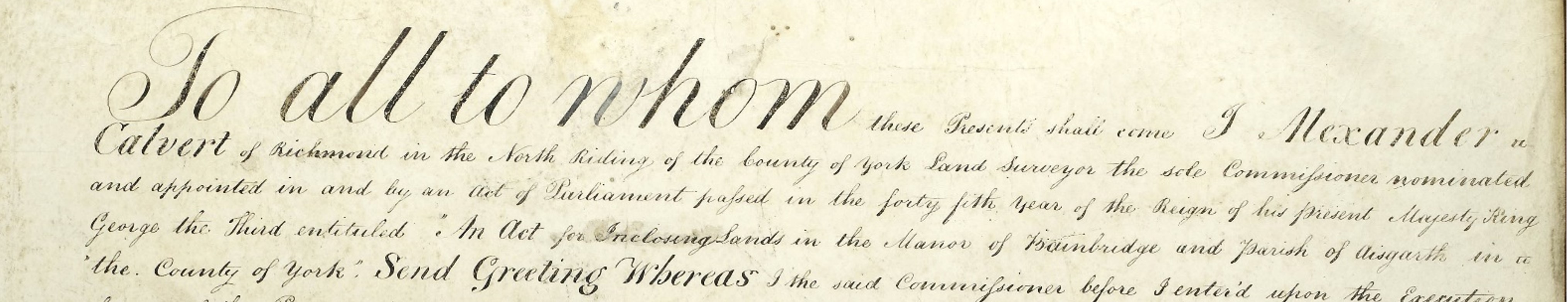
Over 14,000 acres of the manor of Bainbridge were enclosed by an award of 17 October 1816, made under an Act of 1805. In this case a sole commissioner was appointed, Alexander Calvert of Richmond [I/BAB].
In the preamble of the award, Calvert introduces himself, recites the Act and gives a summary of the extent of the enclosure:
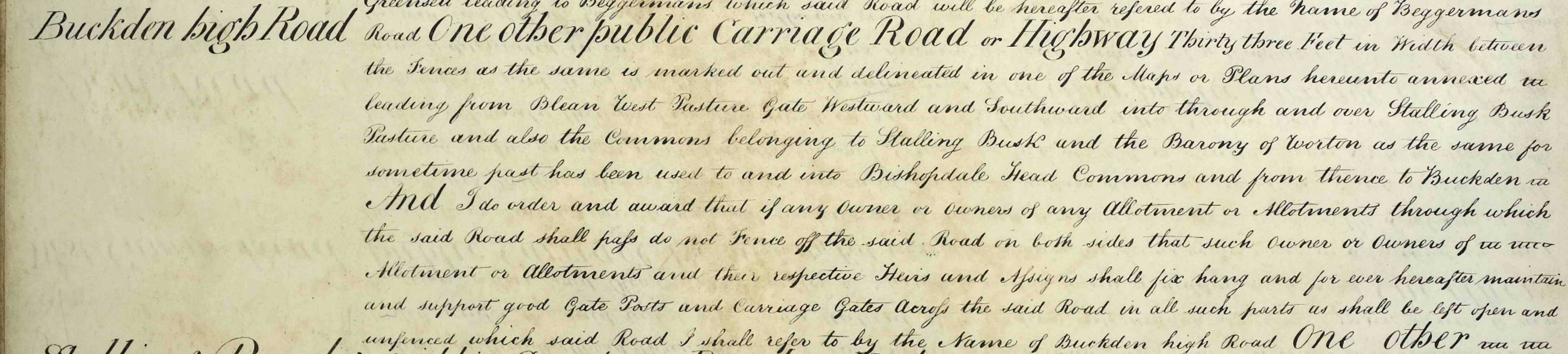
The route and extent of public roads are then given, specifying a width of thirty feet and demanding that owners of adjacent parcels of land fence these off and ‘…fix hand and forever hereafter maintain and support good gate posts and carriage gates…’:
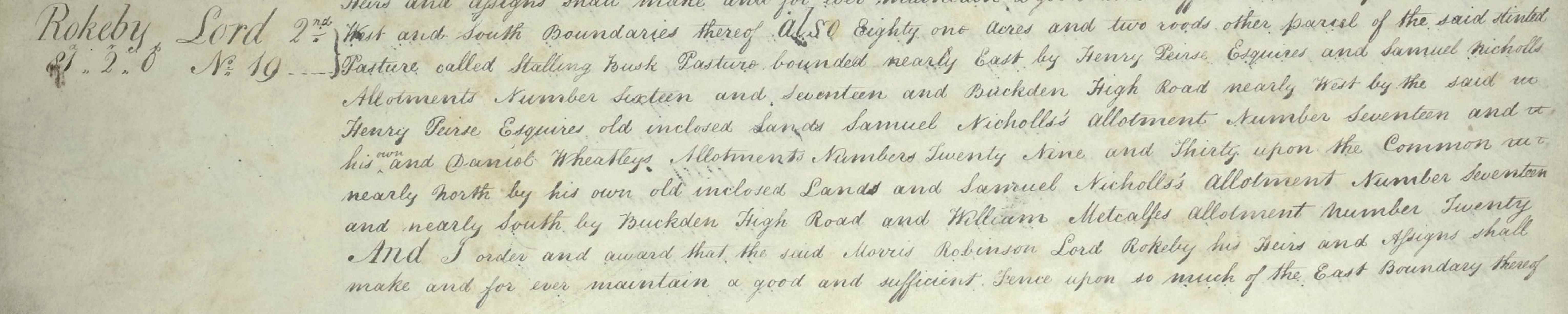
Next, the allotments of land are each described including their extent, location, abuttals and number on plan. Lord Rokeby is awarded 81 acres and two roods of land:
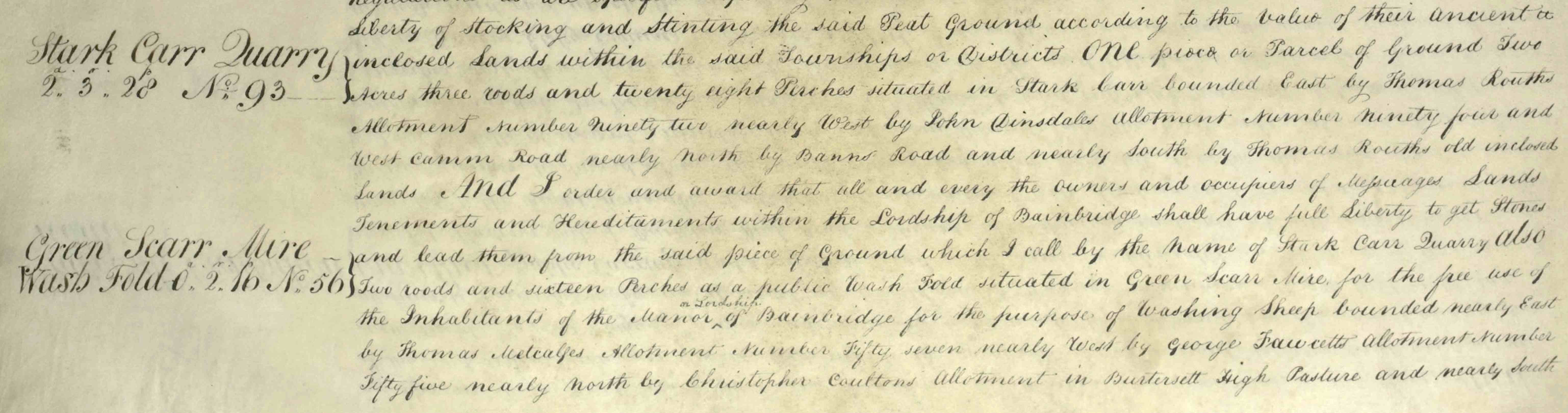
The award also sets out land to be used as a public quarry and a public wash fold (for washing sheep) for the use of the inhabitants of the manor:
Public peat grounds gave inhabitants the right to cut and take away peat:

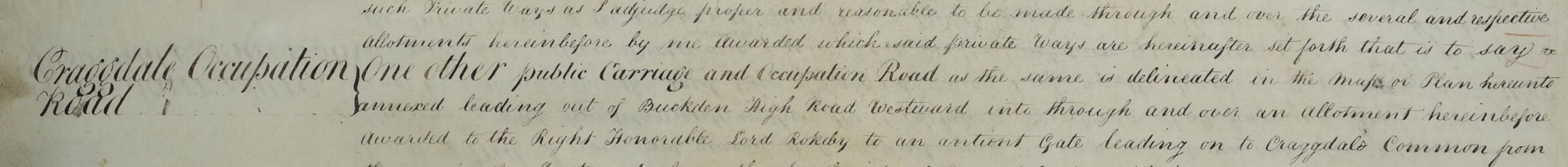
Footpaths, bridleways and occupation roads are also described:
Any springs or wells were to be used or diverted for the watering of allotted lands:

The 1816 enclosure award is accompanied by twelve maps, dated 1807, showing the division of the various areas to be enclosed.
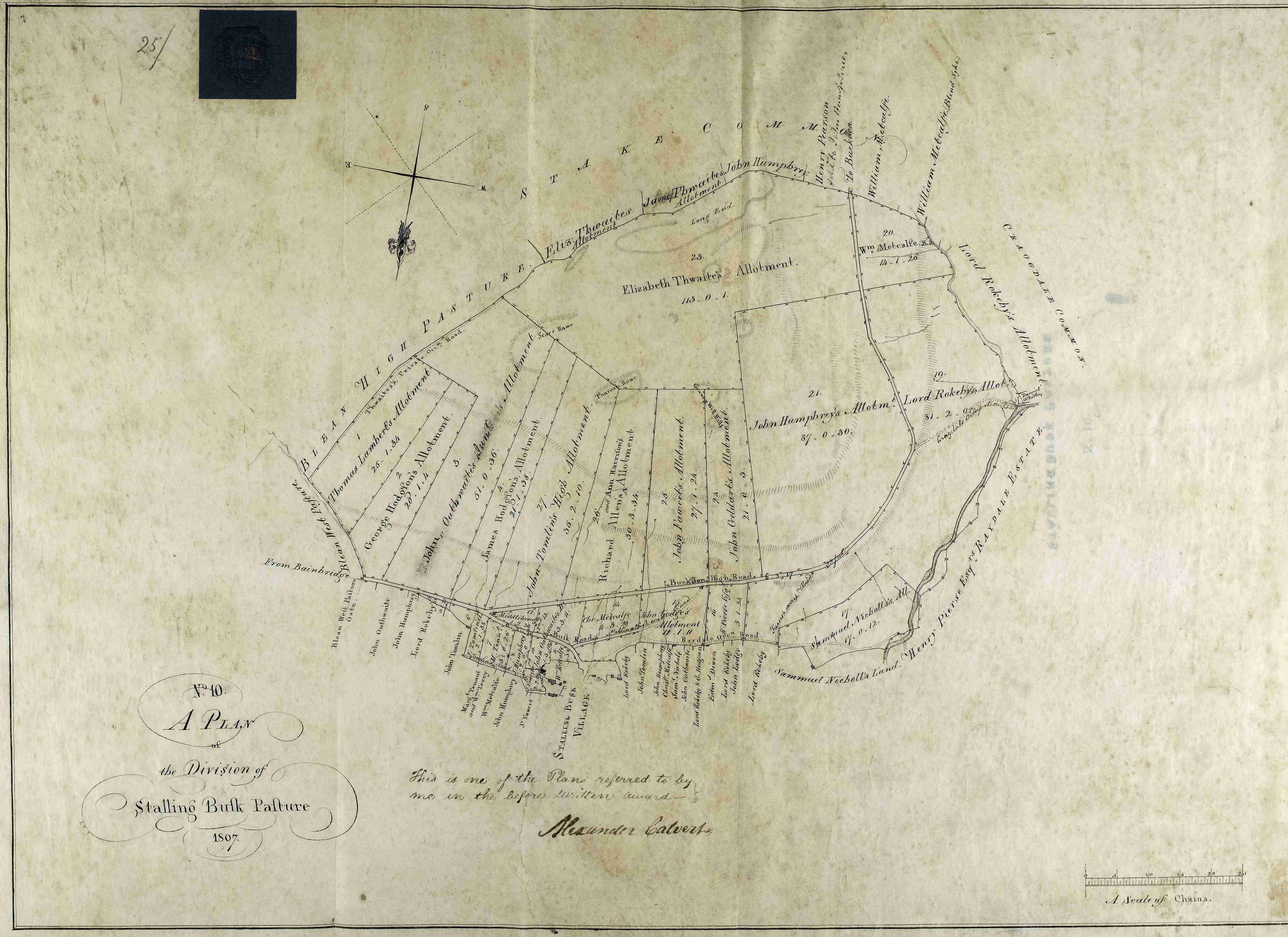
Bainbridge enclosure map no.10, plan of the division of Stalling Busk Pasture, 1807 [I/BAB]
