
Parliamentary enclosure was the legal process of consolidating and privatising communally managed open fields and common land by Act of Parliament
Enclosure in the Archives
North Yorkshire Archives holds hundreds of records relating to the enclosure (sometimes spelled inclosure) of open fields, common lands and manorial waste lands in North Yorkshire and the former North Riding. A listing of these records can be found in our searchroom Guide no. 4 (link opens pdf).
From around 1750 to 1914, the most common method of enclosing lands was by the process of parliamentary enclosure. This method resulted in the creation of an award, documenting which lands were to be allotted to their new owners. In most cases an accompanying map was also made.
It is estimated that 21% of the North Riding was subject to parliamentary enclosure with over 200 awards and 131 maps known to survive. An even greater proportion of the East and West Ridings was enclosed.
Procuring the Act
When most local landowners wished to enclose an area of land, and agreed upon the terms of doing so, a Private Bill could be introduced to Parliament. The Bill would outline the extent of the proposed enclosure and appoint a group of men called commissioners to carry it out. In some cases, only a single commissioner was appointed.
The entire process of enclosure was expensive, and agreement would have to be reached at the outset as to how these expenses would be jointly met by the landowners.
The General Enclosure Act of 1845 streamlined the process by appointing permanent enclosure commissioners who were authorised to issue Enclosure Awards without submitting them to Parliament for approval.
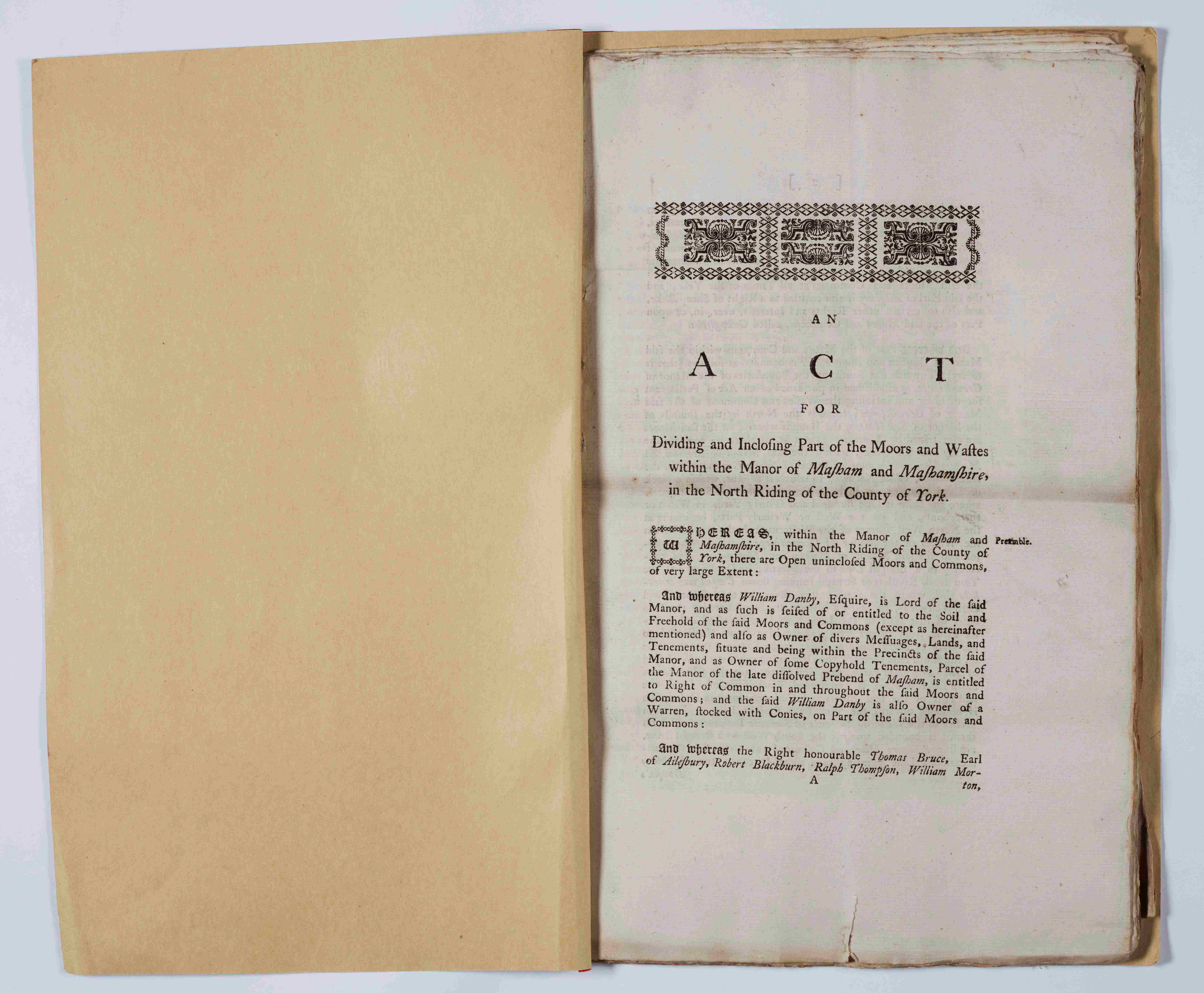
Masham Enclosure Act, 1793 [I/MAS]
The enclosure commissioners
After an enclosure act had been passed, the commissioners ordered all persons alleging an interest in or over the lands to submit their claims. Copies of these claims were displayed for public inspection and meetings would be held to consider claims and counter-claims and decide which new allotments of land would be awarded to whom. Throughout the process a clerk recorded the commissioners’ decisions in meeting minutes.
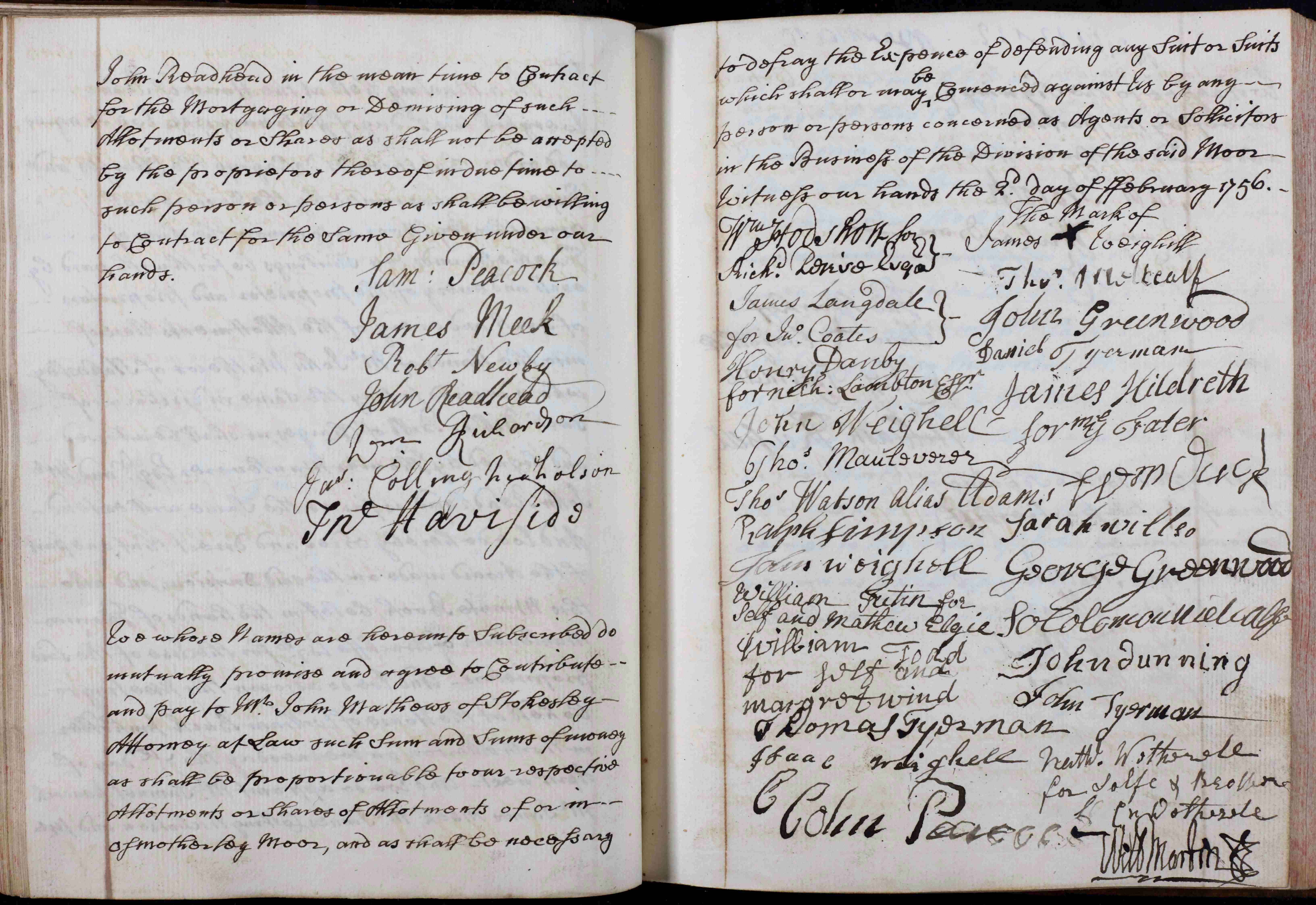
Pages from Osmotherley Enclosure Commissioners’ minutes with agreement relating to expenses, 1755-1758 [Z.148]
The role of the surveyor
As the commissioners carried out their work, a surveyor made a survey and map of the area to be enclosed. As the commissioners decided the location and size of the new allotments and the course and width of the new roads and drains, the surveyor marked them on his map and staked them out on the ground. Some surveyors acted as commissioners.
The award is made
The final act of the commissioners was to produce the enclosure award, usually on several sheets of parchment, describing the size and location of every allotment awarded by the commissioners with new roads and drains. The award was usually accompanied by a map showing their locations. Due to legal challenges, disputes, and technicalities, several years could elapse between the passing of the Act and the sealing of the award. A copy of the award was usually enrolled with the Quarter Sessions or, in Yorkshire, with one of the registries of deeds.
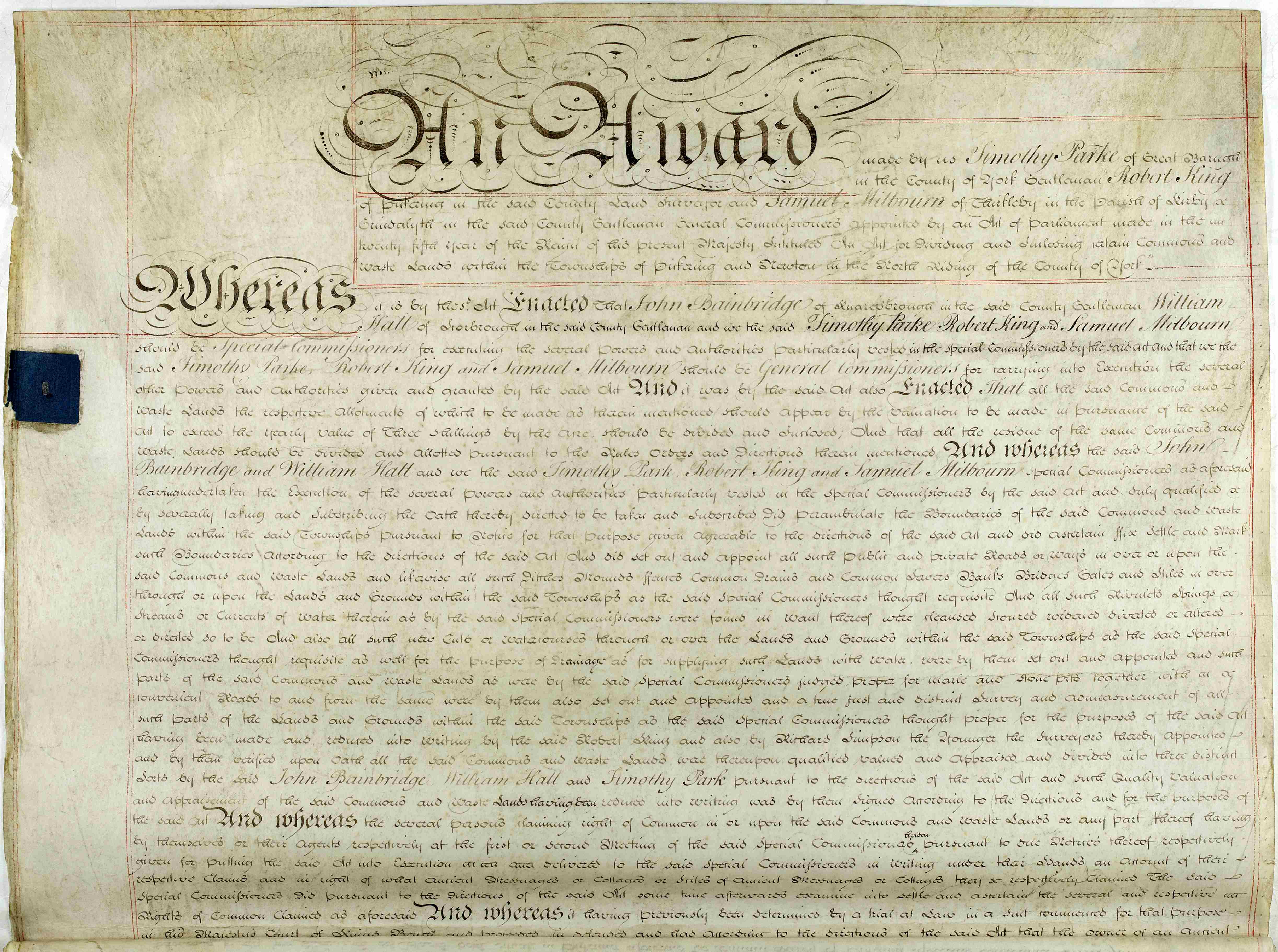
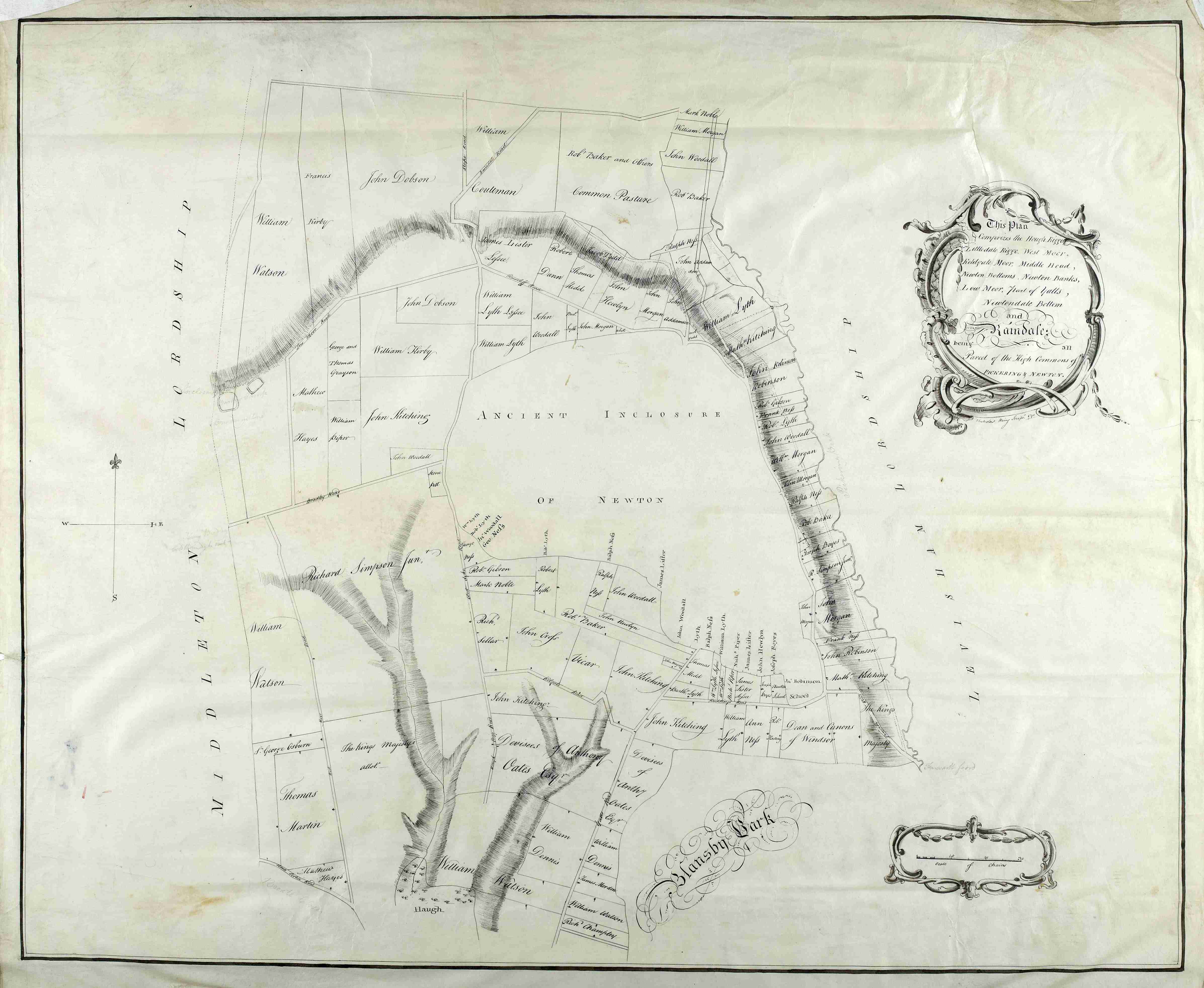
Preamble to Pickering enclosure award and plan (4 of 5), 1789 [I (PR/PI)]
Further examples of enclosure maps
Map of Eskdaleside of 1817 showing enclosure of 1760
Later copy of the Scalby enclosure map of 1777
Fremington Edge enclosure map of 1778 [I]
Little Smeaton and Stubbs Walden enclosure map, 1788
Thornborough enclosure map, 1796
Camblesforth enclosure map, 1805
Gilling enclosure map, 1815
