
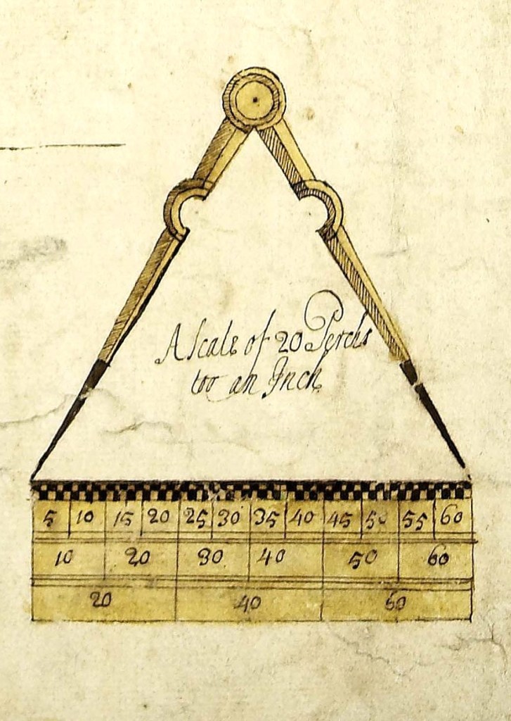
Chains, links, roods and perches, many of the units of measurement that are used in historic maps and documents may be unfamiliar to us today. In addition to maps and documents, other useful sources of information for field systems include aerial photographs.
Units of measurement
Chains and links were named after surveying methods, but most of the other units were agricultural in origin. Furlong meant a furrow length or the distance that could be ploughed by an ox without a rest. An acre was the amount of land that could be ploughed in one day with a yoke of oxen and was one chain in width (66 feet or 22 yards), and one furlong (10 chains or 220 yards) in length. The rectangular shape of this measure came about because arable fields were made up of long strips of land, each containing furrows running lengthwise.
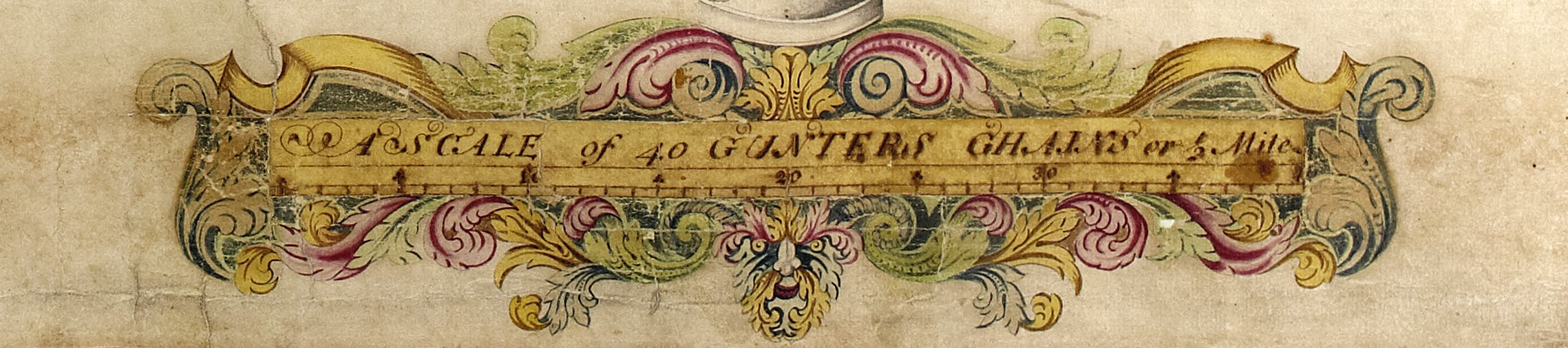
Scale rule from an early-18th-century plan of the Lordship of Walburn [ZAZ M1]
A Gunter’s chain was the standard tool for measuring land and creating maps in the 18th century. Designed in 1620 by English mathematician Edmund Gunter, it was a literal metal chain with 100 links enabling plots of land to be accurately surveyed and plotted for legal and commercial purposes – ten square chains equal one acre.
Other traditional measurements include the hide (aka carucate), the area deemed to be able to support a typical peasant family, ploughed in a year by a team of 8 oxen (nominally 120 acres).
1 hide = 8 oxgangs or bovates, or 4 virgates. An oxgang was the amount of land tillable by one ox in a ploughing season.
The abbreviation A.R.P. stands for acres, roods and perches. 1 rood = 40 square perches; 1 acre = 4 roods.
Units of length:
- 1 yard = 3 feet (0.914 metres)
- 1 link = 7.92 inches
- 25 links = 1 perch = 1 rod = 1 pole
- 4 perches/rods/poles = 1 chain
- 1 chain = 22 yards
- 10 chains = 1 furlong (220 yards)
- 8 furlongs = 1 mile (1760 yards)
Aerial photography
Aerial photography is a key tool for identifying, recording and understanding the surviving remains of former field systems, especially where there are no written records.
Boundary ditches of ancient fields from over 2000 years ago that have since been ploughed level often survive as buried archaeological features. The ditches hold more moisture and nutrients than the surrounding soil, so crops above them grow taller and ripen later than in other areas. Such changes only last a short time and can be seen from the air as crop marks.
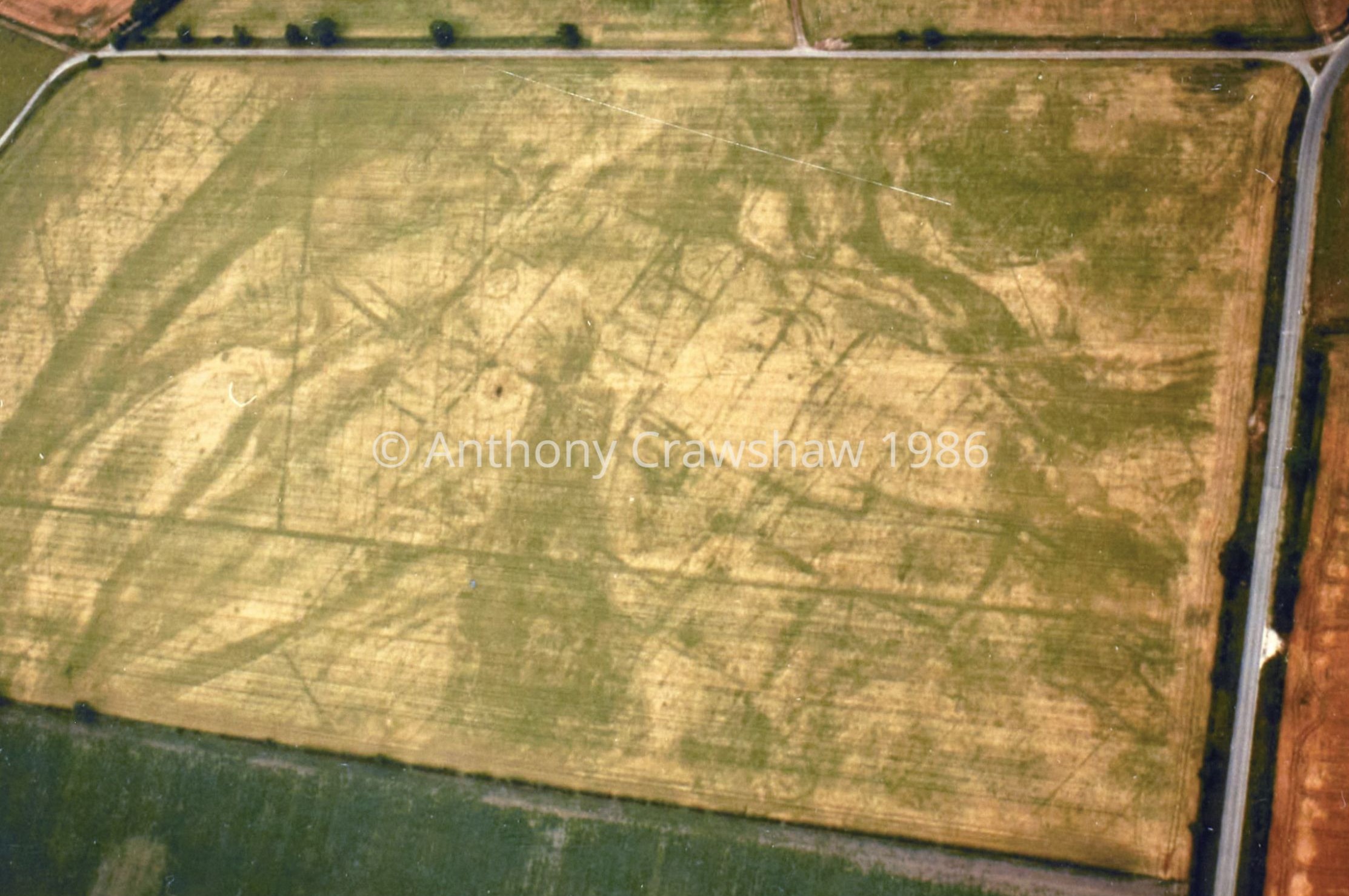
Oblique aerial photograph showing crop marks of the ditches of a former Iron Age/Romano-British settlement and rectilinear field system beneath a modern field at Wistow, 15 July 1986 (irregular patches of dark green are due to changes in underlying geology) [AJC 074/29] reproduced courtesy of the photographer, © Anthony J. Crawshaw
Earthwork remains of the long, narrow strips of former medieval open fields from c.500 years ago can be seen as a corrugated pattern of ridge and furrow. The traditional mouldboard plough always turned soil to the right; over time, soil built up into a central ridge and the edges of the strip became deep furrows. This typically survives today in areas that were converted from arable cultivation to permanent pasture, thus avoiding levelling by modern farm machinery.
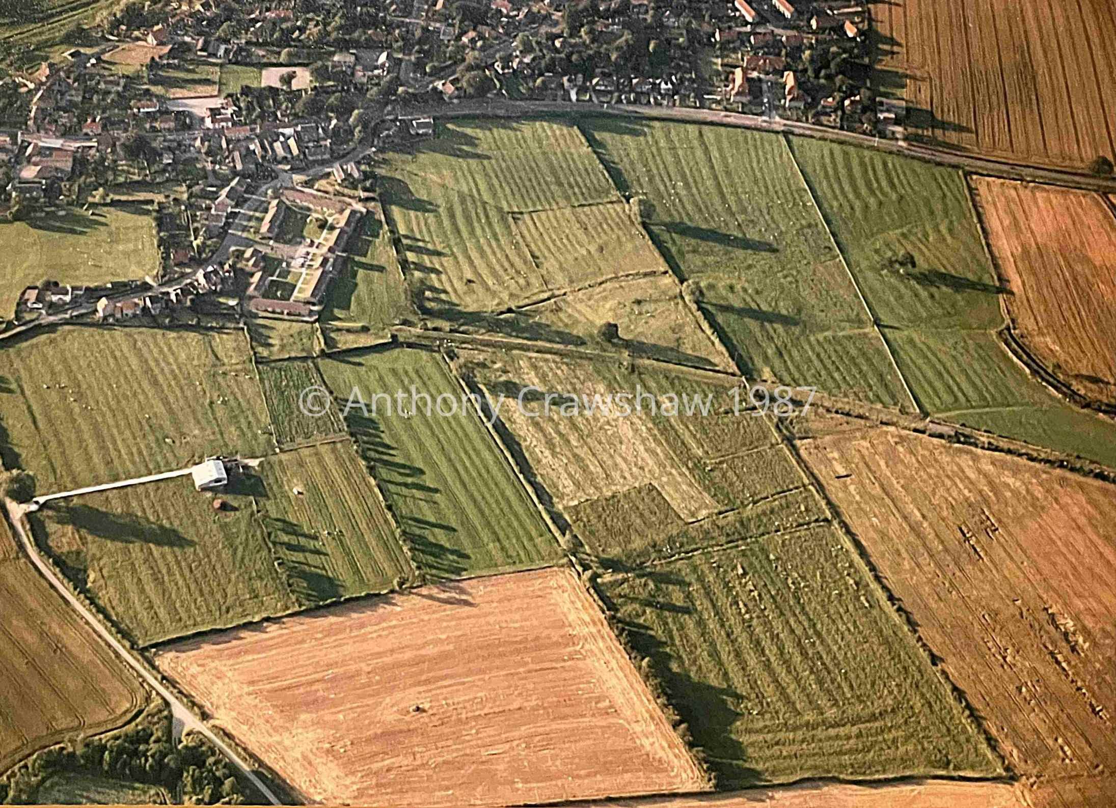
Oblique aerial photograph showing the survival of earthworks of medieval ridge and furrow at East Ayton, 5 August 1987 [AJC 122/33] reproduced courtesy of the photographer, © Anthony J. Crawshaw
Archaeologists use such traces of evidence to map entire landscapes, identifying patterns of prehistoric, Romano-British and medieval fields and their relationship to settlements.
Further reading:
University of Nottingham, Manuscripts and Special Collections’ webpage on Measurements
Sources of aerial photography online:
Britain from Above website
Cambridge University Committee for Aerial Photography website
Google Earth (for historical imagery use slider bar to view older aerial photography)
Historic England Aerial Archaeology Mapping Explorer website
Historic England Aerial Photo Explorer website
National Library of Scotland side by side viewer webpage (a split-screen tool that lets you compare georeferenced historic maps with satellite and LiDAR imagery)
