
Enclosure by agreement: 1670 and 1753-1754, and Parliamentary enclosure: 1806 to 1816
A series of maps and documents preserved in the archive of the Feversham/Duncombe family of Duncombe Park, Helmsley record three phases of enclosure in Wombleton over 150 years.
1670: Enclosure of 197 acres of the Moor Field, Gildersdale and the Hollow or Howle
In 1670, a private agreement was drawn up between the Duke of Buckingham as landowner and the freeholders and copyholders of Wombleton to voluntarily divide up communal land. This required a consensus of all involved. The agreement describes the appointment of commissioners and a surveyor to ‘sett out, allot and appoint their particular share of land to every person’. No map survives.
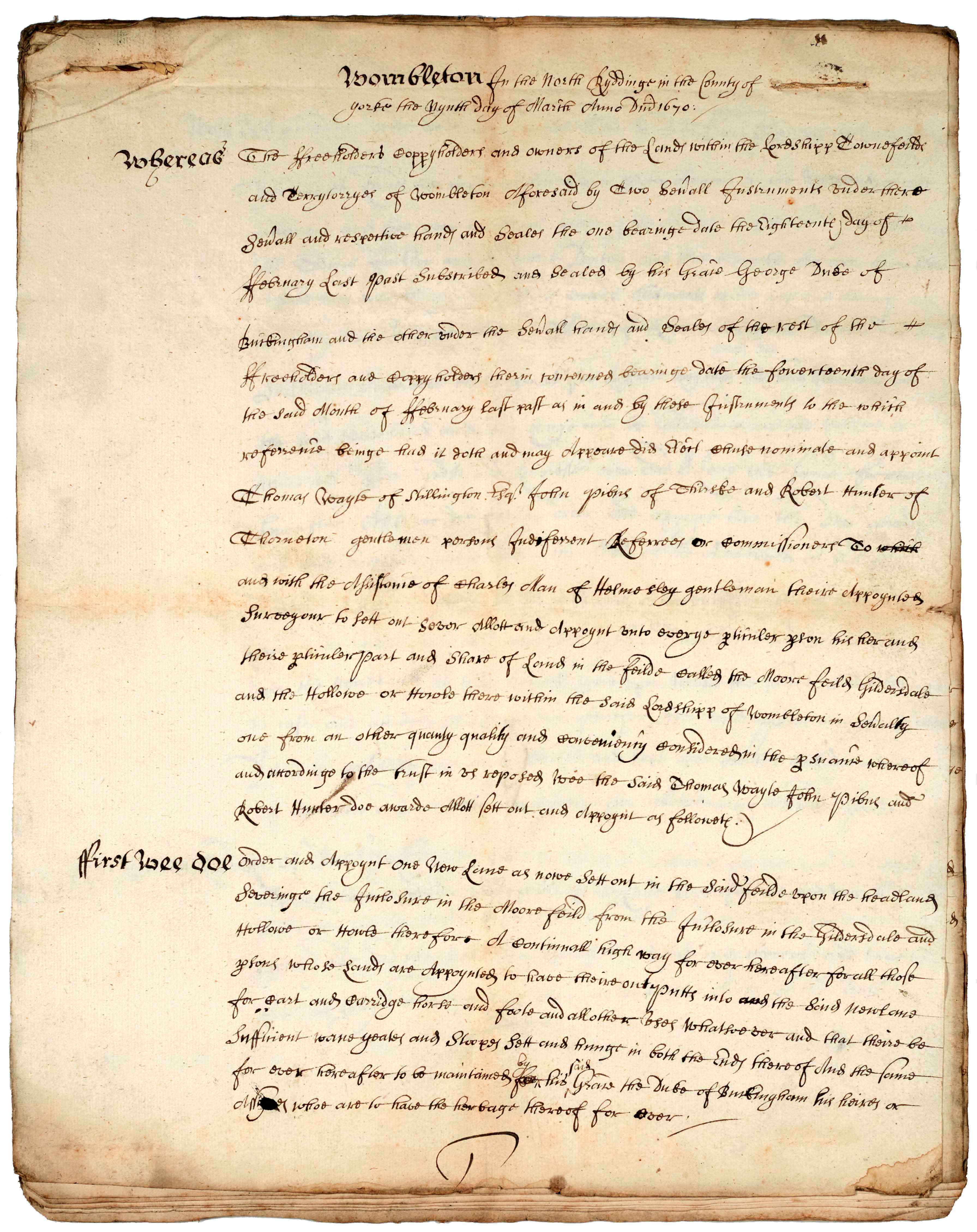
Agreement for the enclosure of the Moor Field, Gildersdale and the Hollow, 1670 [ZEW V 2/1]
1753-1754: Enclosure of 203 acres in the town pasture called Greencroft, Ox Close and Boon Wood
In 1753, an agreement was reached with the landowner Thomas Duncombe Esq. to enclose the common pasture of Wombleton and a plan was drawn up to show the layout of the new fields. Commissioners were appointed to prepare a legally binding written schedule, known as an Award, listing the names of all proprietors and describing the location and size of the parcels of land allotted to them.
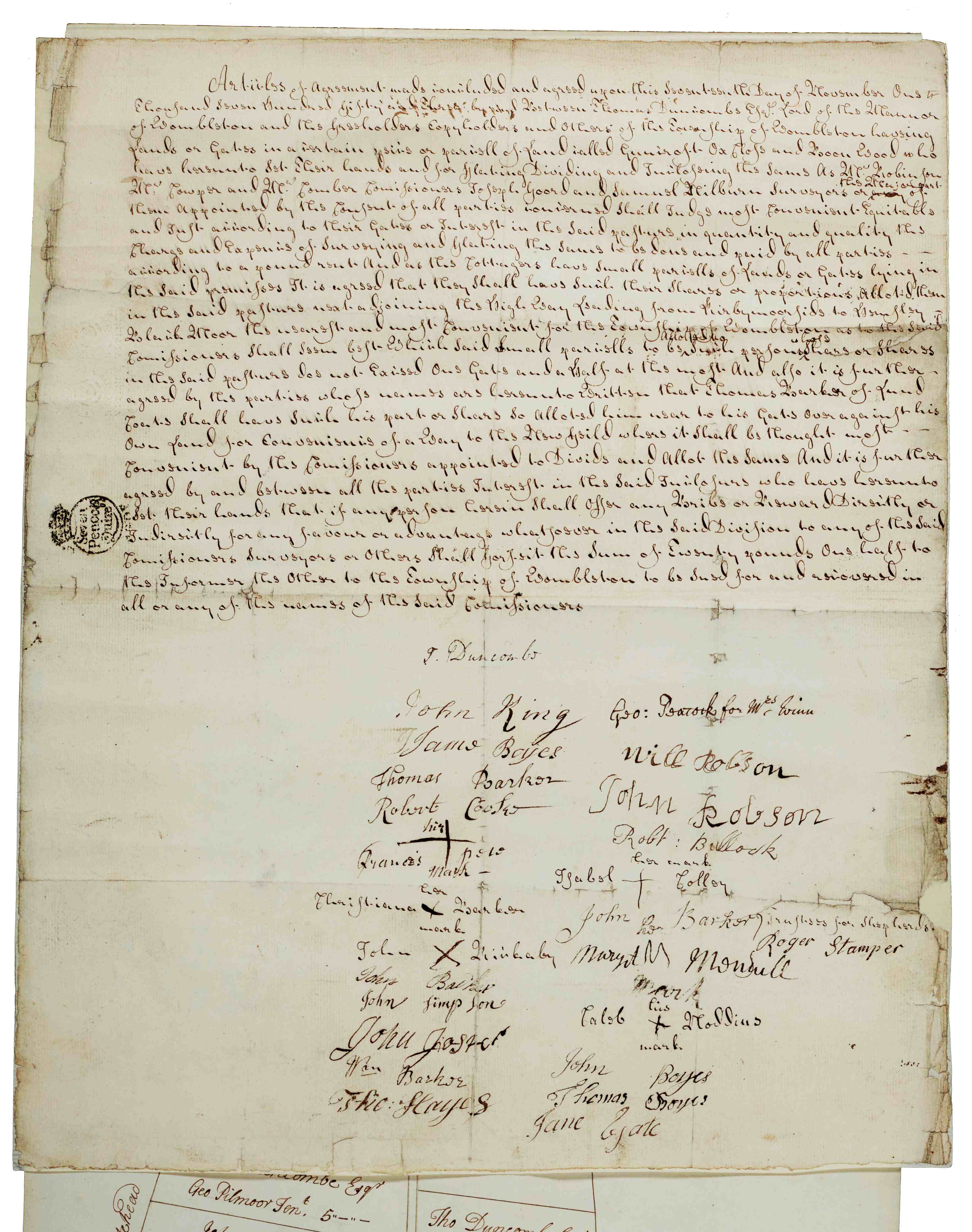
Front page of agreement for the enclosure of the town pasture, signed by all parties,17 November 1753 [ZEW V 3]
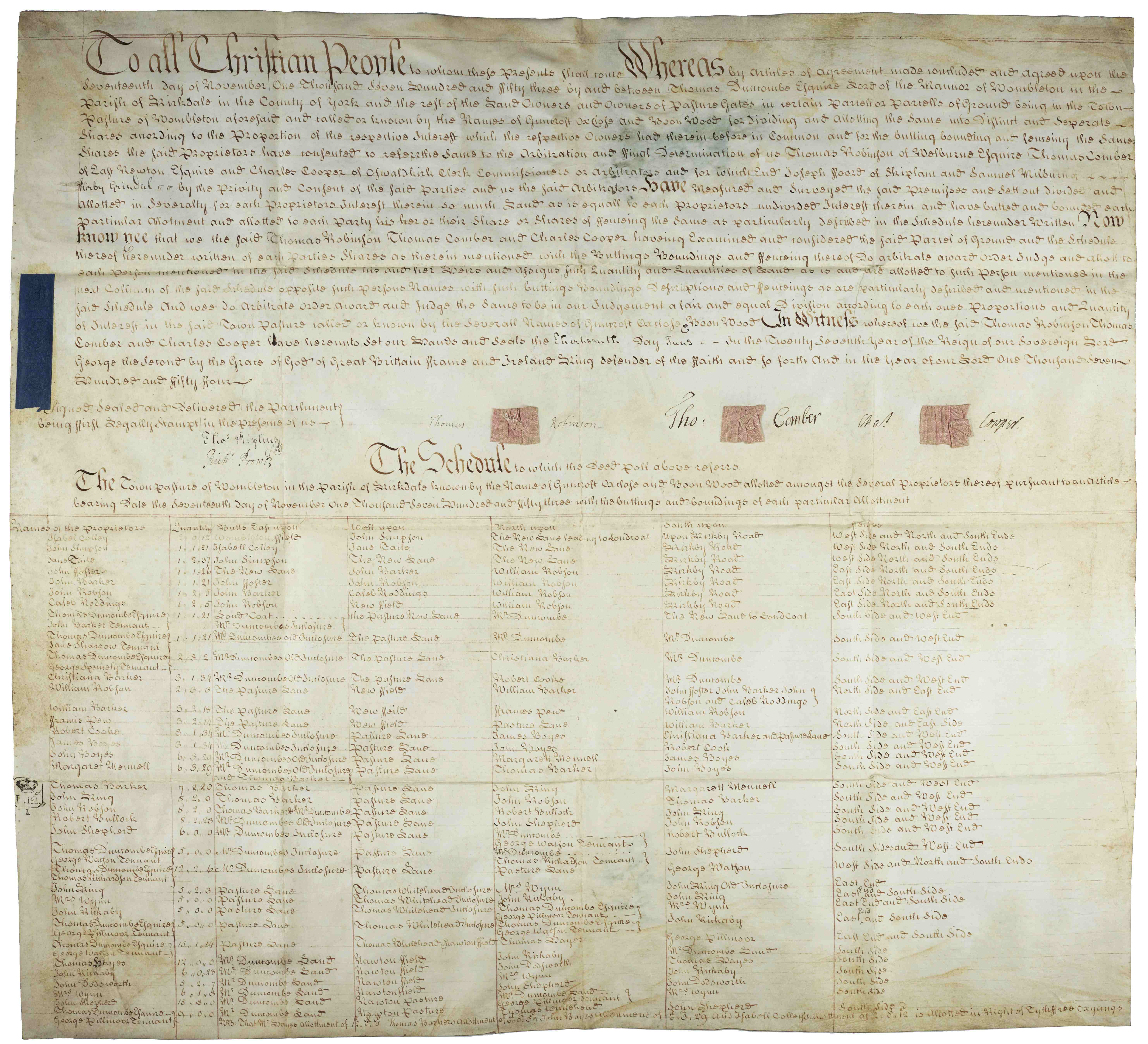
Enclosure Award prepared by the commissioners detailing the allotment of land, 13 June 1754 [ZEW V 2/1]
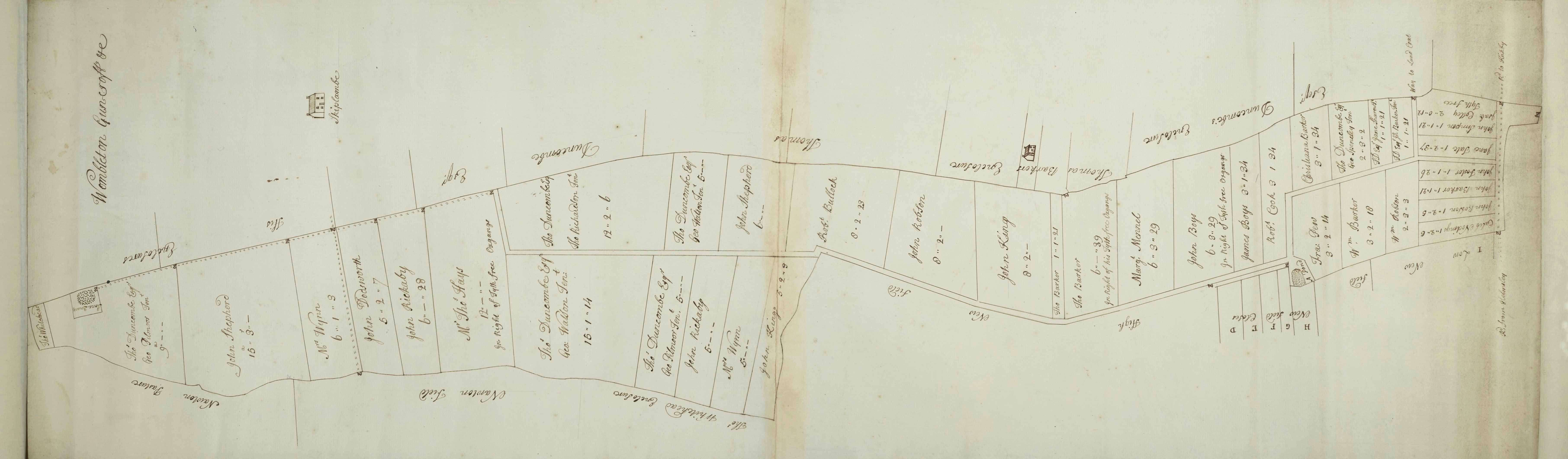
Sketch plan of the enclosure of Wombleton town pasture showing the field divisions, 1753 [ZEW V]
Until the mid-18th century, most of the North Riding was enclosed by private agreement. Between 1750-1850, enclosure by Act of Parliament was favoured as a more secure form of agreement. This was a period of new and improved ploughs, drills and harrows, livestock was improved through selective breeding, and a greater variety of crops were being grown including turnips, swedes and potatoes, clovers and grasses.
1806-1816: Enclosure of 877 acres of the open fields and common in Wombleton, Nawton and Harome
In 1806, an Act of Parliament was passed for the enclosure of open lands in the parishes of Kirkdale and Helmsley. This would have been a major expense for lord of the manor, Charles Duncombe Esq. and other landowners. They would have paid several thousand pounds in legal fees, hiring the commissioner and surveyor as well as paying the costs of digging drainage ditches, laying down public roads, and erecting boundaries around new fields.
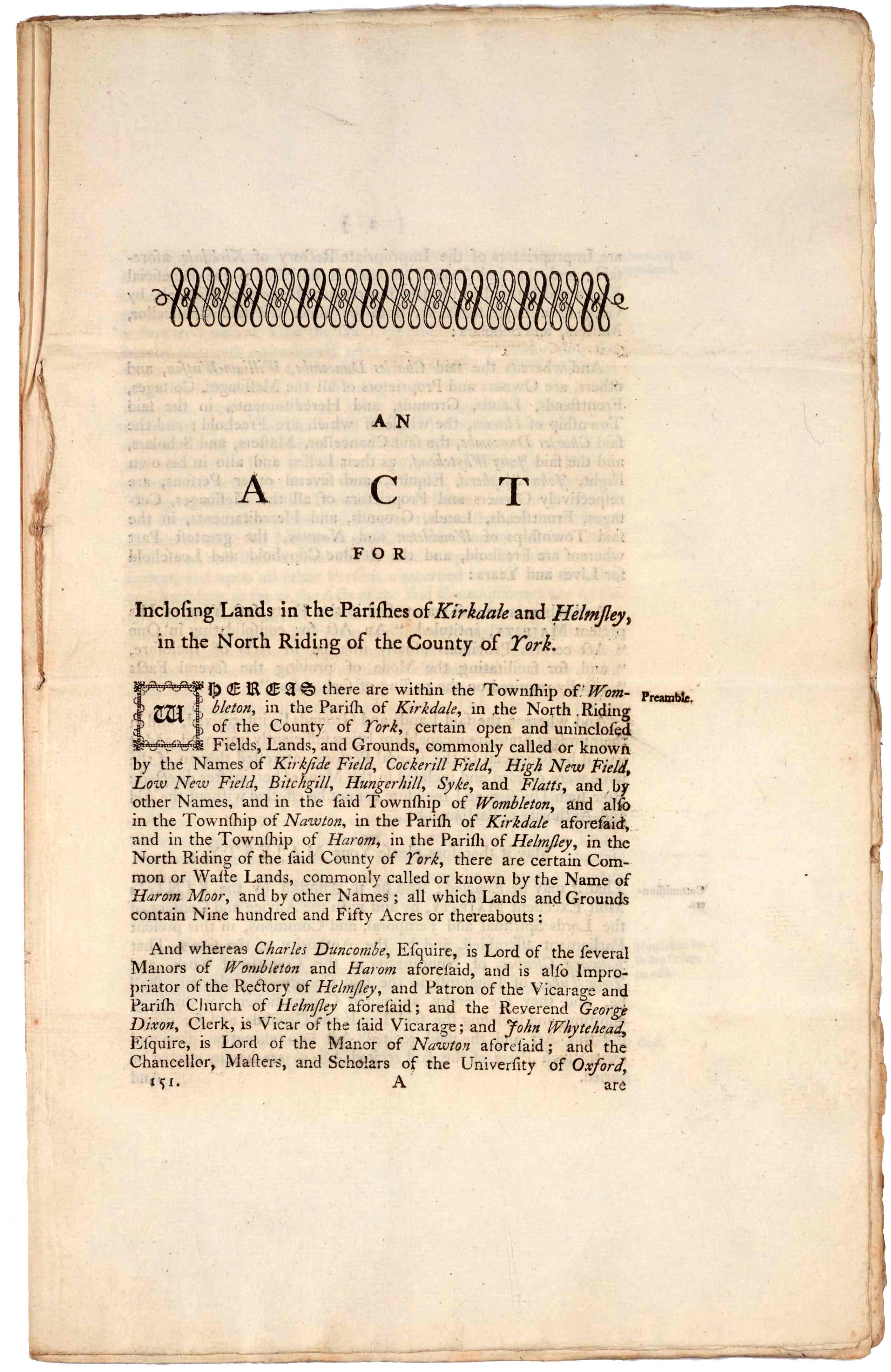
Front page of the Act for enclosing lands in Kirkdale and Helmsley, 1806 [46 Geo III c.69; ZEW V 1/4]
The Award (see image below) is written on several membranes of parchment describing in depth the new field boundaries and the allocation of plots. It also extinguishes the tithes previously payable to the rector and the vicar of Helmsley and makes provision for lands to be awarded to them in lieu of tithes. Unlike enclosure by agreement, Parliamentary enclosure required a majority rather than a consensus. The division of land could be forced upon those who opposed the proposals.
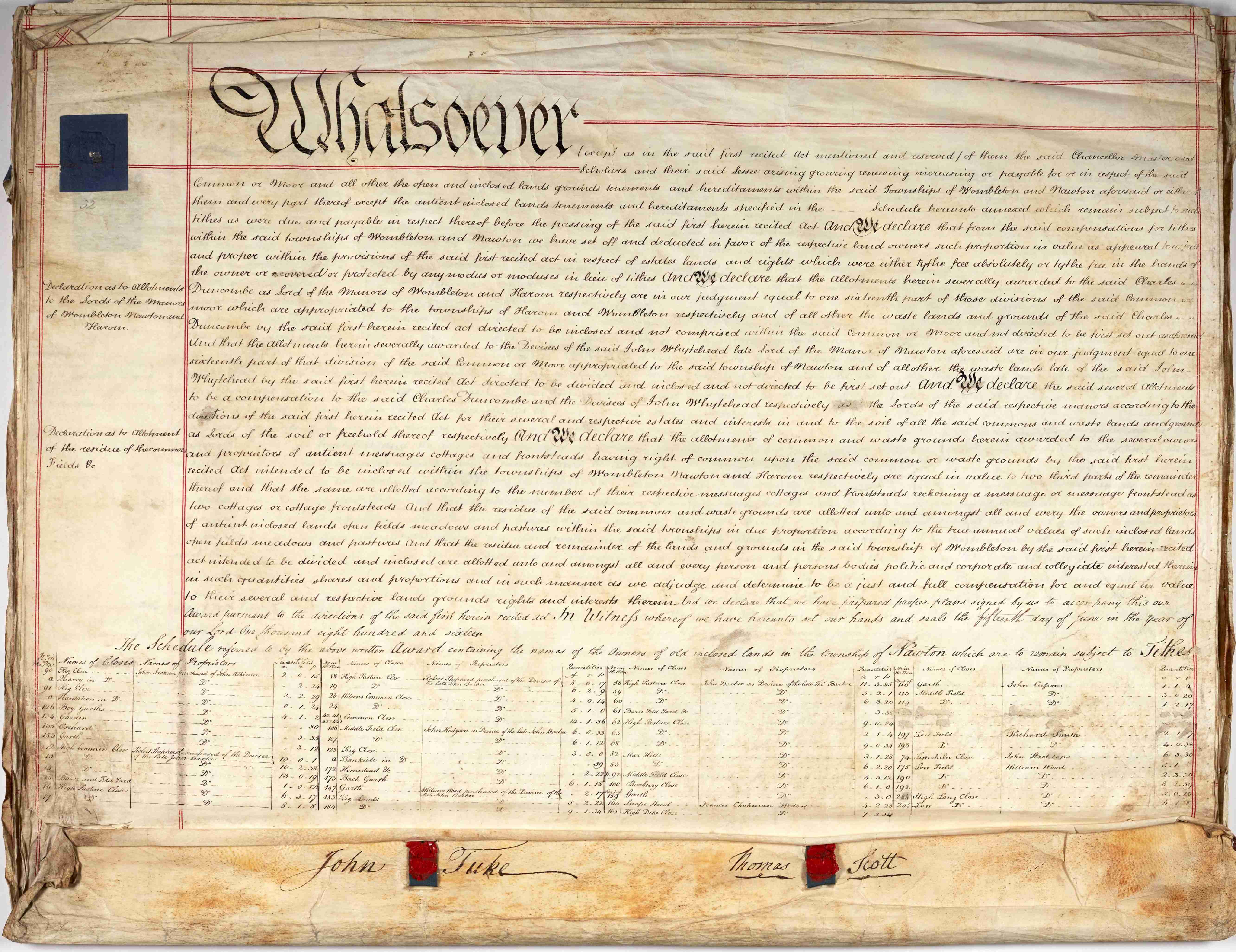
Enclosure Award of 15 June 1816 [NRRD 1]
By the end of these three phases of enclosure in the early 19th century, the open medieval landscape would have been radically transformed, subdivided into a series of rigidly geometric fields bounded by hawthorn hedges or fences, as can be seen on the map below.
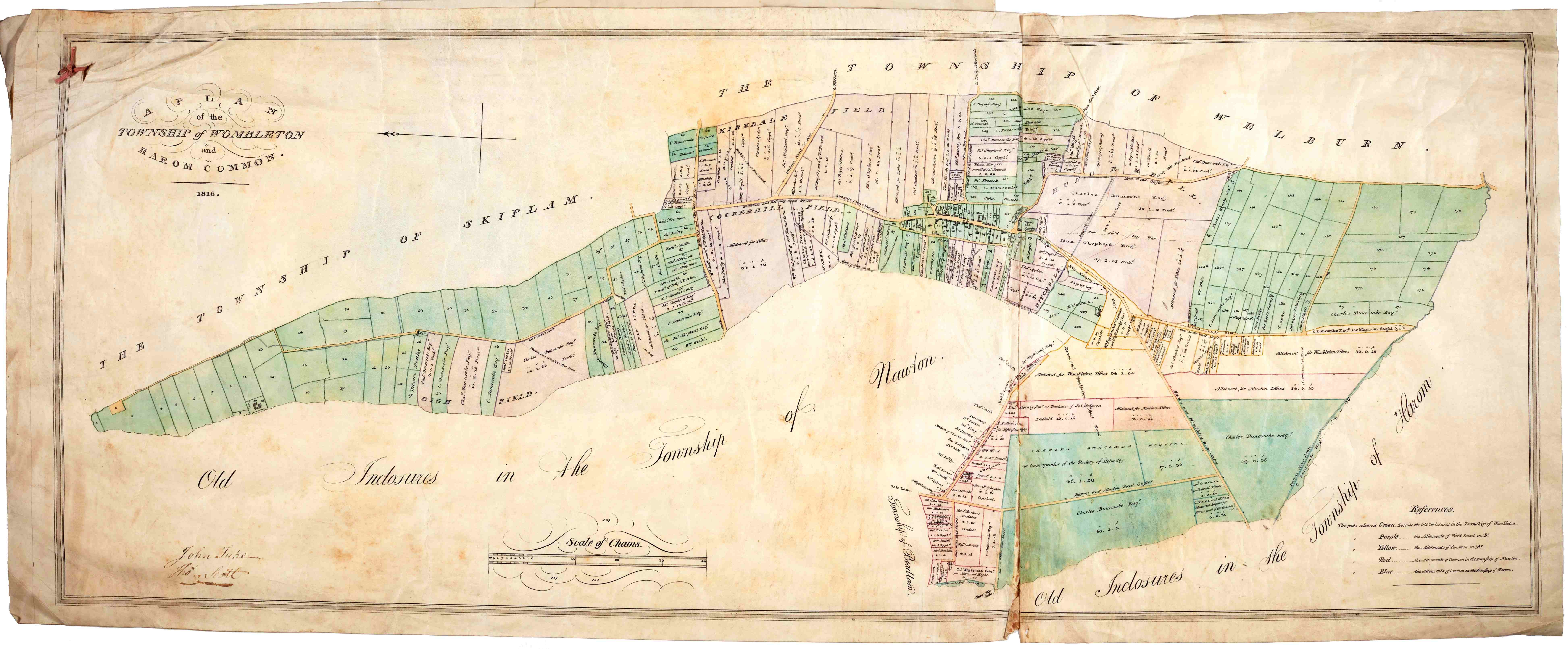
Enclosure plan of the township of Wombleton and Harome Common, 1816 [NRRD 1]
