
Maps of 1766 and tithe records of 1840
The plans of West Field and Gallow Field below show how the narrow strips in two of the open fields of Richmond had continued in use for several hundred years from the medieval period into the 18th century. Whilst some adjacent strips have been combined into larger areas, the plans give a good idea of the layout of an open field, with strips up to 500 metres long.
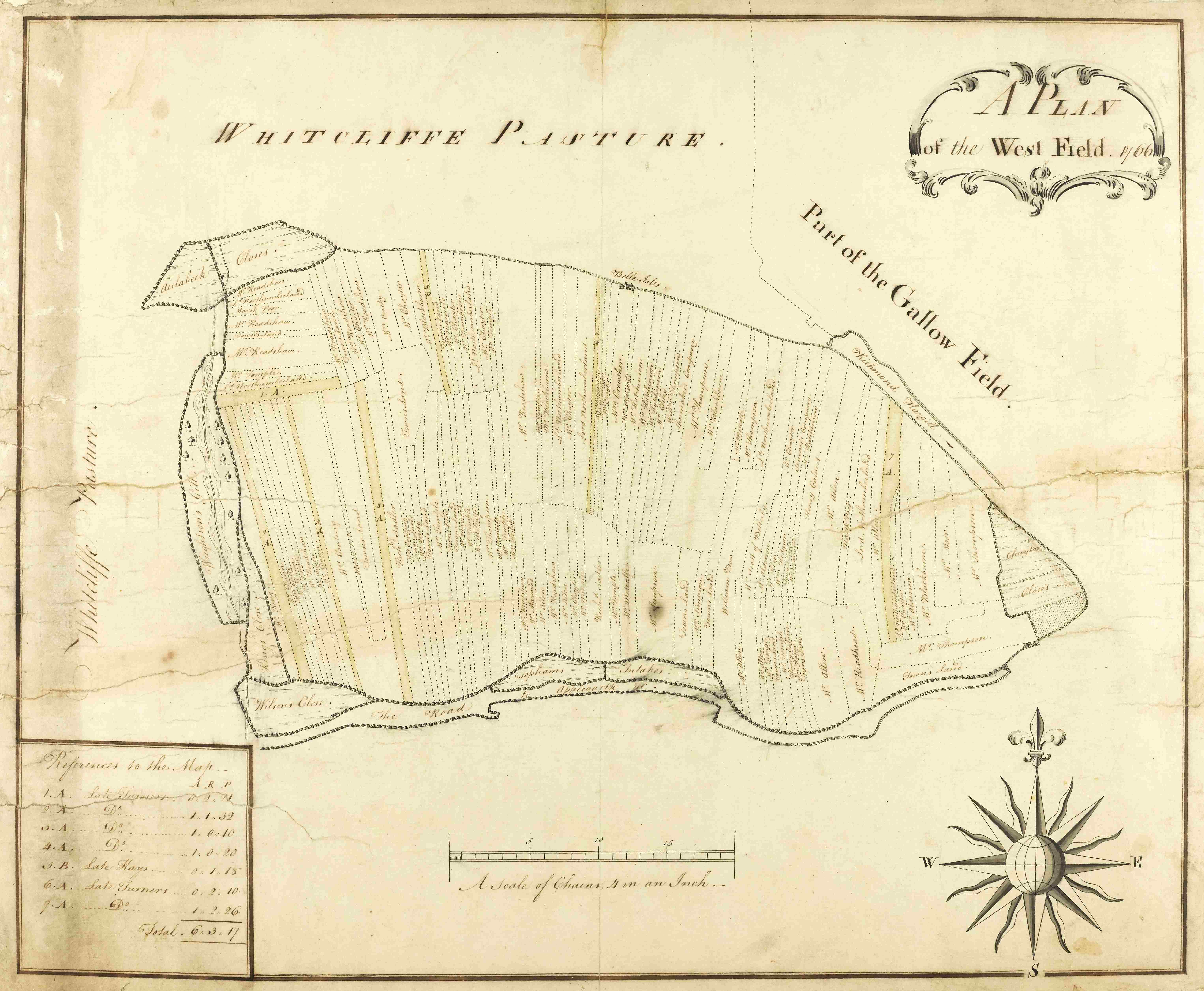
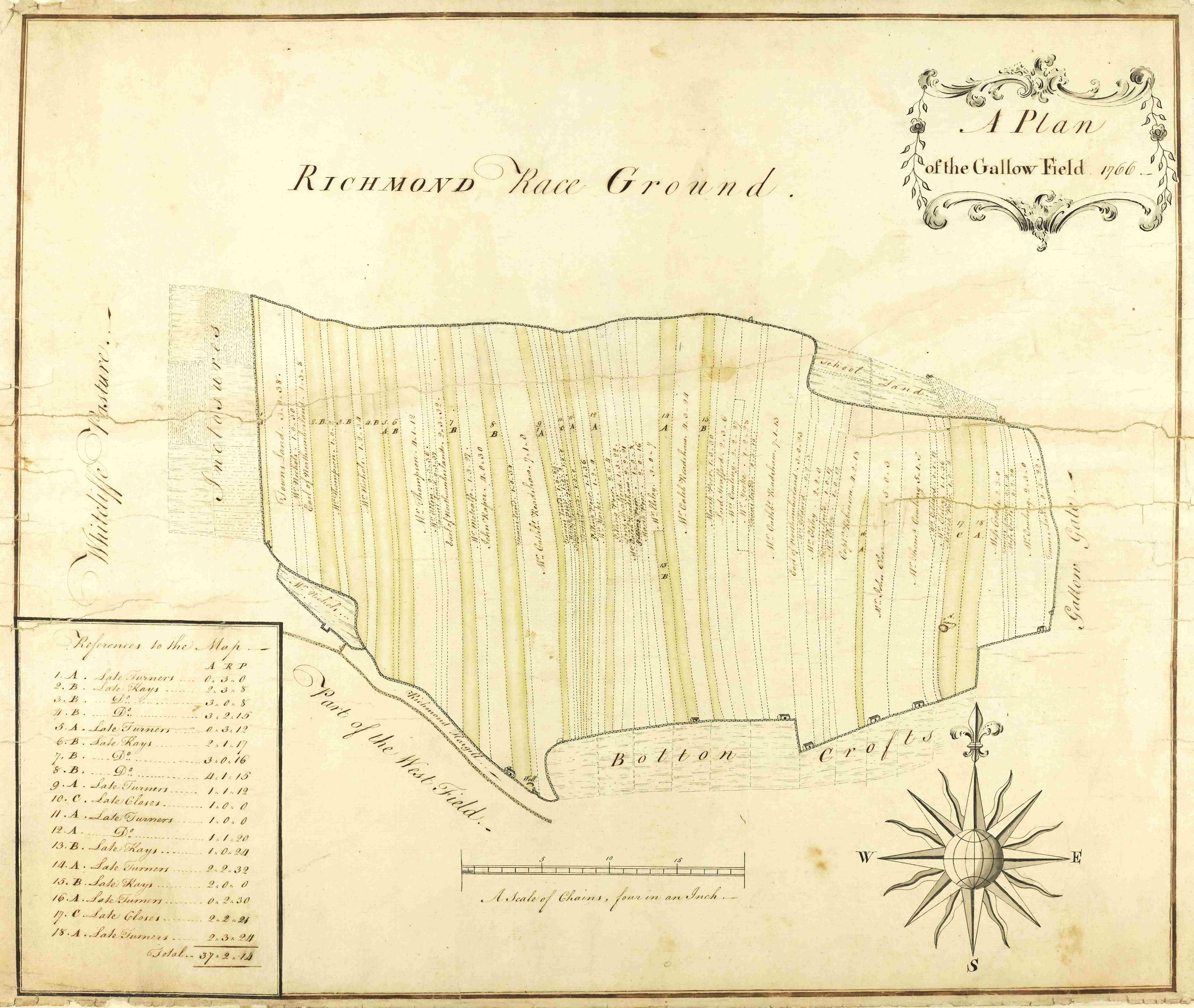
Plans of West Field and Gallow Field, Richmond, 1766, showing owners’ names and acreages of individual strips [ZAZ M4/1 & 2]
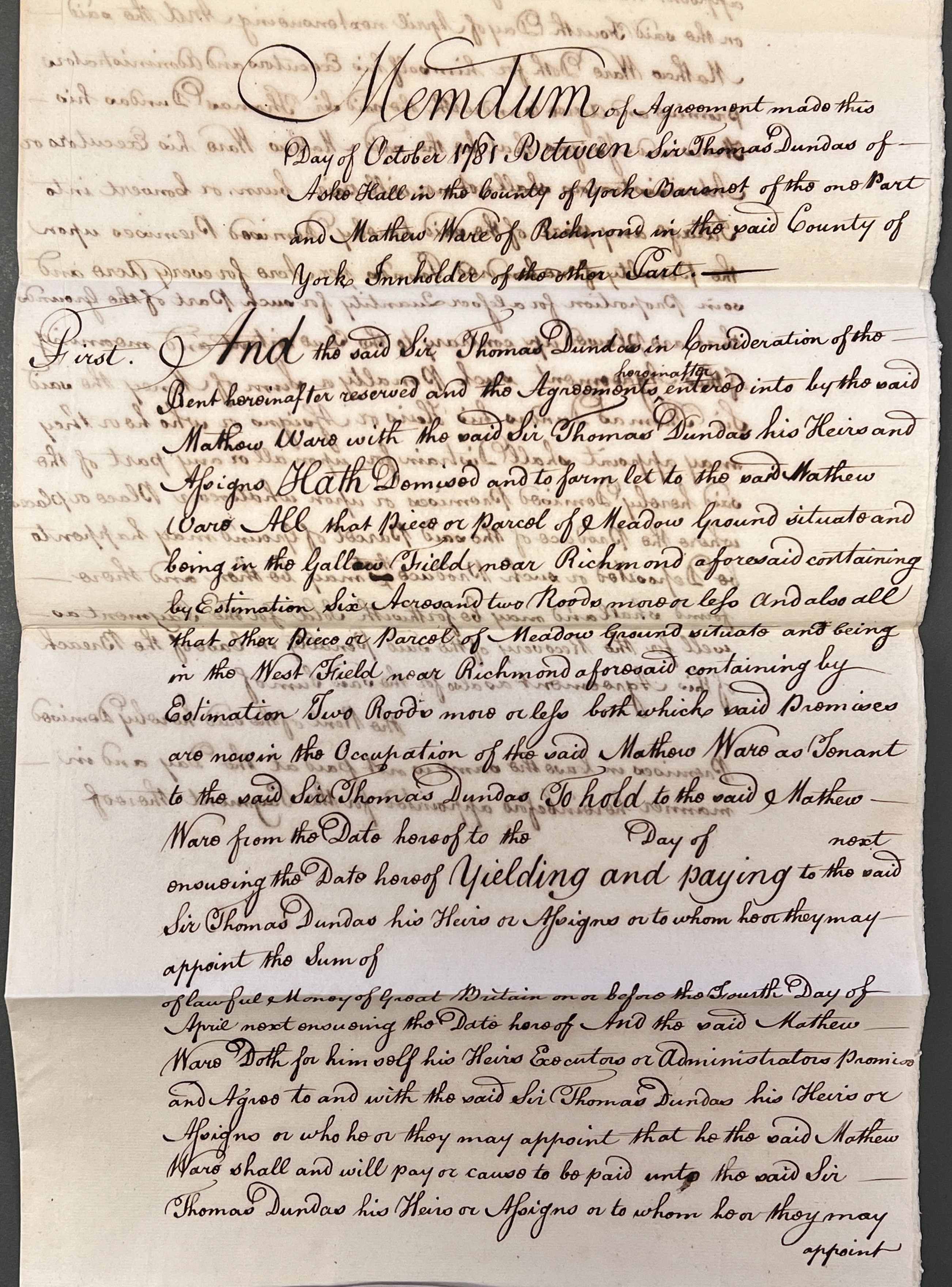
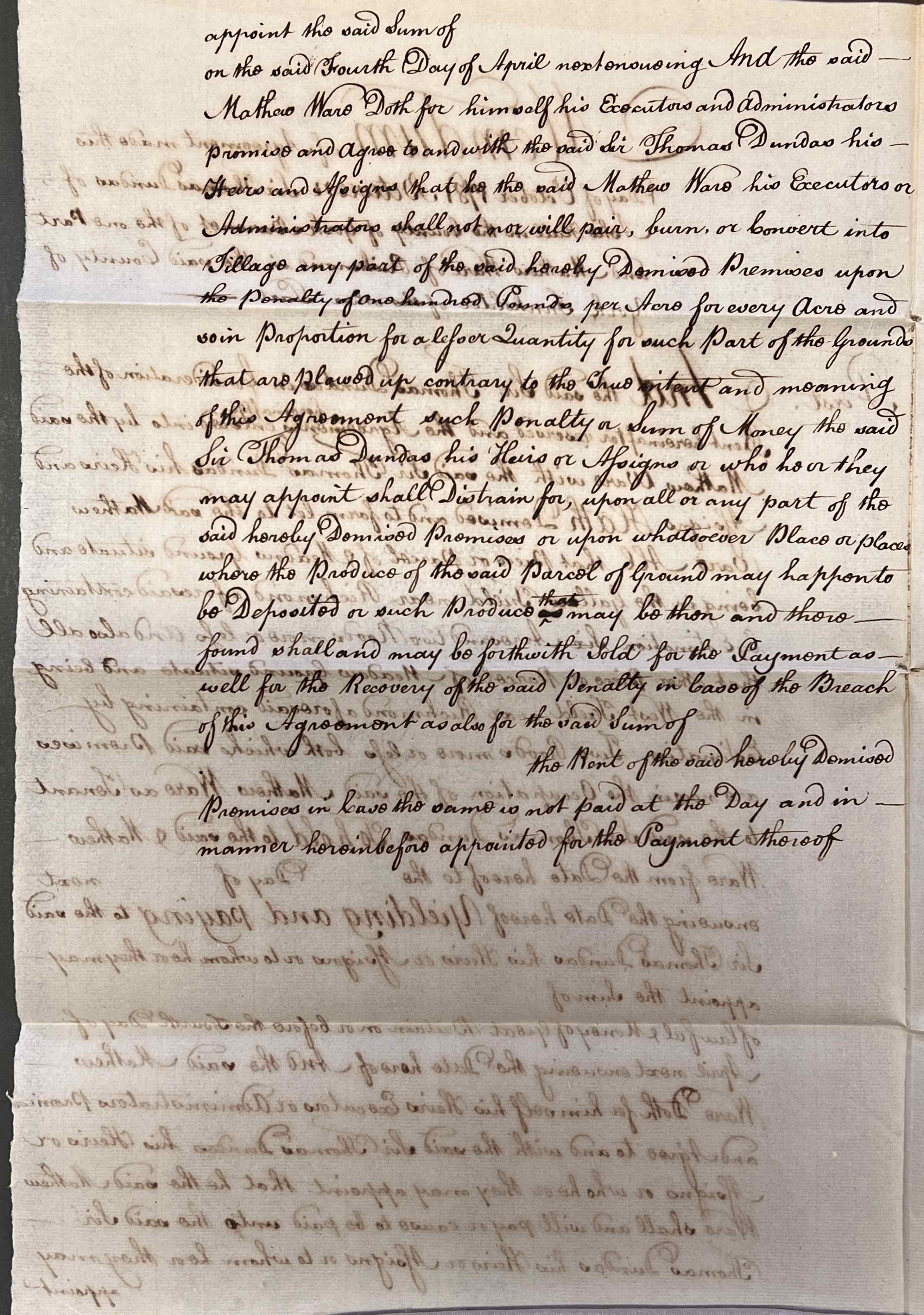
Lease by Sir Thomas Dundas to Mathew Ware, innholder, of 6 acres 2 roods of meadow ground in Gallow Field and 2 roods of meadow ground in West Field for one year, from the records of the Zetland/Dundas family of Aske, October 1781 [ZNK V 2/3/45]
The above agreement includes a clause that Mathew Ware shall not ‘pair, burn or convert into tillage’ any part of the meadow under penalty of one hundred pounds per acre (equivalent to £15,000 today). In the 18th century, ‘paring and burning’ was a popular method used to convert pasture into fertile arable land. It involved slicing off the top layer of turf (the ‘pare’), piling it into mounds to dry out, and setting it on fire to produce nutrient-rich ash. This ash was then spread over the field to fertilise the soil before ploughing it to grow crops.
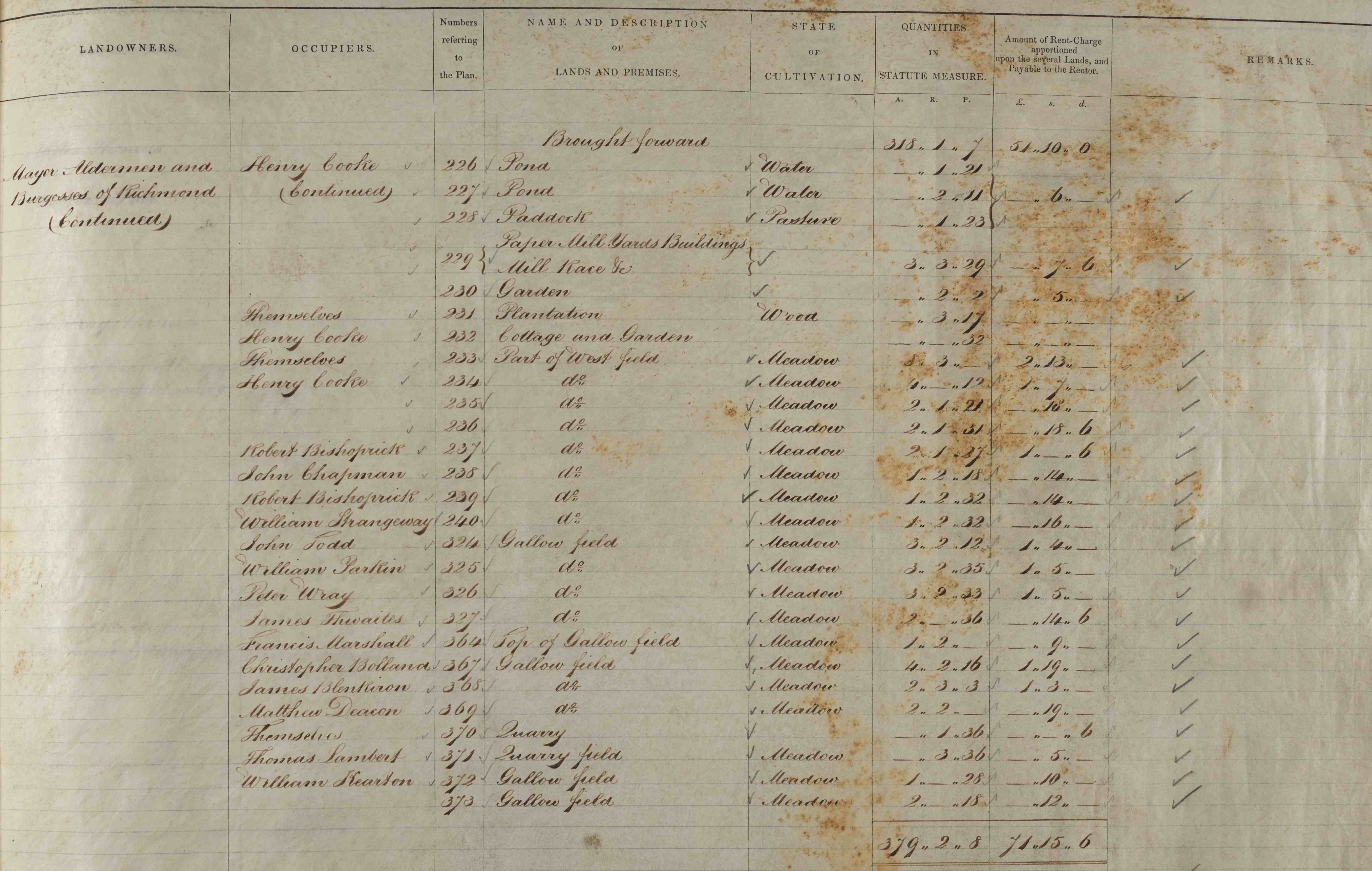
The four open fields of Richmond were enclosed following an Act of Parliament of 1802. Although the Award of 1810 survives, the enclosure map does not. However, the 1840 tithe map (below) shows how Gallow Field and parts of West Field have been reorganised into regular, rectangular fields. The associated tithe apportionment shows the owners as being the Mayor, Aldermen and Burgesses of Richmond.
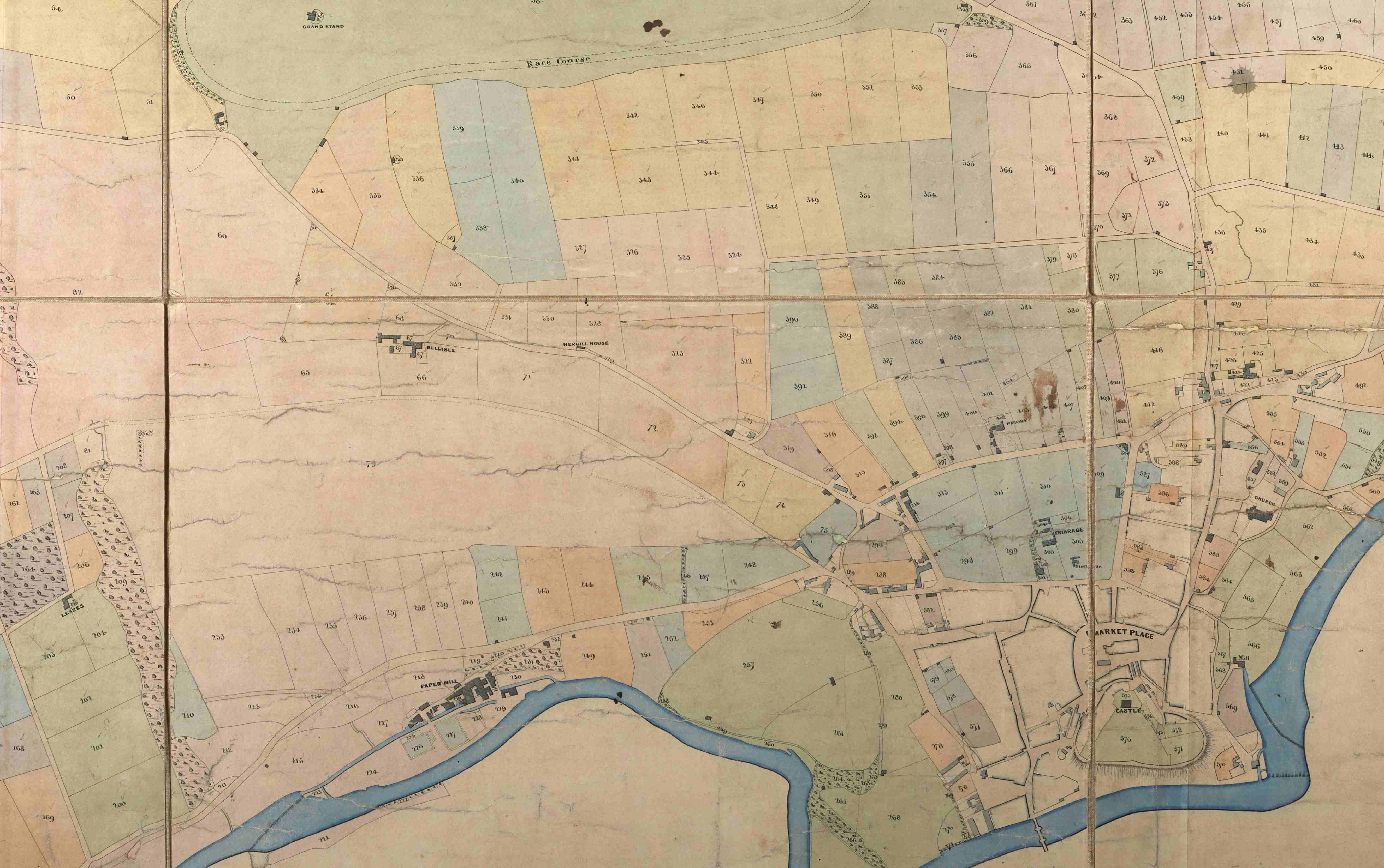
- Left: Extract from Richmond tithe map showing the areas of West Field and Gallow Field, 1840 [T]
- Right: Extract from Richmond tithe apportionment listing landowners and occupiers of land, with parcel numbers corresponding to the map, field names, land-use, acreages and tithe rent charges [T]
