
Maps of 1634 and 1850, and deeds of 1404, 1631, 1632 and 1634
The archive of the Beresford-Peirse family of Bedale contains estate records relating to Rand Grange, some of which are pictured below.
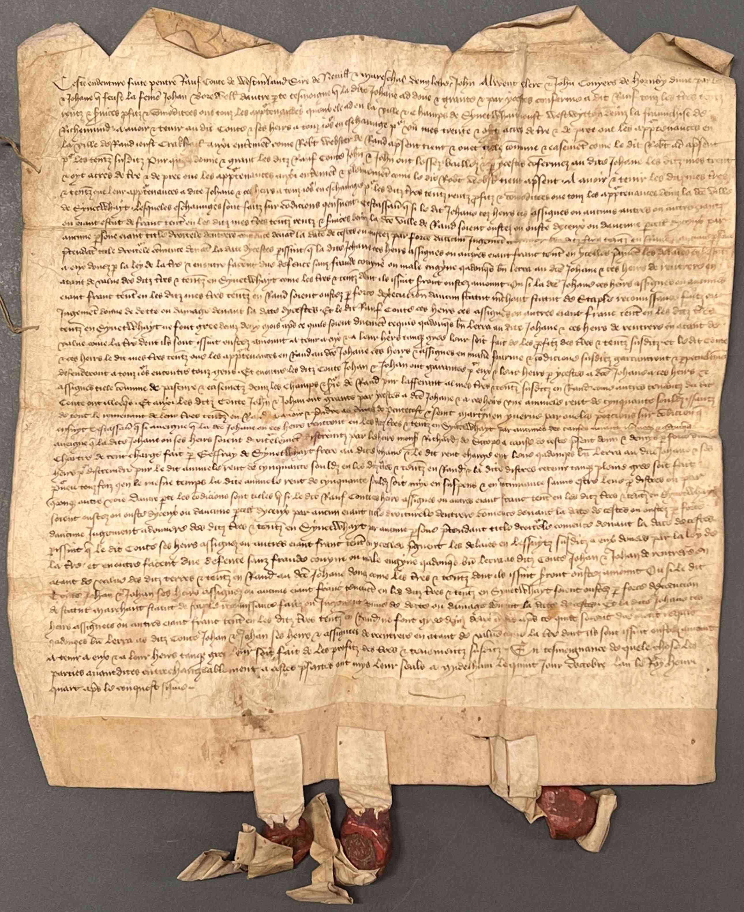
Gift and grant of land between Joan Borewell, who gives lands etc. in Swinithwaite, West Witton to Ralph, Earl of Westmoreland and his heirs in exchange for 1 messuage, 38 acres of land and meadow and appurtenances in Rand near Crakehall from the Earl and others, 5 December 1404 [ZBA 5/4/1]
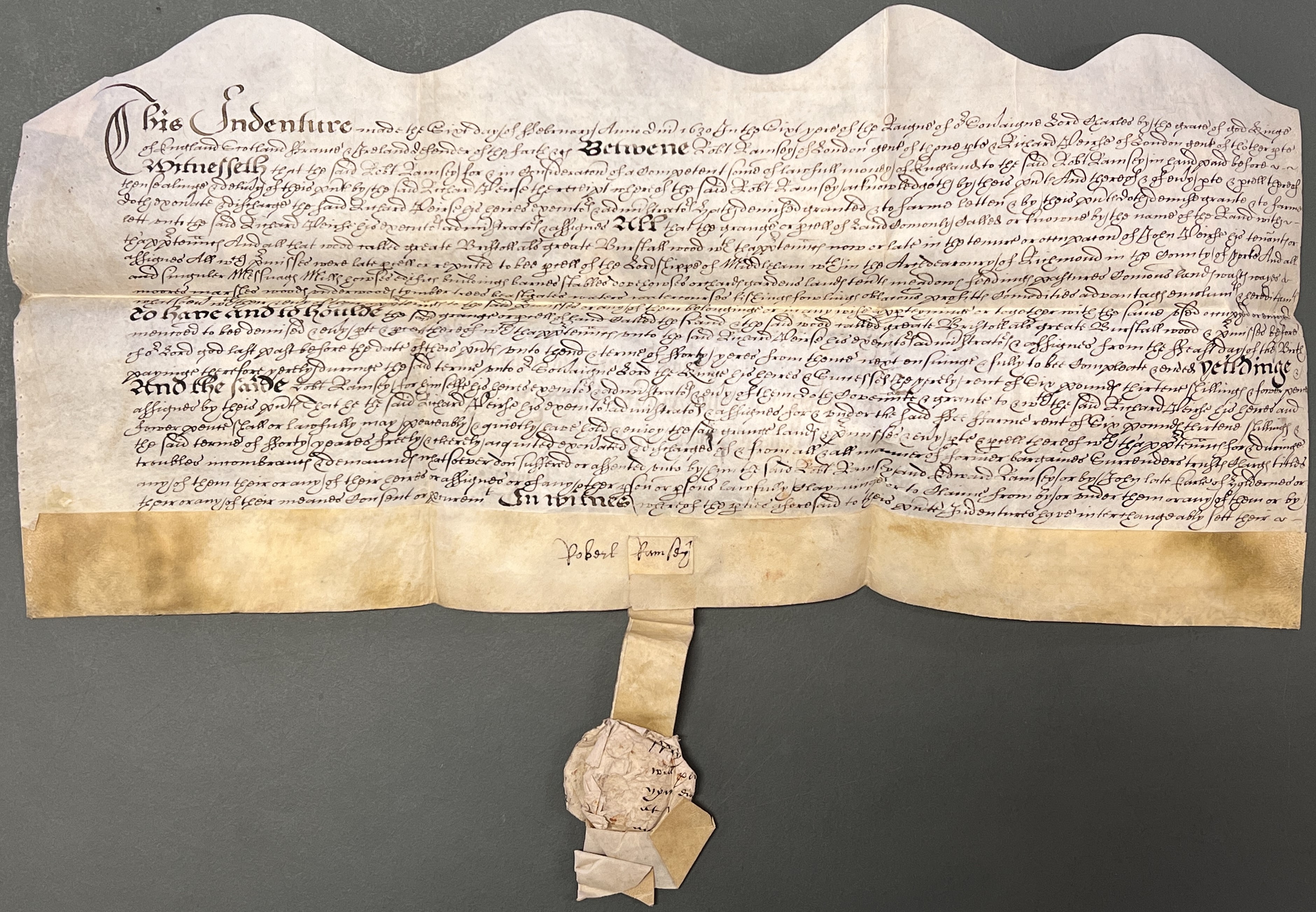
Lease for 40 years of the Grange called Rand with appurtenances from Robert Ramsey of London, gentleman to Richard Peirse of the same, gentleman, 6 February 1631 [ZBA 5/4/8]
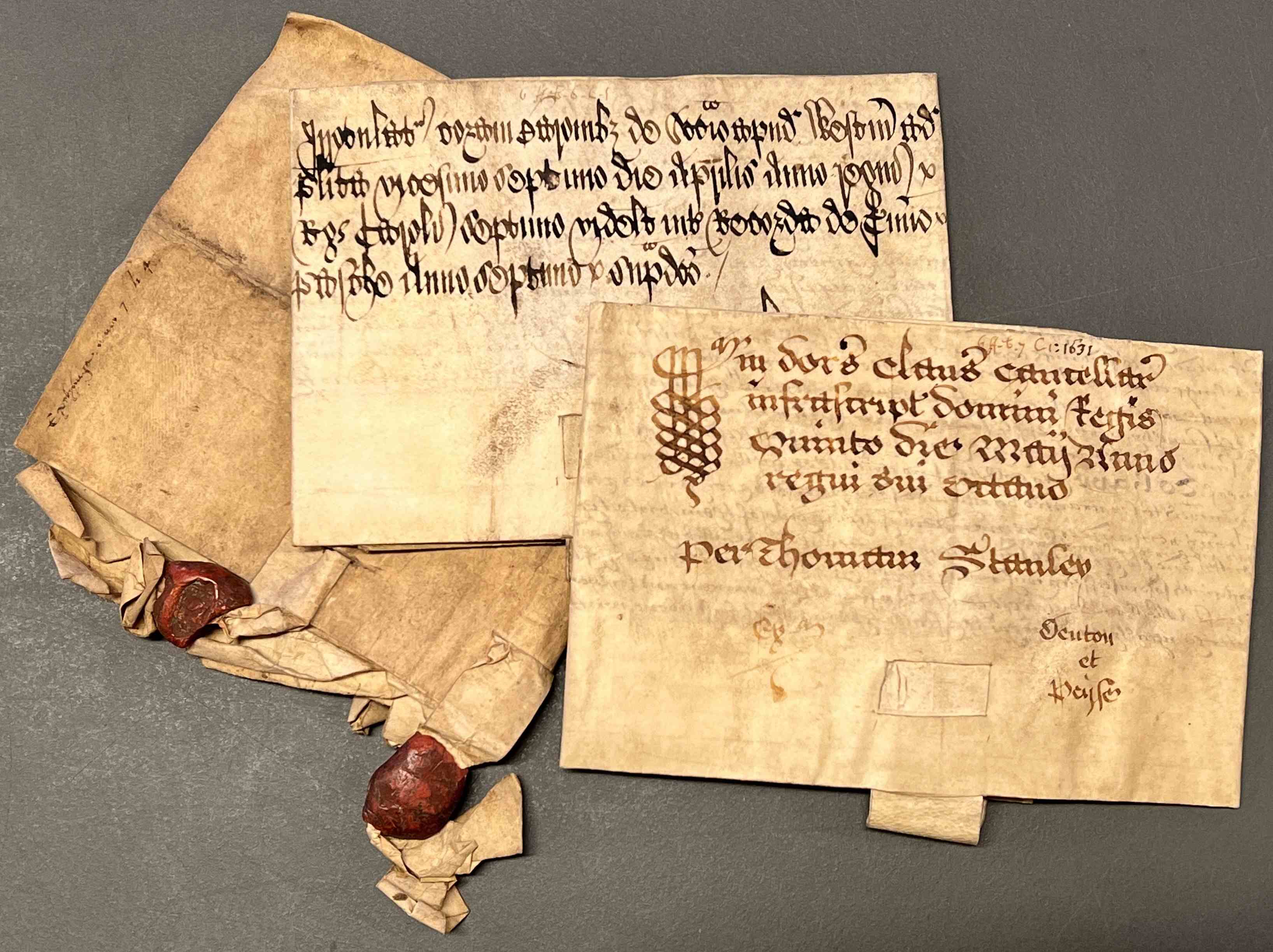
Both of the above deeds folded, along with a third (on top of the pile), which is a conveyance from William Denton of Carthorpe, yeoman to John Peirse junior of grange and wood with buildings, mills, lands and pastures, trees, beastgates, fishings, fowlings etc., 6 February 1632 [ZBA 5/4/13]
Each of these deeds was originally written in duplicate on a single sheet of parchment, which was then cut in half using a wavy or zigzag line. This was done as a safeguard against fraud. Each party to the transaction kept one half, and the matching edges could later be fitted together to prove the document was genuine and had not been altered.
The Beresford-Peirse archive also contains a map and lease of Rand Grange, both dated August 1634 (see below). Together, they provide a wealth of detail about the enclosed landscape, naming areas of arable, pasture and meadow, such as Great and Little Clapham Close, as well as their former tenants and acreages.
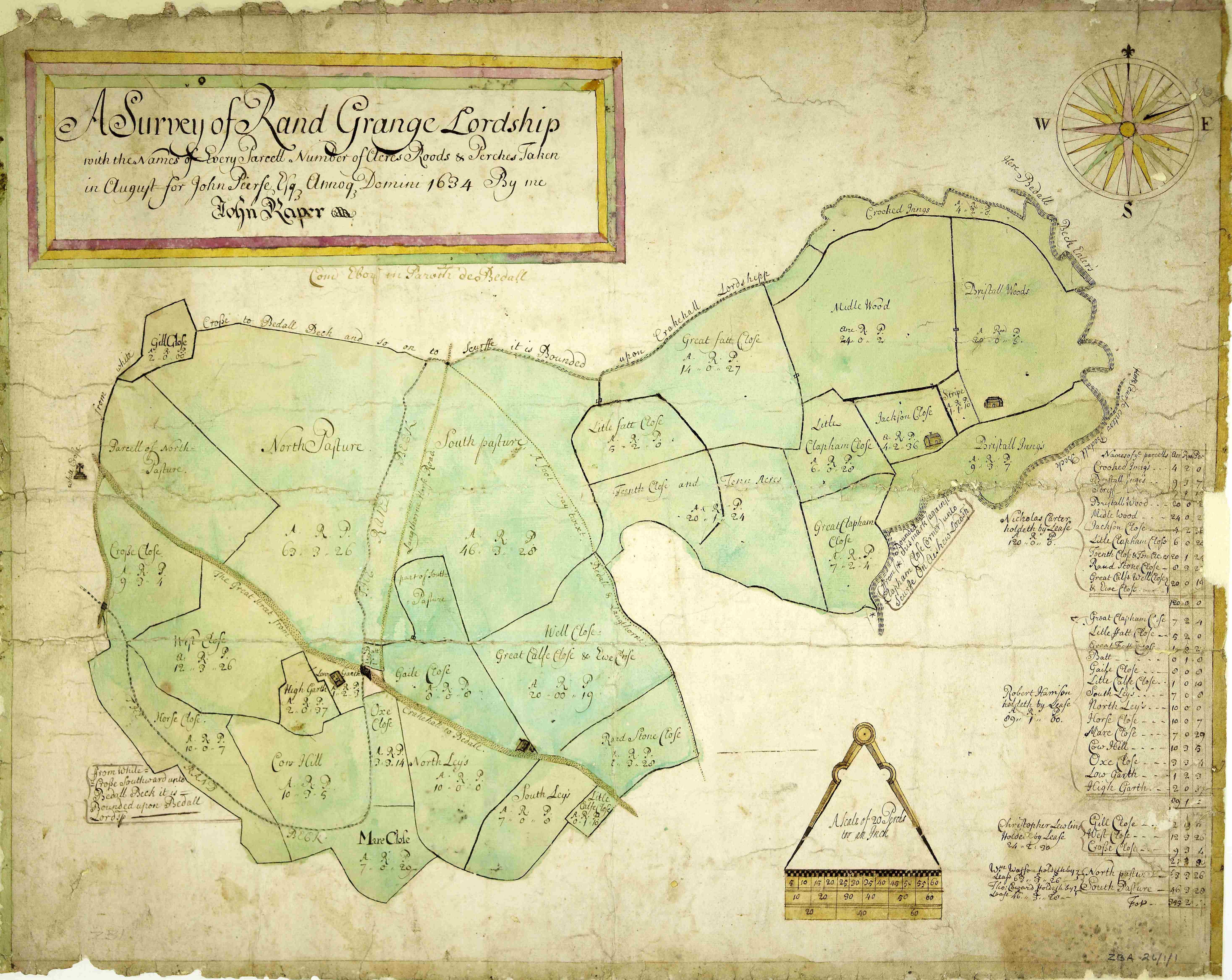
‘A Survey of Rand Grange lordship with the Names of Every Parcell Number of Acres Roods & Perches Taken in August for John Peirse Esq. A.D. 1634 By me John Raper’ [ZBA 26/1/1]
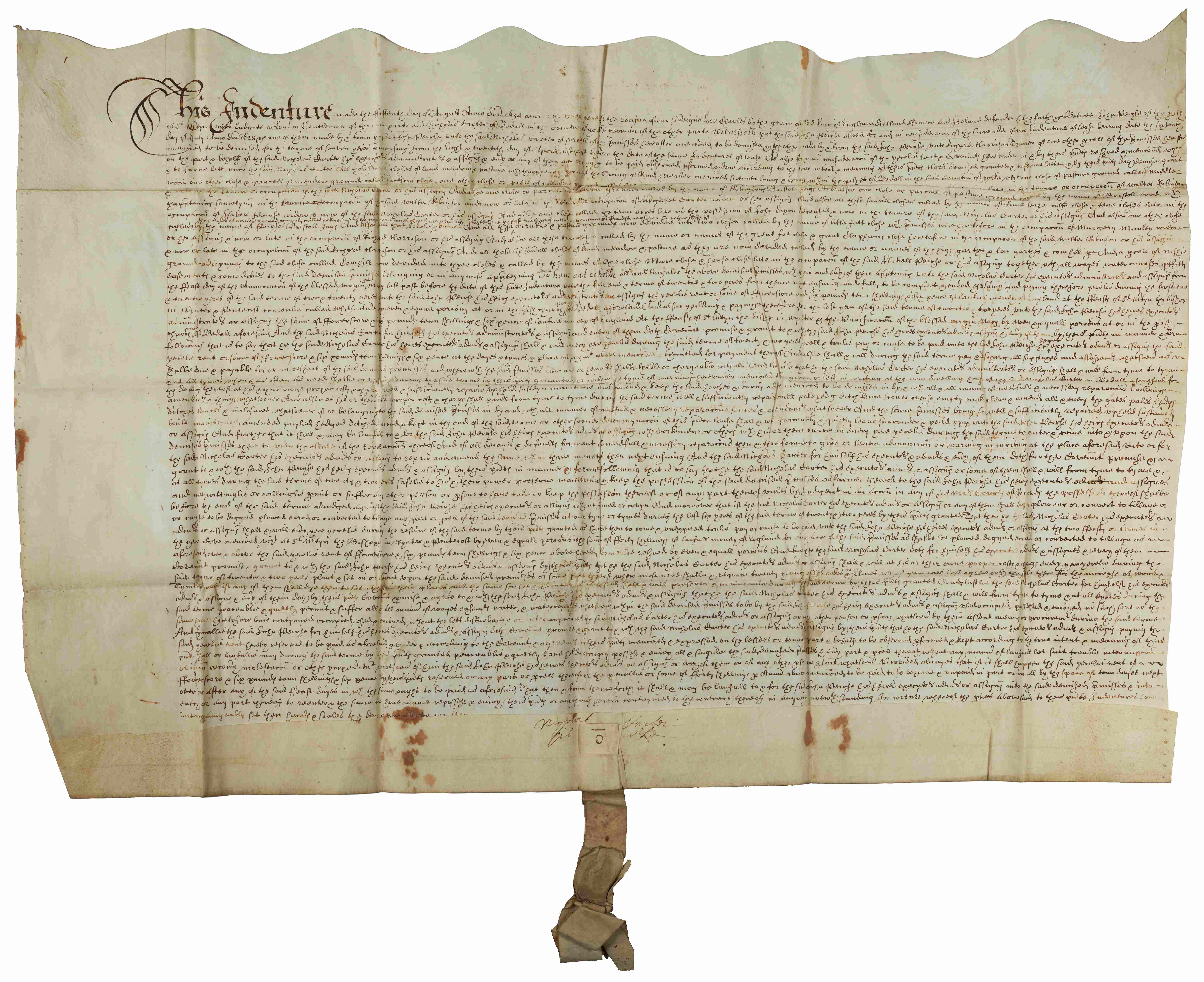
Lease for 22 years of fields in Rand Grange from John Peirse, London, gentleman to Nicholas Carter, Bedale, yeoman, 15 August 1634 [ZBA 11/7/4]
A map of 1850 shows how field patterns have changed over 200 years later. Some fields have been subdivided, others amalgamated, and new areas of woodland have been planted.
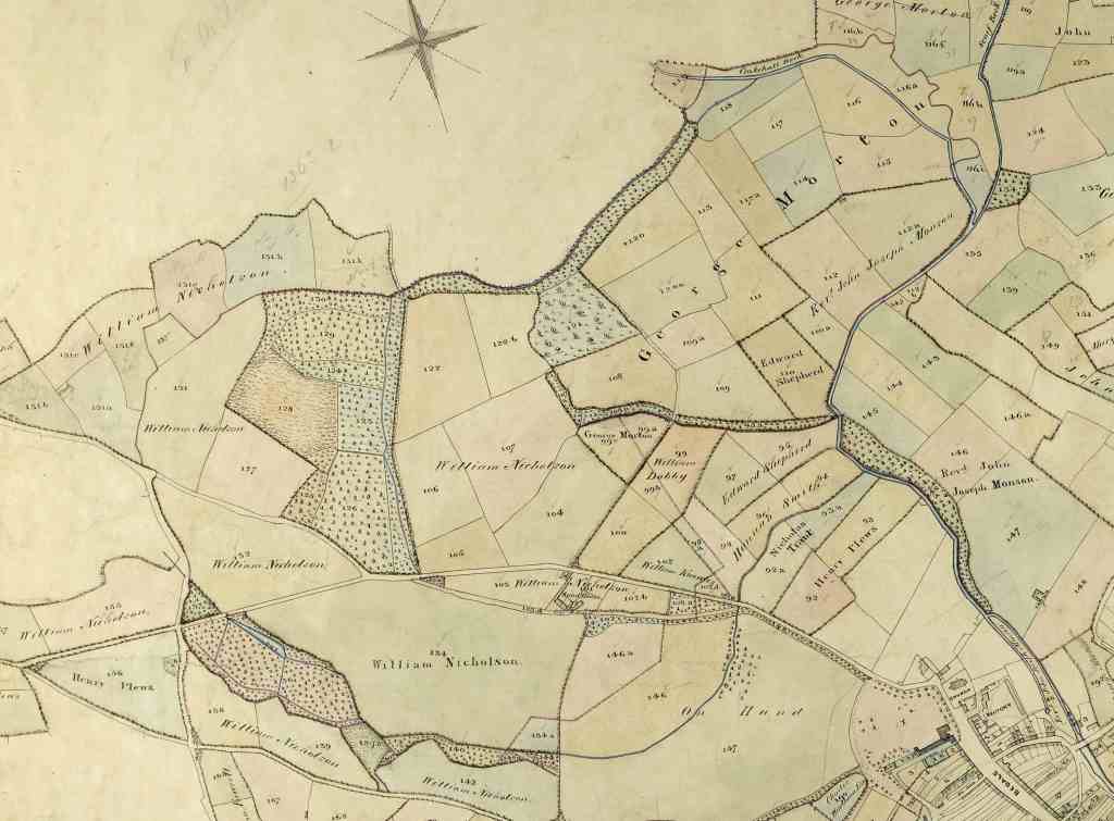
Extract from map of Crakehall, Bedale & Aiskew showing Rand Grange, 1850 [ZBA 26/1/5]
