
By Gwyneth Endersby, Record Assistant
Records we hold portraying places in and around Knaresborough include maps and plans, photographs and works of art.
Maps
Our extensive collection of historic maps and plans for North Yorkshire includes a small number depicting Knaresborough. The earliest representation we hold, showing the town in some detail, is by Thomas Jefferys, geographer to George III, dated 1770.

Other maps featuring Knaresborough and its environs are Ordnance Survey editions (various scales). The first edition of 1854 (sheet 154), shows various industrial developments in the town, including the gas works, the water works and the railway. The arrival of the railway at Knaresborough in 1848 would have had a huge impact on the lives of the townspeople – especially once the viaduct was successfully constructed in 1851, taking the line across the river.

Plans
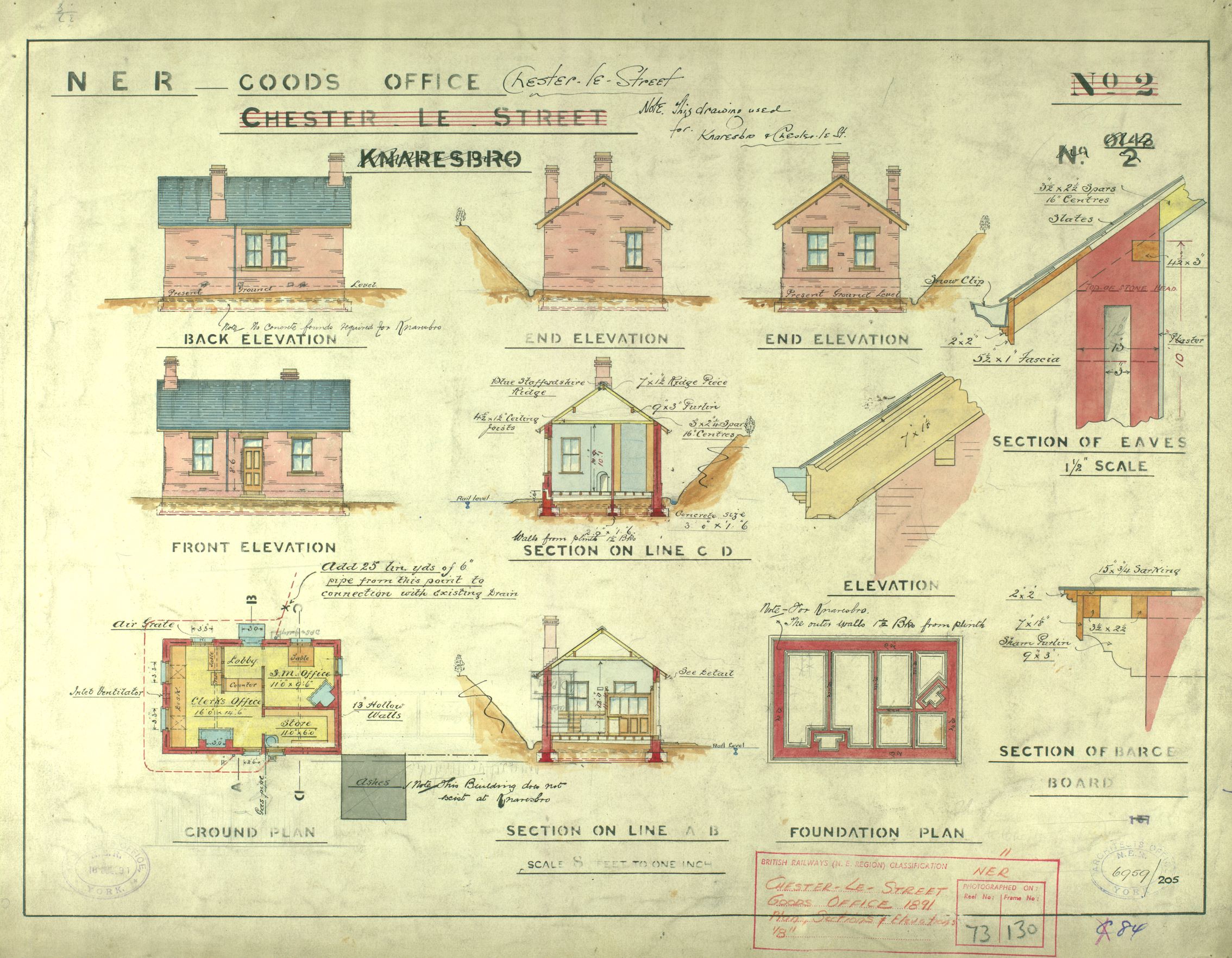
Our holdings of plans of railway lines and buildings (ref: NG/RY) include this colourful North Eastern Railway plan showing the proposed goods office at Knaresborough, 1881. The station and its buildings were improved by re-building in 1891, and notes jotted on this plan state the designs were also used at Chester-le-Street station.
Scotton Banks Sanatorium, once situated high above the town on Ripley Road, is represented in our collections by architectural plans dated 1933-34 (ref: NHS/HOS/KN). We hold no patients’ or other administrative records. Built in 1937, it was designed to accommodate long-stay Tuberculosis patients (children and adults) – offering recuperation facilities and even a small school.
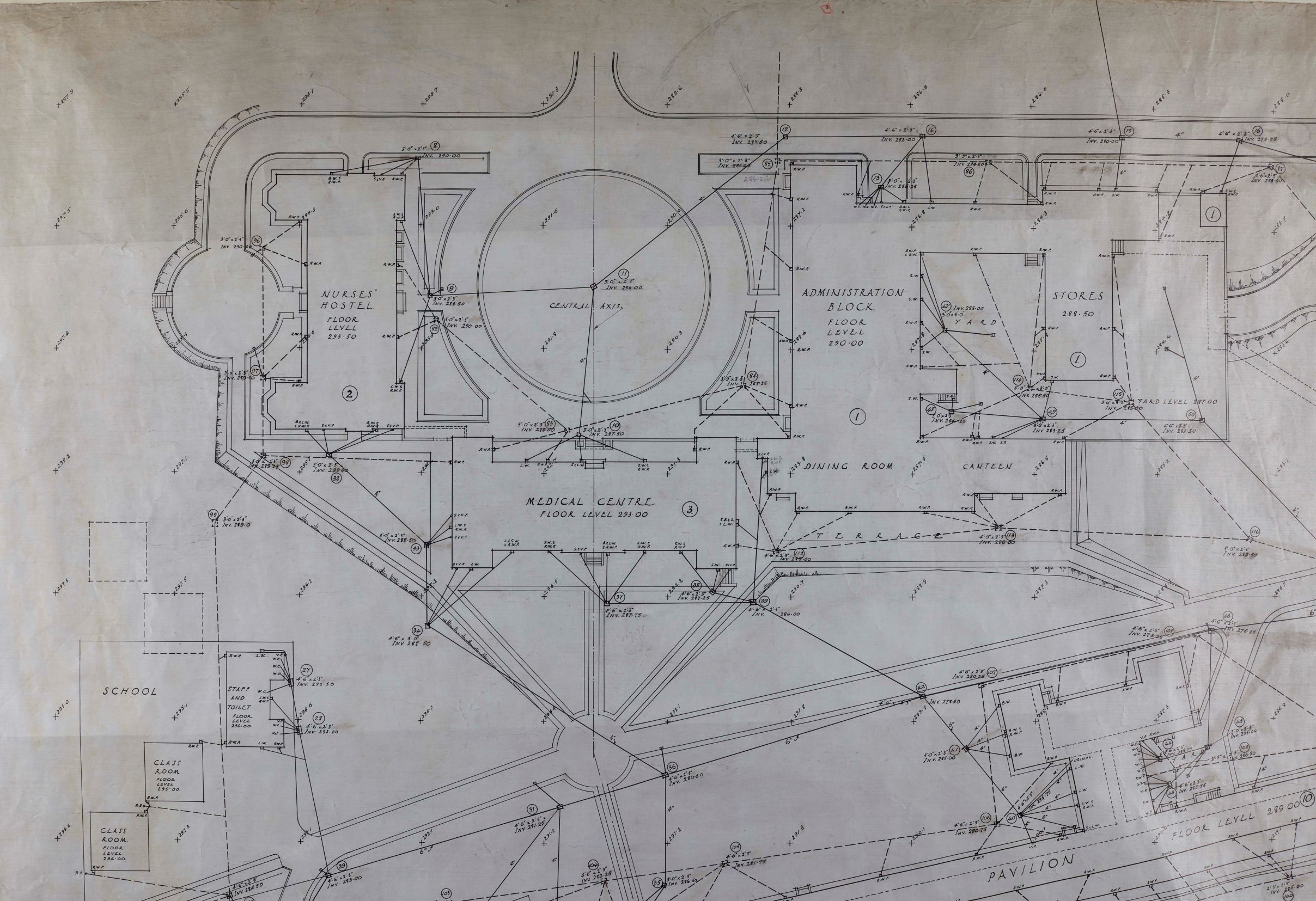
The plans show the administrative areas of the hospital – such as the nurses home, kitchen, laundry and offices – in the north part of the buildings, with the 4 large wards for patients being situated on the sun-catching south side. It became an NHS hospital in 1948, and was demolished in the 1990s to make way for a housing development.
Artwork
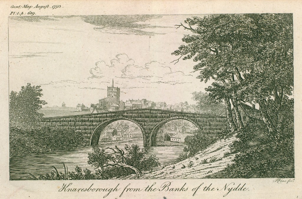
Eighteenth century drawings and etchings offer us views of Knaresborough before the advent of photographs. This detailed etching by R Lane (ref: EE88), shows the town in 1793 – just two decades after Jefferys published his map of the area.
Artist Henrietta Matilda Crompton’s monochrome watercolour of Conyngham Hall (formerly Coghill Hall), near Knaresborough, is within her sketchbook of 1848-9. Henrietta’s sketchbooks, together with the journals in which she records her visits to “Conningham” (July 1834 and June 1844) with her sister Elizabeth, are part of the archive we hold for the Crompton family of Esholt and Azerley (ref: ZCM).

Photographs
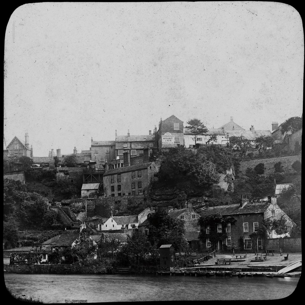
Our photographic deposits contain a variety of images relating to Knaresborough, and include a collection of around 100 glass plate negatives from a photographer’s shop (not named) located on Cheapside (ref: EF 491). The negatives have no attached information, though appear to be early 20th century in date, and include these marvellous riverside views of the town.
EF491/0001 
EF491/0005
The extensive Bertram Unné photographic collection includes a number of historic images of Knaresborough, like this Edwardian view of the Dropping Well. Famous for its petrifying qualities, the well has long been a site of curiosity and attraction. Recorded by Jeffreys on his map in 1770, it remains a popular tourist site today.

The Unné collection also contains photographs of some memorable Knaresborough events; like this dramatic bus crash on High Bridge (undated).

For more examples: visit our online shop for a range of Knaresborough maps and images
Further reading
“A-Z of Knaresborough History” by Dr Arnold Kellett (2009, revised by Paul Chrystal, 2013), Amberley Publishing

Hello These Focus On blogs are interesting. Are you likely to do one on Selby please? Kind regards Sheila Newsome
We’re pleased to hear that you find the Focus On posts interesting. Do keep checking back – we’ll be covering Selby in the coming weeks.