
“Rome, a fine place to live and dye in.” Richard Lassels, A Voyage of Italy, c.1663
In the 18th century, Rome was the centre of the intellectual and artistic world, the ultimate destination for the Grand Tourist. Visitors would stay from several months to several years, and such tourism provided Rome with a major source of revenue. Many artists and British visitors took lodgings in the Piazza di Spagna, which was the cultural heart of the City.

Roma antiqua triumphatrix ex vetustis monumentis expressa by Giacomo Lauro, published by Mariano Vasi, 1792 [ZNK M8/3/3]
The above map comes from the Zetland/Dundas family archive. It is a bird’s-eye view of ancient Rome, copied in the late-18th century from a plan made by Giacomo Lauro that was published by Giovanni Giacomo de Rossi between 1649 and 1677. The names of 102 buildings and monuments are indexed in the left and right margins. The title can be translated as: Ancient Rome triumphant, expressed from ancient monuments.
A typical day for our travellers in Rome might include spending the morning viewing the ruins of ancient monuments, or one of the many historic churches. They might be accompanied by a cicerone, such as James Byres or Thomas Jenkins, who would act as tour guide, translator, banker and antiquities dealer. Later in the afternoon, there would be time for rest, letter or journal writing and, in the evening, social engagements, dining out, entertaining company at home, or outings to a concert or the opera.
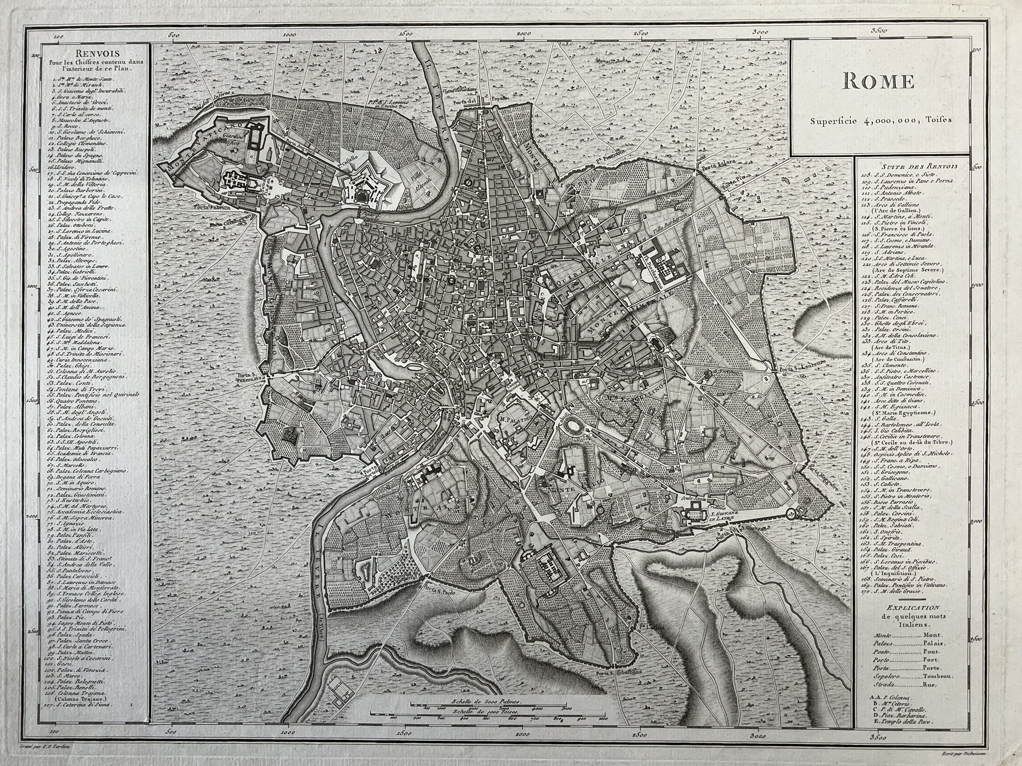
French map of Rome, undated (early-19th-century) [ZS]
We can gain a detailed picture of the daily life in Rome of an English gentleman travelling in Italy in the later-18th century from the travel journals of Thomas Orde. In 1772, he records a visit to St Peter’s at the Vatican. On 11th April 1789, he saw the Strozzi collection of gems and visited the Ludovisi villa, spent the evening with the Cardinal de Bernis and “went at night to see the Colosseum by moonlight and were much pleased. Spent some hours there.” The week before, he made excursions on horseback to explore the surrounding countryside and Hadrian’s villa at Tivoli, where excavations were revealing new discoveries.
Another day, he records spending an evening at the Vatican museum by torch light. Some of the most celebrated works of sculpture of the ancient world, discovered during the Renaissance, were held in the Papal collections at the Vatican. Viewing these at night by the light of a flickering flame, which cast moving shadows, would make the sculptures appear as if they were alive.
As a Papal state, and the home of the Catholic Church, the ceremonies and festivals in Rome were important religious experiences for many travellers. They could attend mass at St Peter’s, where they might have an audience with the Pope, and even kiss his toe or that of the statue of St Peter.
Detail of letter from Mrs Fuller to her mother in Ireland, 12 Feb 1837, in which she mentions her hopes of travelling to Rome to kiss the Pope’s toe [ZMO 27]
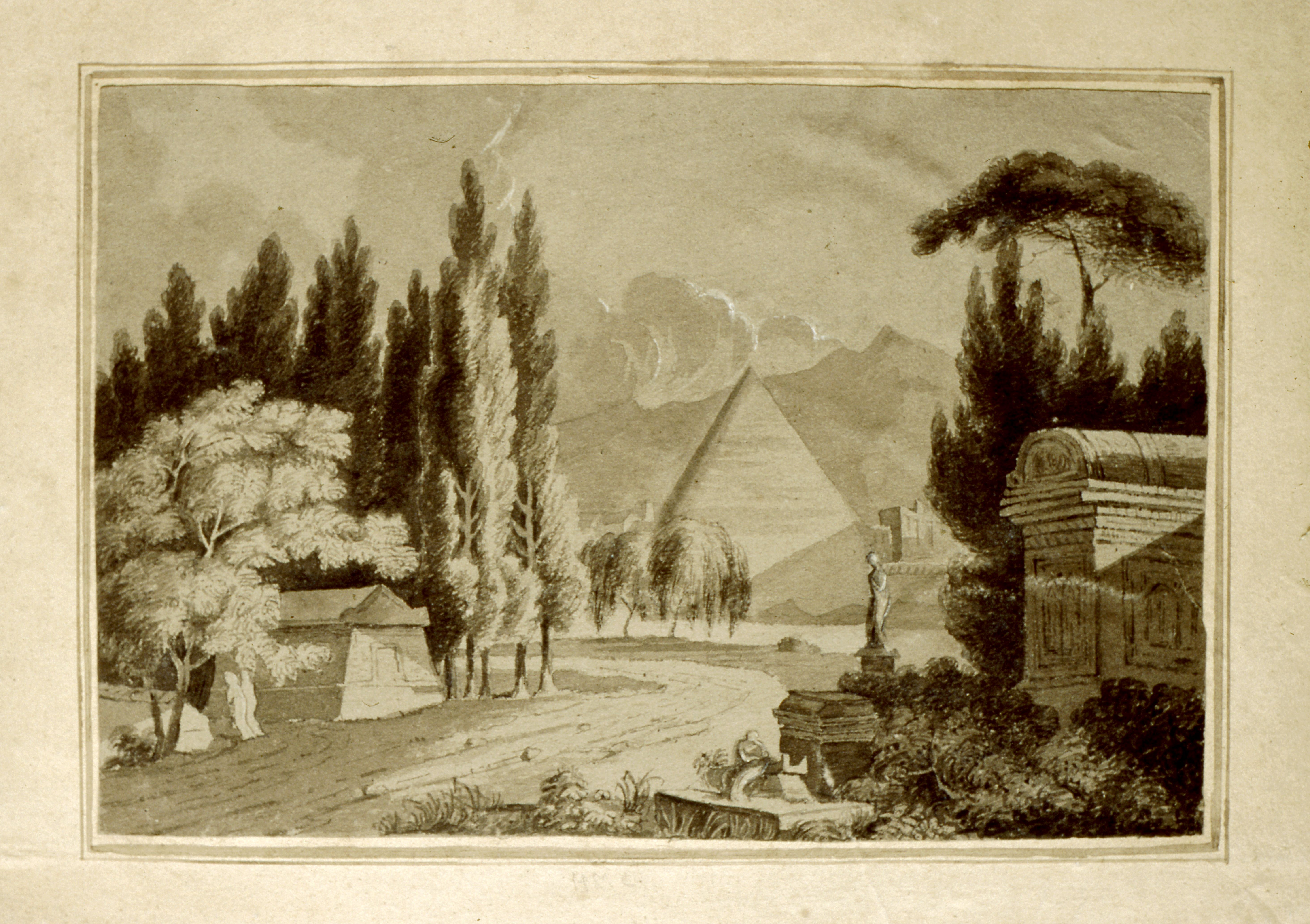
Study of Roman tombs, pyramids and cypress trees by Henrietta Matilda Crompton, 1812 [ZCM]
Architects would study the classical architecture, artists would sketch the ruins and paint views of the City. Piranese’s prints were considered the finest of these and often bought as souvenirs, along with books, maps, original or replica ancient sculptures and models of Roman monuments. The capriccio paintings of Panini were extremely popular, showing fantastical views of a mixture of the real and imaginary Rome. A list of prints and books purchased on the Grand Tour in the 1780s, including Piranesi’s Vedute di Roma, can be found amongst the papers of John Christopher Burton Dawnay [ZDS XVI 8].


Extracts from a large, fold-out panoramic map of Rome, undated (19th-century) [ZNK M8/3/1]
The above map comes from the Zetland/Dundas family archive, and was most likely purchased as a souvenir in Rome. It is an engraving, printed onto twelve separate paper sheets, mounted on a linen backing and folded several times, with an associated card case covered in blue paste paper in which it is housed when folded.
The title is written in Latin along the top edge: ANTEIQUAE URBIS IMAGO ACCURATISSIME EX VETUSTEIS MONUMENTEIS FORMATA (translated as A very accurate image of the ancient city formed from ancient monuments).
In a cartouche in the upper left corner of the map is inscribed: EFFIGIES ANTIQUAE ROMAE EXVESTIGIIS AEDIFICIORUM RUINIS TESTIMONIO VETERUM AUCTORUM FIDE NUMISMATUM MONUMENTS AENEIS PLUMBAEIS SAXEIS TIGLINISQUE COLLECTA ATQUE IN HANC TABELLAM REDACTA ATQUE DESCRIPTA A PYRRHO LIGORIO ROMANO PER XIIII REGIONES IN QUAS URBEM DIVISIT IMP CAESAR. AUG. PIOQUE IIII PONT MAX DICATA EXCUDERUNT ROMAE MICHAEL ET FRANCISCUS TRAMEZZINI M.D.LXI (translated as Pictures of the buildings of Ancient Rome, witnessed by the old authors, coins and the ruins of the monuments of bronze, lead, stone and wood, collected and recorded in this plate, described by the Roman Pirro Ligorio through the 14 regions into which the City was divided by Emperor Caesar Augustus, dedicated to Pope Pius III, inscribed by Michael and Franciso Tramezzini, 1561)
The map is based on the work of Italian Renaissance architect Pirro Ligorio (c.1512-1583), who studied the ancient monuments of Rome. In 1561, his topographical map of the ancient city, as it might have appeared during the reign of the Emperor Augustus (27 BC-14 AD), was published by Michael and Francisco Tramezzini. In later years, Ligorio’s map was reprinted several times from the original plates; by Carlo Losi, a bookseller and publisher of prints in Rome, in 1773 and later by Giovanni Scudellari around 1820/30, which may be the edition pictured above.
