The ‘King’s Highway’
Most of England’s rural highways are likely to have originated as ancient trackways between settlements and pre-date written record. Some routes formed part of the network of roads constructed by the Romans in the period AD 43 to 410, many of which remain part of the highway network to this day.
In 1285, the Statute of Winchester confirmed that the responsibility for the upkeep of most public highways rested with landowners and the inhabitants of the manor in which the road lay. The ‘King’s Highway’, as it was termed, was little more than a series of tracks criss-crossing the countryside upon which the king and his people had a perpetual right of free passage. Records of medieval manor courts show individuals being fined for encroaching on or ploughing up parts of the highway and of the inhabitants of whole settlements for failing to keep the highway clear and in a necessary state of repair. An Act of 1555 shifted the responsibility for highways on to the parish in which it lay. The parish was required to appoint a surveyor of highways and provide all of the materials, equipment and labour required to maintain the roads. Parishes failing to keep roads in sufficient repair risked being indicted at the county quarter sessions.

Whilst some public highways became turnpikes in the eighteenth and nineteenth centuries, the majority remained a parish responsibility until the 1860s when Highways Districts were formed, and some were still maintained by the parish until 1894.
‘Stone breakers’ from Costume of Yorkshire, 1814
Early Road Atlases
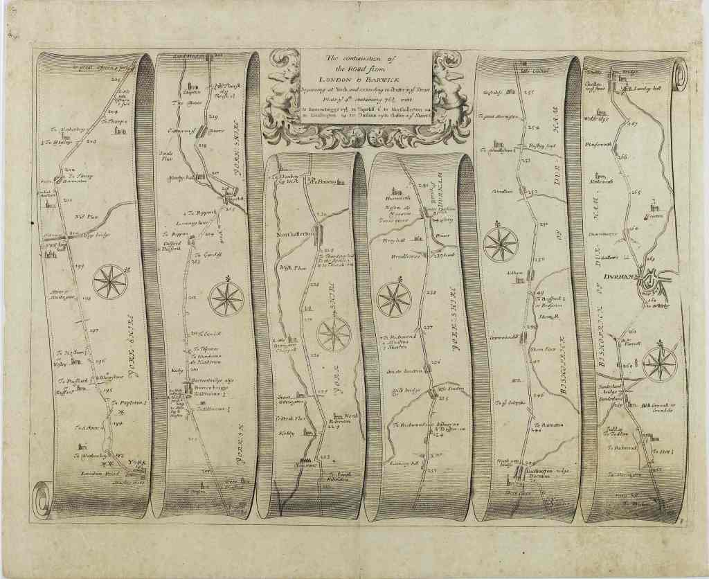
John Ogilby’s Britannia atlas of 1675 is regarded as the first commercially available road atlas of Britain, and set the standard for a series of early road atlases. Brittania contains 100 strip maps together with accompanying text.
Britannia Depicta or Ogilby Improved by Emanuel Bowen and John Owen was a pocket revision of Ogilby’s atlas. First published in 1720, the ‘Bowen and Owen’ atlas was subject to a series of revisions and remained in print well into the nineteenth century.
Part of the road from London to Berwick from Ogilby’s Britannia [NYCRO]

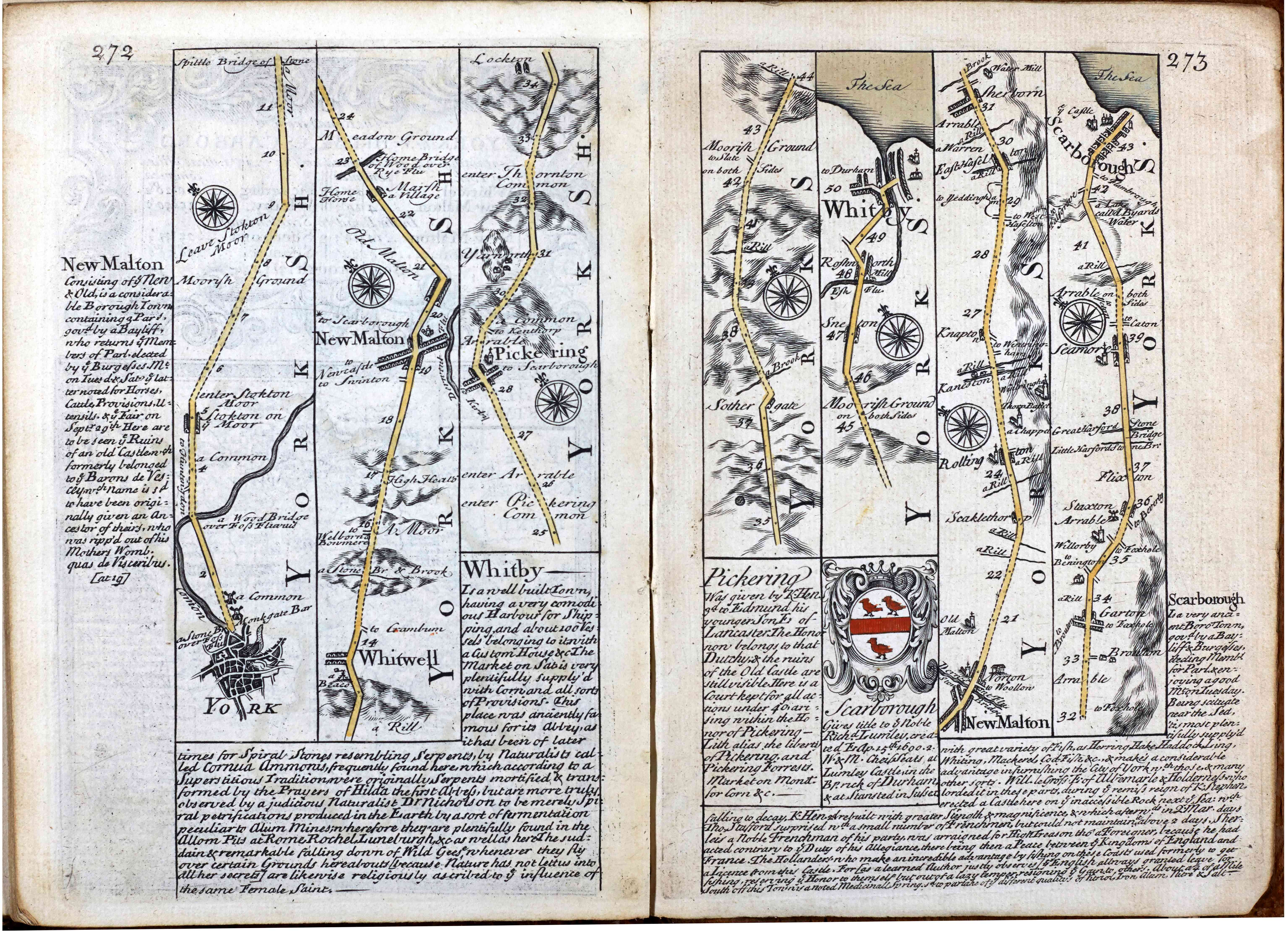
Pages from Britannia Depicta or Ogilby Improved [NYCRO]
Turnpike Roads
The seventeenth century saw an increase in road traffic, both of goods and passengers, particularly on arterial routes such as the Great North Road. Rural parishes with limited resources struggled to keep these roads in a good state of repair and concerns were raised that poor roads were hampering trade.
From the early eighteenth-century, the local gentry, merchants and tradespeople began to obtain Acts of Parliament to establish turnpike trusts, taking over stretches of public highway and collecting tolls to fund their maintenance and improvement. Trusts were not-for-profit, with maximum tolls set down by each Act. Trusts would hold powers for a set amount of time, usually 21 years, though this was routinely extended.
Over 1, 000 turnpike trusts were established in England and Wales, with about 40 of these operating in North Yorkshire and the North Riding. Turnpiking of roads usually led to improvements in their overall quality, either by improving the surface and drainage of the existing carriageway or building entirely new stretches of road. As techniques improved, civil engineers and surveyors developed into professional road builders and would often serve several trusts.
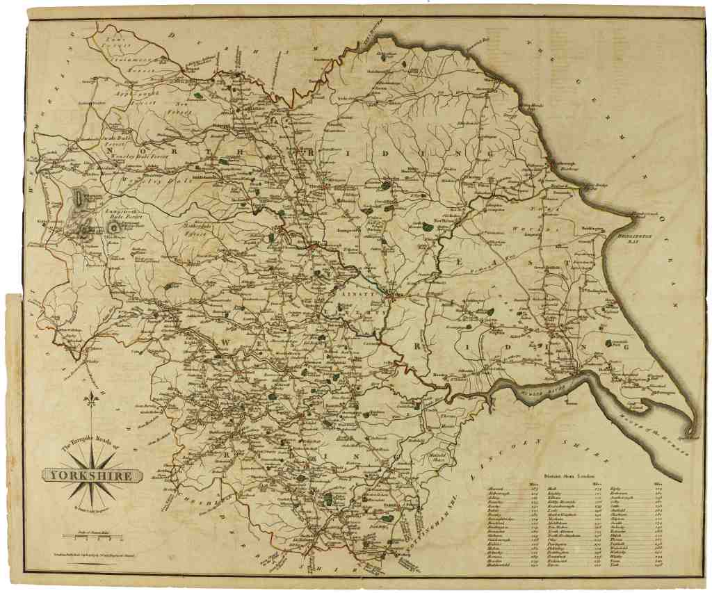
The Turnpike Roads of Yorkshire [M122]
The surveyor John Loudon Macadam is credited with bringing about huge improvements in administration of and the introduction of a smooth hard road surface known as ‘Macadam’, made of crushed stone with a binding layer of stone dust.
The sudden growth of the railways in the 1830s and 1840s led to a sharp downturn in road traffic which proved disastrous to most turnpike trusts as the income from tolls dried up. Mounting debts caused trusts to wind up one–by-one as roads returned to the care of parishes or highway districts and the (sometimes unpopular) tolls were lifted.

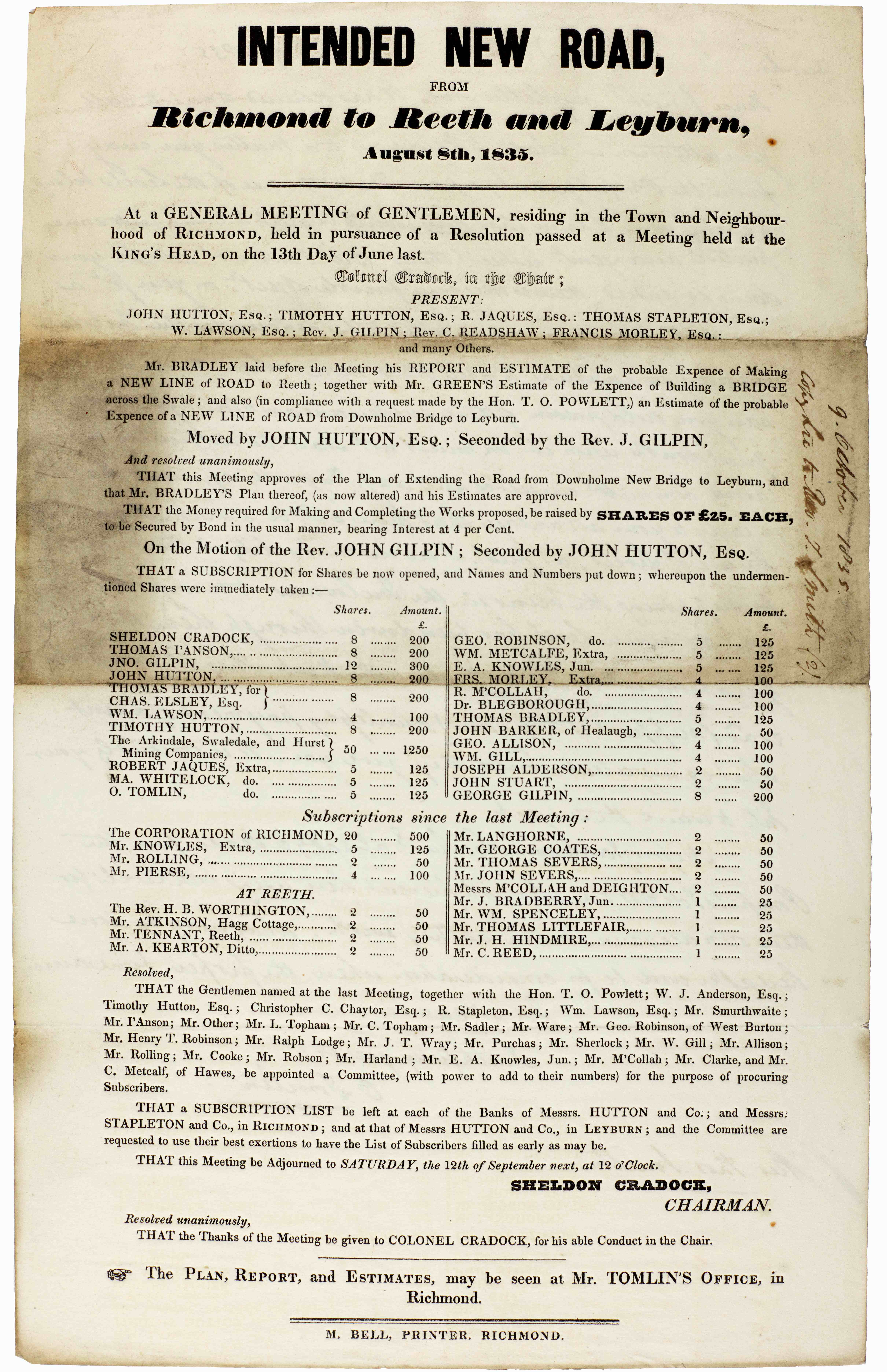
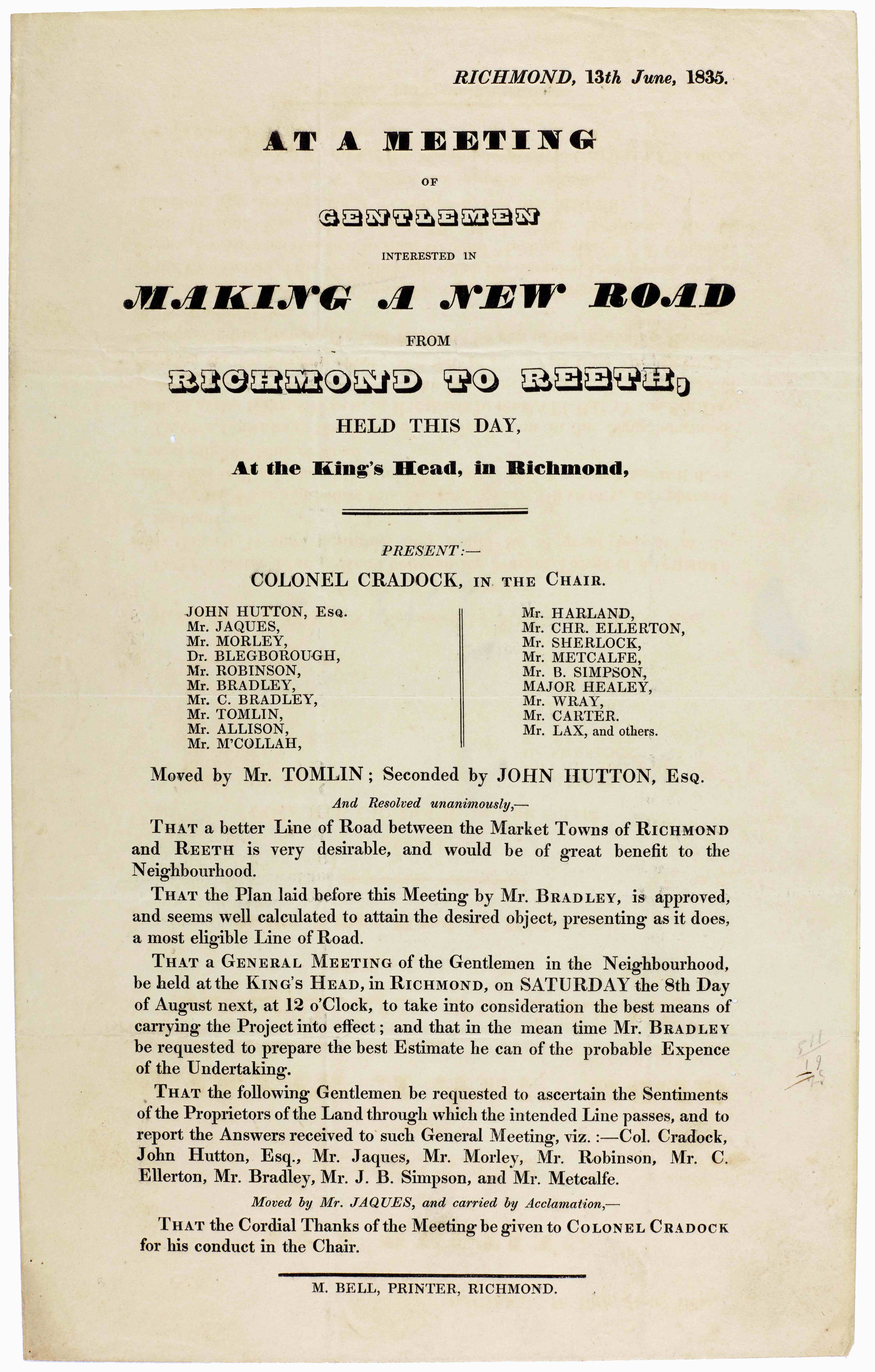

Records relating to Richmond to Reeth turnpike road [ZH]
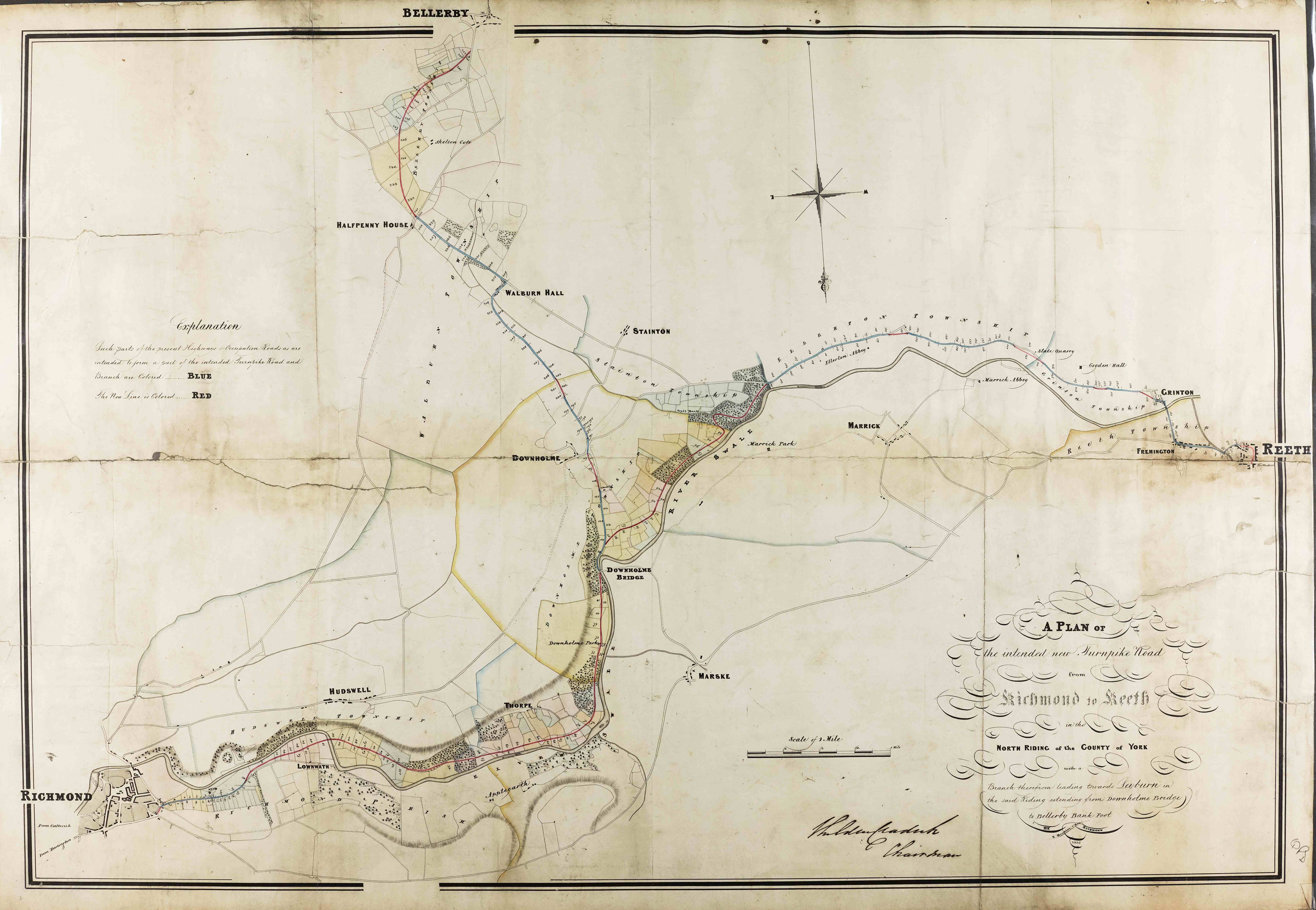
Plan of Richmond to Reeth turnpike road [QDP]
Highway Diversions
Justices at the quarter sessions had the power to stop up or divert public highways. During the eighteenth and nineteenth centuries, many wealthy landowners took advantage of this, having roads re-routed further away from their properties or around their parkland.
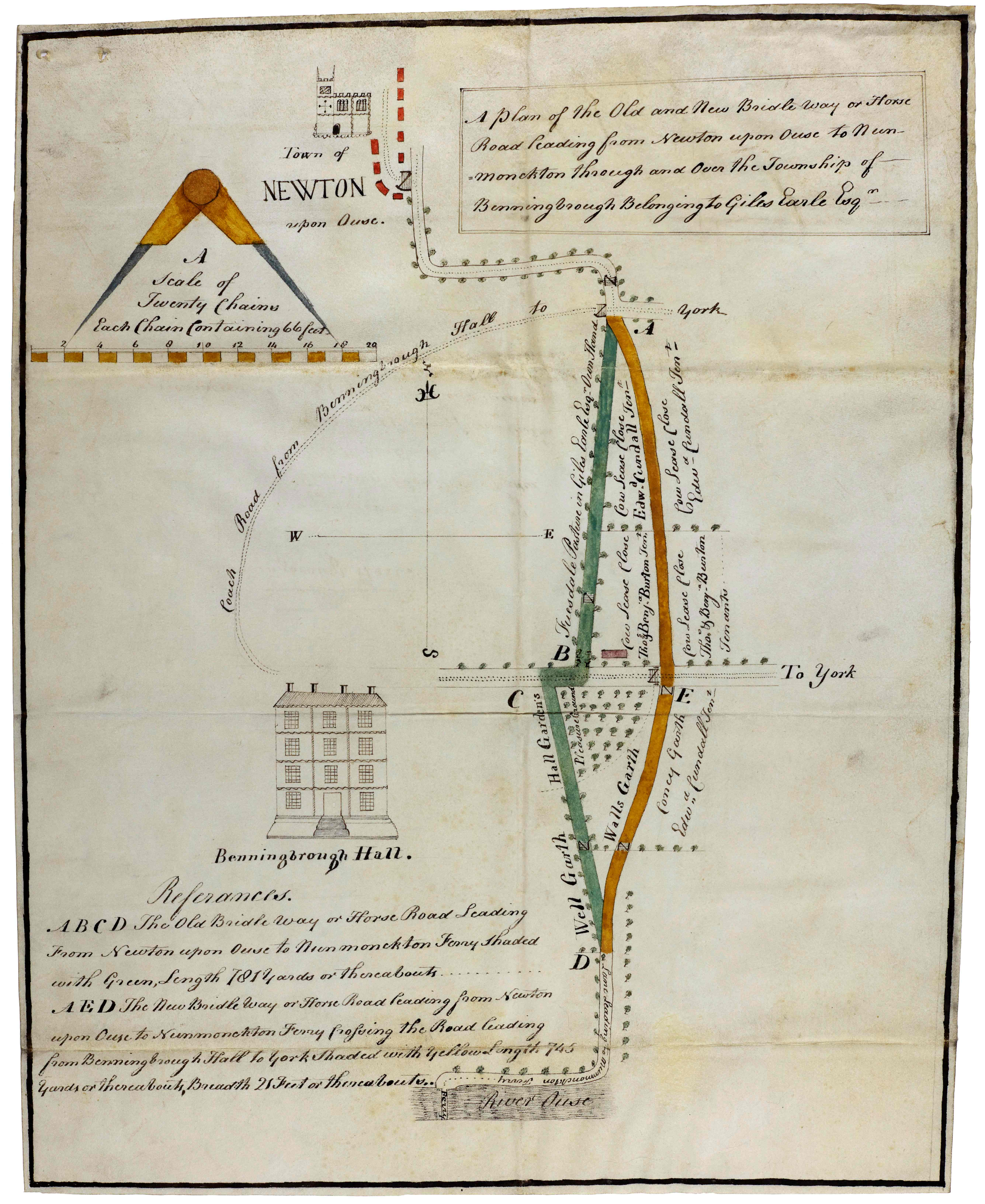

- L: Bridleway diverted around the park at Beningbrough Hall, 1794 [QSB 1794/3/16]
- R: A highway is diverted around Ebberston and away from Ebberston Lodge, 1822 [QSB 1822/4/13]
Highways in Twentieth Century North Yorkshire
From the invention of motor-propelled vehicles in the late-nineteenth century there has been a continual rise in motor traffic. In the North Riding of Yorkshire, some 300 vehicle licences were issued in 1899, rising to over 47, 500 in 1939 and 183, 500 in 1967. Increased motor traffic dominated the development of highways and bridges by the North Riding and North Yorkshire County Councils throughout the twentieth century.
The Local Government Act of 1894 placed the responsibility for the maintenance of most public highways on Boroughs and Urban and Rural District Councils. County Councils could take responsibility for the direct maintenance of main roads and, by 1920, some 276 miles of main road were repaired directly by the North Riding County Council. In 1930, the North Riding County Council took over most district roads in the county, becoming responsible for over 3000 miles of highway. The new county of North Yorkshire, at the time of its formation in April 1974, contained nearly 6,000 miles of highway which was the second largest mileage of roads in the country (after Devon). Following the Trunk Roads Acts of 1937 and 1945, the responsibility for certain roads such as the A1 and A66 were transferred to central government, though the County Councils continued to maintain and improve these roads on behalf of central government on an agency basis.
As well as providing and maintaining highways and bridges, the North Riding County Council was responsible for the registration of motor cars and motor cycles and for granting driving licences – a system that remained in place until the centralising of vehicle records at Swansea and the closure of the North Riding taxation office in the 1970s.
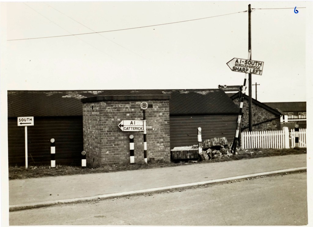
A1 at Catterick [EF 488]