
by Dan Sudron, Archivist
Lead mining took place across Arkengarthdale and Swaledale, as well as parts of Nidderdale, Wensleydale, and Wharfedale. Lead mining has played a crucial part in the economy, industry and geography of the area.
The Yorkshire Dales were a major lead producing region, with evidence of mining dating back to Roman times. The Romans mined extensively and used lead for plumbing and building works. Lead mining expanded during the medieval period, however, it was the 18th and 19th centuries which saw a surge in lead mining. Mines became deeper and new technologies improved extraction methods, smelting, and transportation. In the later 19th century, the industry began to decline, with prices and wages falling, and profits decreasing due to cheaper foreign lead imports. The last lead mines closed in the 1910s, however, they have left many permanent reminders in the geography of the Yorkshire Dales, and in the archival record.
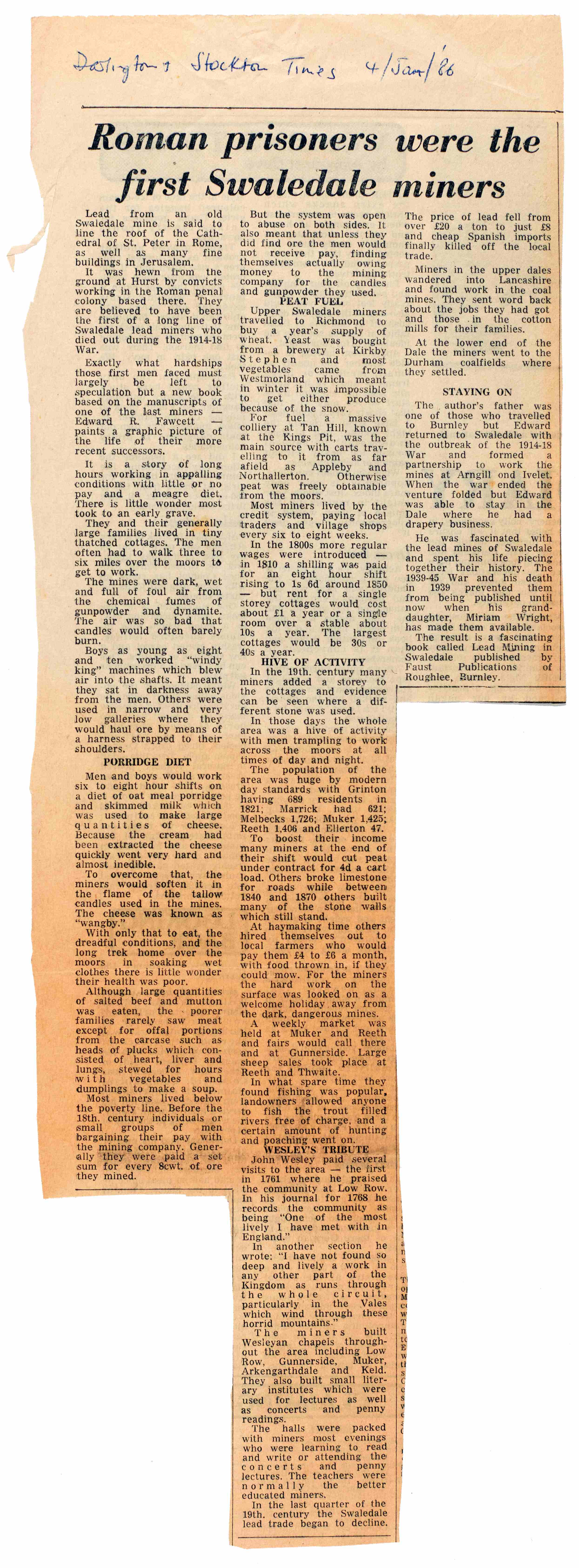
- Left: Newspaper cutting relating to Lead Mining in the Dales from the Stockton and Darlington Times, 4 January 1986 [Z.1296]
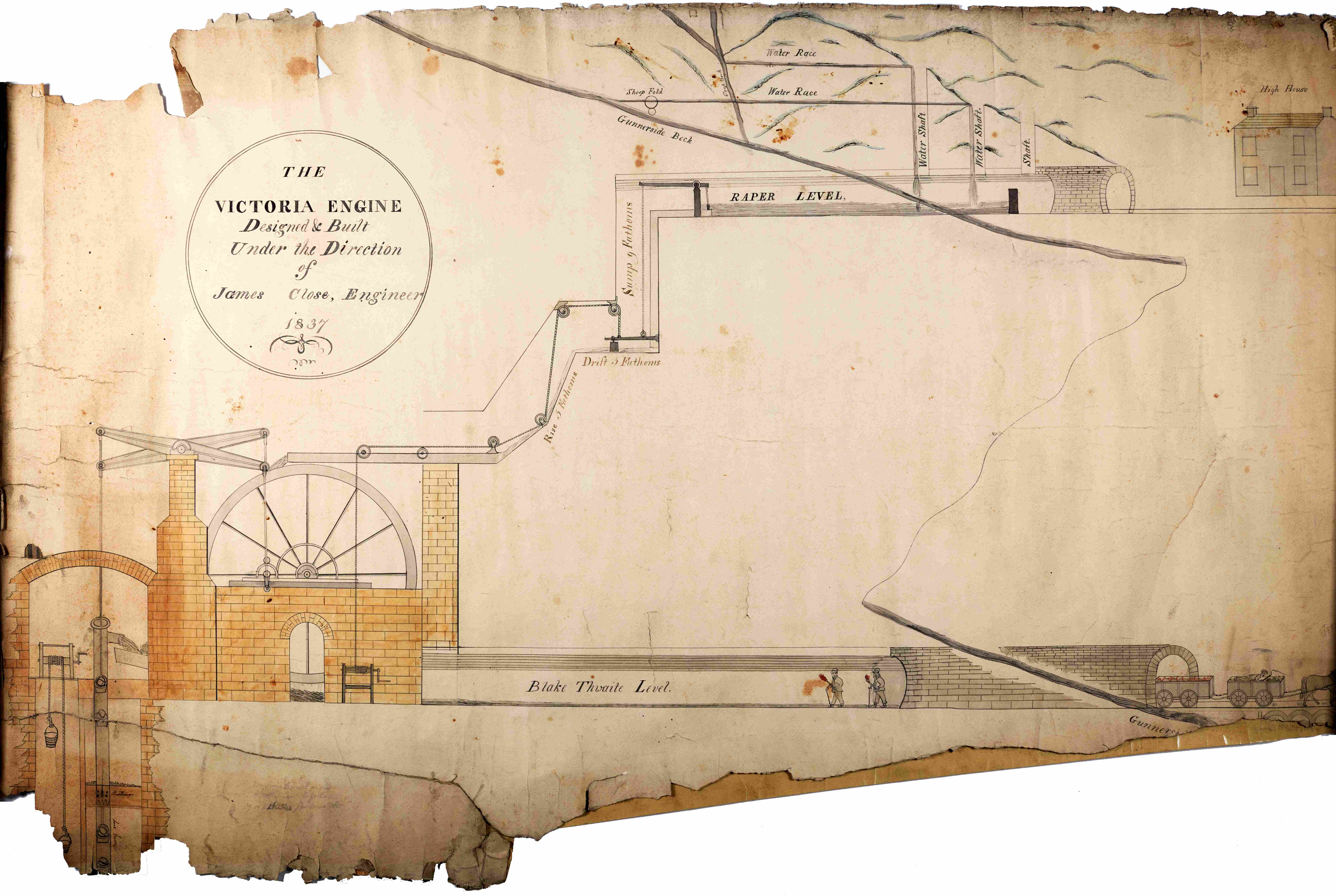
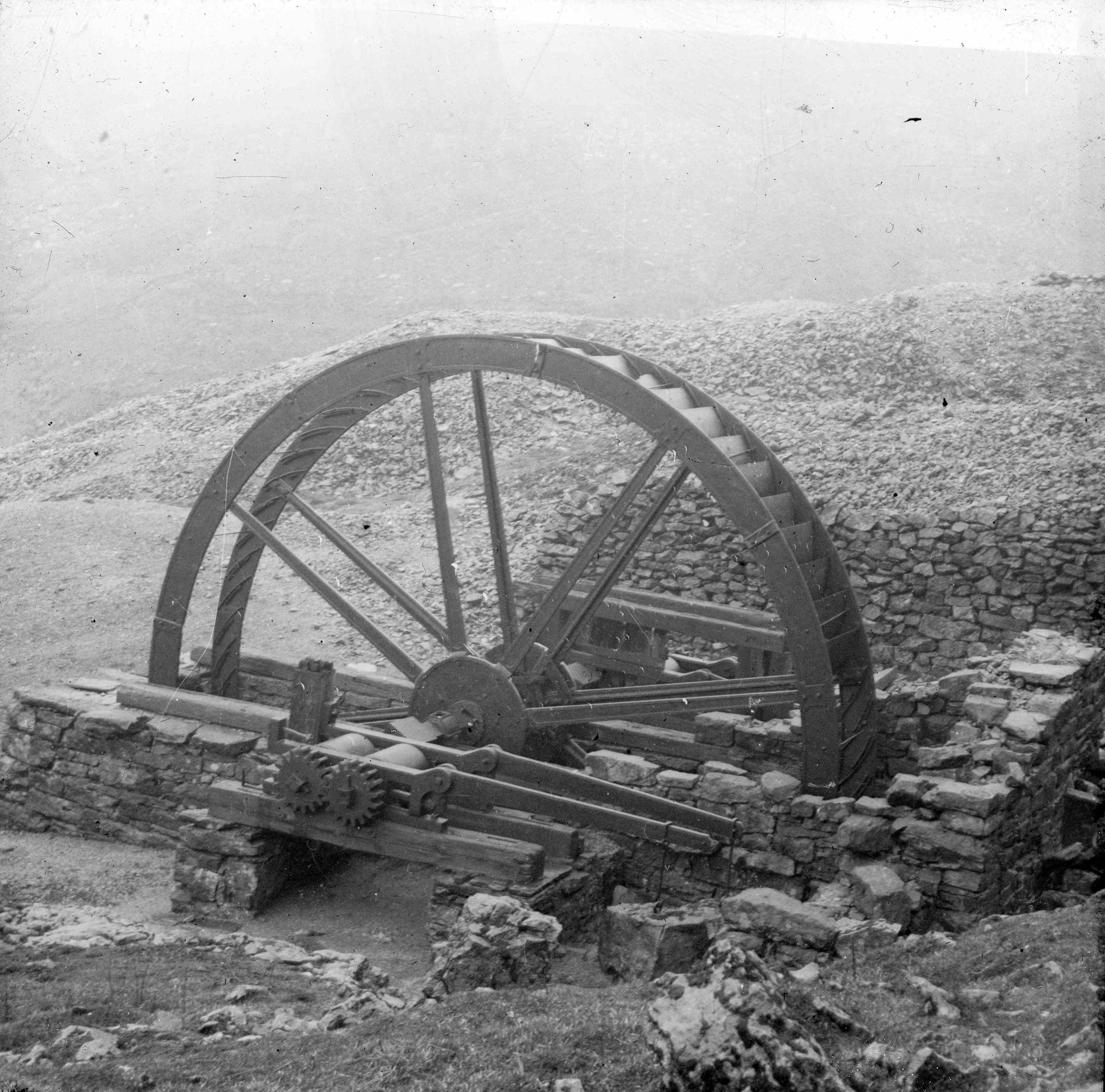
- Right: Plan of ‘Victoria Engine’ water wheel pump, Blakethwaite Mine, Gunnerside, 1837 [Z.1526]
North Yorkshire Archives holds a range of records relating to Lead Mining in estate and business collections. The archives of Draycott Hall (ZLB), Hartley of Middleton Tyas (ZKU) and Kirkleatham Hall (ZK) amongst others contain many documents relating to lead mining in Swaledale and Arkengarthdale.
Early mentions of Lead Mining…
Lead mining can be traced in early deeds relating to the leasing of land and mining rights.
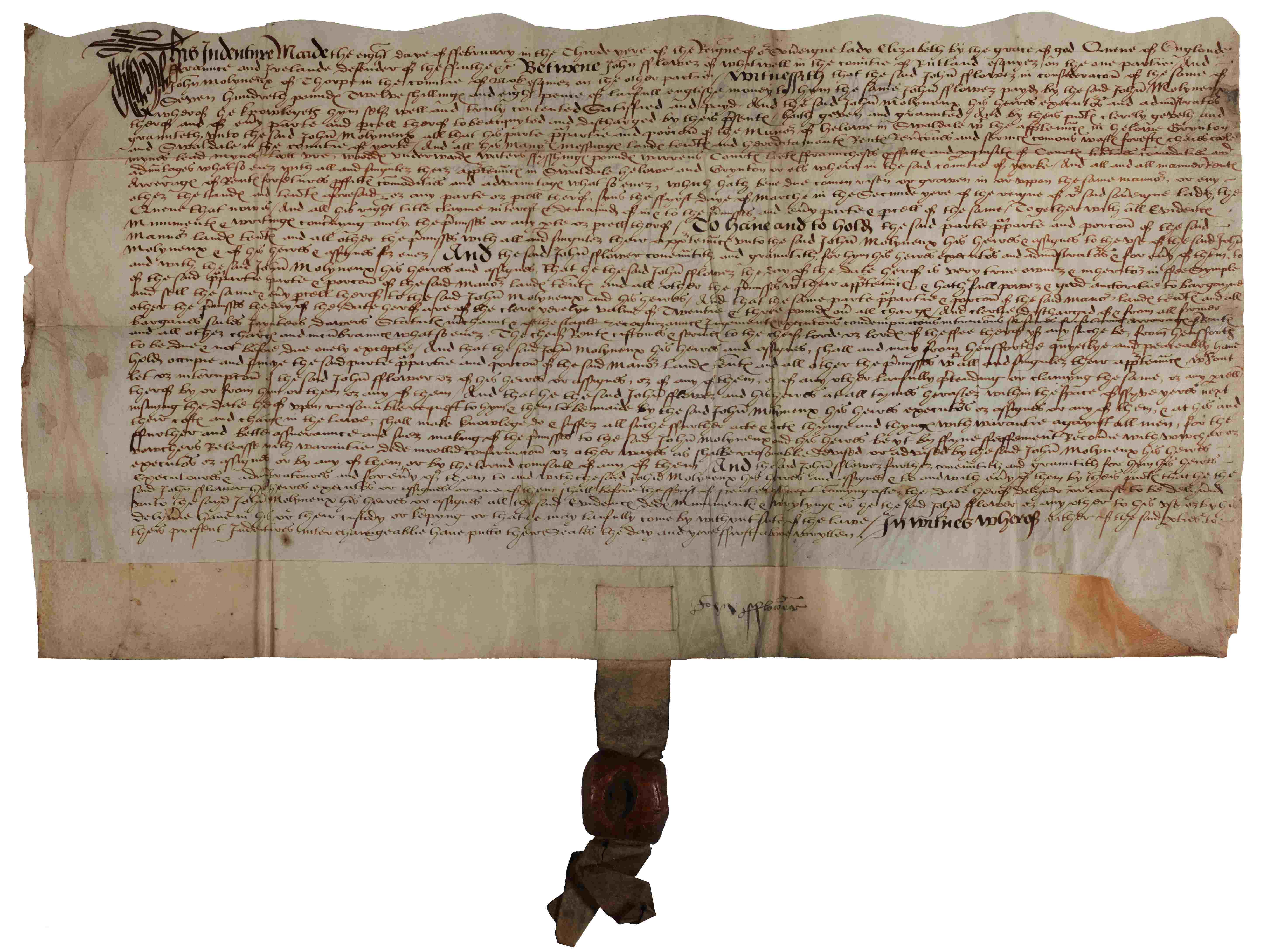
- Left: Grant of the Manor of Helowe [Healaugh] in Swaledale, 8 Feb 1561 [ZLK 1/3]
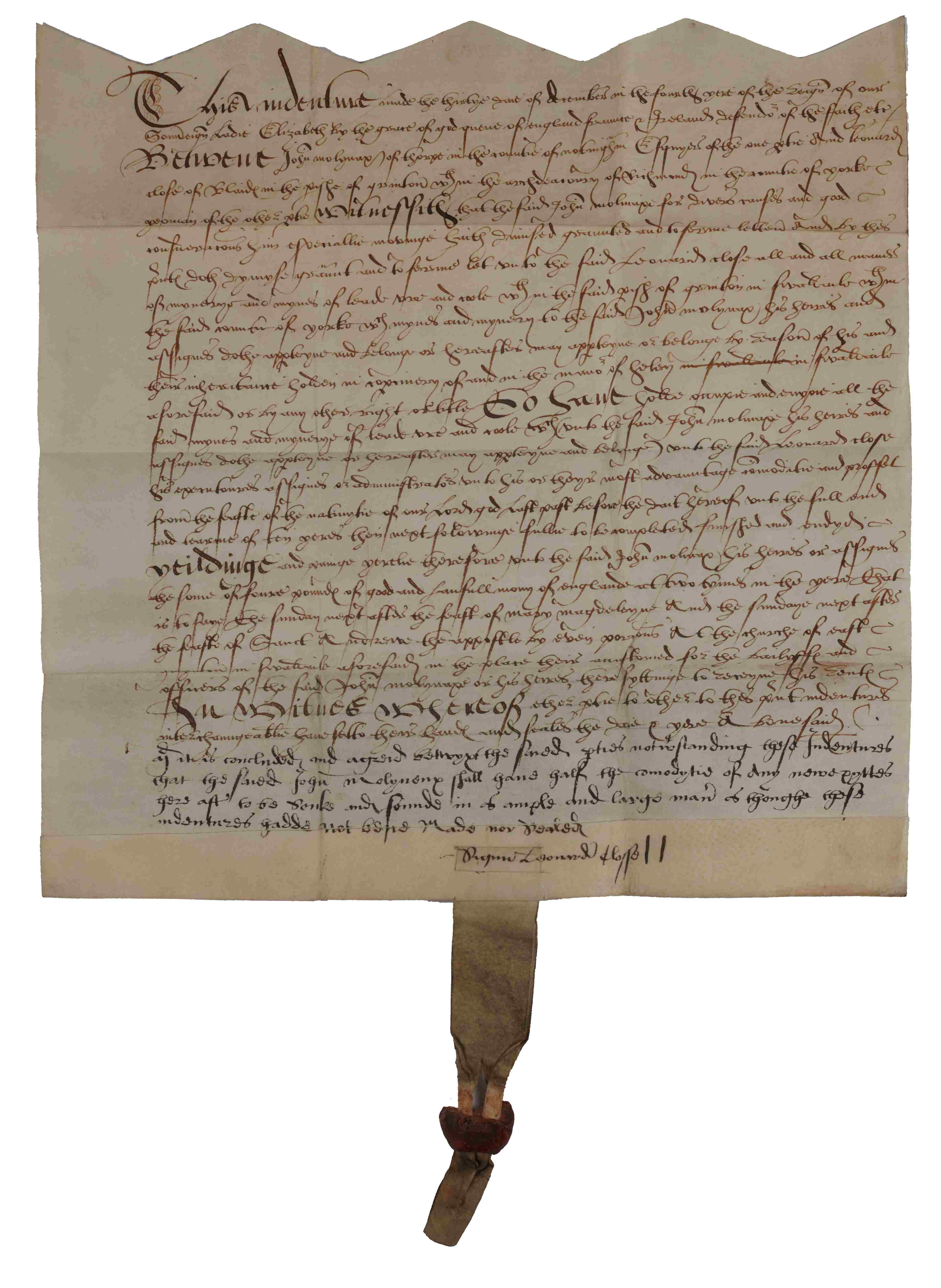
- Right: Counterpart lease for 10 years for mines in the parish of Grinton in Swaledale, 30 Dec 1561 [ZLK 1/1]
These deeds are part of the Denys-Burton Archive.
In 1561, John Flower of Whitwell leased the Manor of Healaugh, along with mines in Haulaugh, Grinton, and Swaledale to John Molyneax. The lease (shown on the left) included the ‘lot ore’, taken as an equivalent to a royalty and is evidence that the mines were being worked at that time.
In the same year, Molyneax gave a lease (shown on the right) of ‘mynerye’ and mines of lead ore and coal in the parish of Grinton, to Leonard Close of Blaides in Swaledale for 10 years. At the bottom of the lease, in a different hand, and showing in a darker ink, a further condition was added that Molyneax reserved the right to have half of any new mines sunk or found
“…Molyneaux shall have half the comodytie of any new pittes here aft to be sonke and founde…”
Surveyor General of Land Revenues
The Surveyor General of Land Revenues was an office under the Crown between 1666 and 1810. The Surveyor General was responsible for the management of Crown lands, including collecting rents, managing leases, and ensuring the proper utilisation of the land for the Crown’s benefit.
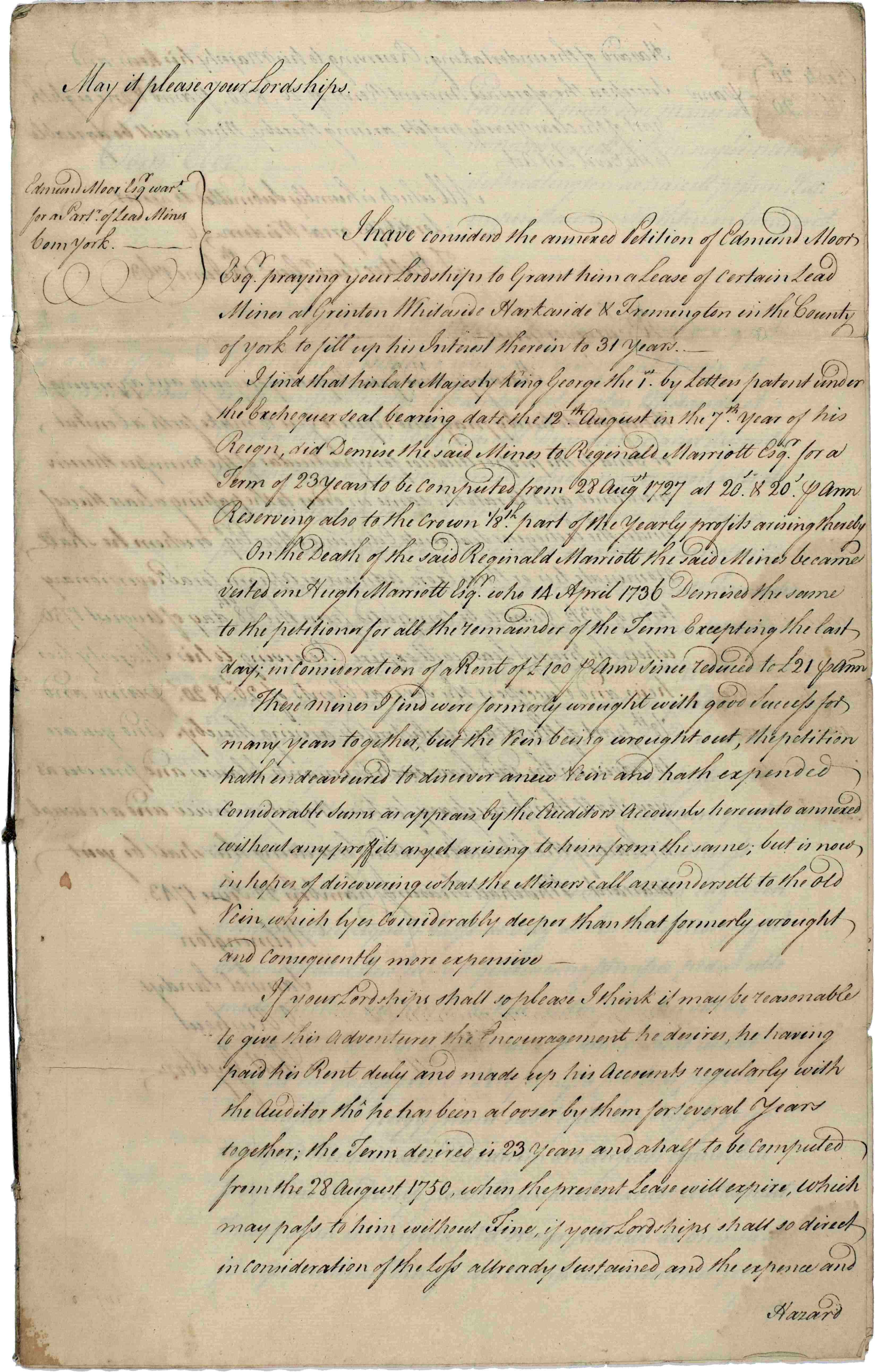
Copy report of Surveyor General for a lease of mines in Grinton, Whitaside, Harkerside and Fremington to Edmund Moor, with warrant for making the lease, 1743 [ZHP]
In this report of 1743, the Surveyor General advises on the lease following a petition from Edmund Moor for a lease of mines in Grinton, Whitaside, Harkerside and Fremington. The report is followed by a warrant for granting a lease to Edmund Moor.
Dispute between George Place of Whitaside and Francis Moore of Treleigh, Cornwall, about the working of lead at Greenhills, Grinton, by ‘hushing’, 1761.
‘Hushing’ involved water being collected by a wall or dam. Once enough water was collected it was allowed to surge downhill to remove topsoil and vegetation and expose veins of lead ore.
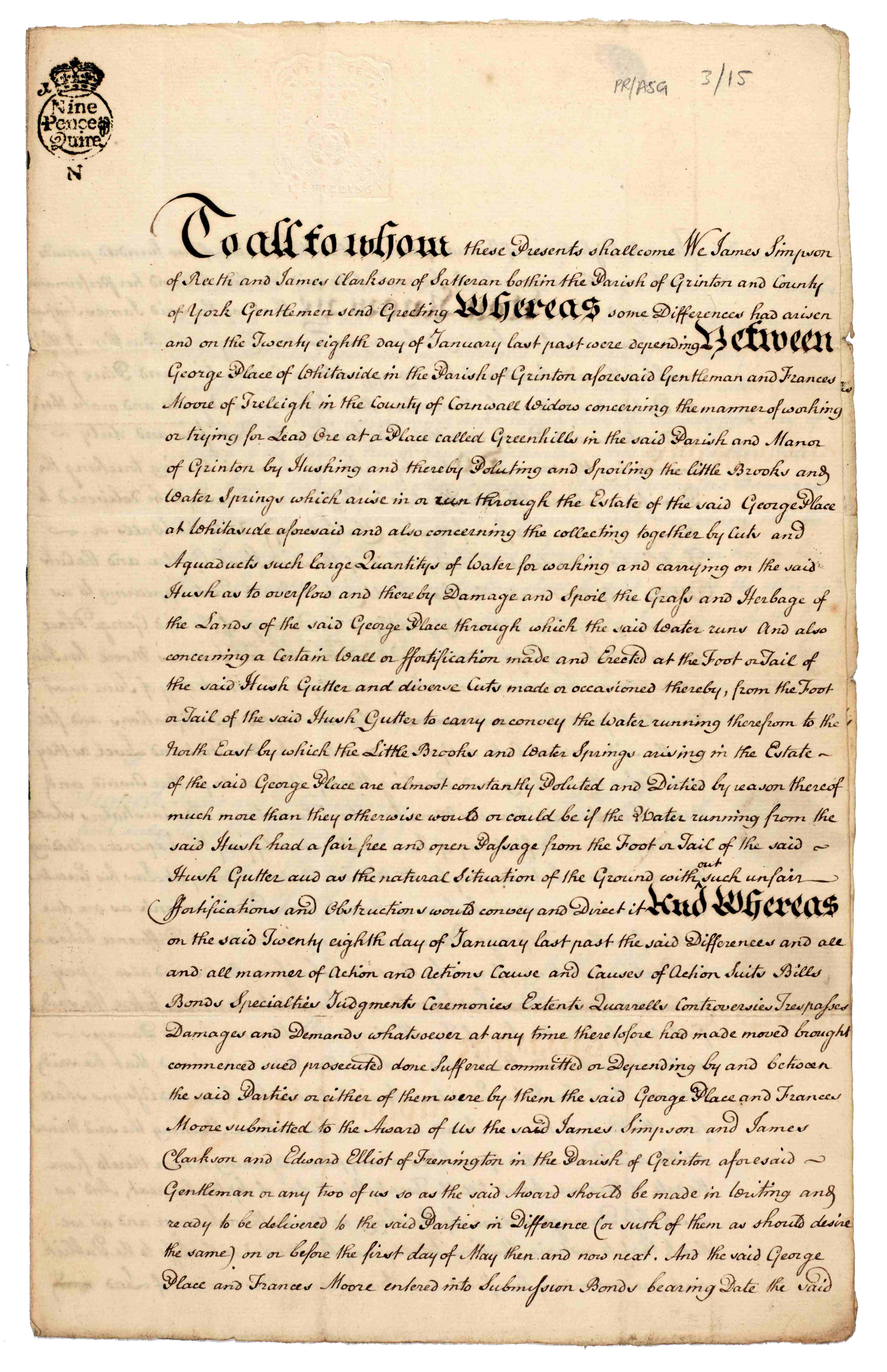
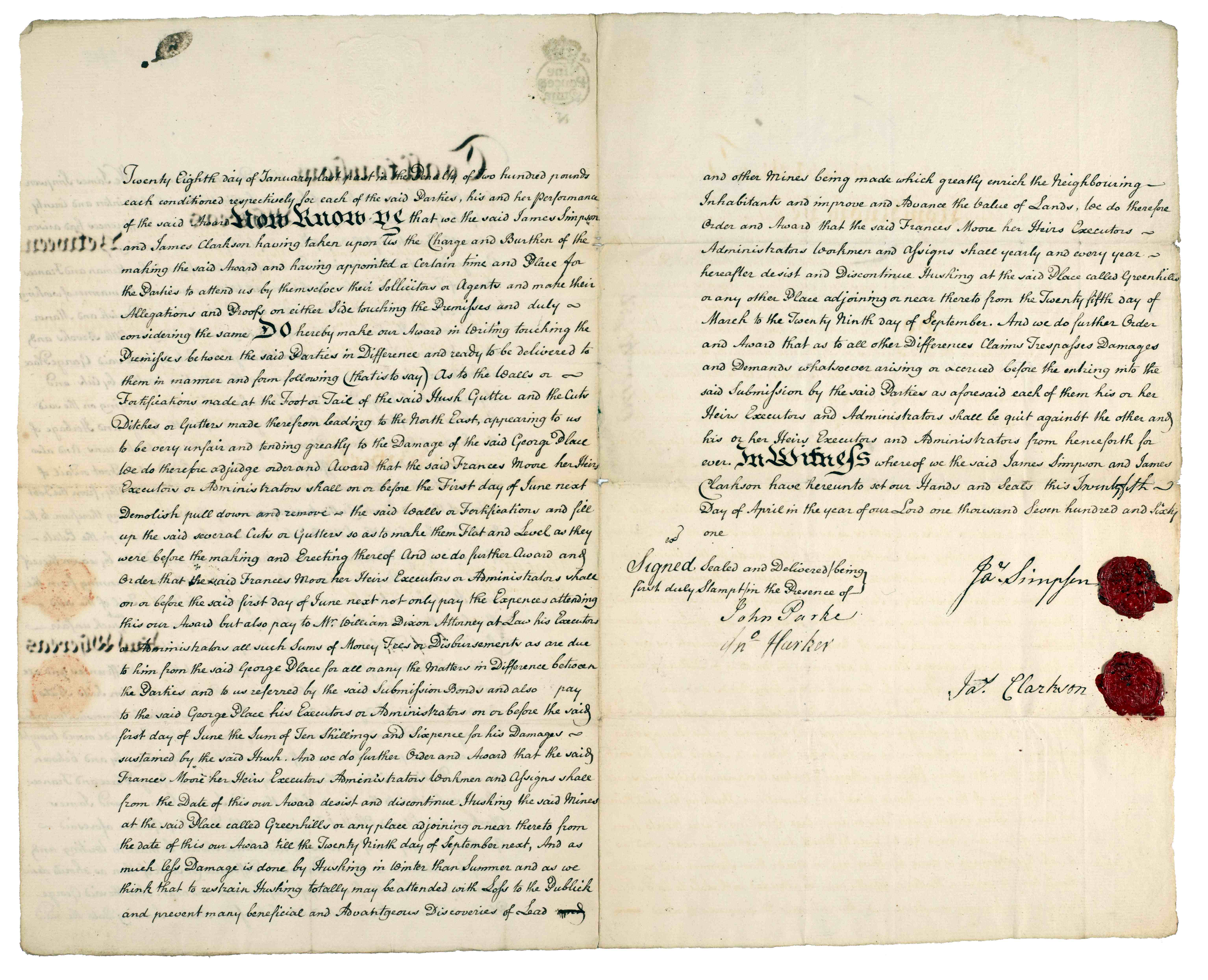
Award in arbitration reciting the dispute between George Place and Francis Moore concerning working of lead ore at Greenhills in Grinton, 25 Apr 1761 [PR/ASG 3/15]
George Place complained that hushing was polluting brooks and springs, obstructing the free flow of water, and flooding and spoiling his land. It was judged that stopping hushing would:
“prevent many beneficial and advantageous discoveries of lead and other mines being made which greatly enrich the neighbouring inhabitants and improve and advance the value of lands.”
However, hushing would only be permitted during winter months when less damage would be caused. Francis Moore was also ordered to pay George Place 10s. 6d. in damages, as well as legal costs.
Reckoning and bargaining
Mining accounts or ‘reckonings’ were agreed at intervals of 12 to 18 months. At West 10 Meers Black Rigg Mine, any costs and any lead produced were divided between the shareholders in ratio to their share. In May 1791-Oct 1792, £1930. 15s. 1½d. was shared between the companies mining agents William Bell (3/7th shares), William Marshall (2/7th shares) and Jacob Bailey (2/7th shares) [Z.1526].
The mineral rights were leased by Lord Fairfax from the Duchy of Lancaster in 1641, however, little work was done until the Duke of Devonshire leased them in 1757. A duty of 1/6th was paid by the shareholders to the Duke of Devonshire.
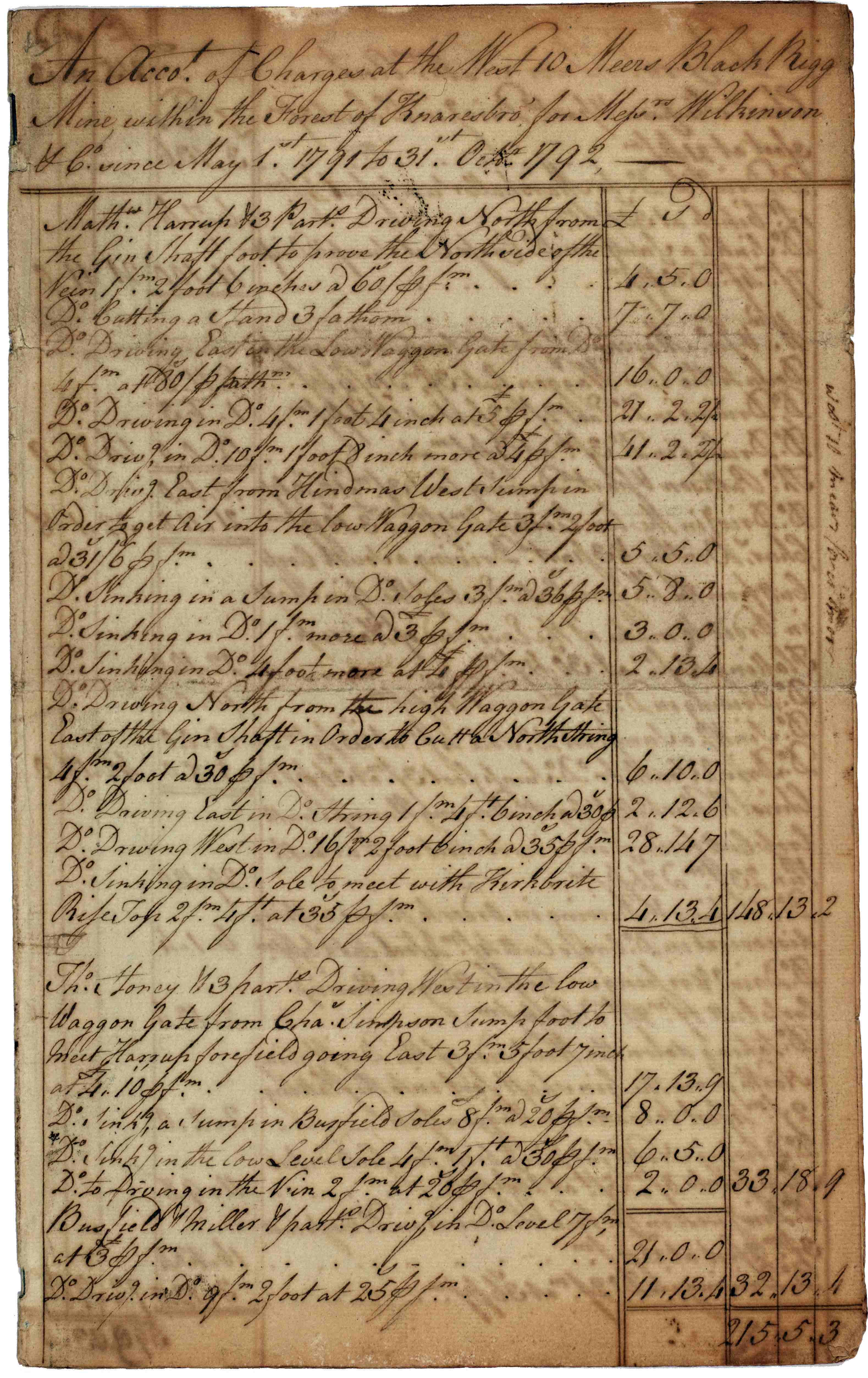
- Left: Account of charges at West 10 Meers Black Rigg Mine, near Greenhow Hill, in the Forest of Knaresborough, for Wilkinson & Co, May 1791-Oct 1792 [Z.1526]
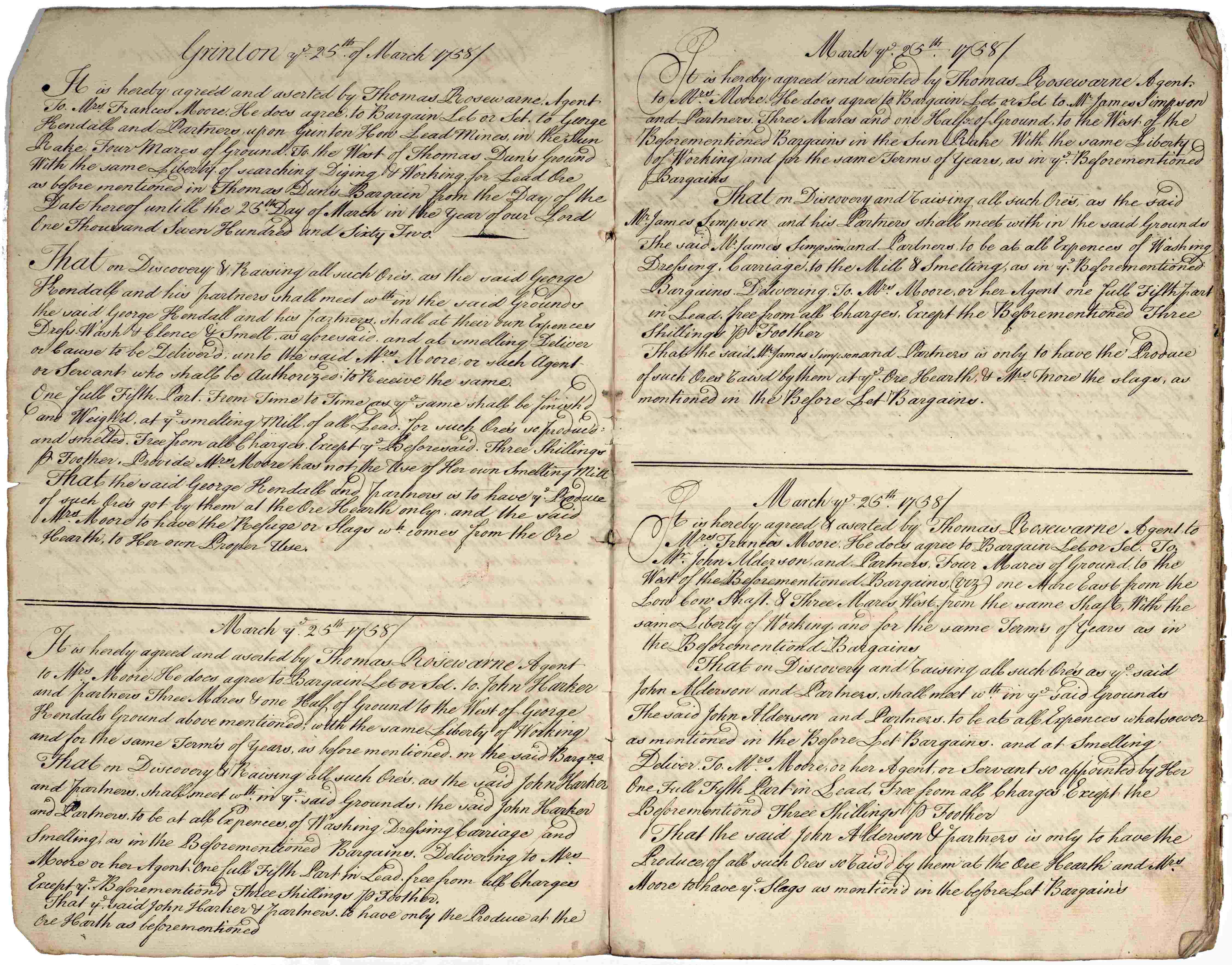
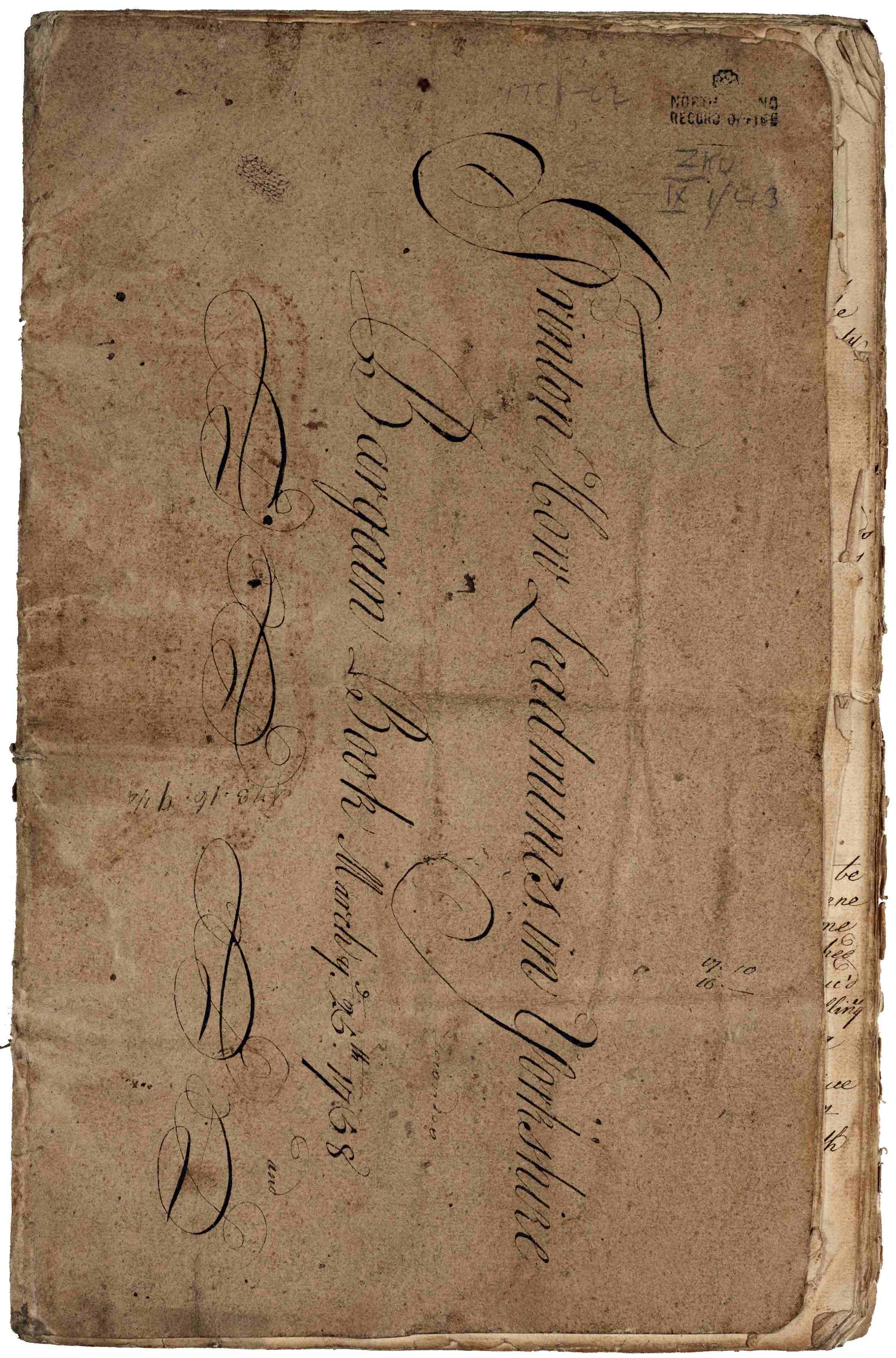
- Centre and right: Bargain book for Grinton How Lead Mines, 1758-1762 [ZKU IX 1/43]
Bargain books record the agreements made between miners and the mine owner for working a promising piece of ground. Payment was by measured work at an agreed rate or was calculated on the ore produced. By the end of the 18th century the majority of the miners in the Yorkshire Dales were working by bargain work.
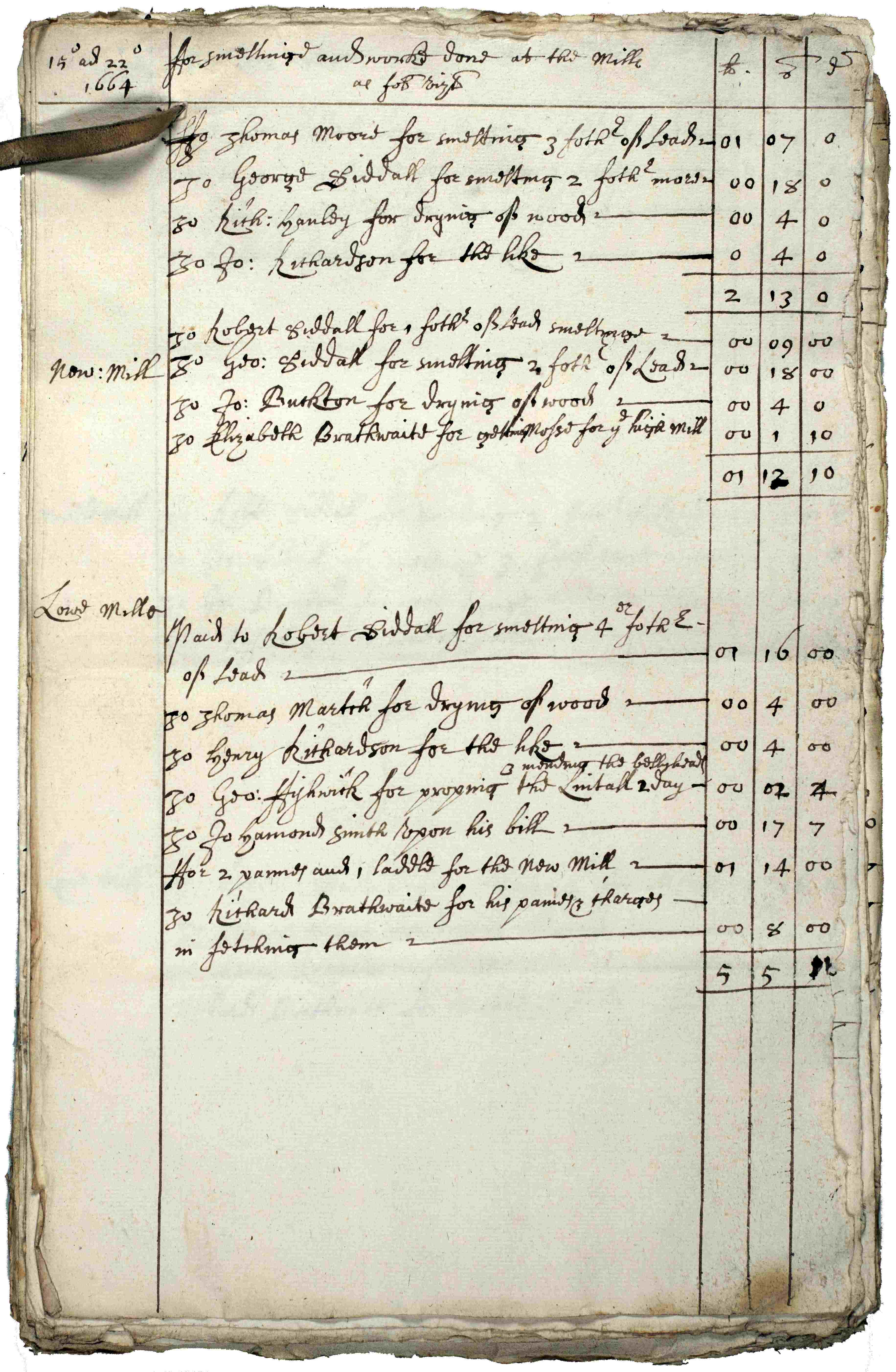
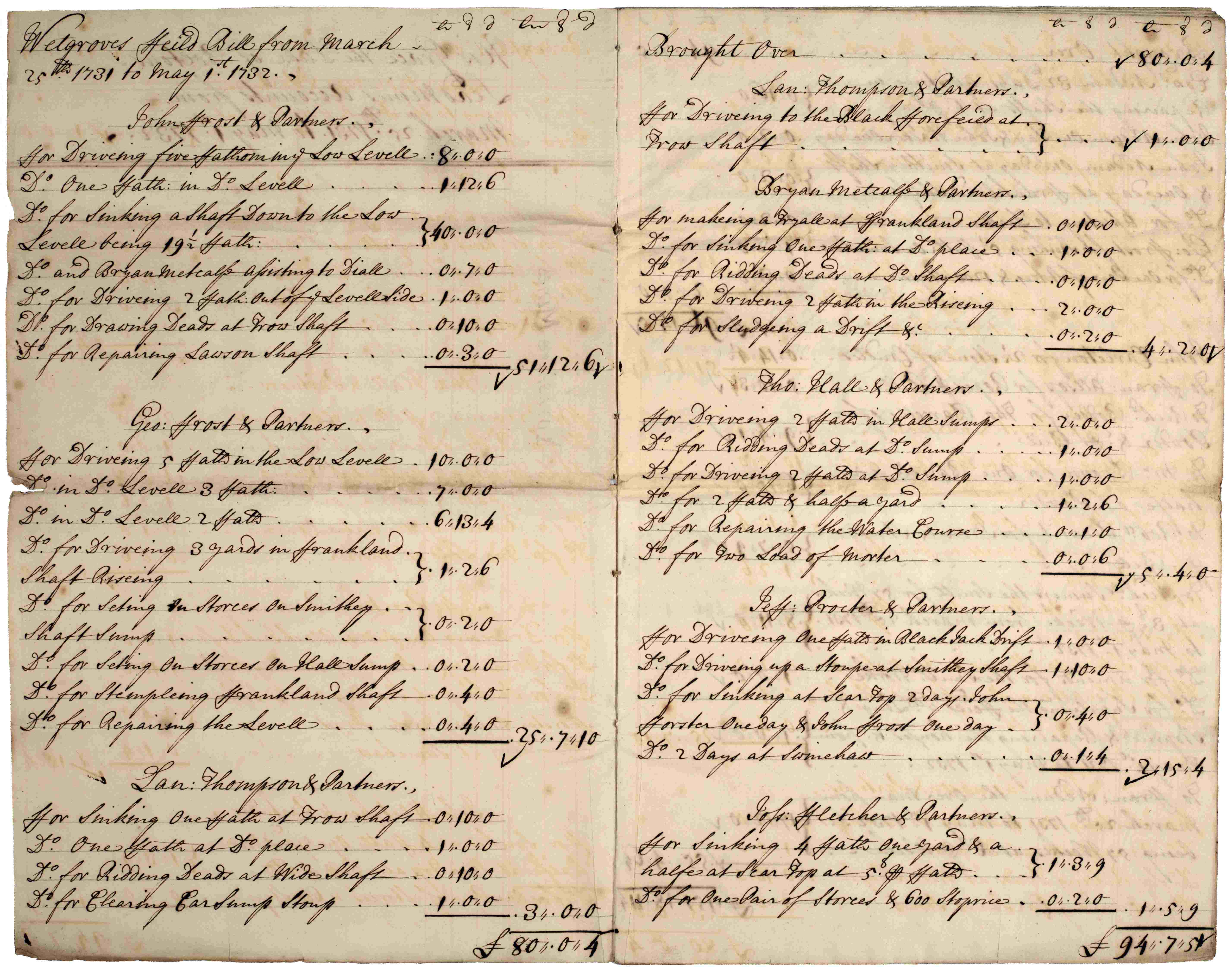
Lead mining accounts for the Duke of Bolton’s lead mines and mills:
- Left: Accounts for smelting and works carried out at the Duke of Bolton’s lead mills, 1664 [ZBO V]
- Right: Lead mine accounts for mining and smelting in Wensleydale at Wetgroves (Wet Grooves), Apedale field, Cobscar field, and the carriage of lead to Yarm, 1731-1732 [ZBO V]
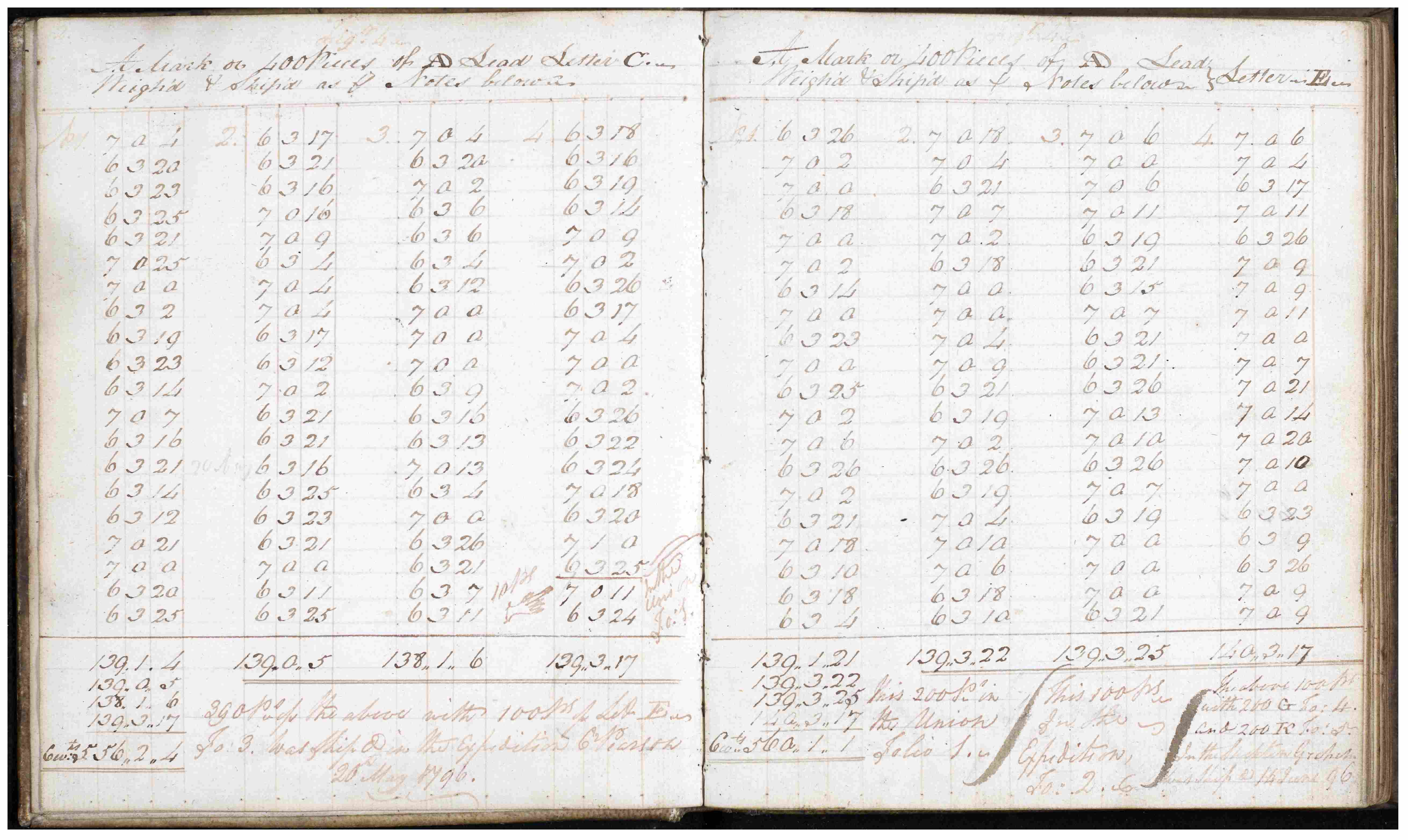
- Left: Matthew Wadeson’s accounts of AD lead weighed and shipped, 1796-1809. Includes notes of who the lead was shipped to and the vessels employed [ZLB 2/1]
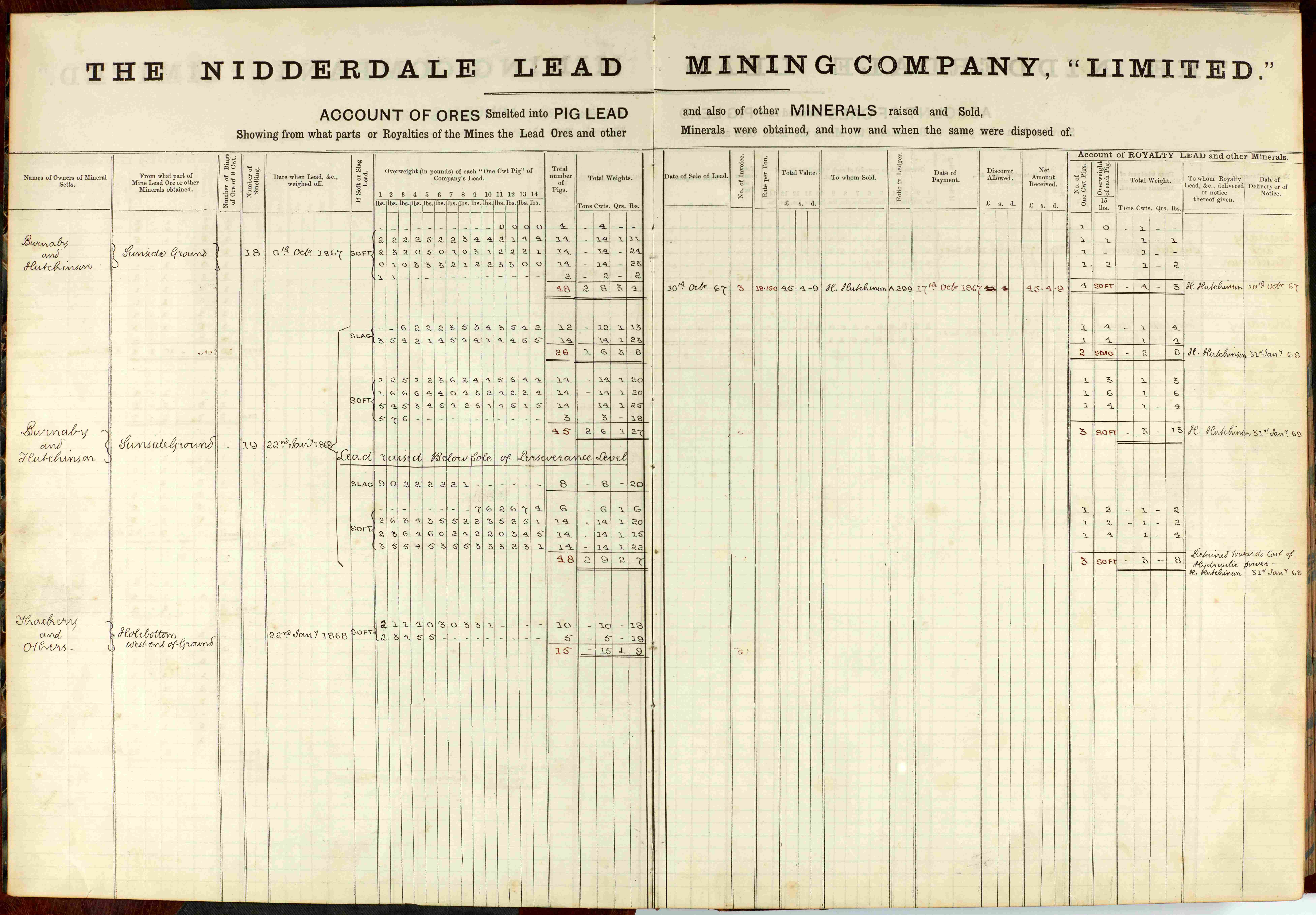
- Right: Nidderdale Lead Mining Company, account of ores and minerals, 1866-1868. Nidderdale Lead Mining Company operated the Prosperous Lead Mine, Bewerley, during 1860s and 1870s [Z.737]
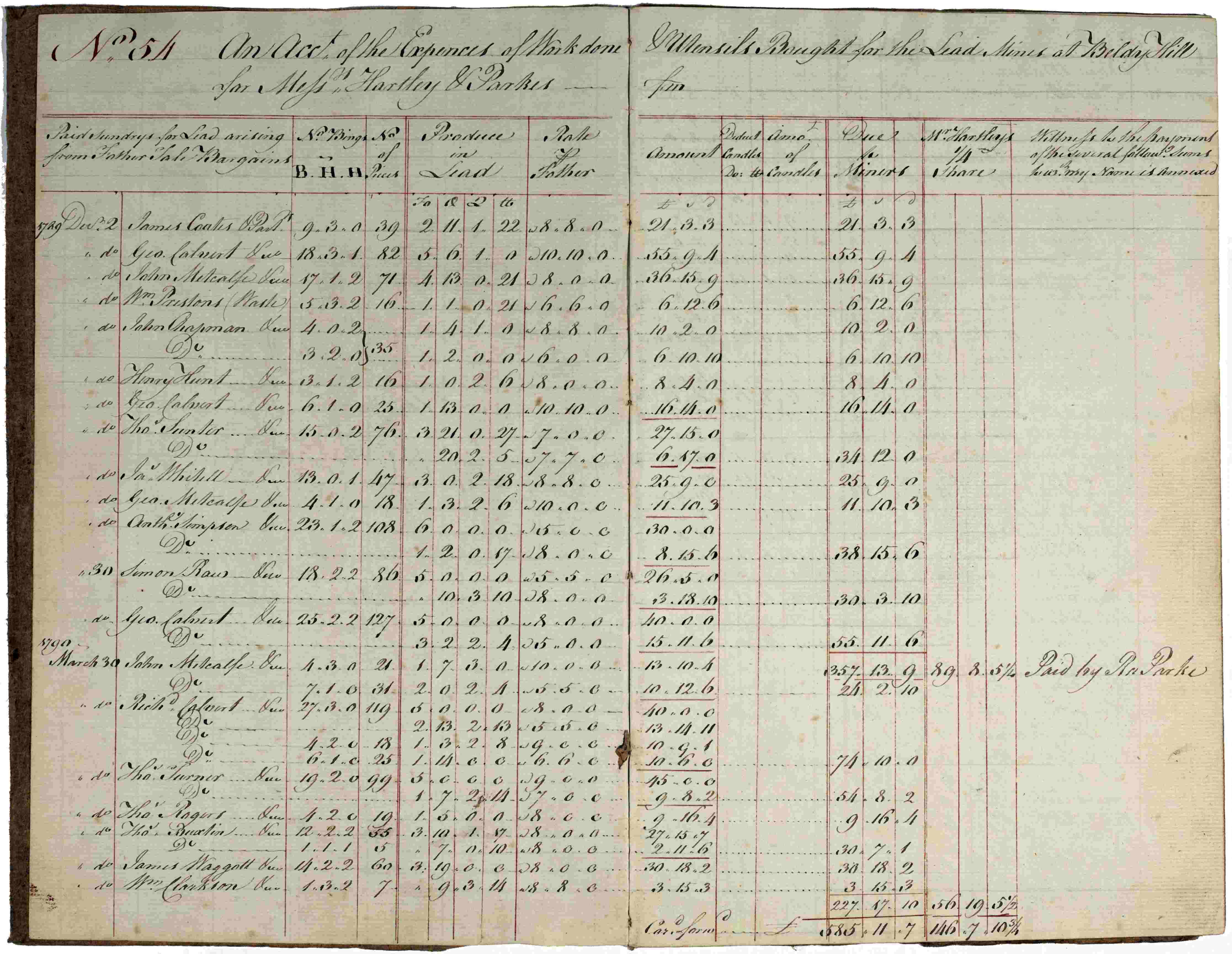
Pay bills of Beldy Hill Mill for Messrs Hartley & Parks, 1789-1790 [ZKU IX 1/5]
Beldy/Beldi Hill Mill (or Swinnergill Mill) was built in 1770-1771 following a dispute over the ownership of minerals between Thomas Smith (Lord of the Manor of Healaugh) and Lord Pomfret. Smith successfully defended his title but built Beldi Hill smelt mill after Lord Pomfret took possession of Spout Gill Mill which Smith had previously claimed to be his as Lord of the Manor of Healaugh.
The pay bills (shown above) give an account of the expenses of work done and utensils bought for the lead mines at Beldy Hill for Messrs Hartley & Parkes in 1789-1790 recording fathom work, day wages, carriage of iron, wood purchased, carriage of wood and other contingencies.
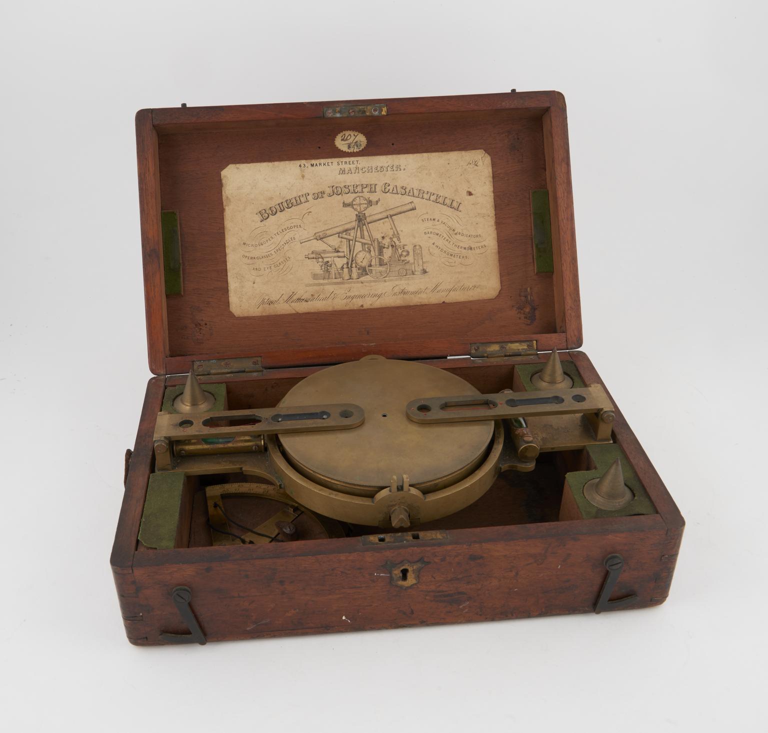
Dialling the mines
Mines were surveyed using dials mounted on tripods to give compass bearings and enabled accurate courses to be followed towards veins of lead. Miners made notes of dialling readings as they went along.
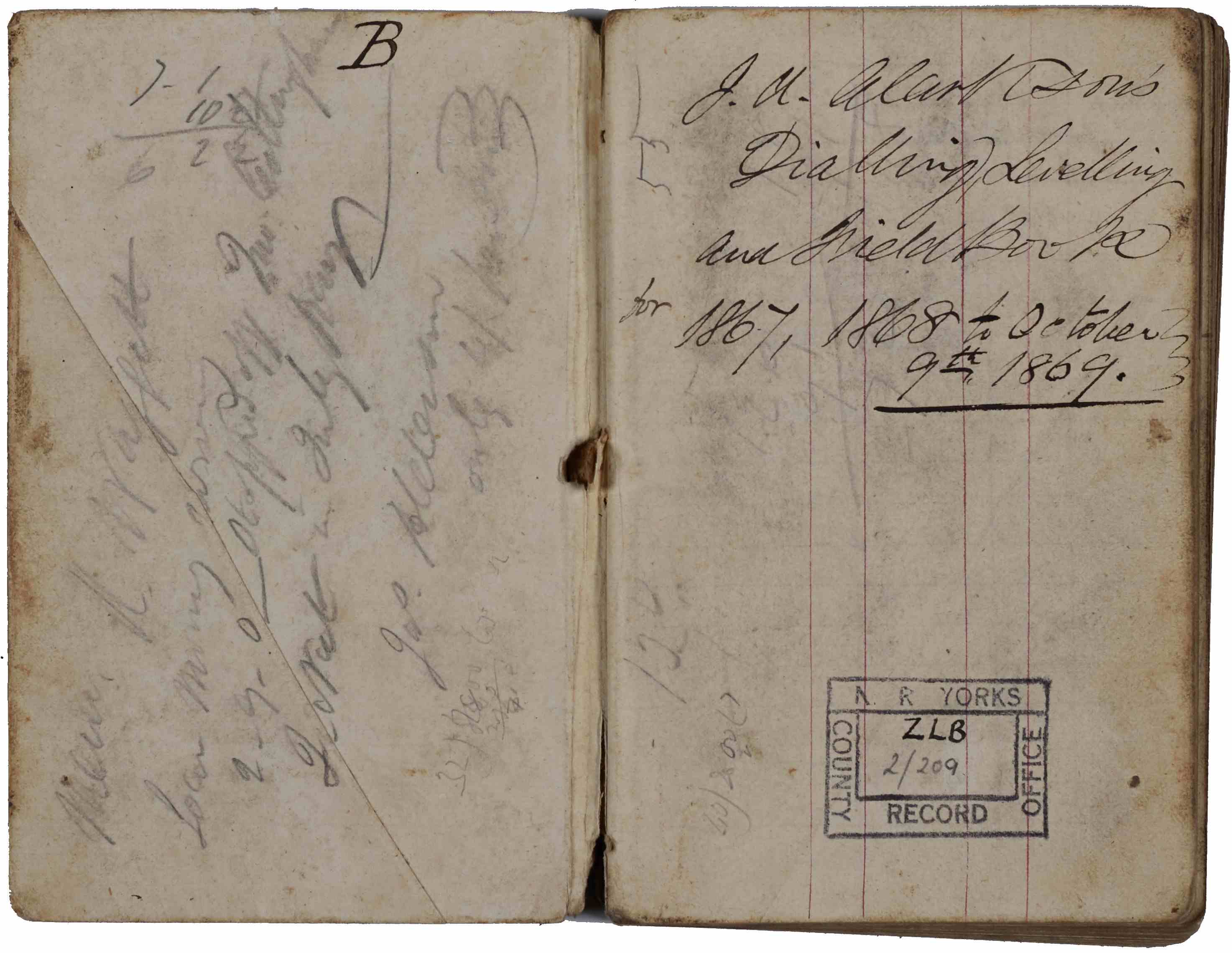
- Left and centre: Dialling book of J.A. Clarkson’s, used as a dialling, levelling and field book for A.D. mines, 1867 [ZLB 2/209]
- Right: Example of a mining dial by J. Casartelli of Manchester, late 19th century [Science Museum Group Collection *]
Mining laws and rules
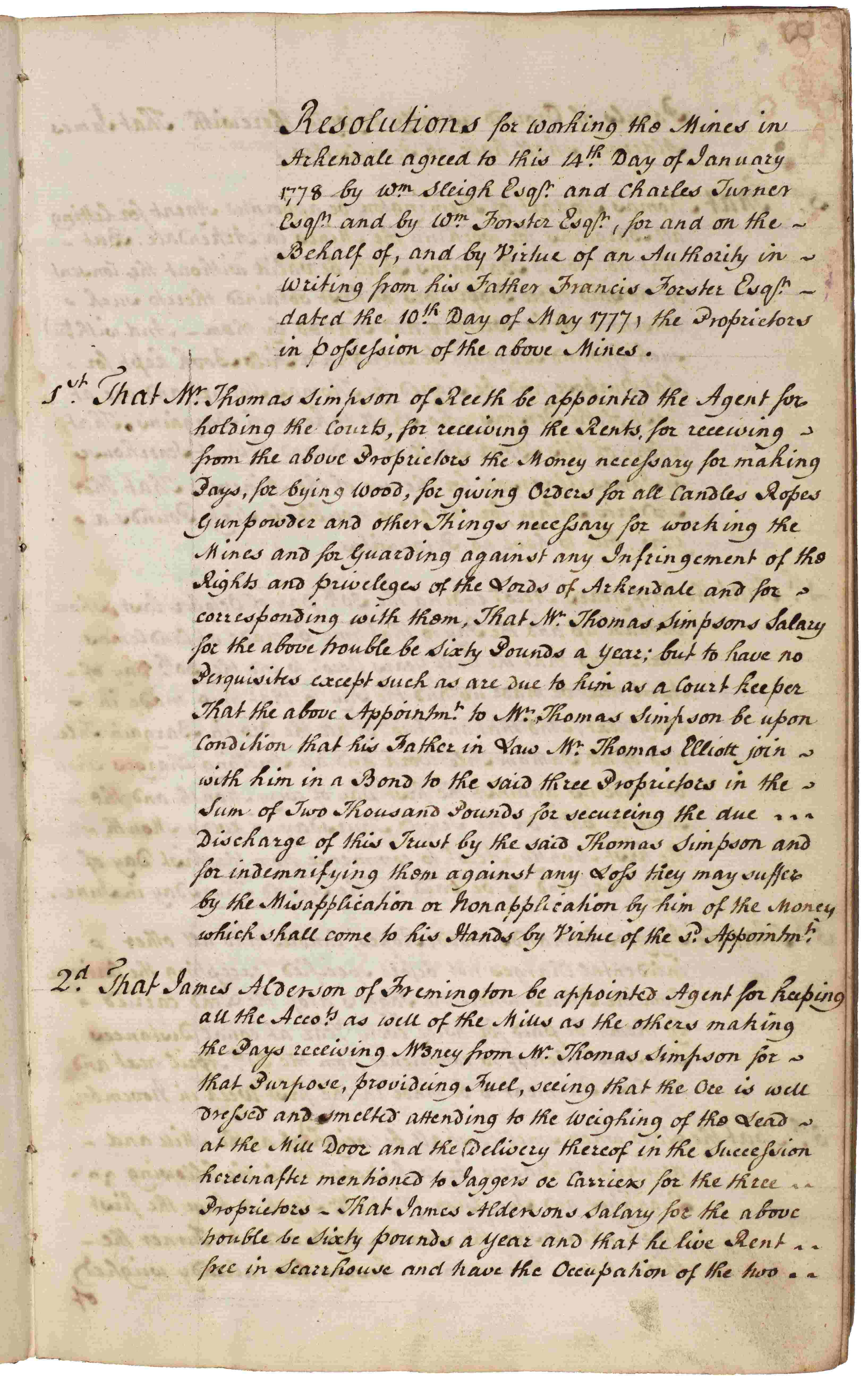
- Left and centre: Arkindale Mine Laws, 1777-1799 [ZQX 2/2/1] Minute book of the Lords of Arkengarthdale recording resolutions and directives from their meetings.
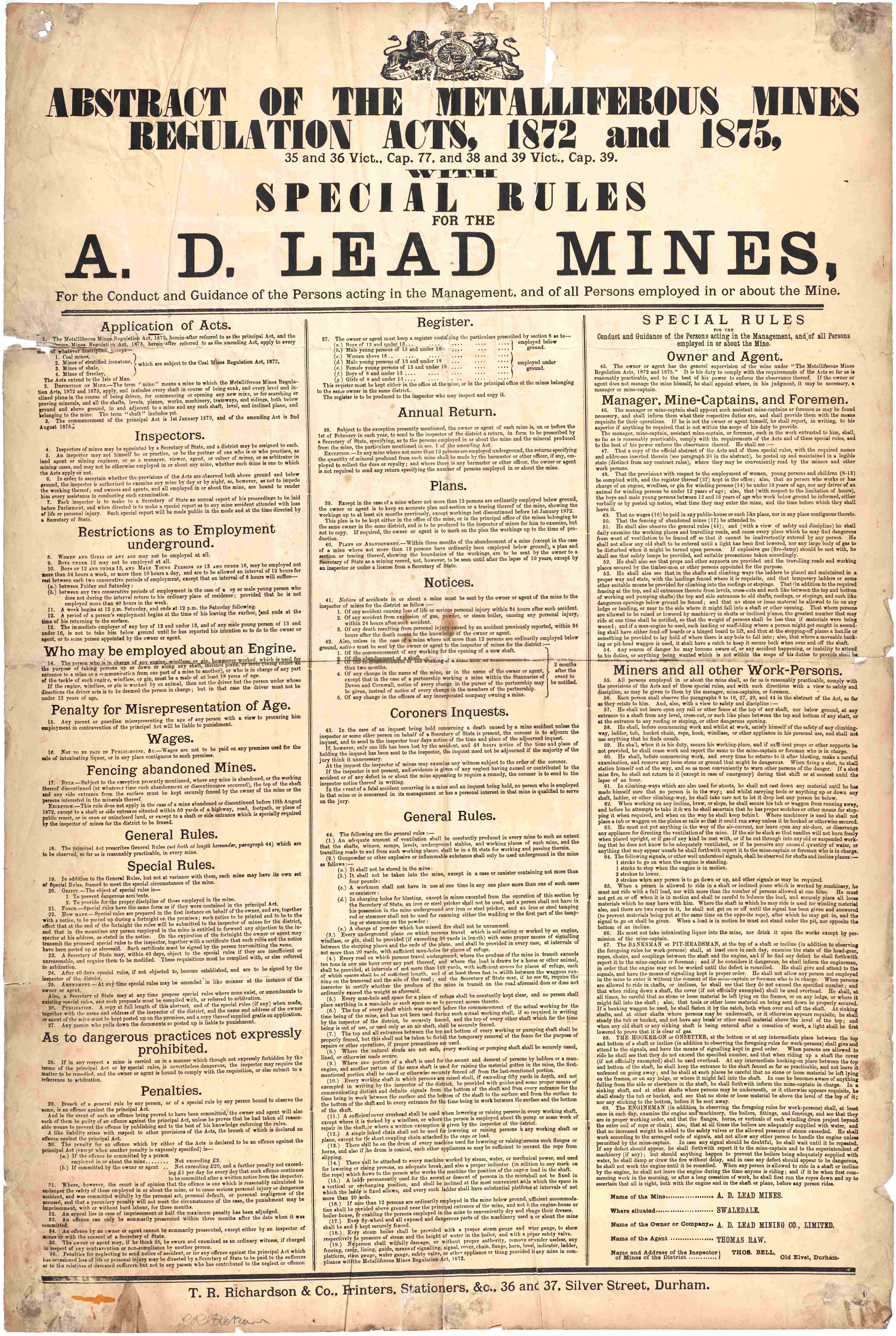
- Right: Poster of an Abstract of the Metalliferous Mines Regulations Act with special rules for the A.D. Lead Mines, c.1875 [ZLB 3/34/7]
A.D. Lead Mines
In the 18th century, the Swaledale estates of Philip, Lord Wharton, passed to the Draycott family of Fremington. Anna Draycott married the 2nd Earl of Pontefract in 1764, and their three children took the lead mines in Swaledale, known collectively as the A.D. Lead Mines.
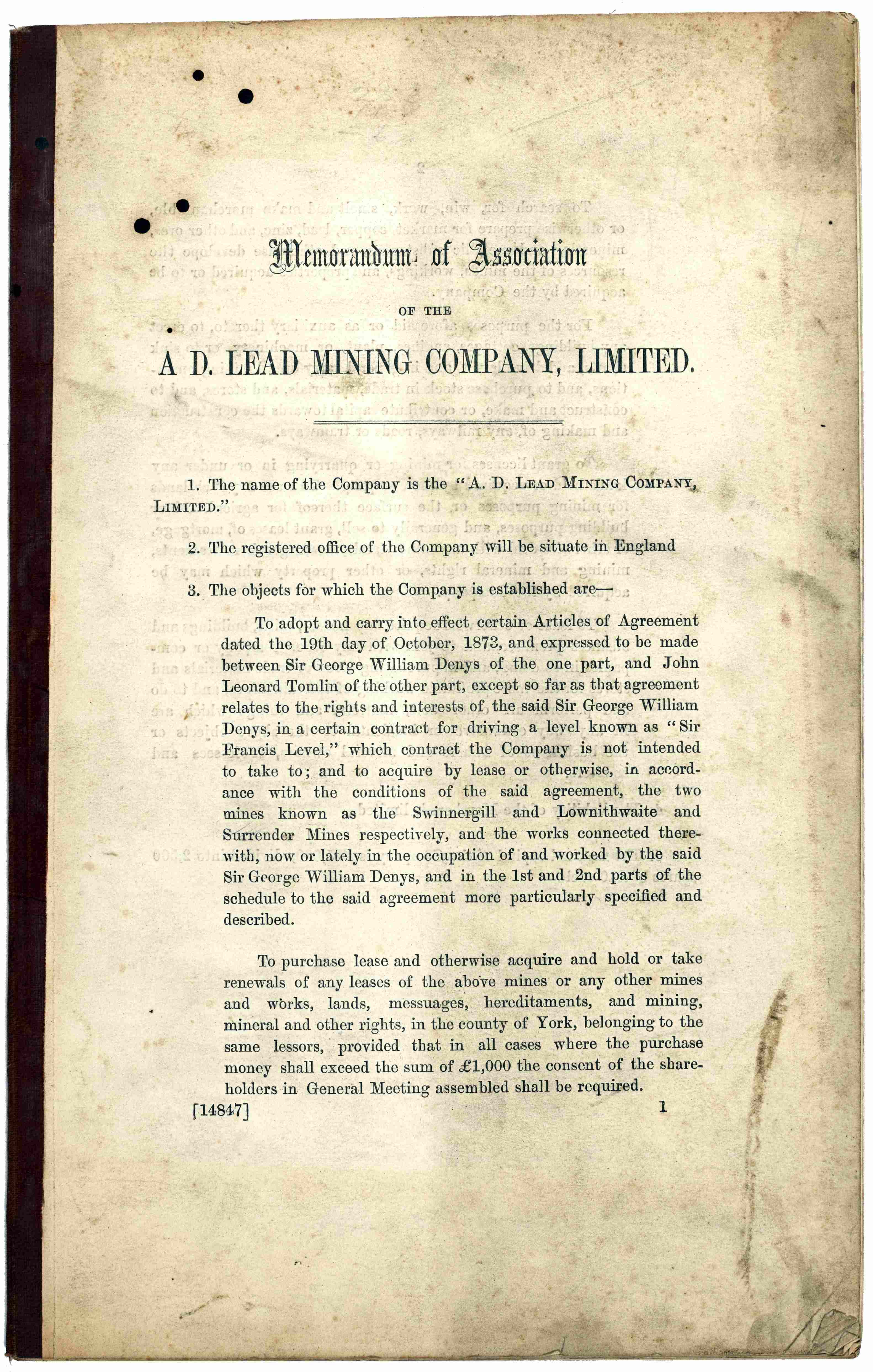
Memorandum of Association of the A.D. Lead Mining Company, 1874 [Z.1576]
Grimwith Lead Mining Company
Grimwith Lead Mining Company was formed in 1863 to exploit lead veins in Grimwith area, with a 21-year lease for mineral rights over 3,000 acres of land. However, the company did not have great success and was wound up in 1878.
The veins are shown on the plan from 1863, with the extent of Red-Scar level shown in 1872.
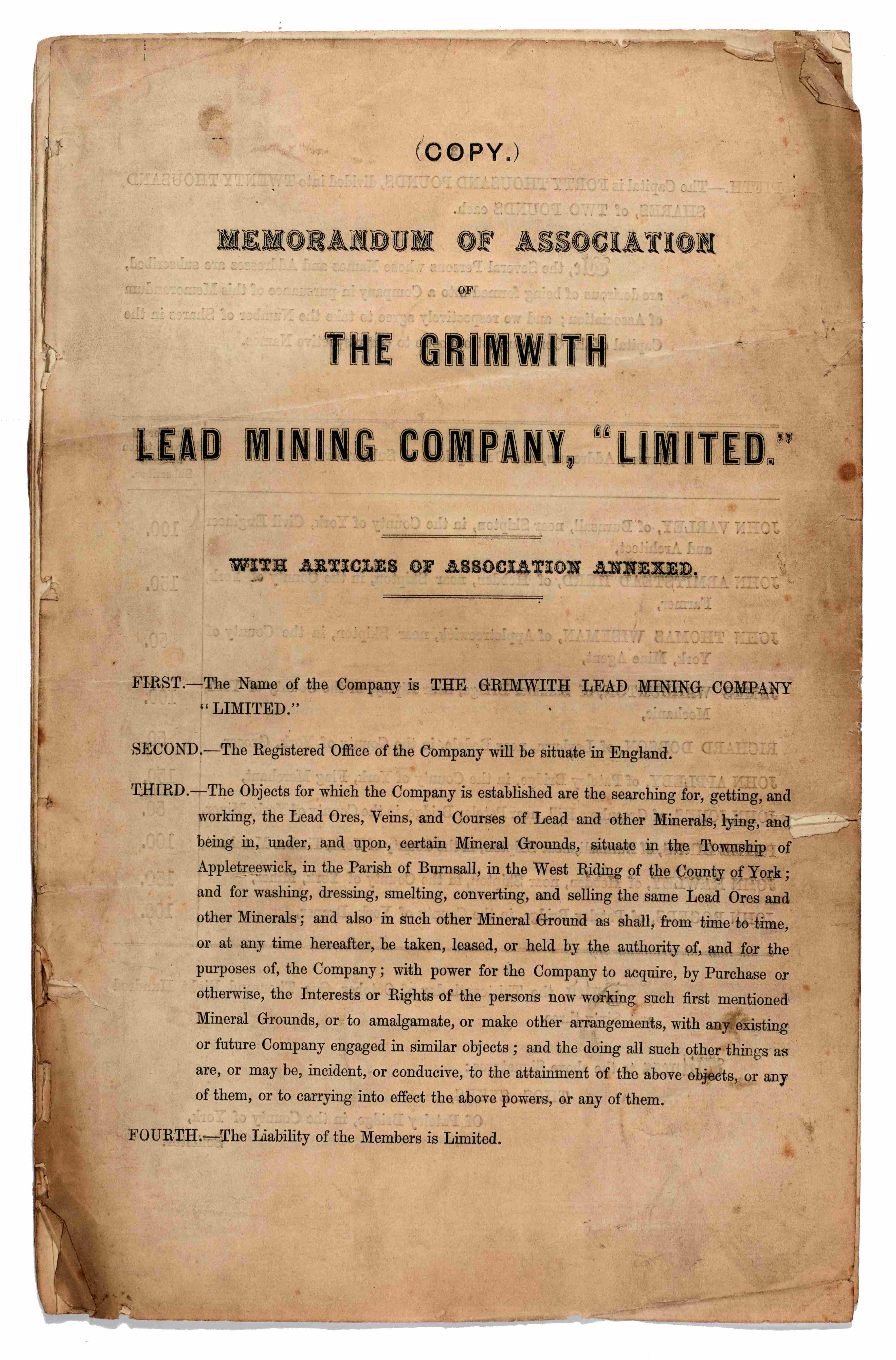
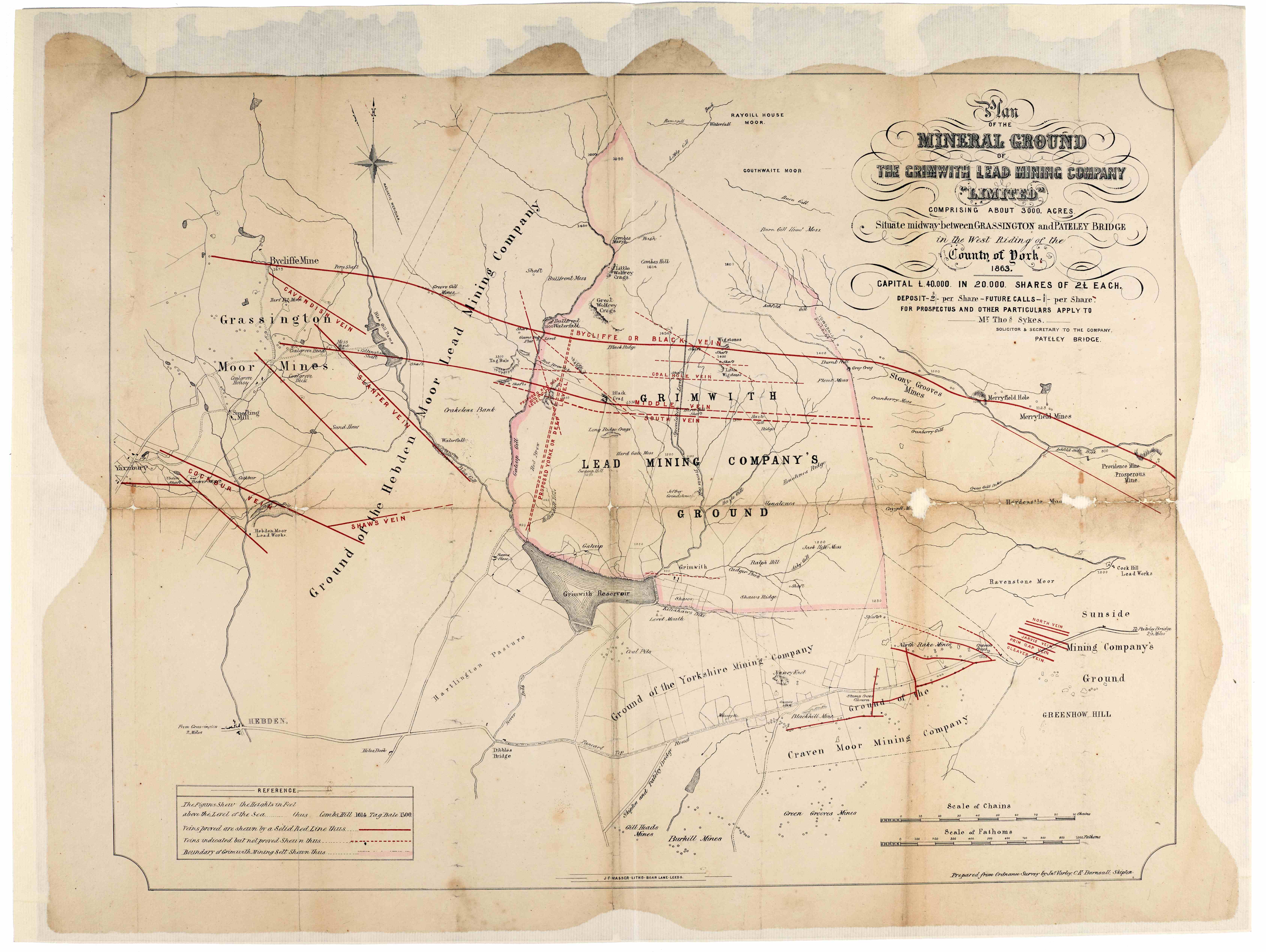
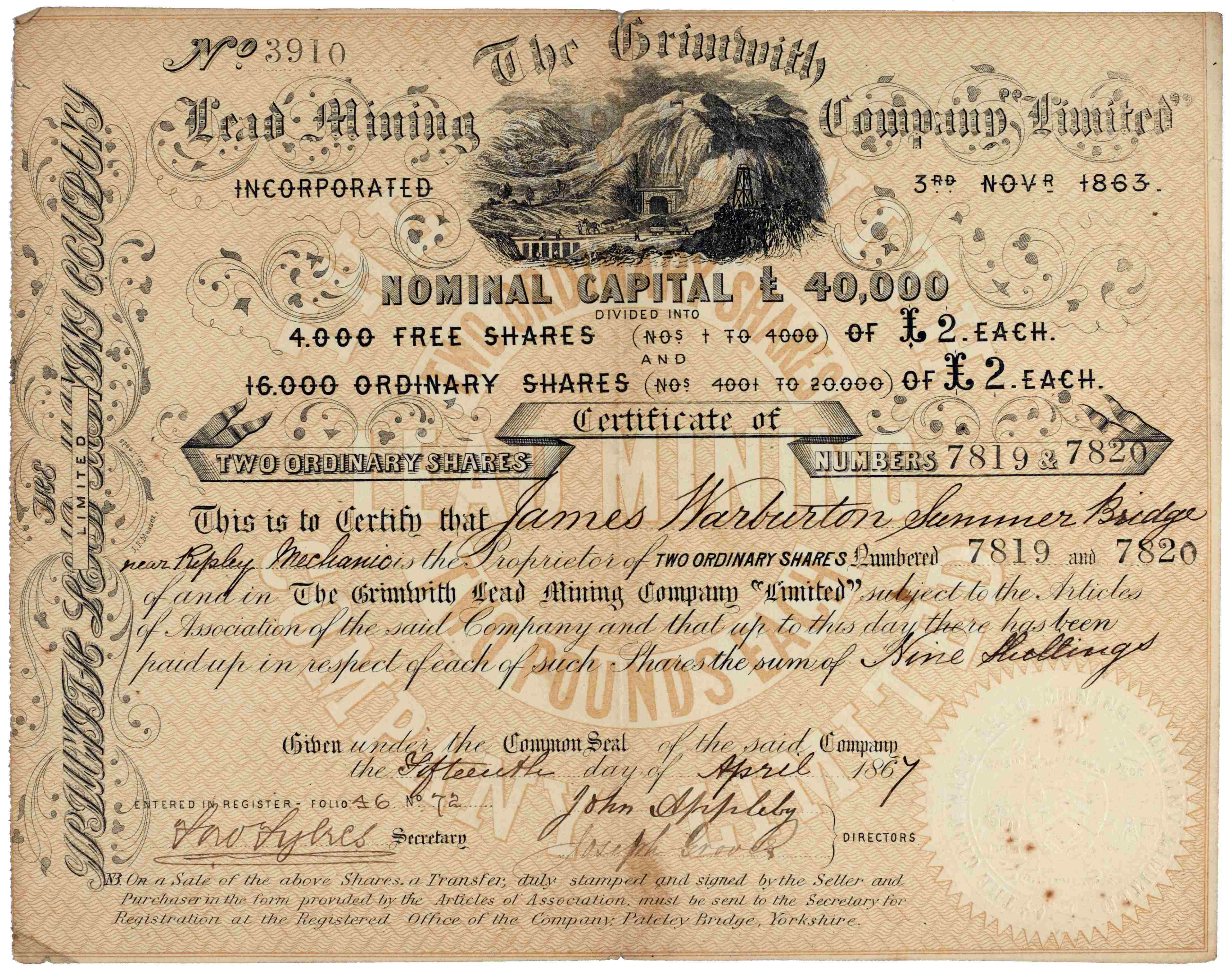
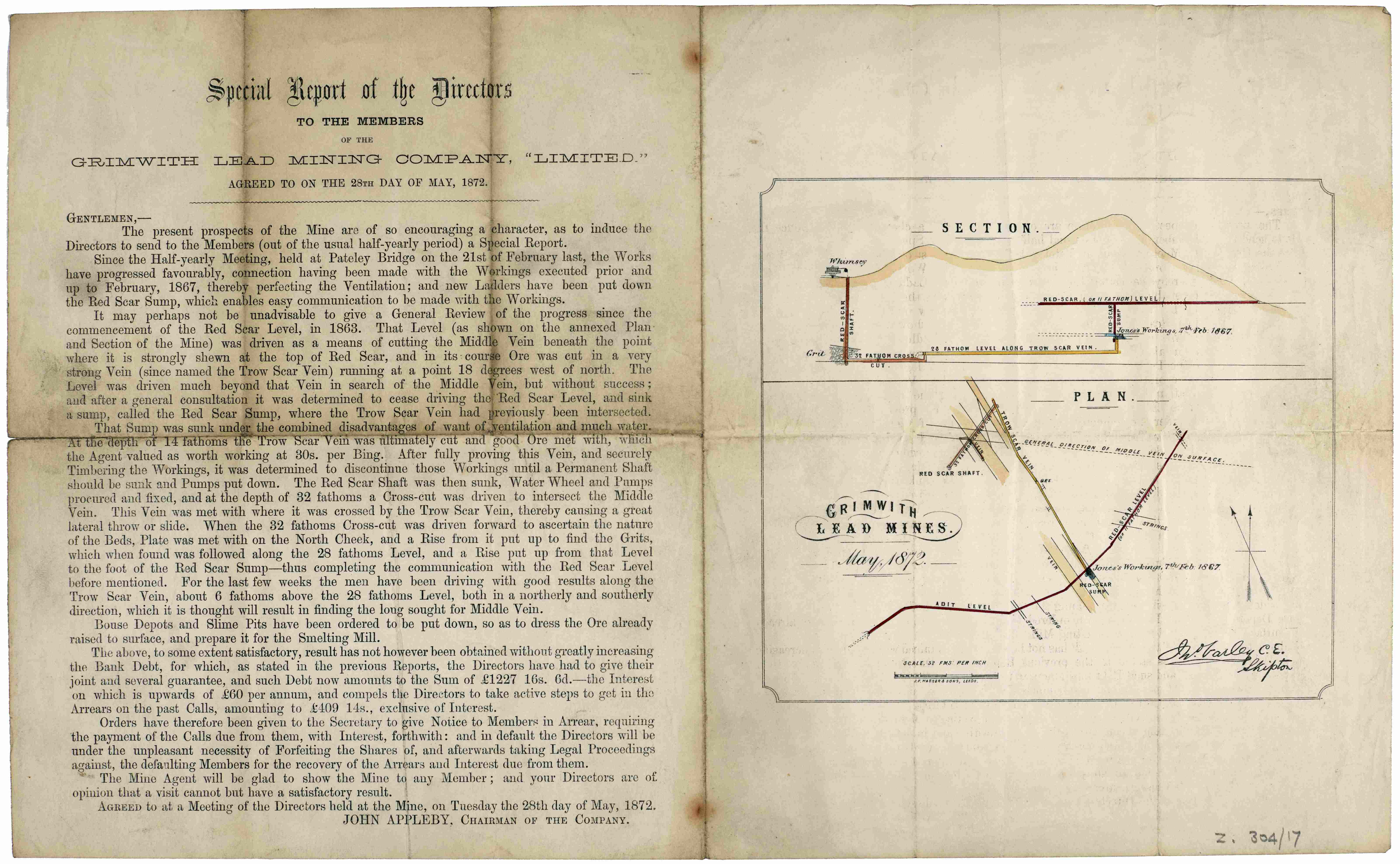
Grimwith Lead Mining Company Records, 1863-1874 [Z.304]
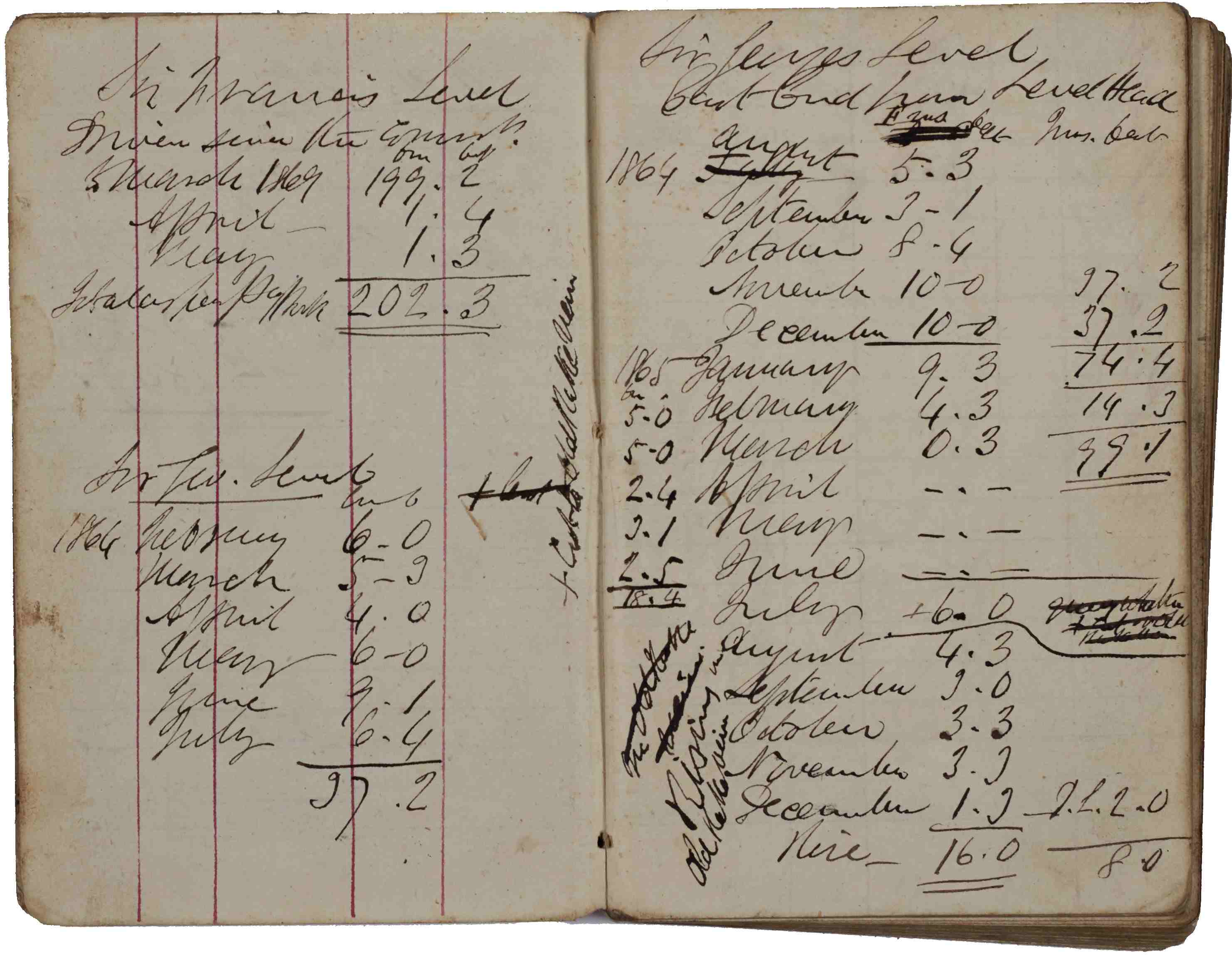
Sir George W. Denys and his mines
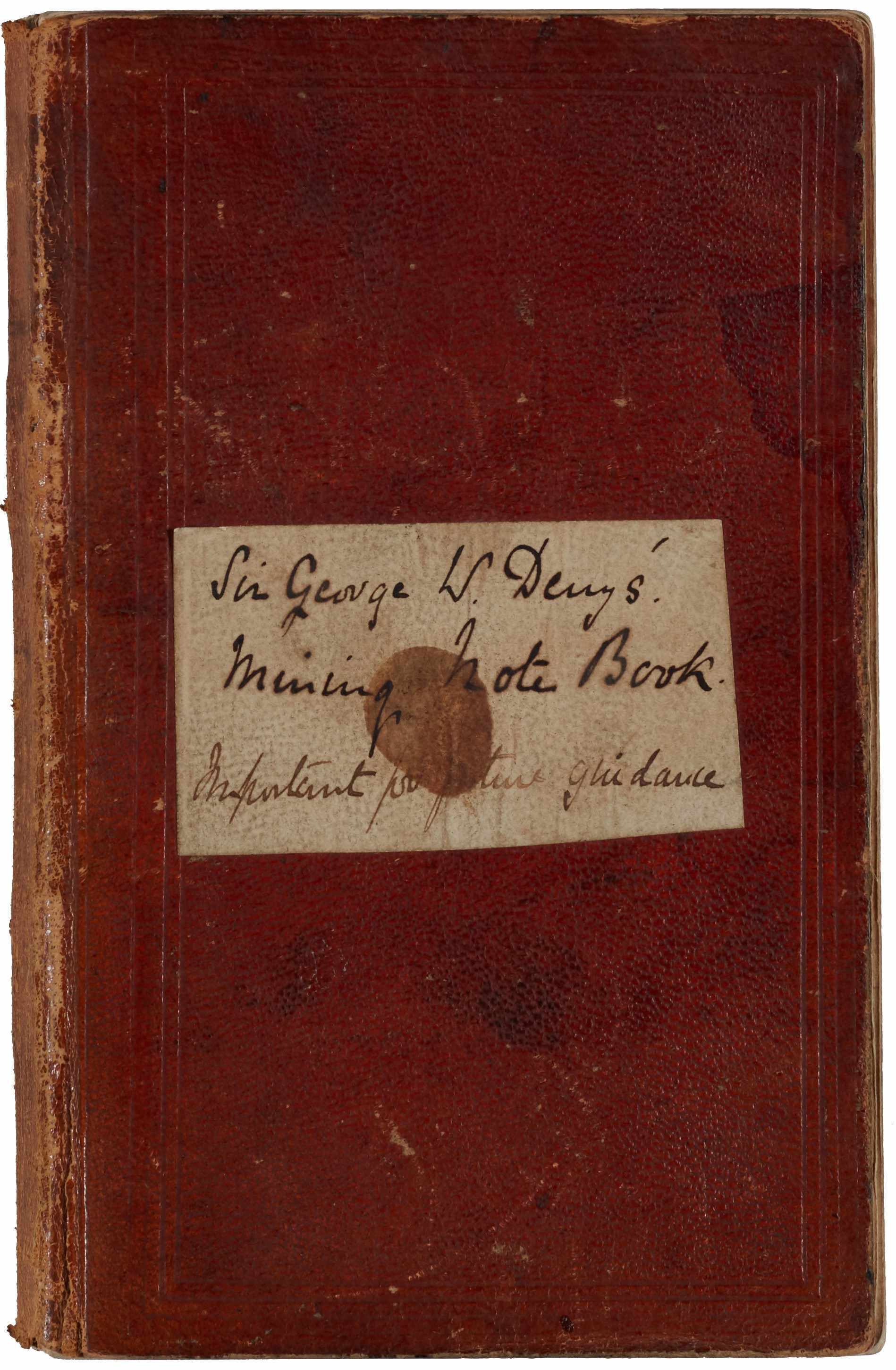
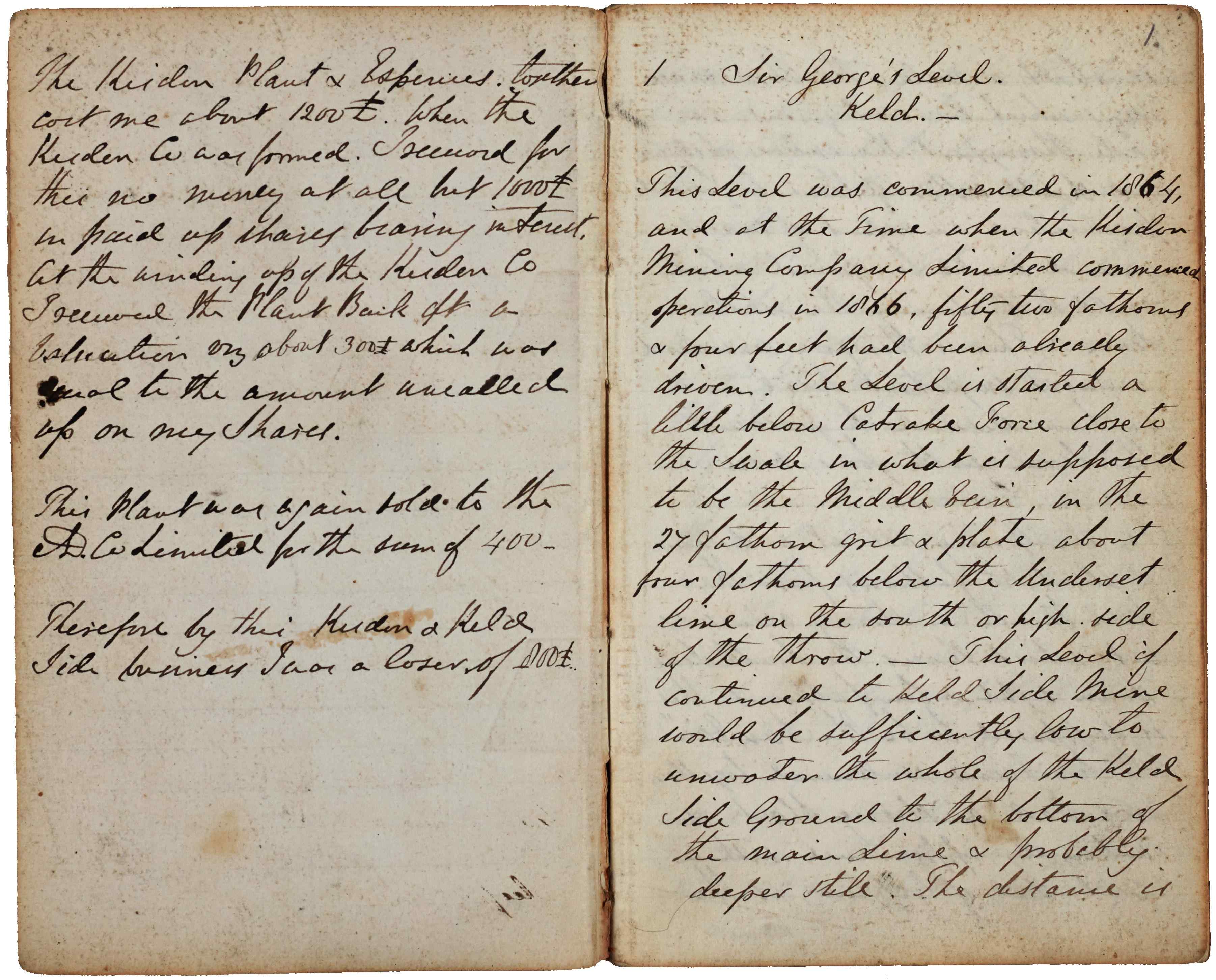
Sir George W. Denys’ mining notebook c.1864-1920 marked as “Important for future guidance” [Z.1526]
Sir George W. Denys, one of the mineral lords for the north side of Swaledale, kept a detailed notebook of mining activity. He begins by recording the work of the Kisdon Mining Company Limited (1866-1870) in upper Swaledale. He suggests ways of trying the Blakethwaite Vein by reopening Stonesdale Shaft or driving Sir Francis Level up to the West Engine Sump at Blakethwaite Mine. He records his work at Surrender Mine from 1871 until the formation of the A.D. Lead Mining Co. Ltd in 1873. He held a share in the company and continued to record progress undertaken by the company. At Sir Francis Level, he was the first to use compressed air rock drills in a Yorkshire lead mine. He refers to the installation of the Hathorn Davey water-pressure engine in Sir Francis Mine, and the activities of the Old Gang Mining Company, which was struggling to keep going. Sir George died in 1881 and was followed by his son, Sir Francis Denys-Burton, who continued the notebook and added comments to some of his father’s notes, including a note on the inside cover saying “This notebook might prove of great use and should be carefully preserved”. At the rear of the book are more notes about possible deep trials and other likely places where lead might be found
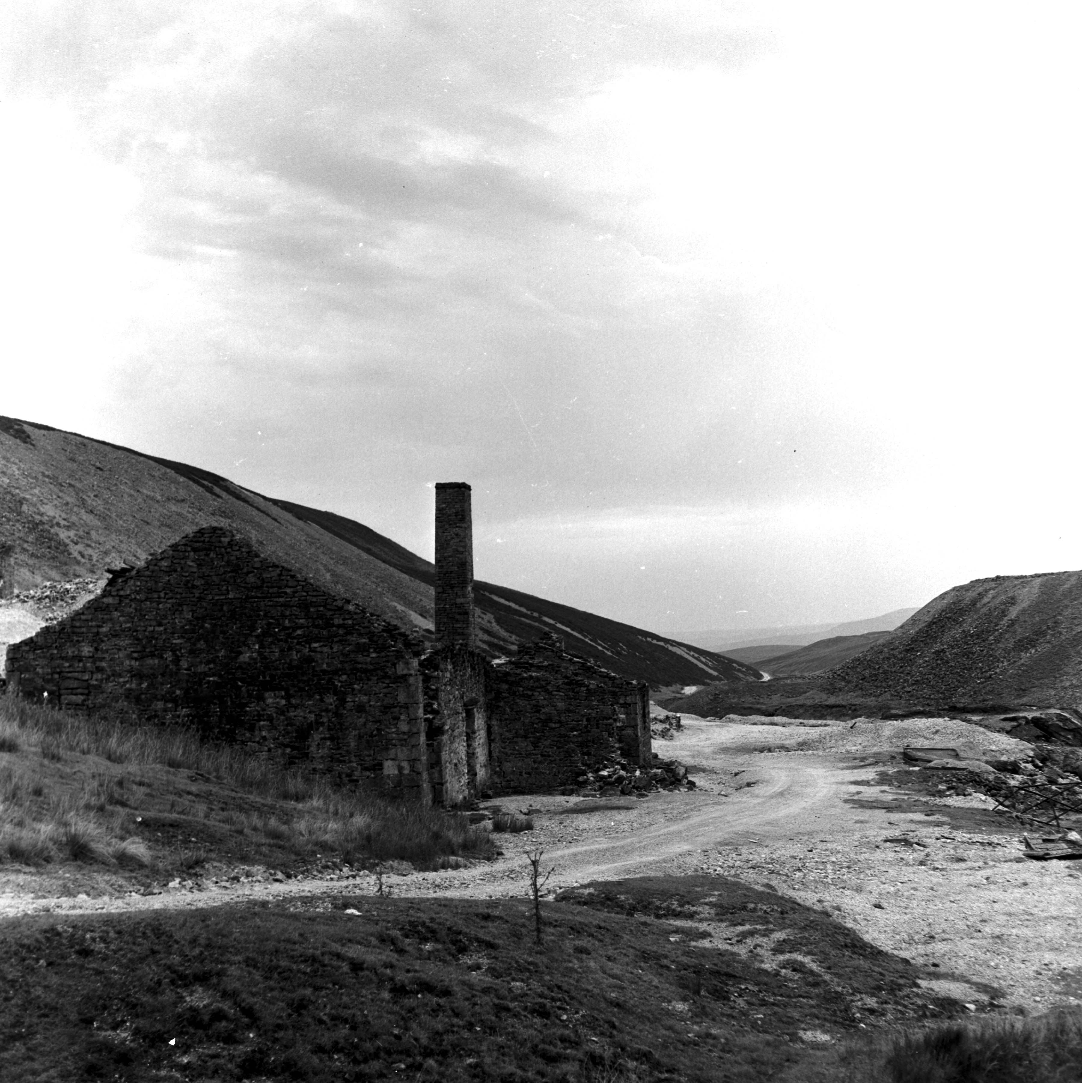
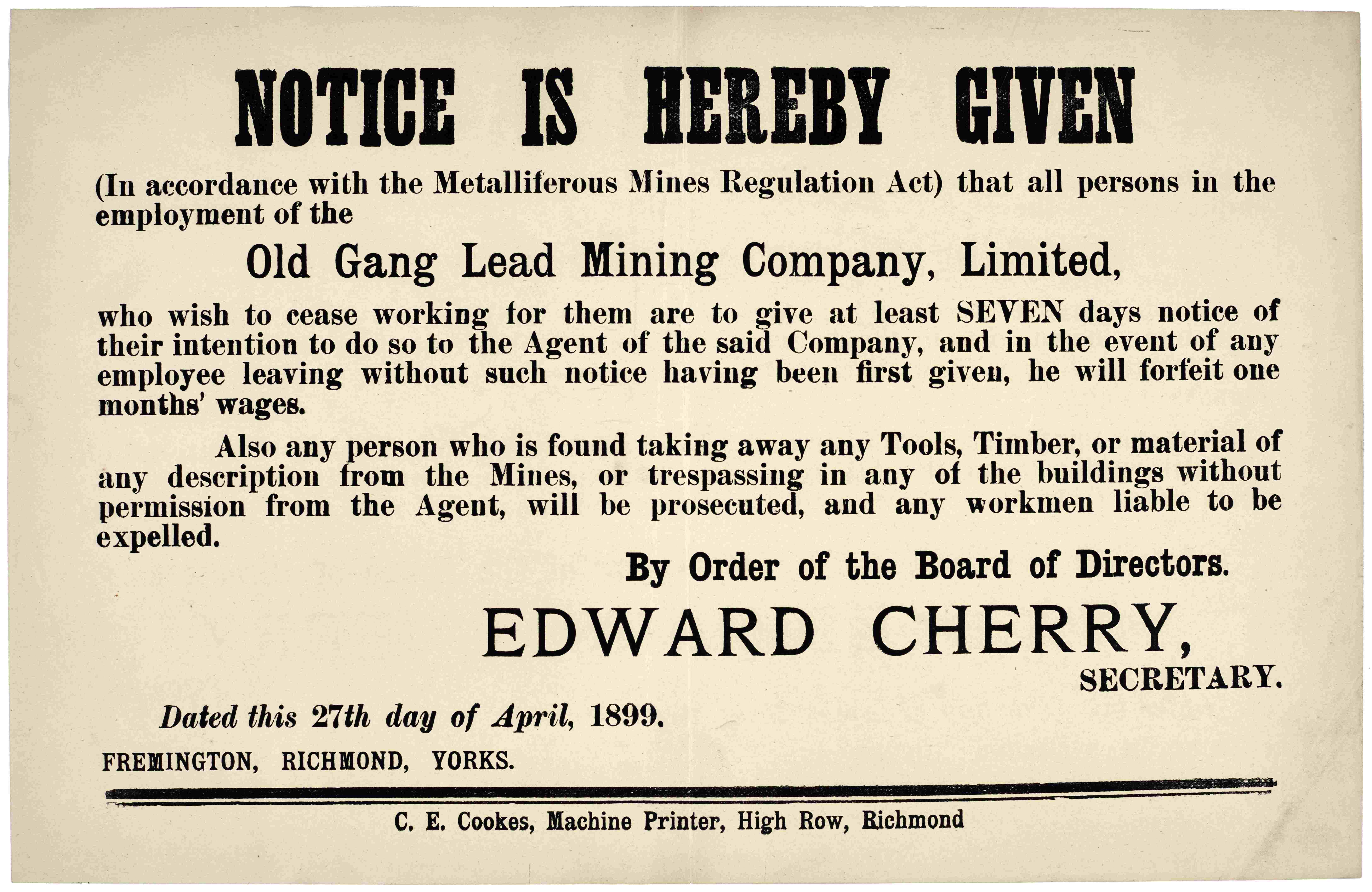
Old Gang mines and mills in Swaledale
The Old Gang mines and mills in Swaledale operated between c.1840s and c.1899. The mills were one of the largest in the area and Historic England considers them one of the best-preserved lead smelt mills in the North Pennines, retaining evidence of many of the industry’s processing techniques, designated as a Scheduled Monument.
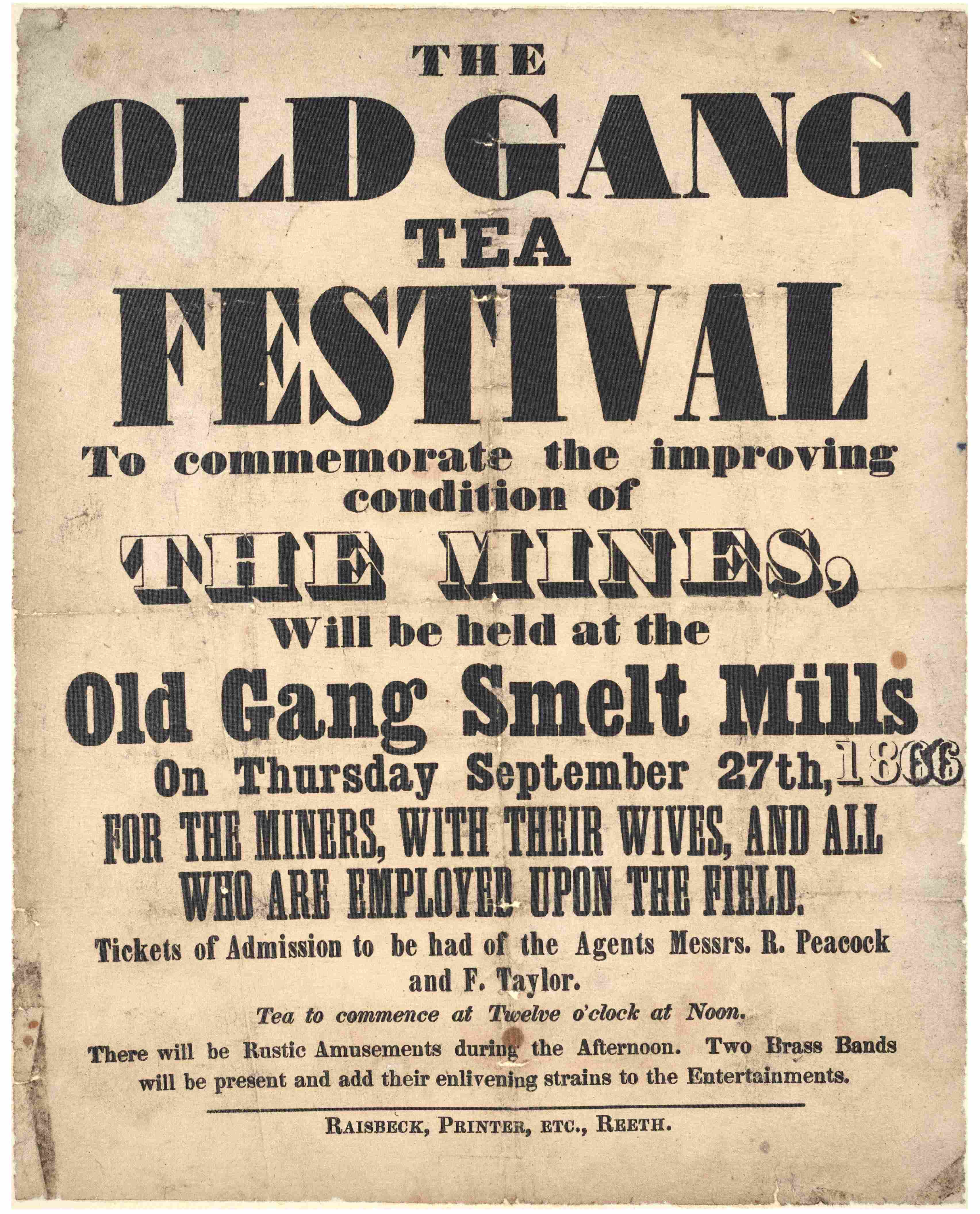
- Left: Poster for the Old Gang Tea Festival, 1866 [ZLB 3/34/4]
- Centre: Old Gang Smelt Mill, photographed by Bertram Unné, 1964 [BU05508A]
- Right: Notice regarding working conditions at Old Gang Lead Mining Company, 1899 [ZLB 3/34/14]
Maps and plans in the Archives
Within the Archives, we hold a range of maps and plans showing the locations, layouts and workings of lead mines across the Dales. The following are examples of some of the plans we hold.
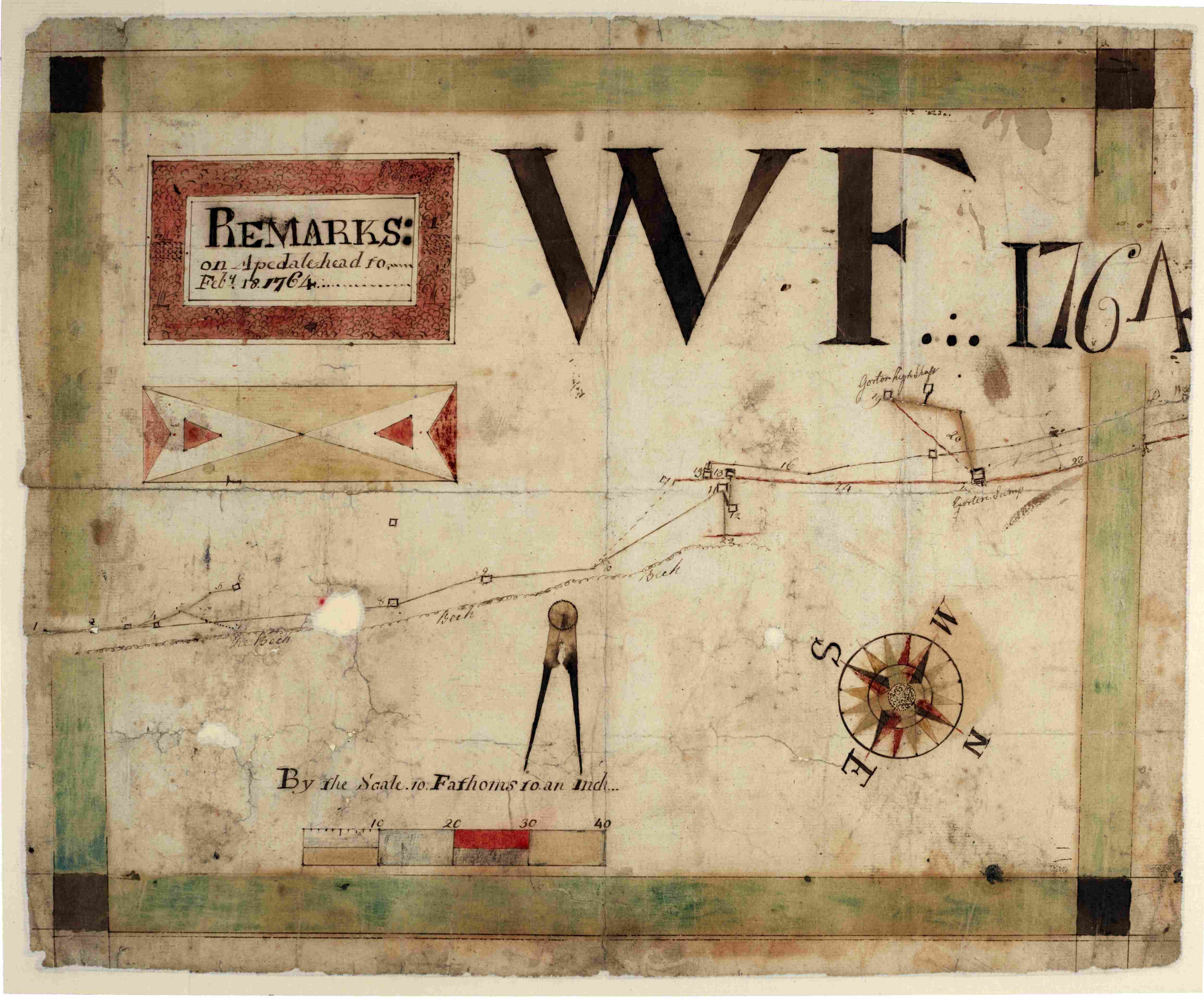
- Left: Plan of the Duke of Bolton’s mines at Apedale Head, Castle Bolton, 1764 [ZBO(L) 2/2]
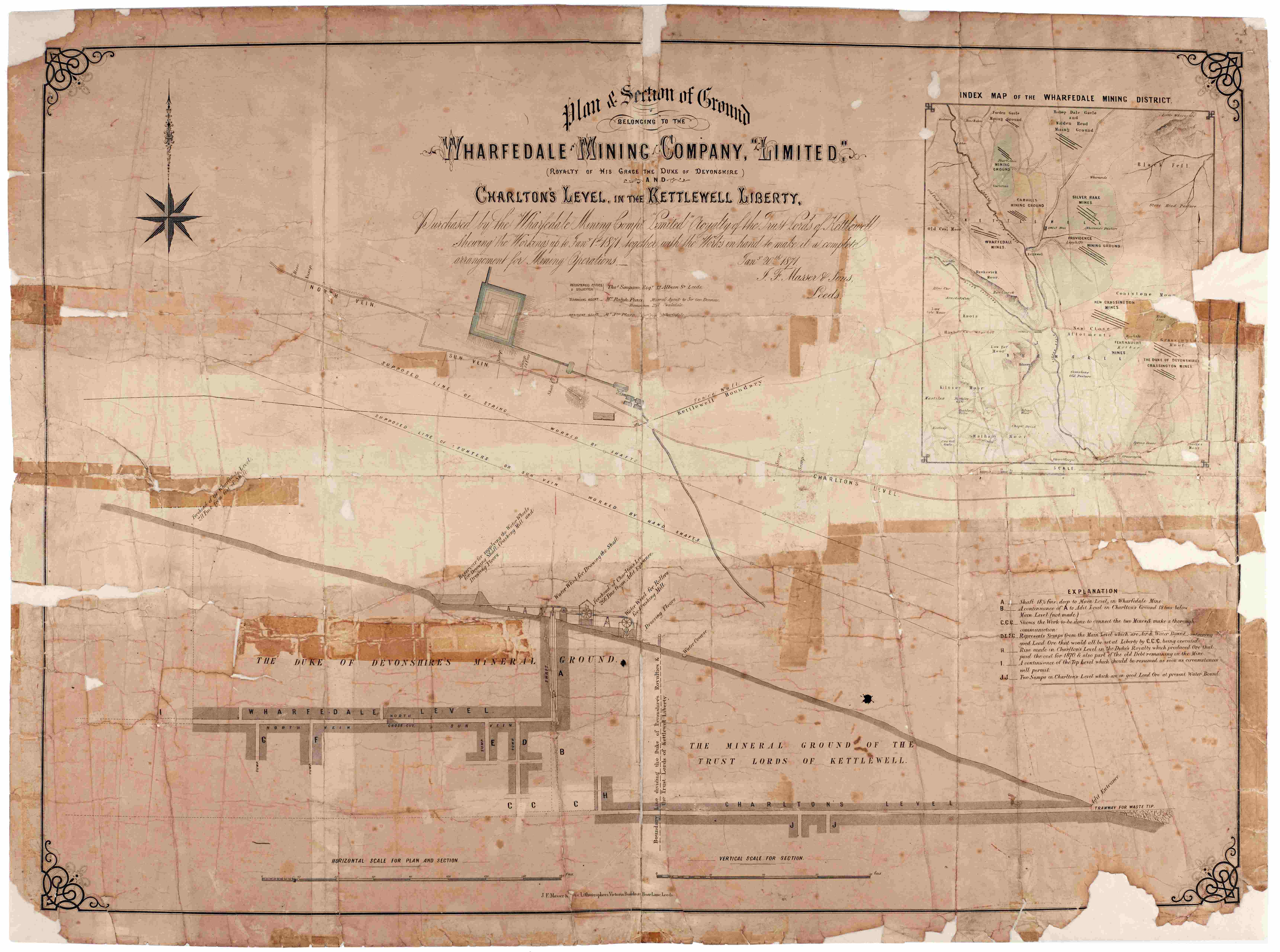
- Right: Plan of ground belonging to Wharfedale Mining Company Limited, 1871 [ZQJ]
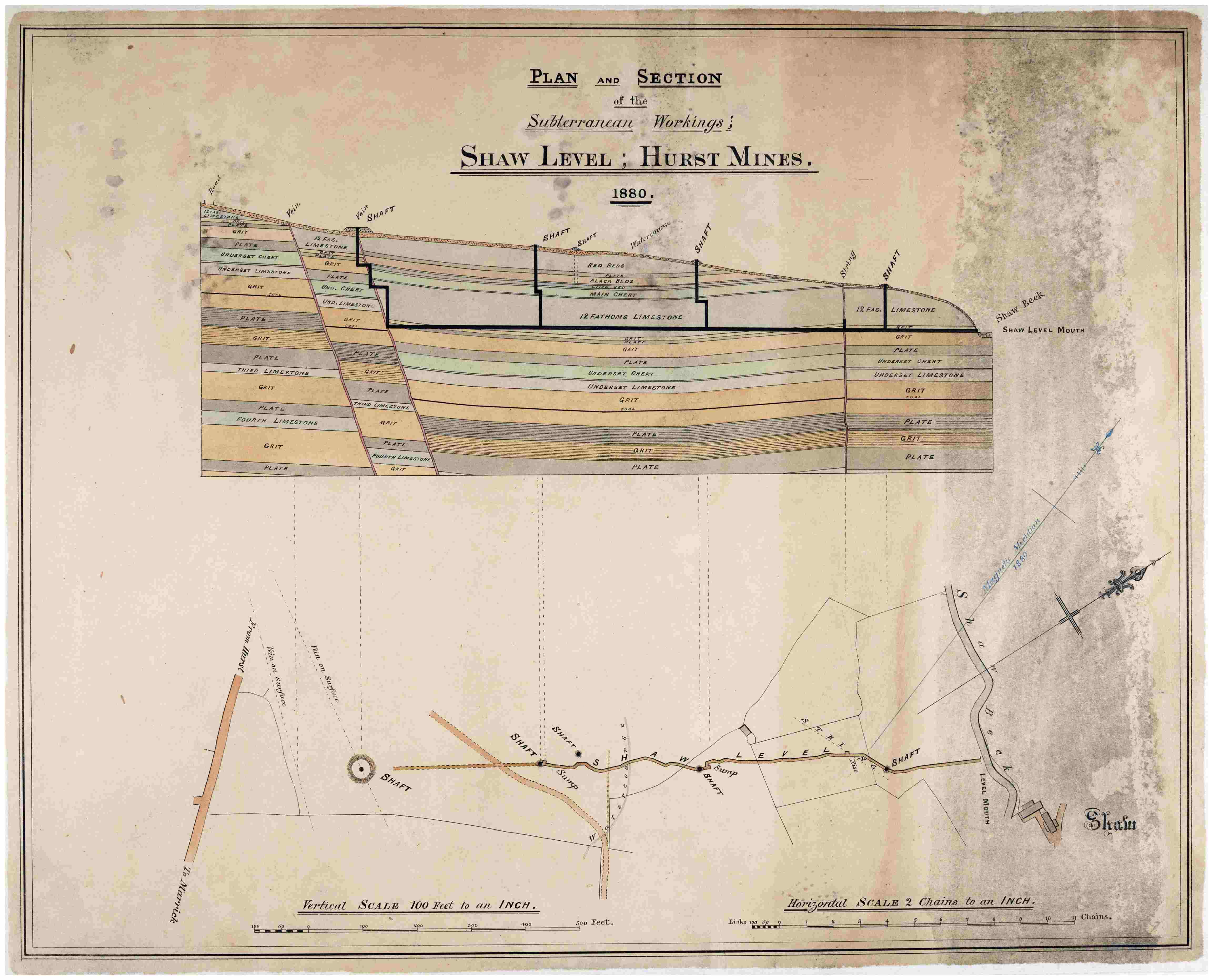
- Left: Plan and sections of the subterranean works of Shaw Level at Hurst Mines, 1880 [ZWX (M) 14]
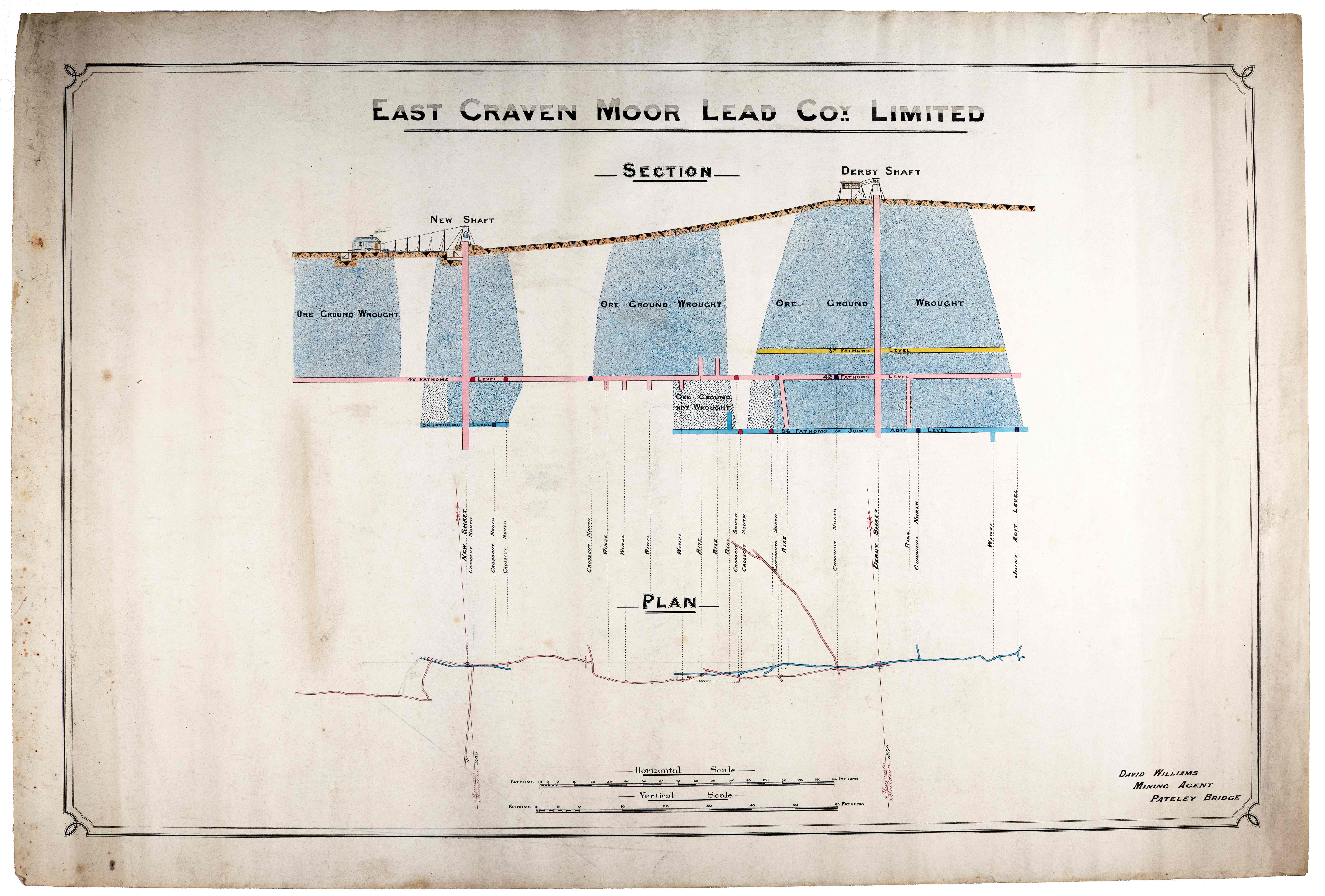
- Centre: Plan and section of East Craven Moor Lead Mine, 1880 [M 108]
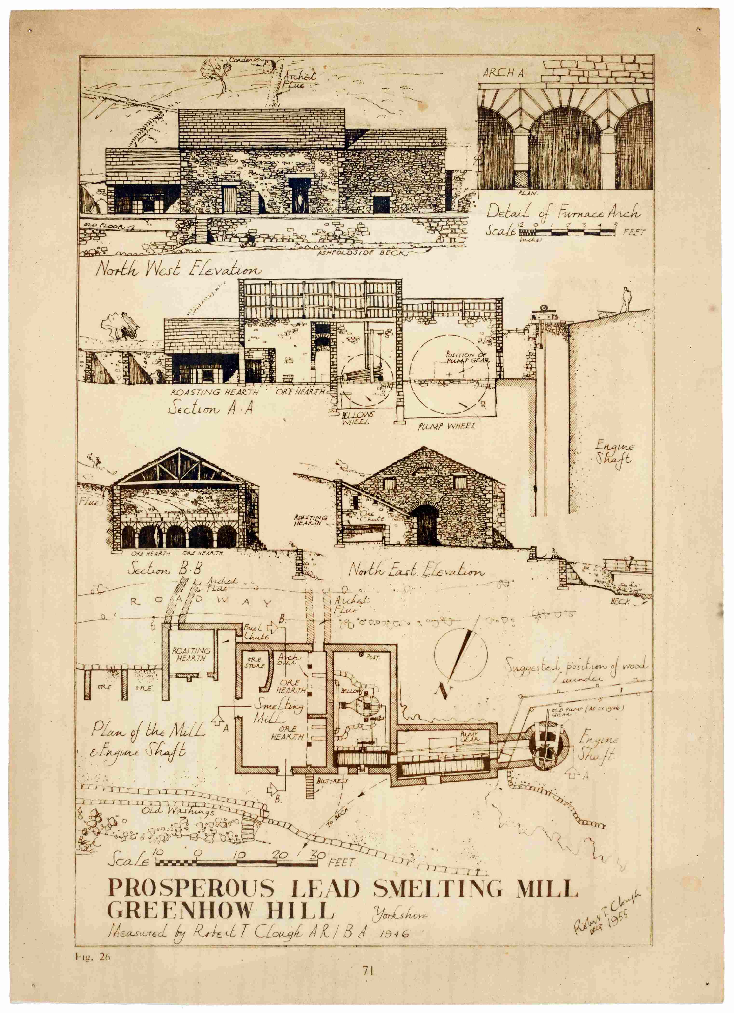
- Right: Plan of Prosperous Lead Smelting Mill, Greenhow Hill, 1955 [Z.1621]. Smelting mills, like the Prosperous Lead Smelting Mill in Nidderdale, turned raw lead into usable metal.
We also hold a range of photographs showing lead mines. Although many show the mines as archaeological sites, we do hold some showing the active mines.
- Left: Stang Mine, Stang Level, Arkengarthdale, 1910 [EF 264 Box 8/80]
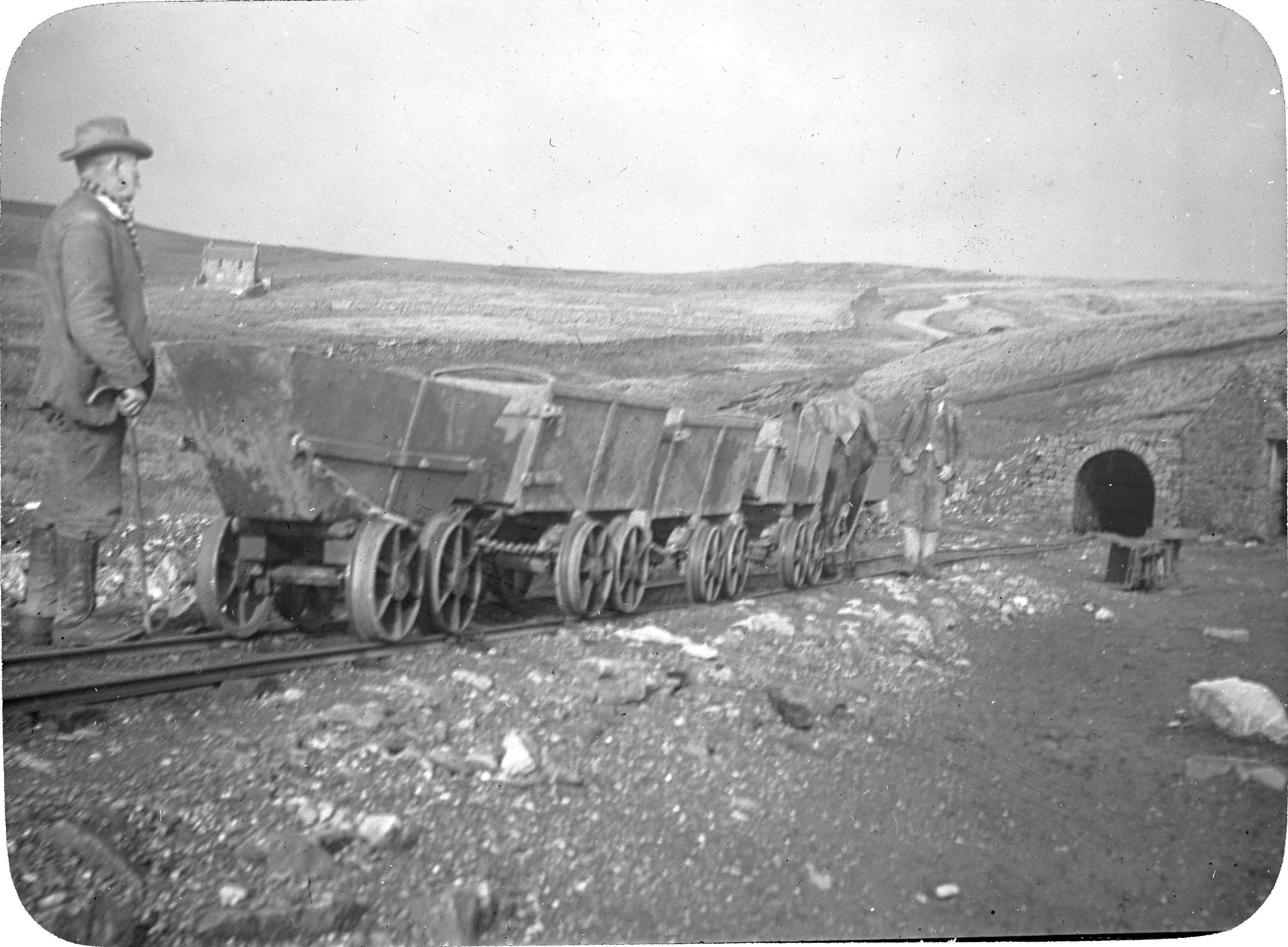
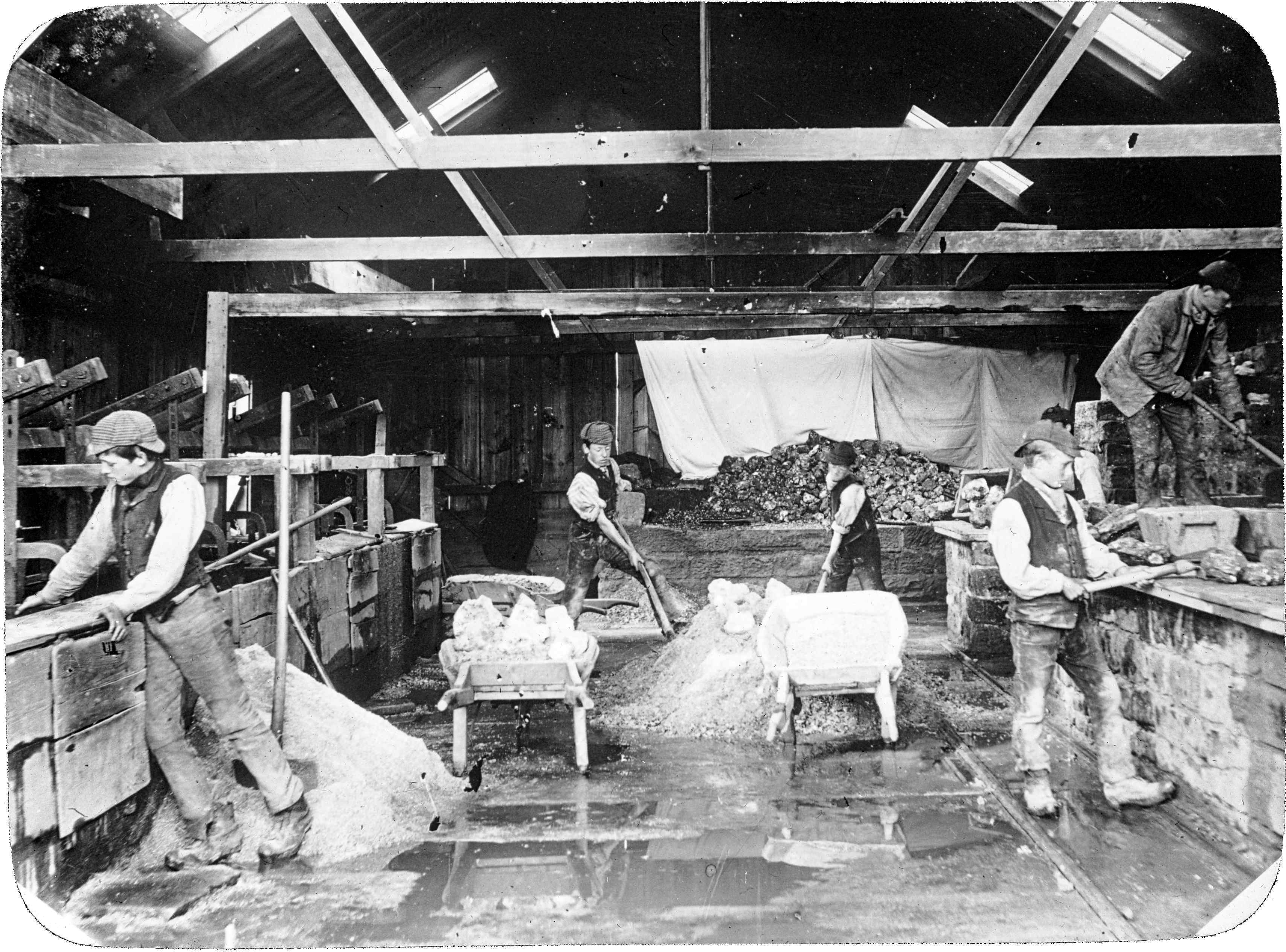
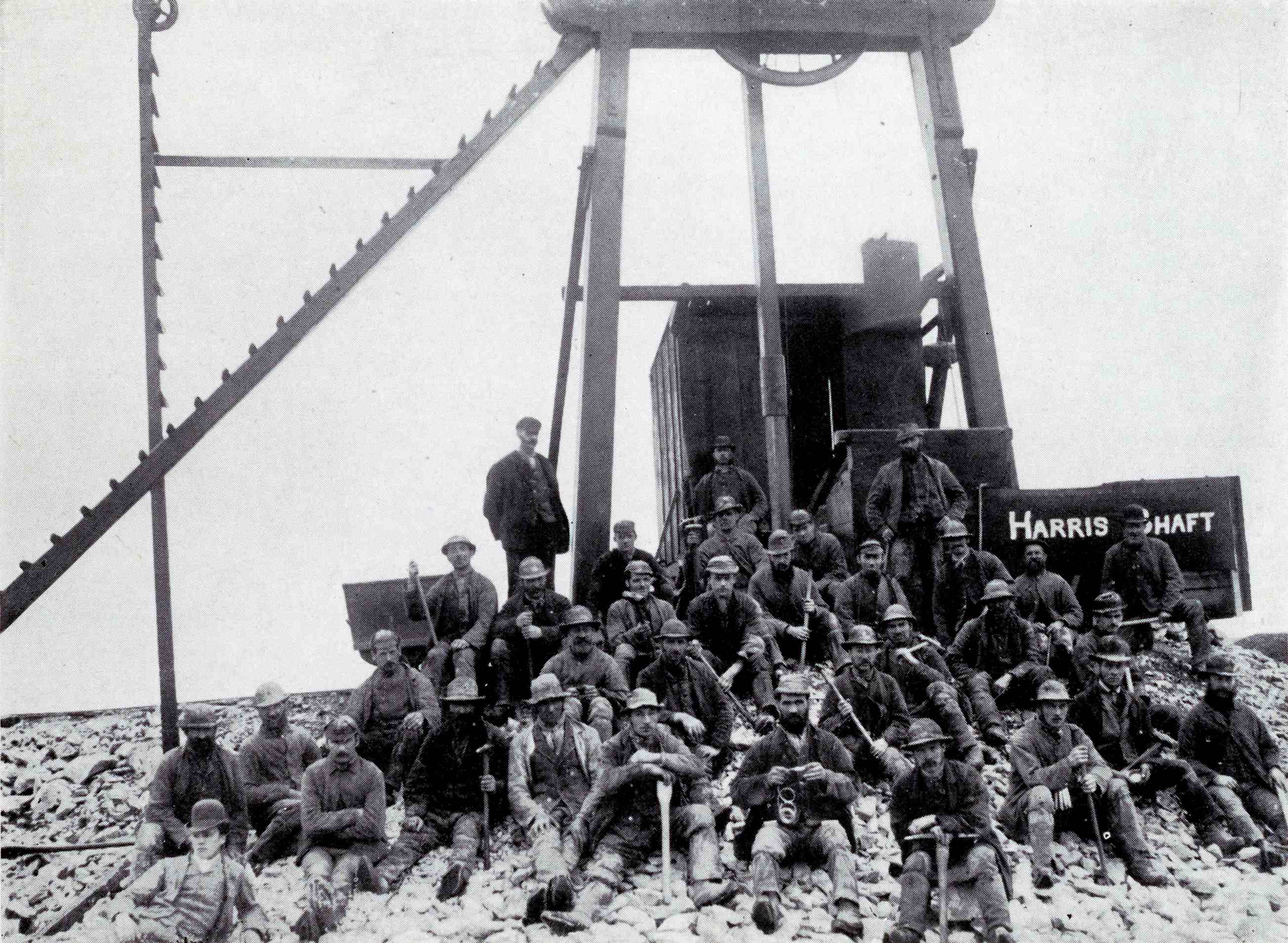
- Centre: Lead being sorted at Harris Shaft, Greenhow Hill, c.1890 [EF 264 Box 8/56]
- Right: Old Providence Mine, Kettlewell, 1924 [EF 264 Box 8/67]
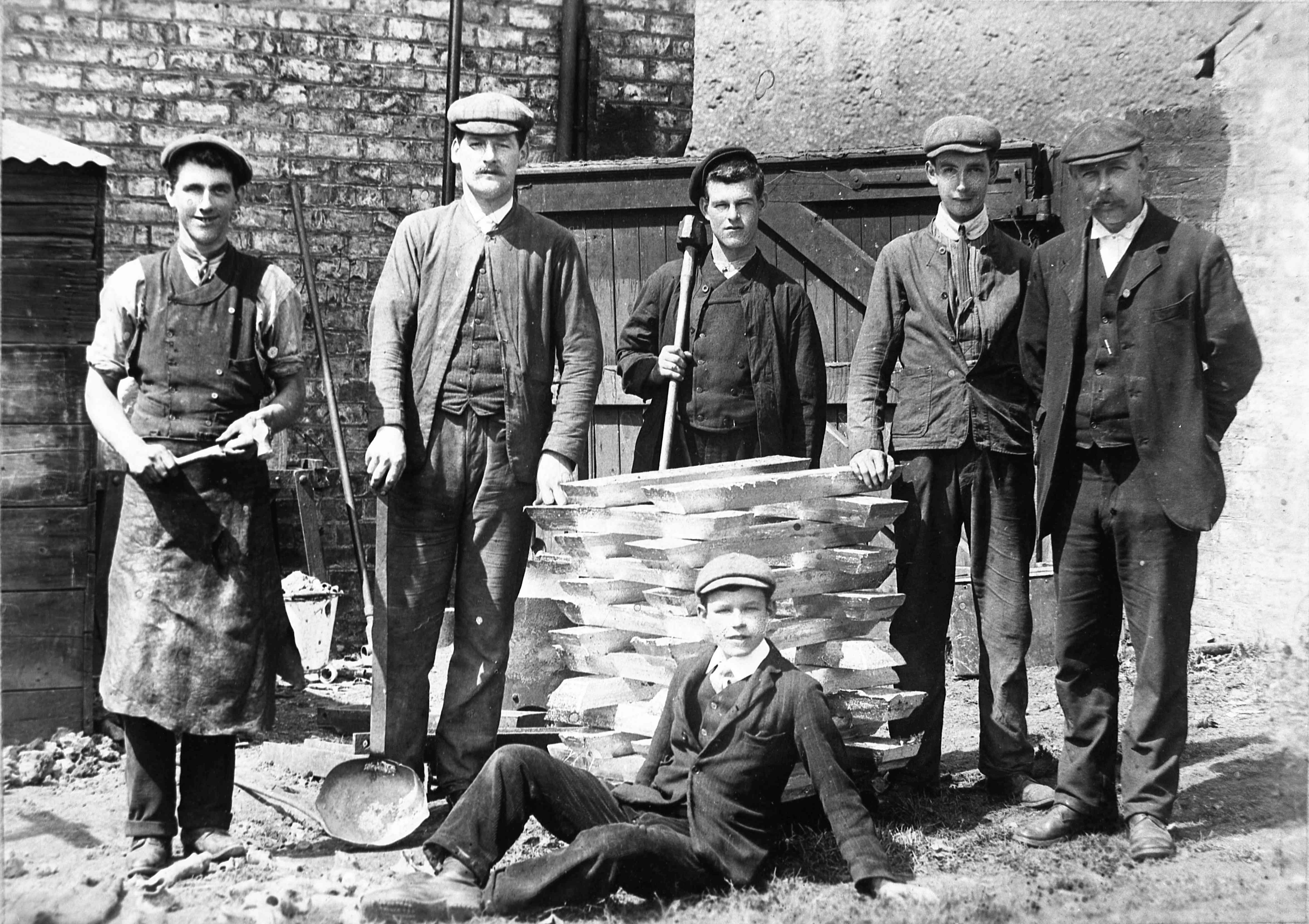
- Left: Benson family at the lead works, King Street, Ripon with lead ingots known as ‘pigs’ [C6809]
- Right: Miners at the head of Harris Shaft, Greenhow Hill, c.1890 [Z.1621]. Harris Shaft was worked between 1887 and 1895.
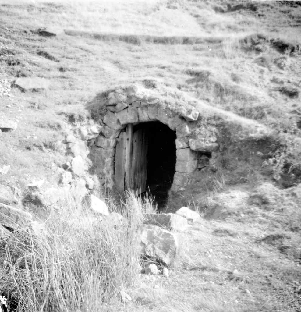
- Left: Gillfield Level, Greenhow Hill [EF 264 Box 8/62]
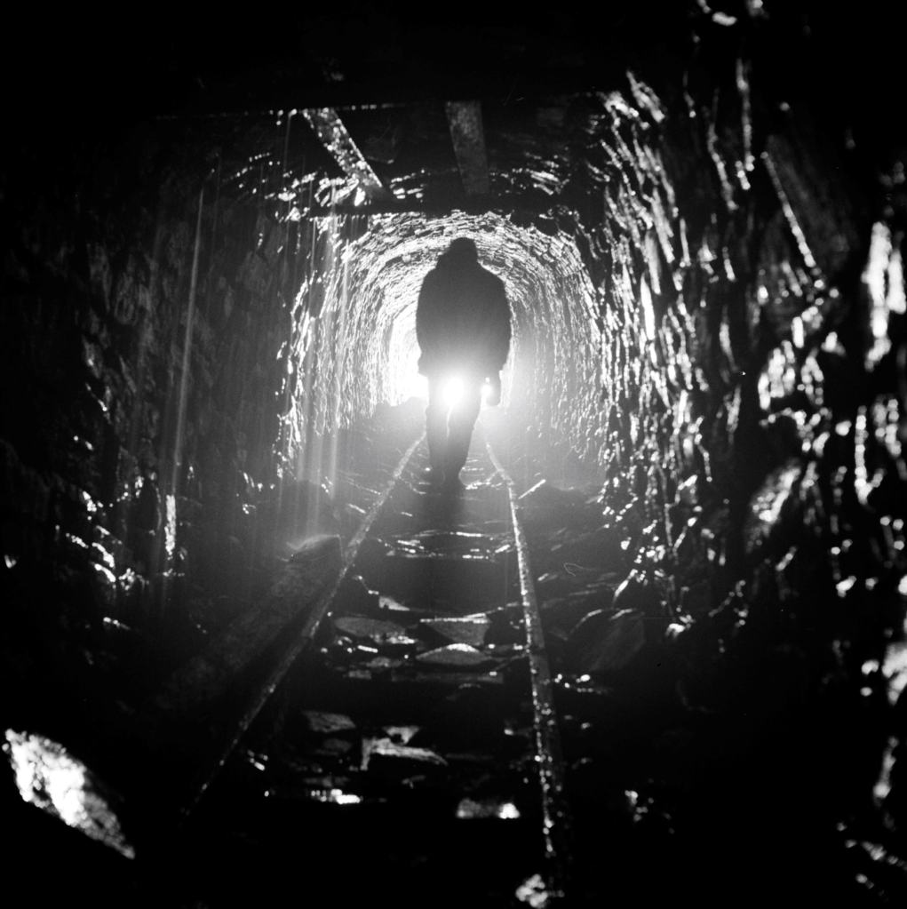
- Right: Brandy Bottle incline, Gunnerside, 1970 [BU05697A]
If you would like to research Lead Mining in the North Yorkshire Archives, you can search our online catalogue. Plans for lead mines can also be found using our Guide 9 – Mining Plans [opens as pdf]. More photographs can also be seen in our online shop.
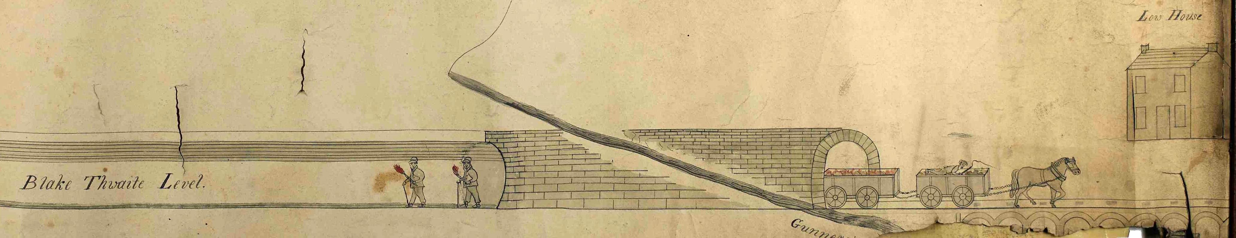
Detail from plan of ‘Victoria Engine’ water wheel pump, Blakethwaite Mine, Gunnerside, 1837 [Z.1526]
Endnote
* Mining dial by J. Casartelli of Manchester, 1988-1379, Science Museum Group Collection Online, accessed 18 March 2026, used under CC License.
